Category:Lillington, Dorset
hamlet in Dorset England  | |||||
| Upload media | |||||
| Instance of | |||||
|---|---|---|---|---|---|
| Location | Dorset, South West England, England | ||||
 | |||||

Subcategories
This category has the following 2 subcategories, out of 2 total.
L
- Tythe Barn, Lillington (5 F)
S
Media in category "Lillington, Dorset"
The following 78 files are in this category, out of 78 total.
-

-
 Bridleway, Lillington - geograph.org.uk - 1567576.jpg 640 × 480; 201 KB
-
 Cancer Drove - geograph.org.uk - 5696620.jpg 427 × 640; 128 KB
-
 Country lane and Ditch - geograph.org.uk - 1192328.jpg 640 × 428; 111 KB
-
 Countryside near Bailey Ridge Farm - geograph.org.uk - 1216568.jpg 640 × 428; 57 KB
-
 Countryside near Knighton - geograph.org.uk - 2292314.jpg 640 × 480; 80 KB
-
 Countryside near Leigh - geograph.org.uk - 1216569.jpg 640 × 480; 116 KB
-
 Farm excavation on Knighton Hill - geograph.org.uk - 6032400.jpg 1,024 × 768; 234 KB
-
 Farm gates on Gordon's Lane - geograph.org.uk - 6032575.jpg 1,024 × 768; 219 KB
-
 Farm Machinery, Lillington - geograph.org.uk - 1192236.jpg 640 × 428; 118 KB
-
 Footbridge and Stile near Knighton - geograph.org.uk - 2292322.jpg 640 × 480; 161 KB
-

-
 Gas Installation near Beer Hackett - geograph.org.uk - 1192086.jpg 640 × 437; 100 KB
-
 Gas Plant Gate Sign on Knighton Hill - geograph.org.uk - 2292369.jpg 640 × 480; 86 KB
-
 Gas Processing Site on Knighton Hill - geograph.org.uk - 2292366.jpg 640 × 480; 78 KB
-
 Gordon's Lane - geograph.org.uk - 6033170.jpg 1,024 × 794; 233 KB
-
 Hedge Cutting at The Holm Bushes. - geograph.org.uk - 1192331.jpg 640 × 428; 136 KB
-
 High Lynch, Lillington - geograph.org.uk - 6032405.jpg 1,024 × 768; 188 KB
-
 Higher Farm - geograph.org.uk - 6032407.jpg 1,024 × 707; 149 KB
-
 Higher Stockbridge Farm - geograph.org.uk - 5696712.jpg 640 × 427; 86 KB
-
 Holm Bushes bridle path in early spring - geograph.org.uk - 2347279.jpg 1,280 × 960; 734 KB
-
 House on Gordon's Lane - geograph.org.uk - 6032593.jpg 1,024 × 789; 236 KB
-
 Knighton Hill - geograph.org.uk - 1192082.jpg 640 × 428; 61 KB
-

-

-
 Leigh, signpost at Bailey Ridge - geograph.org.uk - 4072230.jpg 640 × 480; 126 KB
-
 Leigh, signpost at The Holm Bushes - geograph.org.uk - 4072225.jpg 640 × 480; 127 KB
-
 Lillington Church - geograph.org.uk - 6022556.jpg 1,024 × 768; 175 KB
-
 Lillington Copse - geograph.org.uk - 1192232.jpg 640 × 428; 94 KB
-
 Lillington Village - geograph.org.uk - 1192087.jpg 640 × 439; 63 KB
-
 Lillington, church and hamlet - geograph.org.uk - 107164.jpg 640 × 411; 101 KB
-
 Lillington, postbox № DT9 47 - geograph.org.uk - 3905581.jpg 479 × 640; 106 KB
-
 Lillington, the phone box - geograph.org.uk - 3905575.jpg 640 × 480; 77 KB
-
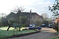
 Lillington, village centre - geograph.org.uk - 3905579.jpg 640 × 480; 65 KB
-
 Looking towards East Wood - geograph.org.uk - 5696718.jpg 640 × 427; 51 KB
-
 Lower Farmhouse (geograph 6464959).jpg 1,024 × 681; 206 KB
-

-
 Macmillan Way near Knighton - geograph.org.uk - 2292361.jpg 640 × 480; 70 KB
-
 Middle Farm - geograph.org.uk - 6032562.jpg 1,024 × 768; 195 KB
-
 Minor road to Lillington - geograph.org.uk - 6032404.jpg 1,024 × 768; 236 KB
-
 New Drainage Ditch, Lillington - geograph.org.uk - 1192235.jpg 640 × 428; 131 KB
-
 Outbuildings at Whitefield Farm - geograph.org.uk - 6032394.jpg 1,024 × 810; 200 KB
-
 Ploughed field near Leigh - geograph.org.uk - 1216570.jpg 640 × 444; 117 KB
-
 PLoughed Field on Knighton Hill - geograph.org.uk - 1192085.jpg 640 × 428; 92 KB
-
 Ploughed Field, Lillington - geograph.org.uk - 1192234.jpg 640 × 455; 136 KB
-
 Sheep Field and muck pile - geograph.org.uk - 1192459.jpg 640 × 428; 99 KB
-
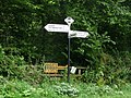
 Signpost near Lillington - geograph.org.uk - 1192471.jpg 640 × 428; 129 KB
-
 Stile near Leigh - geograph.org.uk - 1567706.jpg 640 × 480; 238 KB
-
 Stile, Baileys Ridge Lane - geograph.org.uk - 1567735.jpg 480 × 640; 191 KB
-
 Stile, Higher Farm - geograph.org.uk - 1567514.jpg 480 × 640; 125 KB
-
 Stile, Lillington - geograph.org.uk - 1567608.jpg 480 × 640; 197 KB
-
 Stockbridge Drove - geograph.org.uk - 5903765.jpg 640 × 427; 79 KB
-
 Stockpiling the logs - geograph.org.uk - 428922.jpg 640 × 477; 73 KB
-
 Stockpiling the logs - geograph.org.uk - 438228.jpg 640 × 477; 84 KB
-
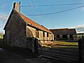
 Stone barn at Higher Farm - geograph.org.uk - 6032518.jpg 1,024 × 768; 198 KB
-
 T-junction at the Holme Bushes - geograph.org.uk - 5903766.jpg 640 × 427; 94 KB
-
 Telephone box, Lillington - geograph.org.uk - 1567596.jpg 640 × 480; 111 KB
-
 Telephone box, Lillington - geograph.org.uk - 6032542.jpg 1,024 × 788; 198 KB
-
 The Holm Bushes - geograph.org.uk - 1192329.jpg 640 × 428; 96 KB
-
 The Holm Bushes, Bailey Ridge - geograph.org.uk - 1112327.jpg 640 × 480; 113 KB
-
 Tower at St Anthony's-Leweston School - geograph.org.uk - 6022555.jpg 1,024 × 768; 124 KB
-
 Turning for Lillington - geograph.org.uk - 6032527.jpg 1,024 × 768; 252 KB
-
 Turning for Lillington - geograph.org.uk - 6033171.jpg 1,024 × 769; 139 KB
-
 Venerable tree on Windmill Hill - geograph.org.uk - 6033175.jpg 1,024 × 768; 181 KB
-
 Weather vane, Lillington - geograph.org.uk - 1567601.jpg 481 × 640; 81 KB
-
 Yard at Higher Farm - geograph.org.uk - 6032522.jpg 1,024 × 768; 149 KB
-
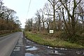
 Approaching Lillington - geograph.org.uk - 516475.jpg 640 × 429; 99 KB
-
 Bailey Ridge Farm - geograph.org.uk - 436842.jpg 640 × 480; 59 KB
-

-
 Farmland below Bailey Ridge Farm - geograph.org.uk - 490030.jpg 640 × 480; 128 KB
-
 Footpath in Honeycombe Wood - geograph.org.uk - 428901.jpg 640 × 477; 129 KB
-
 Gordon's Lane near Lillington - geograph.org.uk - 428913.jpg 640 × 477; 106 KB
-

-
 Near Windmill Hill Farm - geograph.org.uk - 438196.jpg 640 × 477; 83 KB
-
 Part of Windmill Hill Farm - geograph.org.uk - 428908.jpg 640 × 477; 87 KB
-
 Pasture near Leigh - geograph.org.uk - 489871.jpg 640 × 480; 114 KB
-
 Towards Honeycombe Wood - geograph.org.uk - 438182.jpg 640 × 477; 78 KB
-
 View from Bailey Ridge - geograph.org.uk - 436849.jpg 640 × 202; 70 KB


.jpg)


