Category:Lindisfarne National Nature Reserve
 | |||||
| Upload media | |||||
| Instance of | |||||
|---|---|---|---|---|---|
| Location | Northumberland, North East England, England | ||||
 | |||||
Media in category "Lindisfarne National Nature Reserve"
The following 80 files are in this category, out of 80 total.
-
 Back Skerrs Holy Island - geograph.org.uk - 216550.jpg 640 × 480; 88 KB
-
 Beach near Lindisfarne Castle - geograph.org.uk - 918446.jpg 640 × 480; 96 KB
-
 Beach news Goswick, Northumberland - geograph.org.uk - 1092612.jpg 640 × 480; 25 KB
-
 Beach, eastern Holy Island - geograph.org.uk - 179975.jpg 640 × 480; 122 KB
-
 Beach, Eastern Holy Island - geograph.org.uk - 179978.jpg 640 × 480; 111 KB
-
 Beal Point - geograph.org.uk - 180279.jpg 640 × 480; 79 KB
-
 Beal Sands - geograph.org.uk - 1332690.jpg 640 × 480; 46 KB
-
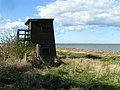 Bird hide, Lowmoor Point - geograph.org.uk - 153497.jpg 640 × 480; 141 KB
-
 Boiler on the shore - geograph.org.uk - 397700.jpg 480 × 640; 97 KB
-
 Broadstones - geograph.org.uk - 179972.jpg 640 × 480; 148 KB
-

-
 Cheswick Links - geograph.org.uk - 1511771.jpg 640 × 422; 168 KB
-
 Cheswick Sands - geograph.org.uk - 1509933.jpg 640 × 408; 186 KB
-
 Cheswick Sands - geograph.org.uk - 1509939.jpg 640 × 427; 177 KB
-
 Cheswick Sands - geograph.org.uk - 1509954.jpg 427 × 640; 173 KB
-
 Cheswick Sands - geograph.org.uk - 1511923.jpg 640 × 393; 149 KB
-
 Dune Slack - geograph.org.uk - 179986.jpg 640 × 480; 156 KB
-

-
 Dunes, Holy Island - geograph.org.uk - 1001711.jpg 640 × 359; 80 KB
-
 Dusk at The Lough, Lindisfarne Island - geograph.org.uk - 65087.jpg 640 × 480; 89 KB
-
 East Coast of Holy Island - geograph.org.uk - 1060051.jpg 640 × 480; 71 KB
-
 East coast, Holy Island - geograph.org.uk - 996698.jpg 640 × 359; 115 KB
-
 Emmanuel Head and Keel Head - geograph.org.uk - 995507.jpg 640 × 348; 58 KB
-
 Fenham Flats - geograph.org.uk - 180023.jpg 640 × 480; 116 KB
-

-
 Foreshore below the Heugh, Holy Island - geograph.org.uk - 409683.jpg 640 × 426; 120 KB
-
 Foreshore near Broadstones, Holy Island - geograph.org.uk - 401505.jpg 640 × 429; 170 KB
-
 Foreshore near causeway, Holy Island - geograph.org.uk - 1235476.jpg 640 × 426; 86 KB
-
 Foreshore near causeway, Holy Island - geograph.org.uk - 1235493.jpg 640 × 426; 70 KB
-
 Foreshore near causeway, Holy Island - geograph.org.uk - 1235524.jpg 640 × 465; 81 KB
-
 Foreshore near causeway, Holy Island - geograph.org.uk - 1235532.jpg 640 × 426; 83 KB
-
 Foreshore near causeway, Holy Island - geograph.org.uk - 1235556.jpg 640 × 426; 85 KB
-
 Foreshore near causeway, Holy Island - geograph.org.uk - 1235577.jpg 640 × 426; 83 KB
-
 Foreshore near causeway, Holy Island - geograph.org.uk - 1235649.jpg 640 × 426; 69 KB
-
 Foreshore near Holy Island - geograph.org.uk - 1238897.jpg 640 × 353; 40 KB
-
 Foreshore, Holy Island, Northumberland - geograph.org.uk - 1232398.jpg 640 × 425; 109 KB
-
 Foreshore, Holy Island, Northumberland - geograph.org.uk - 1232704.jpg 640 × 425; 100 KB
-

-
 Holy Island Sands - geograph.org.uk - 104305.jpg 640 × 409; 40 KB
-
 Holy Island Sands - geograph.org.uk - 180004.jpg 640 × 480; 89 KB
-
 Holy Island Sands - geograph.org.uk - 180334.jpg 640 × 480; 93 KB
-
 Holy Island Sands - geograph.org.uk - 928493.jpg 640 × 465; 35 KB
-
 Holy Island Sands - geograph.org.uk - 928517.jpg 640 × 434; 33 KB
-
 Holy Island Sands - geograph.org.uk - 971553.jpg 640 × 480; 171 KB
-
 Holy Island Sands, Northumberland - geograph.org.uk - 1235362.jpg 640 × 426; 100 KB
-
 Lindisfarne National Nature Reserve - geograph.org.uk - 312191.jpg 640 × 480; 113 KB
-
 Lindisfarne National Nature Reserve - geograph.org.uk - 312381.jpg 640 × 480; 94 KB
-
 Lindisfarne National Nature Reserve - geograph.org.uk - 312582.jpg 640 × 399; 80 KB
-
 Lindisfarne National Nature Reserve - geograph.org.uk - 322627.jpg 640 × 480; 79 KB
-
 Lindisfarne National Nature Reserve - geograph.org.uk - 444285.jpg 632 × 465; 95 KB
-
 Long Ridge - geograph.org.uk - 1030869.jpg 640 × 513; 118 KB
-
 Long Ridge, Holy Island - geograph.org.uk - 181158.jpg 640 × 480; 106 KB
-

-

-

-
 North Shore Patterns - geograph.org.uk - 1039582.jpg 640 × 480; 73 KB
-
 Oblivious - geograph.org.uk - 1030233.jpg 480 × 640; 63 KB
-
 Oyster Scap - geograph.org.uk - 179999.jpg 640 × 480; 88 KB
-
 Rocky beach, Holy Island - geograph.org.uk - 996700.jpg 640 × 359; 144 KB
-
 Rocky coastline at Nessend - geograph.org.uk - 410560.jpg 640 × 480; 89 KB
-
 Ruined Chapel, Holy Island - geograph.org.uk - 1059893.jpg 640 × 480; 55 KB
-
 Ruined Chapel, Holy Island - geograph.org.uk - 109808.jpg 640 × 480; 106 KB
-
 Salt tolerant plants, Holy Island - geograph.org.uk - 993730.jpg 640 × 480; 108 KB
-

-
 Sand and sea Holy Island - geograph.org.uk - 216554.jpg 640 × 480; 35 KB
-
 Sand, Sea and Sky - geograph.org.uk - 1039608.jpg 640 × 480; 40 KB
-
 Sandbanks from Holy Island - geograph.org.uk - 179993.jpg 640 × 480; 102 KB
-
 Sandeel Beds - geograph.org.uk - 181157.jpg 640 × 480; 133 KB
-
 Sandham - geograph.org.uk - 995501.jpg 640 × 359; 81 KB
-
 Sandham Bay Sculpture - geograph.org.uk - 1039675.jpg 640 × 480; 53 KB
-
 Sandham Bay, Holy Island - geograph.org.uk - 409927.jpg 640 × 426; 144 KB
-
 Sandham Bay, Holy Island - geograph.org.uk - 410529.jpg 640 × 480; 90 KB
-
 Sandon Bay, Holy Island - geograph.org.uk - 1007714.jpg 600 × 450; 76 KB
-
 Sandon Bay, Holy Island - geograph.org.uk - 135592.jpg 640 × 248; 42 KB
-
 Sea markers - geograph.org.uk - 1082419.jpg 640 × 480; 56 KB
-
 Sea Mayweed - geograph.org.uk - 971223.jpg 640 × 426; 325 KB
-
 Sea Thrift on the Mud Flats - geograph.org.uk - 309525.jpg 640 × 411; 142 KB
-
 Slack, The Links - geograph.org.uk - 995523.jpg 640 × 359; 88 KB
-
 Snook Point - geograph.org.uk - 1074129.jpg 640 × 480; 32 KB
-
 Snook Point and Holy Island Sands - geograph.org.uk - 971538.jpg 640 × 480; 154 KB


