Category:Linslade
town in Bedfordshire, England, UK  | |||||
| Upload media | |||||
| Instance of | |||||
|---|---|---|---|---|---|
| Location | Leighton–Linslade, Central Bedfordshire, Bedfordshire, East of England, England | ||||
| Owned by |
| ||||
 | |||||
English: Linslade is a town in Bedfordshire, England, near the county boundary with Buckinghamshire border. It adjoins onto the town of Leighton Buzzard and is part of the civil parish of Leighton-Linslade. Linslade was an urban district in Buckinghamshire until it was transferred to Bedfordshire in 1965.
Subcategories
This category has the following 5 subcategories, out of 5 total.
Media in category "Linslade"
The following 92 files are in this category, out of 92 total.
-
 11 And 11A, Market Square.jpg 4,032 × 3,024; 3.44 MB
-
 45 Miles to Braunston - geograph.org.uk - 1354454.jpg 480 × 640; 108 KB
-
 46 miles to Braunston - geograph.org.uk - 956590.jpg 640 × 480; 124 KB
-
 47 Miles to Braunston - geograph.org.uk - 1354373.jpg 480 × 640; 113 KB
-

-

-

-
 Canalside flats, Linslade - geograph.org.uk - 5783712.jpg 1,024 × 683; 249 KB
-
 Canalside flats, Linslade - geograph.org.uk - 5783718.jpg 1,024 × 768; 306 KB
-
 Church Road, Linslade - geograph.org.uk - 2650663.jpg 640 × 480; 94 KB
-

-
 Dillamore Funeral Service, Linslade - geograph.org.uk - 3995077.jpg 640 × 480; 96 KB
-
 Footpath in Linslade - geograph.org.uk - 1572725.jpg 640 × 480; 73 KB
-
 Georgian Houses on Old Road, Linslade - geograph.org.uk - 3195151.jpg 2,048 × 1,536; 2.35 MB
-
 Grand Union Canal - geograph.org.uk - 2534.jpg 640 × 369; 60 KB
-
 Grand Union Canal near Leighton Buzzard - geograph.org.uk - 585.jpg 640 × 402; 35 KB
-
 Grand Union Canal, Linslade - geograph.org.uk - 2651638.jpg 640 × 480; 93 KB
-
 Grand Union Canal, Linslade - geograph.org.uk - 3445379.jpg 1,280 × 855; 282 KB
-
 Grand Union Canal, Linslade - geograph.org.uk - 3452993.jpg 1,280 × 856; 346 KB
-

-

-
 Graveyard, Old Linslade - geograph.org.uk - 4917027.jpg 640 × 426; 56 KB
-
 Graveyard, Old Linslade - geograph.org.uk - 4924551.jpg 640 × 319; 47 KB
-
 Ledburn Crossing Cottage, Linslade - geograph.org.uk - 5781928.jpg 1,024 × 768; 252 KB
-
 Linslade - 350105 (9364967968).jpg 4,608 × 3,072; 3.35 MB
-
 Linslade - 350125 (9362183721).jpg 4,608 × 3,072; 3.01 MB
-
 Linslade - 377206 (9362188017).jpg 4,608 × 3,072; 5.2 MB
-
 Linslade - 90046 (9362178489).jpg 4,608 × 3,072; 2.76 MB
-
 Linslade - Houses on Church Road - geograph.org.uk - 4221531.jpg 1,339 × 1,000; 945 KB
-
 Linslade - Narrow alley - geograph.org.uk - 4221519.jpg 1,000 × 1,333; 1.45 MB
-
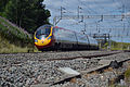 Linslade - Pendolino (9362181393).jpg 4,608 × 3,072; 3.08 MB
-
 Linslade Methodist Chapel - geograph.org.uk - 5781874.jpg 1,024 × 768; 283 KB
-
 Linslade Rec- autumn leaves - geograph.org.uk - 2644682.jpg 640 × 480; 101 KB
-
 Linslade Rec- drinking fountain - geograph.org.uk - 2644680.jpg 640 × 480; 88 KB
-

-
 Linslade Rec- path - geograph.org.uk - 2644684.jpg 640 × 480; 123 KB
-
 Linslade Tunnel geograph-2173685.jpg 1,024 × 576; 262 KB
-
 Linslade Tyres - geograph.org.uk - 2641094.jpg 480 × 640; 75 KB
-

-
 Linslade, Bridge No 114 - geograph.org.uk - 5615795.jpg 1,024 × 753; 272 KB
-
 Linslade, Buckingham Arms - geograph.org.uk - 5615807.jpg 1,024 × 755; 144 KB
-
 Linslade, canal - geograph.org.uk - 5615790.jpg 1,024 × 768; 132 KB
-
 Linslade, Grand Union Canal - geograph.org.uk - 96934.jpg 640 × 480; 114 KB
-
 Linslade, Laura Alice in action - geograph.org.uk - 97839.jpg 640 × 480; 120 KB
-
 Linslade, River Ouzel - geograph.org.uk - 5615785.jpg 1,024 × 768; 301 KB
-
 Linslade, The Globe Inn - geograph.org.uk - 3694594.jpg 640 × 480; 88 KB
-
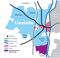 LinsladeMap.svg 729 × 707; 95 KB
-
 Narrowboats on the Grand Union Canal in Linslade - geograph.org.uk - 4921154.jpg 1,500 × 999; 232 KB
-
 Narrowboats on the Grand Union Canal in Linslade - geograph.org.uk - 4921156.jpg 1,500 × 999; 172 KB
-
 New Road, Linslade - geograph.org.uk - 2650701.jpg 640 × 480; 75 KB
-
 Old Road, Linslade - geograph.org.uk - 1446016.jpg 640 × 427; 73 KB
-
 Old Road, Linslade - geograph.org.uk - 2650733.jpg 640 × 480; 69 KB
-
 Old Road, Linslade - geograph.org.uk - 3195012.jpg 2,048 × 1,536; 2 MB
-
 Old Road, Linslade - geograph.org.uk - 3195042.jpg 2,048 × 1,536; 2.22 MB
-

-
 Public Footpath - geograph.org.uk - 401806.jpg 480 × 640; 126 KB
-
 Railway Bridge at Old Linslade - geograph.org.uk - 1876107.jpg 640 × 480; 141 KB
-

-

-

-
 River Ouzel north of Linslade - geograph.org.uk - 1464258.jpg 640 × 433; 106 KB
-
 River Ouzel north of Linslade - geograph.org.uk - 1464752.jpg 640 × 427; 87 KB
-
 School playing fields, Linslade - geograph.org.uk - 5782303.jpg 1,024 × 768; 316 KB
-
 Sheep safely graze next to the West Coast Main Line. - panoramio.jpg 1,167 × 776; 344 KB
-

-

-
 Snow covered Allotments, Linslade - geograph.org.uk - 2247556.jpg 640 × 430; 119 KB
-
 Southcourt Avenue, Linslade - geograph.org.uk - 2650616.jpg 640 × 480; 97 KB
-
 Southcourt Road, Linslade - geograph.org.uk - 2650630.jpg 640 × 480; 78 KB
-
 Springfield Road, Linslade - geograph.org.uk - 2650625.jpg 640 × 480; 84 KB
-
 Stoke Road, Linslade - geograph.org.uk - 1446007.jpg 640 × 462; 89 KB
-
 Texture Road, Linslade - geograph.org.uk - 2668001.jpg 480 × 640; 76 KB
-
 The Globe Inn Pub, Linslade.jpg 2,048 × 1,536; 624 KB
-
 The Grand Union Canal in Linslade - geograph.org.uk - 4921138.jpg 1,500 × 999; 172 KB
-
 The Grand Union Canal in Linslade - geograph.org.uk - 4921141.jpg 1,500 × 999; 209 KB
-
 The Grand Union Canal in Linslade - geograph.org.uk - 4921151.jpg 1,500 × 999; 165 KB
-
 The Railway Hotel - geograph.org.uk - 1906794.jpg 1,600 × 1,026; 393 KB
-
 The River Ouzel, Linslade - geograph.org.uk - 2651641.jpg 640 × 480; 128 KB
-
 The White Horse, New Road, Linslade - geograph.org.uk - 2650715.jpg 640 × 480; 80 KB
-
 Vicarage Road, Linslade - geograph.org.uk - 2644689.jpg 640 × 480; 85 KB
-
 Farm Entrance and Drive - geograph.org.uk - 350779.jpg 640 × 439; 168 KB
-
 Leighton Buzzard, River Ouzel - geograph.org.uk - 97835.jpg 640 × 480; 171 KB
-

-
 Linslade, Bideford Green - geograph.org.uk - 96945.jpg 640 × 480; 175 KB
-
 Linslade, Decisions, decisions - geograph.org.uk - 97843.jpg 640 × 480; 116 KB
-
 Linslade, The Railway Hotel - geograph.org.uk - 97848.jpg 640 × 480; 85 KB
-

-
 Road Construction Sign - geograph.org.uk - 326055.jpg 640 × 430; 84 KB
-
 Site of Linslade bypass, looking North - geograph.org.uk - 5620.jpg 640 × 426; 60 KB
-

-

-
 View towards Whitefields - geograph.org.uk - 325738.jpg 640 × 480; 101 KB


.jpg)
.jpg)
.jpg)
.jpg)


.jpg)


_-_geograph.org.uk_-_2601134.jpg)
_-_geograph.org.uk_-_2601135.jpg)
_-_geograph.org.uk_-_2601139.jpg)


