Category:Linton, Derbyshire
village and civil parish in South Derbyshire district, Derbyshire, England  | |||||
| Upload media | |||||
| Instance of | |||||
|---|---|---|---|---|---|
| Location | South Derbyshire, Derbyshire, East Midlands, England | ||||
 | |||||
Subcategories
This category has the following 3 subcategories, out of 3 total.
L
- Linton Heath (1 F)
Media in category "Linton, Derbyshire"
The following 45 files are in this category, out of 45 total.
-
 Across the Fields to Linton - geograph.org.uk - 285439.jpg 640 × 480; 61 KB
-
 Across the valley from Badge Wood - geograph.org.uk - 385754.jpg 640 × 463; 144 KB
-
 Bell Cote at Christ Church, Coton Park - geograph.org.uk - 4776752.jpg 4,483 × 3,304; 3.32 MB
-
-
 Calf pens in a row - geograph.org.uk - 395016.jpg 455 × 640; 131 KB
-
 Cauldwell Road, Linton - geograph.org.uk - 6203856.jpg 800 × 600; 154 KB
-

-
 Derbyshire UK parish map highlighting Linton.svg 888 × 1,308; 2.35 MB
-
 Ewe looking at me^ - geograph.org.uk - 337335.jpg 640 × 480; 105 KB
-
 Farmhouse at Longlands - geograph.org.uk - 395028.jpg 640 × 481; 112 KB
-
 Field of Oilseed Rape near Linton - geograph.org.uk - 2389723.jpg 3,296 × 2,472; 1.01 MB
-
 Former shop on High Street, Linton - geograph.org.uk - 6203890.jpg 800 × 510; 91 KB
-
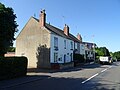
 High Street in Linton - geograph.org.uk - 2389746.jpg 3,296 × 2,472; 1 MB
-
 High Street, Linton - geograph.org.uk - 5464223.jpg 480 × 640; 40 KB
-
 Hill Crest Farm in Badger Wood - geograph.org.uk - 385605.jpg 640 × 480; 79 KB
-
 Hillside Road, Linton - geograph.org.uk - 6203899.jpg 800 × 600; 102 KB
-
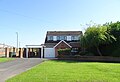 House on Cauldwell Road, Linton - geograph.org.uk - 6203854.jpg 800 × 544; 86 KB
-
 Houses on Hillside Road, Linton - geograph.org.uk - 6203892.jpg 800 × 600; 85 KB
-
 Leaving Linton - geograph.org.uk - 394956.jpg 640 × 481; 116 KB
-
 Linton Heath - geograph.org.uk - 5566114.jpg 2,000 × 1,333; 1.5 MB
-
 Linton Heath - geograph.org.uk - 6203840.jpg 800 × 600; 81 KB
-

-
 Linton Primary School - geograph.org.uk - 6203843.jpg 800 × 539; 91 KB
-
 Linton Primary School - geograph.org.uk - 64166.jpg 640 × 480; 60 KB
-
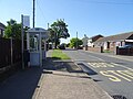
 Linton Village sign - geograph.org.uk - 2782735.jpg 640 × 480; 60 KB
-
 Lintonvillage3.JPG 1,280 × 960; 606 KB
-
 Longlands Farm - geograph.org.uk - 394992.jpg 640 × 481; 82 KB
-
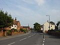 Main Street, Linton - geograph.org.uk - 285436.jpg 640 × 480; 59 KB
-
 Not a pretty sight - geograph.org.uk - 337188.jpg 640 × 480; 87 KB
-
 Old Graffiti at Linton Heath - geograph.org.uk - 705304.jpg 640 × 480; 92 KB
-
 Path out of Linton - geograph.org.uk - 5464228.jpg 480 × 640; 87 KB
-
 Peep - O - geograph.org.uk - 337191.jpg 640 × 480; 62 KB
-

-
 Sheep in a field - geograph.org.uk - 385725.jpg 640 × 480; 90 KB
-
 Sign for the Red Lion, Linton - geograph.org.uk - 6203852.jpg 800 × 690; 97 KB
-
 Small Water hole at Blakenhall Farm - geograph.org.uk - 395094.jpg 640 × 481; 170 KB
-
 Sports ground, Linton Heath - geograph.org.uk - 6203835.jpg 800 × 600; 86 KB
-
 Sunset on Linton Heath - geograph.org.uk - 51672.jpg 640 × 480; 66 KB
-
 Swansong - geograph.org.uk - 337196.jpg 640 × 480; 120 KB
-
 Terraced housing at Linton Heath - geograph.org.uk - 64159.jpg 640 × 480; 61 KB
-
 The Red Lion, Linton - geograph.org.uk - 6203849.jpg 800 × 578; 99 KB
-
 The village of Linton - geograph.org.uk - 5566110.jpg 2,000 × 1,333; 1.63 MB
-
 Tradesmans Entrance - geograph.org.uk - 337189.jpg 640 × 480; 104 KB
-
 Wood with no name - geograph.org.uk - 394979.jpg 640 × 481; 93 KB
-
 Woodside Farm, Linton - geograph.org.uk - 64167.jpg 640 × 480; 57 KB


