Category:Lisvane
district and community of Cardiff, Wales  .svg) | |||||
| Upload media | |||||
| Instance of | |||||
|---|---|---|---|---|---|
| Location | Cardiff, Wales | ||||
| Different from | |||||
 | |||||
Cymraeg: Ardal a chymuned yng Nghaerdydd yw Llysfaen. Lleolir tua pum milltir i'r gogledd o ganol y dref. Mae'r pentref hynafol wedi ei amgylchynnu gai dai newydd, ac erbyn hyn mae'n un o gymunedau cyfoethocaf Caerdydd.
English: Lisvane, a suburb in north Cardiff
Subcategories
This category has the following 7 subcategories, out of 7 total.
C
- Caerphilly Tunnel (5 F)
- Cefn Onn quarry (7 F)
L
P
- Parc Cefn Onn (39 F)
S
- St Denys Church, Lisvane (19 F)
W
- Lisvane War Memorial (5 F)
Media in category "Lisvane"
The following 200 files are in this category, out of 293 total.
(previous page) (next page)-
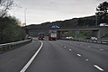
 10-15 to Cardiff calling at Lisvane-Thornhill - geograph.org.uk - 2201170.jpg 1,936 × 2,592; 3.14 MB
-
 2010 Wales Cardiff Community Lisvane map.svg 512 × 546; 341 KB
-
 2024 Wales Cardiff Community Lisvane map.svg 512 × 546; 319 KB
-

-
 A glimpse of some golfers - geograph.org.uk - 2549705.jpg 640 × 480; 181 KB
-
 A469 Bridge, M4 - geograph.org.uk - 3672110.jpg 640 × 430; 37 KB
-
 A469 road over Caerphilly Mountain - geograph.org.uk - 1988489.jpg 640 × 480; 91 KB
-

-

-
 Air shaft - geograph.org.uk - 6145879.jpg 1,536 × 2,048; 1.39 MB
-
 Another stile near Lisvane - geograph.org.uk - 1527173.jpg 640 × 480; 87 KB
-
 Ashgrove House, Lisvane, Cardiff - geograph.org.uk - 5650915.jpg 800 × 618; 106 KB
-
 Balmoral Close, Lisvane, Cardiff - geograph.org.uk - 5631553.jpg 800 × 706; 130 KB
-

-
 Bend in Graig Road, Lisvane, Cardiff - geograph.org.uk - 5668305.jpg 800 × 756; 116 KB
-
 Bend in the road near Lisvane - geograph.org.uk - 3793215.jpg 640 × 480; 94 KB
-
 Bends in Capel Gwilym Road - geograph.org.uk - 2009376.jpg 640 × 480; 74 KB
-

-

-
 Bridge over the M4 - geograph.org.uk - 210144.jpg 640 × 480; 57 KB
-

-
 Buckingham Close, Lisvane, Cardiff - geograph.org.uk - 5631560.jpg 800 × 522; 93 KB
-
 Caerphilly Tunnel Air Shaft No.4. - geograph.org.uk - 457520.jpg 640 × 480; 349 KB
-

-

-
 Capel Gwilym Road heading east - geograph.org.uk - 2009364.jpg 640 × 480; 78 KB
-
 Cardiff , The M4 Motorway - geograph.org.uk - 3926520.jpg 4,288 × 2,848; 4.84 MB
-
 Cardiff , The M4 Motorway - geograph.org.uk - 3926522.jpg 4,288 × 2,848; 4.58 MB
-
 Cardiff , The M4 Motorway - geograph.org.uk - 3926525.jpg 4,288 × 2,848; 4.68 MB
-
 Cardiff , The M4 Motorway - geograph.org.uk - 3926527.jpg 4,288 × 2,848; 4.67 MB
-
 Cardiff , The M4 Motorway - geograph.org.uk - 3928407.jpg 4,288 × 2,848; 4.11 MB
-
 Cardiff , The M4 Motorway - geograph.org.uk - 3928408.jpg 4,288 × 2,848; 5.19 MB
-
 Cardiff , The M4 Motorway - geograph.org.uk - 3928409.jpg 4,288 × 2,848; 4.94 MB
-

-
 Cardiff UK community map (Lisvane).svg 1,187 × 1,266; 438 KB
-
 Cardinal Drive, Lisvane, Cardiff - geograph.org.uk - 5650886.jpg 800 × 613; 95 KB
-
 Carn Ingli, Lisvane Road, August 2019 01.jpg 4,032 × 3,024; 3.03 MB
-
 Carn Ingli, Lisvane Road, August 2019 02.jpg 1,536 × 2,048; 1.03 MB
-
 Cattle on Hill Farm, Thornhill, Cardiff - geograph.org.uk - 1881499.jpg 3,296 × 2,472; 1.9 MB
-
 Cefn Mably Road, Lisvane, Cardiff - geograph.org.uk - 5650283.jpg 652 × 800; 168 KB
-
 Cefn Onn, near Lisvane, Cardiff (28170574454).jpg 4,907 × 3,271; 13.84 MB
-
 Cerrig Llwyd, Lisvane Road, August 2019 01.jpg 4,032 × 3,024; 3.35 MB
-
 Cerrig Llwyd, Lisvane Road, August 2019 02.jpg 1,536 × 2,048; 945 KB
-
 Cerrig Llwyd, Lisvane Road, August 2019 03.jpg 4,032 × 3,024; 2.84 MB
-

-
 Chartwell Drive, Lisvane, Cardiff - geograph.org.uk - 5631511.jpg 800 × 536; 87 KB
-
 Chartwell Drive, Lisvane, Cardiff - geograph.org.uk - 5631596.jpg 800 × 650; 96 KB
-

-

-

-

-
 Cherry Orchard Road, Thornhill - geograph.org.uk - 410342.jpg 640 × 479; 104 KB
-
 Cherry Tree Close, Lisvane, Cardiff - geograph.org.uk - 5656696.jpg 800 × 720; 159 KB
-
 Church Close, Lisvane, Cardiff - geograph.org.uk - 5650286.jpg 800 × 626; 96 KB
-
 Church Road businesses, Lisvane, Cardiff - geograph.org.uk - 5650295.jpg 800 × 436; 103 KB
-
 Churchill Close, Lisvane, Cardiff - geograph.org.uk - 5632032.jpg 800 × 570; 92 KB
-
 Churchyard in Lisvane, Cardiff - geograph.org.uk - 5658149.jpg 800 × 600; 136 KB
-
 Class 37 at Lisvane ^ Thornhill - geograph.org.uk - 6152261.jpg 4,154 × 3,115; 5.09 MB
-
 Class 37 at Lisvane ^ Thornhill - geograph.org.uk - 6182403.jpg 2,863 × 3,820; 4.12 MB
-
 Clos Llysfaen, Lisvane, Cardiff - geograph.org.uk - 5637286.jpg 800 × 536; 87 KB
-
 Clos Llysfaen, Lisvane, Cardiff - geograph.org.uk - 5666661.jpg 800 × 652; 132 KB
-

-
 Concrete blocks, Lisvane, Cardiff - geograph.org.uk - 5666684.jpg 800 × 600; 172 KB
-

-

-
 Cornflower Close, Lisvane, Cardiff - geograph.org.uk - 5632021.jpg 800 × 686; 94 KB
-
 Corpus Christi High School - geograph.org.uk - 5661804.jpg 3,264 × 2,448; 2.48 MB
-
 Cotswold Avenue, Lisvane, Cardiff - geograph.org.uk - 5656734.jpg 800 × 650; 90 KB
-

-
 Country Road to Lisvane - geograph.org.uk - 3793206.jpg 640 × 480; 41 KB
-
 Craig Llanishen - geograph.org.uk - 4542478.jpg 640 × 480; 140 KB
-
 Craig Llysfaen - geograph.org.uk - 4542504.jpg 640 × 480; 99 KB
-
 Craig Llysfaen - geograph.org.uk - 4542515.jpg 640 × 480; 111 KB
-
 Crofta, Lisvane, Cardiff - geograph.org.uk - 5635647.jpg 800 × 725; 132 KB
-

-

-
 Dead tree stump on Graig Llysfaen - geograph.org.uk - 1934437.jpg 3,296 × 2,472; 1.97 MB
-

-

-

-

-

-
 Down Cornflower Close, Lisvane, Cardiff - geograph.org.uk - 5632028.jpg 800 × 664; 118 KB
-

-

-

-
 Eastbound M4 viewed from Heol Hir - geograph.org.uk - 2009444.jpg 640 × 483; 69 KB
-

-
 Electricity pylons - geograph.org.uk - 5967430.jpg 2,448 × 3,264; 2.45 MB
-
-

-

-
 Entrance to Tai-mawr Farm - geograph.org.uk - 1527764.jpg 640 × 480; 127 KB
-

-
 Feral honeybees' nest in a hollow tree on Graig Llysfaen - geograph.org.uk - 1934483.jpg 2,472 × 3,296; 2.56 MB
-
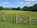 Field beside Ty-Draw Road - geograph.org.uk - 1909502.jpg 640 × 480; 105 KB
-

-

-

-
 Footpath directly above Caerphilly Tunnel - geograph.org.uk - 457515.jpg 480 × 640; 344 KB
-

-

-
 Foxfield, seen from Tai-mawr - geograph.org.uk - 1527217.jpg 640 × 480; 61 KB
-

-

-
 Graig Llanishen Footpath, Thornhill - geograph.org.uk - 441288.jpg 600 × 600; 386 KB
-
 Graig Llanishen Footpath, Thornhill - geograph.org.uk - 441320.jpg 480 × 640; 128 KB
-
 Graig Llanishen Footpath, Thornhill - geograph.org.uk - 443135.jpg 480 × 640; 102 KB
-

-
 Graig Road bridge over M4 cutting north of Cardiff - geograph.org.uk - 5819581.jpg 1,600 × 1,201; 748 KB
-
 Graig Road, Lisvane. - geograph.org.uk - 361359.jpg 640 × 465; 80 KB
-

-
 Hairpin bend in Lisvane, Cardiff - geograph.org.uk - 5666681.jpg 800 × 600; 163 KB
-
-
 Heol Hir Bridge, M4 - geograph.org.uk - 3672109.jpg 640 × 430; 33 KB
-
 Heol Hir road bridge over M4 on the edge of Cardiff - geograph.org.uk - 5819589.jpg 1,600 × 1,066; 664 KB
-
 Hill Farm access road - geograph.org.uk - 2009286.jpg 640 × 604; 76 KB
-
 Hill on flank of Craig llanisen - geograph.org.uk - 6161571.jpg 5,179 × 3,451; 5.16 MB
-
 Hillside, Capel Gwilym Road - geograph.org.uk - 2009308.jpg 640 × 594; 162 KB
-
 Holly Grove, Lisvane, Cardiff - geograph.org.uk - 5650254.jpg 800 × 508; 94 KB
-
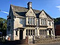
 House, Lisvane - geograph.org.uk - 938280.jpg 640 × 480; 66 KB
-

-

-

-
 Insync Pharmacy, Lisvane, Cardiff - geograph.org.uk - 5656736.jpg 800 × 758; 115 KB
-
 Jade Close, Lisvane, Cardiff - geograph.org.uk - 5650899.jpg 800 × 616; 110 KB
-

-

-

-
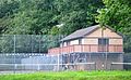 Lisvane (CAC) Tennis Club.JPG 2,736 × 1,678; 1.07 MB
-
 Lisvane boundary sign, Cardiff - geograph.org.uk - 5631523.jpg 800 × 669; 207 KB
-
 Lisvane House, Lisvane, July 2020 (1).jpg 4,032 × 3,024; 2.92 MB
-
 Lisvane House, Lisvane, July 2020 (2).jpg 4,032 × 3,024; 2.76 MB
-

-
 Lisvane Road, Lisvane, Cardiff - geograph.org.uk - 5631636.jpg 800 × 687; 191 KB
-
 Lisvane Tennis Club access road, Cardiff - geograph.org.uk - 5666675.jpg 800 × 725; 194 KB
-
 Lisvane Tennis Club car park, Cardiff - geograph.org.uk - 5645517.jpg 800 × 745; 157 KB
-
 Lisvane Tennis Club, Cardiff - geograph.org.uk - 5645513.jpg 800 × 779; 201 KB
-

-
 Llanishen Golf Club, Cardiff - geograph.org.uk - 457523.jpg 640 × 480; 287 KB
-
 Llwyn Celyn Forestry Walk - geograph.org.uk - 437268.jpg 640 × 480; 96 KB
-

-

-
 Llwyn y Pia Road, Lisvane, Cardiff - geograph.org.uk - 5656704.jpg 750 × 800; 144 KB
-
 Longleat Close, Lisvane, Cardiff - geograph.org.uk - 5631564.jpg 800 × 590; 118 KB
-
 Looking down on Foxfield - geograph.org.uk - 1527208.jpg 640 × 480; 90 KB
-
 Looking South East towards Cardiff from Brynhill road - geograph.org.uk - 3169127.jpg 3,456 × 2,304; 867 KB
-
-

-
 M4 eastbound at Thornhill - geograph.org.uk - 3274083.jpg 640 × 480; 37 KB
-
 M4 eastbound towards junction 30 - geograph.org.uk - 4322529.jpg 1,600 × 1,200; 1,015 KB
-
 M4 eastbound towards junction 30 - geograph.org.uk - 4322532.jpg 1,600 × 1,200; 987 KB
-

-
 M4 motorway overbridge, Lisvane, Cardiff - geograph.org.uk - 5645506.jpg 800 × 600; 128 KB
-
 M4 motorway to Newport from bridge - geograph.org.uk - 3793211.jpg 640 × 480; 37 KB
-
 M4 near Cardiff, looking west - geograph.org.uk - 1988486.jpg 640 × 480; 76 KB
-
 M4 skirting North Cardiff - geograph.org.uk - 130052.jpg 640 × 480; 56 KB
-
 M4 westbound near Church Farm - geograph.org.uk - 3263512.jpg 640 × 481; 36 KB
-

-
 Maerdy Lane, Lisvane, Cardiff - geograph.org.uk - 5650316.jpg 800 × 770; 228 KB
-
 Maerdy Lane, Lisvane, Cardiff - geograph.org.uk - 5650328.jpg 800 × 649; 149 KB
-

-

-

-
 Motorway road bridge. - geograph.org.uk - 1559785.jpg 640 × 481; 129 KB
-
 Nant Fawr - geograph.org.uk - 4542495.jpg 640 × 480; 134 KB
-

-

-
 North along Rudry Road, Lisvane, Cardiff - geograph.org.uk - 5656737.jpg 800 × 648; 126 KB
-

-
 Oaktree House, Lisvane, Cardiff - geograph.org.uk - 5656735.jpg 800 × 586; 113 KB
-

-

-
-
 Panoramic autumn landscape - geograph.org.uk - 5967930.jpg 5,057 × 2,347; 3.41 MB
-

-
 Parc Cefn Onn - geograph.org.uk - 3278051.jpg 4,000 × 3,000; 5.32 MB
-

-

-

-
 Pavement resurfacing in Lisvane, Cardiff - geograph.org.uk - 5635653.jpg 800 × 727; 158 KB
-

-
-
 Portland Place, Lisvane, Cardiff - geograph.org.uk - 5631545.jpg 800 × 585; 124 KB
-
 Power lines over the M4 north of Cardiff - geograph.org.uk - 5819574.jpg 1,600 × 1,200; 808 KB
-
 Pub and church in Lisvane - geograph.org.uk - 1909510.jpg 640 × 480; 72 KB
-

-
 Public footpath, Lisvane, Cardiff - geograph.org.uk - 5635664.jpg 800 × 704; 281 KB
-
 Pylon in field below Craig Llanisen - geograph.org.uk - 6161548.jpg 5,184 × 3,456; 7.3 MB
-

-

-

-

-

-
 Road bridge over stream. - geograph.org.uk - 1559789.jpg 640 × 502; 115 KB
-

-
 Road junction - geograph.org.uk - 5847606.jpg 3,264 × 2,448; 2.7 MB
-
 Roadworks on the Brynhill farm Road - geograph.org.uk - 3169136.jpg 3,456 × 2,304; 1.02 MB
-
 Rowan Way speed bumps, Lisvane, Cardiff - geograph.org.uk - 5656697.jpg 795 × 800; 171 KB
-


.jpg)


.jpg)


_Tennis_Club.JPG)

.jpg)
.jpg)


