Category:Little Budworth
English: Little Budworth is a civil parish and village between Winsford and Chester, in the unitary authority of Cheshire West and Chester and the ceremonial county of Cheshire, England. It is primarily known as the location of the Oulton Park motor racing circuit.
village and civil parish in Cheshire West and Chester, Cheshire, England  | |||||
| Upload media | |||||
| Instance of | |||||
|---|---|---|---|---|---|
| Location | Cheshire West and Chester, Cheshire, North West England, England | ||||
 | |||||
Subcategories
This category has the following 3 subcategories, out of 3 total.
D
O
P
Media in category "Little Budworth"
The following 158 files are in this category, out of 158 total.
-
 A boggy pond filled with bulrushes and willow - geograph.org.uk - 2692768.jpg 3,072 × 2,304; 4.68 MB
-
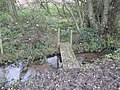 A footbridge over a tributary of Shay's Lane Brook - geograph.org.uk - 2689025.jpg 3,072 × 2,304; 5.2 MB
-
 A stand of poplars delineate the course of Shays Lane Brook - geograph.org.uk - 2691436.jpg 3,072 × 2,304; 4.89 MB
-
 A wooded lane, Oulton Park - geograph.org.uk - 2366794.jpg 1,600 × 1,200; 698 KB
-
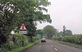
 A49 (Tarporley Road) - geograph.org.uk - 4226873.jpg 4,000 × 3,000; 3.7 MB
-
 A49 at Longstone Lane - geograph.org.uk - 2808507.jpg 640 × 480; 53 KB
-
 A49 Tarporley Road - geograph.org.uk - 2057289.jpg 640 × 480; 155 KB
-
 A54 approaching A49 junction - geograph.org.uk - 4006855.jpg 640 × 408; 61 KB
-
 A54 at The Shrewsbury Arms - geograph.org.uk - 3361544.jpg 640 × 480; 36 KB
-
 A54 Chester Lane-Clay Lane junction - geograph.org.uk - 3361540.jpg 640 × 481; 34 KB
-
 Bawk House - geograph.org.uk - 2692995.jpg 3,072 × 2,304; 4.32 MB
-
 Beech Road - geograph.org.uk - 6124268.jpg 1,024 × 768; 384 KB
-
 Boggy pond with rushes ^ willow at Cocked Hat Covert - geograph.org.uk - 2692947.jpg 3,072 × 2,304; 4.03 MB
-
 Bridge over the Poolstead Brook at Fennywood Farm - geograph.org.uk - 2692799.jpg 3,072 × 2,304; 4.67 MB
-
 Budworth Pool - geograph.org.uk - 4535598.jpg 2,184 × 1,456; 1.29 MB
-
 Chester Road looking west - geograph.org.uk - 3361548.jpg 640 × 479; 36 KB
-
 Clay Lane - geograph.org.uk - 3968237.jpg 640 × 480; 67 KB
-
 Cocked Hat Covert-external view - geograph.org.uk - 2692954.jpg 3,072 × 2,304; 3.16 MB
-
 Cocked Hat Covert-internal view - geograph.org.uk - 2692957.jpg 3,072 × 2,304; 4.94 MB
-
 Coming into Lodge Corner, Oulton Park - geograph.org.uk - 5110810.jpg 1,500 × 1,000; 1.09 MB
-
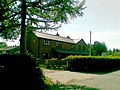
 Cottages, Little Budworth 1.jpg 4,000 × 3,000; 939 KB
-
 Crossroads at Cornhill Farm - geograph.org.uk - 4006850.jpg 640 × 427; 63 KB
-
 Darley Hall, Little Budworth - geograph.org.uk - 178400.jpg 640 × 427; 80 KB
-

-
 Dodd's House, Little Budworth - geograph.org.uk - 4537192.jpg 3,184 × 2,123; 1.96 MB
-
 Entrance and driveway to Bawk House and Farm - geograph.org.uk - 2693007.jpg 3,072 × 2,304; 3.45 MB
-

-
 Entrance to Oulton Park - geograph.org.uk - 4533822.jpg 3,184 × 2,123; 2.26 MB
-
 Entrance to Oulton Park Cricket Club - geograph.org.uk - 4535233.jpg 2,184 × 1,456; 1.03 MB
-
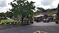 Farm shop and tea room - geograph.org.uk - 6234022.jpg 1,600 × 900; 451 KB
-
 Farm track ^ footpath from Lower Farm to Fennywood Farm - geograph.org.uk - 2692761.jpg 3,072 × 2,304; 4.43 MB
-
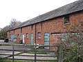
 Fennywood farm - geograph.org.uk - 2692798.jpg 3,072 × 2,304; 3.63 MB
-
 Field off Beech Road - geograph.org.uk - 6124267.jpg 1,024 × 768; 397 KB
-
 Field off Longstone Lane - geograph.org.uk - 6124261.jpg 1,024 × 768; 285 KB
-
 Field opposite Townfield Farm - geograph.org.uk - 3643627.jpg 1,024 × 680; 167 KB
-
 Footpath across Oak Tree Farm - geograph.org.uk - 5919446.jpg 4,000 × 3,000; 4.55 MB
-
 Footpath to Little Budworth - geograph.org.uk - 4533969.jpg 2,184 × 1,456; 1.51 MB
-

-
 Forest Farm - geograph.org.uk - 6246630.jpg 4,615 × 3,236; 1.73 MB
-
 Forest Road, Sandybrow Traffic Lights - geograph.org.uk - 5017386.jpg 640 × 427; 357 KB
-
 From Old Hall Corner, Oulton Park - geograph.org.uk - 5110822.jpg 1,500 × 1,000; 1.16 MB
-
 Front of former stable block at Bawk House Farm - geograph.org.uk - 2692990.jpg 3,072 × 2,304; 3.72 MB
-

-
 Glenn Irwin - geograph.org.uk - 4939705.jpg 2,321 × 1,570; 358 KB
-
 Grass runway 27 at Ashcroft Farm private airstrip - geograph.org.uk - 2693030.jpg 3,072 × 2,304; 3.8 MB
-
 Grazing meadow at Lower Farm - geograph.org.uk - 2692764.jpg 3,072 × 2,304; 3.7 MB
-
-

-

-
 Hickhurst Lane - geograph.org.uk - 3361464.jpg 640 × 480; 71 KB
-
 Holmston Hall - geograph.org.uk - 178404.jpg 640 × 480; 113 KB
-
 Holmston Hall - geograph.org.uk - 2693059.jpg 3,072 × 2,304; 4.91 MB
-
 Jakub Smrz - geograph.org.uk - 4939709.jpg 2,337 × 1,802; 569 KB
-
 Keith Farmer at Oulton Park - geograph.org.uk - 4945017.jpg 2,265 × 1,686; 470 KB
-
 Lane at Oultonlowe Green - geograph.org.uk - 3361476.jpg 640 × 480; 93 KB
-
 Little Budworth Common - geograph.org.uk - 6124271.jpg 1,024 × 768; 484 KB
-
 Little Budworth Country Park - geograph.org.uk - 4073604.jpg 4,000 × 2,248; 3.63 MB
-
 Little Budworth Country Park - geograph.org.uk - 4073609.jpg 4,000 × 2,248; 3.28 MB
-
 Little Budworth Country Park - geograph.org.uk - 4533842.jpg 2,184 × 1,456; 1.55 MB
-
 Little Budworth Country Park - geograph.org.uk - 4533847.jpg 3,184 × 2,123; 1.68 MB
-
 Little Budworth Country Park - geograph.org.uk - 4533853.jpg 2,184 × 1,456; 1.68 MB
-
 Little Budworth Country Park - geograph.org.uk - 4533857.jpg 2,184 × 1,456; 1.8 MB
-
 Little Budworth Country Park - geograph.org.uk - 4533882.jpg 3,184 × 2,123; 3.85 MB
-
 Little Budworth landscape - geograph.org.uk - 4535157.jpg 3,184 × 2,123; 1.29 MB
-
 Little Budworth Methodist Church - geograph.org.uk - 286967.jpg 640 × 480; 79 KB
-
 Little Budworth Village Hall - geograph.org.uk - 4535640.jpg 3,524 × 2,337; 1.31 MB
-
 Little Budworth War Memorial - geograph.org.uk - 4537221.jpg 3,184 × 2,123; 1.62 MB
-
 Lodge Corner, Oulton Park - geograph.org.uk - 4939717.jpg 3,184 × 2,120; 3.55 MB
-
 Longstone Lane - geograph.org.uk - 6124259.jpg 1,024 × 768; 476 KB
-
 Longstone Lane - geograph.org.uk - 6124262.jpg 1,024 × 768; 376 KB
-
 Longstone Lane junction - geograph.org.uk - 4006854.jpg 640 × 349; 37 KB
-
 Mill Lane Little Budworth - geograph.org.uk - 2691386.jpg 3,072 × 2,304; 3.33 MB
-
 Moss Hall Farm - geograph.org.uk - 6246615.jpg 5,366 × 3,295; 1.76 MB
-
 New house construction at Conygreaves Farm - geograph.org.uk - 2691410.jpg 3,072 × 2,304; 2.84 MB
-
 New house, Longstone Lane - geograph.org.uk - 2980132.jpg 640 × 480; 86 KB
-
 New house, Longstone Lane - geograph.org.uk - 2980134.jpg 640 × 480; 92 KB
-

-
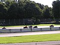 NG Road Racing Club Bike Championships, Oulton Park - geograph.org.uk - 3818225.jpg 1,440 × 1,080; 616 KB
-
 NG Road Racing Club Bike Championships, Oulton Park - geograph.org.uk - 3818238.jpg 1,440 × 1,080; 484 KB
-

-

-

-
 Oulton Park 1965 Cobra - geograph.org.uk - 5016464.jpg 1,024 × 688; 153 KB
-
 Oulton Park 1965 Ferrari 250LM - geograph.org.uk - 5016470.jpg 1,024 × 683; 100 KB
-
 Oulton Park 1965 Jim Clark Lotus 30 - geograph.org.uk - 5016493.jpg 1,024 × 707; 203 KB
-
 Oulton Park 1965 Lodge Corner - geograph.org.uk - 5016483.jpg 1,024 × 664; 136 KB
-
 Oulton Park Cricket Club - geograph.org.uk - 4535241.jpg 3,184 × 2,123; 1.27 MB
-
 Oulton Park Cricket Club - geograph.org.uk - 4535244.jpg 3,928 × 2,544; 1.83 MB
-
 Oulton Park Cricket Club Practice Nets and Entrance - geograph.org.uk - 4535227.jpg 3,184 × 2,123; 1.6 MB
-
 Oulton Park, Autumn - geograph.org.uk - 265902.jpg 368 × 640; 100 KB
-
 Oulton Park, Race Track - geograph.org.uk - 5061547.jpg 1,500 × 1,000; 836 KB
-
 Oultonlowe Cottage - geograph.org.uk - 2692905.jpg 3,072 × 2,304; 2.22 MB
-
 Park Road, Little Budworth - geograph.org.uk - 4537267.jpg 3,184 × 2,123; 1.54 MB
-
 Permissive bridleway Little Budworth - geograph.org.uk - 2691395.jpg 3,072 × 2,304; 4.87 MB
-
 Pinfold and Old Road Sign near Little Budworth (2) - geograph.org.uk - 4535193.jpg 3,184 × 2,123; 1.42 MB
-

-
 Pinfold near Little Budworth - geograph.org.uk - 4535196.jpg 2,184 × 1,456; 1.12 MB
-
 Pit straight, Oulton Park - geograph.org.uk - 4945005.jpg 2,120 × 3,184; 3.18 MB
-
 Plague stone.jpg 2,592 × 1,944; 1.04 MB
-
 Plastic Cow at The Hollies Farm Shop - geograph.org.uk - 4226888.jpg 4,000 × 3,000; 2.84 MB
-
 Pond with duck island - geograph.org.uk - 2692926.jpg 3,072 × 2,304; 4.11 MB
-
 Rear of stable block at Bawk House Farm - geograph.org.uk - 2692987.jpg 3,072 × 2,304; 3.73 MB
-
 Rectory, Little Budworth 1.jpg 4,000 × 3,000; 958 KB
-
 Rectory, Little Budworth 3.jpg 4,000 × 3,000; 975 KB
-
 Restricted Byway near Little Budworth - geograph.org.uk - 4535164.jpg 3,340 × 2,263; 1.99 MB
-
 Restricted Byway near Little Budworth - geograph.org.uk - 4535167.jpg 2,184 × 1,456; 1.08 MB
-
 Road approaching Keeper's Cottage - geograph.org.uk - 3643604.jpg 1,024 × 680; 238 KB
-
 Road sign, Little Budworth Common - geograph.org.uk - 6124277.jpg 1,024 × 768; 541 KB
-
 Rough grazing between Cocked Hat Covert and Bawk House Farm - geograph.org.uk - 2692966.jpg 3,072 × 2,304; 3.74 MB
-
 Rushton Lane near Oulton Park - geograph.org.uk - 5927650.jpg 4,000 × 3,000; 4.65 MB
-
 Rushton Lane, Little Budworth - geograph.org.uk - 4533833.jpg 2,184 × 1,456; 1.03 MB
-
 Sandybrow junction - geograph.org.uk - 2900805.jpg 640 × 454; 77 KB
-
 Shay's Lane Brook - geograph.org.uk - 2689021.jpg 3,072 × 2,304; 4.57 MB
-
 Shay's Lane Brook - geograph.org.uk - 2689023.jpg 3,072 × 2,304; 4.84 MB
-
 Shays Lane Brook behind Brook Farm - geograph.org.uk - 2691429.jpg 3,072 × 2,304; 4.21 MB
-
 Sheep grazing meadow at Bawk House Farm - geograph.org.uk - 2693002.jpg 3,072 × 2,304; 4.9 MB
-
 Shrewsbury Arms on A54 - geograph.org.uk - 4006852.jpg 640 × 373; 37 KB
-
 Southbound A49 (Forest Road) - geograph.org.uk - 5017389.jpg 640 × 480; 453 KB
-
 St Peter's Church, Little Budworth - geograph.org.uk - 4535290.jpg 3,184 × 2,123; 1.39 MB
-
 St Peter's Church, Little Budworth - geograph.org.uk - 4535292.jpg 2,886 × 1,935; 1.09 MB
-
 St Peter's Church, Little Budworth - geograph.org.uk - 4535297.jpg 3,184 × 2,123; 1.3 MB
-
 St Peter's Church, Little Budworth - geograph.org.uk - 4535299.jpg 3,184 × 2,123; 1.09 MB
-
 St Peter's Church, Little Budworth - geograph.org.uk - 4535304.jpg 3,184 × 2,123; 1.61 MB
-

-
 Stile and footpath at Oultonlowe Cottage - geograph.org.uk - 2692822.jpg 3,072 × 2,304; 3.53 MB
-
 Stile and footpath to Conygreaves Farm - geograph.org.uk - 2691404.jpg 3,072 × 2,304; 4.44 MB
-
 Stile on the footpath between Darley Hall and Bawk House - geograph.org.uk - 2692973.jpg 3,072 × 2,304; 4.34 MB
-

-
 Stile on the footpath to Fennywood Farm - geograph.org.uk - 2692770.jpg 3,072 × 2,304; 3.6 MB
-
 Sunken path near The White Hall - geograph.org.uk - 4535144.jpg 3,184 × 2,123; 1.95 MB
-
 The access road to Ash House - geograph.org.uk - 2693035.jpg 3,072 × 2,304; 3.9 MB
-
 The Hollies Farm Shop, Little Budworth - geograph.org.uk - 4226864.jpg 4,000 × 3,000; 2.55 MB
-
 The Old Vicarage, Little Budworth - geograph.org.uk - 4535650.jpg 3,184 × 2,123; 1.63 MB
-
 The Poolstead Brook looking downstream - geograph.org.uk - 2692794.jpg 3,072 × 2,304; 5.1 MB
-
 The Poolstead brook looking downstream from the bridge - geograph.org.uk - 2692796.jpg 3,072 × 2,304; 4.98 MB
-
 The Red Lion, Little Budworth - geograph.org.uk - 4535325.jpg 3,184 × 2,123; 1.26 MB
-

-
 Townfield Farm near Wettenhall - geograph.org.uk - 3643624.jpg 1,024 × 680; 280 KB
-
 Track from Oultonlowe Farm to Cocked Hat Covert - geograph.org.uk - 2692939.jpg 3,072 × 2,304; 3.74 MB
-
 Tree near Oulton Park - geograph.org.uk - 4950196.jpg 3,184 × 2,120; 4.41 MB
-
 Vr littlebudworth.png 591 × 443; 63 KB
-
 Wetland near Little Budworth - geograph.org.uk - 4533951.jpg 2,184 × 1,456; 1.56 MB
-
 White Hall Lane near Little Budworth - geograph.org.uk - 4533932.jpg 2,184 × 1,456; 1.07 MB
-
 White Hall Lane near Little Budworth - geograph.org.uk - 4533940.jpg 2,184 × 1,456; 1.05 MB
-
 Whitehall Lane, Little Budworth Country Park - geograph.org.uk - 4533875.jpg 2,184 × 1,456; 1.54 MB
-
 Winston Churchill at the entrance to 'Reclaimed Wood' - geograph.org.uk - 3868008.jpg 2,000 × 1,815; 1.96 MB
-
 Woodland at Oulton Park - geograph.org.uk - 2366779.jpg 1,072 × 804; 343 KB
-
 Adjuncts Covert - geograph.org.uk - 178401.jpg 640 × 427; 56 KB
-
 Beech Road fields - geograph.org.uk - 286971.jpg 640 × 480; 88 KB
-
 Brookhouse Farm - geograph.org.uk - 390025.jpg 635 × 476; 85 KB
-
 Cornhill Farm - geograph.org.uk - 192770.jpg 640 × 480; 181 KB
-
-
 Little Budworth Common - geograph.org.uk - 59838.jpg 640 × 480; 70 KB
-
 Old Hall, Little Budworth - geograph.org.uk - 108643.jpg 640 × 480; 93 KB
-
 Oultonlowe Green - geograph.org.uk - 178403.jpg 640 × 480; 69 KB
-
 Shays Lane, Winsford - geograph.org.uk - 192768.jpg 640 × 483; 175 KB
-
 Track to Cocked Hat Covert - geograph.org.uk - 178406.jpg 640 × 480; 66 KB
-
 Track to Shaw's Farm - geograph.org.uk - 286962.jpg 640 × 480; 145 KB


_-_geograph.org.uk_-_4226873.jpg)


_and_microlight_(common)_at_Ashcroft_Farm_private_airstrip_-_geograph.org.uk_-_2693016.jpg)


_-_geograph.org.uk_-_4535193.jpg)


_-_geograph.org.uk_-_5017389.jpg)


