Category:Littlehampton
town in West Sussex, England  | |||||
| Upload media | |||||
| Instance of | |||||
|---|---|---|---|---|---|
| Location | Arun, West Sussex, South East England, England | ||||
| Population |
| ||||
| Area |
| ||||
| Said to be the same as | Littlehampton (Wikimedia duplicated page, civil parish) | ||||
| official website | |||||
 | |||||
Deutsch: Littlehampton ist eine Stadt in West Sussex in Südengland mit etwa 25.600 Einwohnern (Stand: 2001) und einer Fläche von 11,35 km². Der Badeort liegt am Ende der South Downs an der Mündung des Aruns in den Ärmelkanal. Die Stadt verfügt über einen Yachthafen.
English: Littlehampton is a seaside resort town and civil parish in the Arun District of West Sussex, England, located on the east bank at the mouth of the River Arun. It lies east of the county town of Chichester.
Bahasa Indonesia: Littlehampton adalah kota yang terletak di Distrik Arun, Sussex Barat, Inggris. Kota ini meliputi wilayah seluas dan dengan populasi sebesar 25.593 jiwa (menurut sensus tahun 2001). Littlehampton terletak di tepi timur Sungai Arun.
Italiano: Littlehampton è una città di 25.593 abitanti della contea del West Sussex, in Inghilterra.
Nederlands: Littlehampton is een plaats en civil parish in het bestuurlijke gebied Arun, in het Engelse graafschap West Sussex. De plaats telt 25.593 inwoners.
Norsk bokmål: Littlehampton er en by i grevskapet West Sussex i England. Den ligger ved elven Arun, og tilhører distriktet Arun. Byer i nærheten inkluderer Bognor Regis og Worthing.
Română: Littlehampton este un oraş şi o staţiune litorală în comitatul West Sussex, regiunea South East England, Anglia. Oraşul aparţine districtului Arun a cărui reşedinţă este.
Svenska: Littlehampton är en havsnära stad i sydöstra England i Storbritannien. Staden ingår i grevskapet West Sussex och distriktet Arun.
Subcategories
This category has the following 21 subcategories, out of 21 total.
B
- Buildings in Littlehampton (8 F)
E
- East Beach Cafe, Littlehampton (12 F)
F
- Ford railway bridge (14 F)
L
- Littlehampton Library (5 F)
- Littlehampton Green (4 F)
- Littlehampton Redoubt (10 F)
- Littlehampton war memorial (20 F)
- Longest Bench (4 F)
M
- Mewsbrook Park (7 F)
N
P
- Pubs in Littlehampton (13 F)
S
T
- The Littlehampton Academy (3 F)
- Toddington, West Sussex (2 F)
W
Media in category "Littlehampton"
The following 200 files are in this category, out of 1,170 total.
(previous page) (next page)-
 "Three Brothers" Home From The Sea - geograph.org.uk - 3799086.jpg 2,048 × 3,072; 1.08 MB
-
 'On this spot....' - Flickr - grassrootsgroundswell.jpg 2,193 × 2,325; 1.26 MB
-
 'Sarah Louise' on the River Arun - geograph.org.uk - 5698213.jpg 640 × 428; 101 KB
-
 028a Littlehampton September 1971 (51494506442).jpg 2,060 × 1,445; 588 KB
-
 029 Littlehampton September 1971 (51496013329).jpg 2,402 × 1,484; 603 KB
-
 030 Littlehampton September 1971 (51495302111).jpg 2,365 × 1,516; 509 KB
-
 1 River Road, Littlehampton.jpg 3,000 × 4,000; 3.54 MB
-
 100th birthday cake (13177068725).jpg 5,513 × 3,680; 2.96 MB
-

-
 67A And 69, High Street, Littlehampton 01.jpg 4,000 × 3,000; 3.53 MB
-
 67A And 69, High Street, Littlehampton 02.jpg 4,000 × 3,000; 2.94 MB
-
 6th tee at Littlehampton Golf Club - geograph.org.uk - 1058083.jpg 640 × 480; 95 KB
-
 7, 9, Church St - geograph.org.uk - 5583997.jpg 640 × 426; 63 KB
-
 7, 9, Church St - geograph.org.uk - 5584000.jpg 640 × 426; 69 KB
-
 7th green at Littlehampton Golf Club - geograph.org.uk - 1058063.jpg 640 × 480; 59 KB
-
 9 am West Beach - geograph.org.uk - 1883795.jpg 2,048 × 1,536; 662 KB
-
 A Lazy Day - geograph.org.uk - 5049150.jpg 5,472 × 3,648; 6.04 MB
-
 A little place near the sea - geograph.org.uk - 5099206.jpg 1,024 × 717; 143 KB
-

-
 A new road off the East Street Fitzalan Road roundabout - geograph.org.uk - 2555243.jpg 1,600 × 1,200; 574 KB
-
 A stony spit, Littlehampton - geograph.org.uk - 5692318.jpg 640 × 428; 192 KB
-
 A stony spit, Littlehampton - geograph.org.uk - 5692327.jpg 640 × 428; 190 KB
-
 A stony spit, Littlehampton - geograph.org.uk - 5692345.jpg 640 × 428; 191 KB
-

-
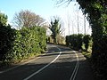
 A259 - geograph.org.uk - 4746533.jpg 640 × 396; 30 KB
-
 A259 approaching Wick Roundabout - geograph.org.uk - 4746545.jpg 640 × 415; 62 KB
-
 A259, Littlehampton - geograph.org.uk - 4746535.jpg 640 × 426; 38 KB
-
 A259, Littlehampton - geograph.org.uk - 4746539.jpg 640 × 377; 37 KB
-
 Access road for Littlehampton Marina - geograph.org.uk - 1055612.jpg 480 × 640; 44 KB
-
 Across the fields to gasometer, Littlehampton - geograph.org.uk - 4904577.jpg 1,600 × 1,200; 291 KB
-
 Admiralty Chart No 2154 Newhaven, Published1888, New Edition 1949.jpg 8,172 × 11,054; 35.63 MB
-
 Admiralty Chart No 2154 Plans on the South Coast of England, Published 1958.jpg 16,236 × 11,092; 65.57 MB
-

-
 Albert Road - geograph.org.uk - 5644846.jpg 640 × 427; 58 KB
-
 Albert Road - Terminus Road - geograph.org.uk - 4441900.jpg 640 × 480; 68 KB
-
 Allotments, Wick - geograph.org.uk - 1943545.jpg 640 × 428; 87 KB
-
 Alpha Court in Terminus Road - geograph.org.uk - 1055418.jpg 640 × 480; 54 KB
-
 Amberley Close - geograph.org.uk - 4761689.jpg 800 × 600; 155 KB
-
 Anchor on the Green, Littlehampton - geograph.org.uk - 3685432.jpg 1,600 × 1,200; 386 KB
-
 Anchor Springs, Littlehampton - geograph.org.uk - 4995231.jpg 640 × 427; 52 KB
-
 Anchor Springs, Littlehampton - geograph.org.uk - 4995236.jpg 640 × 427; 49 KB
-
 Another sad, sad sight - geograph.org.uk - 1055692.jpg 480 × 640; 74 KB
-
 Approach to retracting bridge - geograph.org.uk - 600176.jpg 640 × 480; 95 KB
-

-

-
 Approaching the Rajdoot in Pier Road - geograph.org.uk - 3779977.jpg 480 × 640; 62 KB
-
 Arable field - geograph.org.uk - 5589156.jpg 640 × 426; 44 KB
-
 Arable field - geograph.org.uk - 5589194.jpg 640 × 426; 45 KB
-
 Arable landscape - geograph.org.uk - 5589164.jpg 640 × 426; 43 KB
-
 Arable landscape - geograph.org.uk - 5589192.jpg 640 × 425; 35 KB
-
 Arcade Road - Clifton Road - geograph.org.uk - 4441917.jpg 640 × 480; 66 KB
-
 Arun Civic Centre - geograph.org.uk - 608161.jpg 640 × 480; 94 KB
-
 Arun District Council Civic Centre - geograph.org.uk - 5573925.jpg 640 × 426; 66 KB
-
 Arun journey - geograph.org.uk - 802961.jpg 634 × 415; 60 KB
-
 Arun journey - geograph.org.uk - 802966.jpg 639 × 411; 60 KB
-
 Arun journey - geograph.org.uk - 802971.jpg 637 × 425; 48 KB
-
 Arun journey - geograph.org.uk - 802974.jpg 637 × 425; 52 KB
-
 Arun journey - geograph.org.uk - 802979.jpg 637 × 425; 46 KB
-
 Arun journey - geograph.org.uk - 802981.jpg 637 × 425; 61 KB
-
 Arun journey - geograph.org.uk - 802996.jpg 637 × 425; 54 KB
-
 Arun journey - geograph.org.uk - 803001.jpg 637 × 425; 57 KB
-
 Arun journey - geograph.org.uk - 803006.jpg 637 × 425; 46 KB
-
 Arun Parade - geograph.org.uk - 5573627.jpg 640 × 426; 43 KB
-

-
 Arun View pub, Littlehampton - geograph.org.uk - 1907442.jpg 640 × 480; 92 KB
-
 Arun Yacht Club - geograph.org.uk - 1058034.jpg 640 × 480; 64 KB
-
 Arun Yacht Club - geograph.org.uk - 5573643.jpg 640 × 426; 46 KB
-
 Arun Yacht Club, Littlehampton - geograph.org.uk - 5120968.jpg 1,600 × 1,200; 327 KB
-
 ArunYachtClub.JPG 1,600 × 1,200; 354 KB
-
 At the Oyster Pond (i) - geograph.org.uk - 3779971.jpg 640 × 480; 54 KB
-
 At the Oyster Pond (ii) - geograph.org.uk - 3779972.jpg 640 × 480; 53 KB
-
 At the Oyster Pond (iii) - geograph.org.uk - 3779999.jpg 640 × 480; 67 KB
-
 Attraction at Littlehampton funfair - geograph.org.uk - 3359818.jpg 3,264 × 2,448; 3.29 MB
-
 B2187 - geograph.org.uk - 5584064.jpg 640 × 426; 59 KB
-
 B2187 - geograph.org.uk - 5584078.jpg 640 × 426; 58 KB
-

-
 Bayford Rd - geograph.org.uk - 5573618.jpg 640 × 426; 61 KB
-
 Bayford Rd - geograph.org.uk - 5573909.jpg 640 × 426; 55 KB
-
 Bayford Rd - geograph.org.uk - 5573910.jpg 640 × 426; 66 KB
-
 Beach at Littlehampton - geograph.org.uk - 1138088.jpg 640 × 419; 69 KB
-
 Beach Huts at Littlehampton - geograph.org.uk - 4437.jpg 640 × 480; 67 KB
-
 Beach huts in need of paint - geograph.org.uk - 3341157.jpg 1,600 × 1,196; 491 KB
-
 Beach huts on East Beach - geograph.org.uk - 2959627.jpg 1,500 × 1,000; 220 KB
-

-
 Beach huts, Littlehampton - geograph.org.uk - 4659078.jpg 2,000 × 1,333; 2.94 MB
-
 Beach huts, Littlehampton - geograph.org.uk - 4659081.jpg 2,000 × 1,333; 2.36 MB
-
 Beach huts, Littlehampton - geograph.org.uk - 4660973.jpg 2,000 × 1,333; 1.71 MB
-
 Beach huts, Littlehampton - geograph.org.uk - 5693019.jpg 640 × 428; 95 KB
-
 Beach Rd, B2140 - geograph.org.uk - 5573919.jpg 640 × 425; 64 KB
-
 Beach Road - viewed from High Street - geograph.org.uk - 4441948.jpg 640 × 480; 64 KB
-

-

-
 Beach Safety - geograph.org.uk - 5049189.jpg 5,472 × 3,648; 2.45 MB
-
 Beach view - geograph.org.uk - 3568778.jpg 4,000 × 3,000; 2.61 MB
-
 Beach, Littlehampton - geograph.org.uk - 5693549.jpg 640 × 428; 114 KB
-
 Beach, Littlehampton - geograph.org.uk - 5693556.jpg 640 × 428; 130 KB
-
 Beacon - Littlehampton - geograph.org.uk - 3685811.jpg 1,200 × 1,600; 265 KB
-
 Beacon, Littlehampton - geograph.org.uk - 2051225.jpg 640 × 480; 54 KB
-
 Beacon, Littlehampton - geograph.org.uk - 2051227.jpg 640 × 480; 46 KB
-
 Bed and Breakfast in Rope Walk - geograph.org.uk - 1055495.jpg 640 × 480; 65 KB
-
 Beer garden at The Dolphin - geograph.org.uk - 1959432.jpg 2,048 × 1,536; 698 KB
-

-
-
 Benjamin Grey Drive, Littlehampton - geograph.org.uk - 5823408.jpg 2,048 × 1,536; 1.41 MB
-
 Benjamin Grey Drive, Littlehampton - geograph.org.uk - 5823766.jpg 2,004 × 1,476; 1.49 MB
-
 Billy smart statue at harbour park.JPG 800 × 1,066; 303 KB
-
 Black Ditch in Toddington - geograph.org.uk - 1501802.jpg 640 × 480; 137 KB
-
 Black Ditch in Toddington - geograph.org.uk - 1509210.jpg 640 × 480; 108 KB
-
 Blowing out the cake (13177441234).jpg 6,016 × 4,016; 4.14 MB
-
 Blue beach huts, Littlehampton - geograph.org.uk - 4659096.jpg 2,000 × 1,333; 2.63 MB
-
 Boat repair facilities, Rope Walk, Littlehampton - geograph.org.uk - 5099192.jpg 1,024 × 768; 171 KB
-
 Boat yard ,west bank, River Arun - geograph.org.uk - 600189.jpg 640 × 480; 111 KB
-
 Boating lake - geograph.org.uk - 5573574.jpg 640 × 426; 71 KB
-
 Boating pool, Littlehampton - geograph.org.uk - 5693884.jpg 640 × 428; 115 KB
-
 Boats at a jetty in the River Arun - geograph.org.uk - 5120959.jpg 1,600 × 1,186; 302 KB
-
 Boats below Littlehampton Bridge - geograph.org.uk - 5099077.jpg 1,024 × 768; 223 KB
-
 Boats on the Arun, Littlehampton - geograph.org.uk - 2051231.jpg 640 × 480; 70 KB
-

-
 Bollards near the lifeboat station - geograph.org.uk - 3780013.jpg 640 × 480; 45 KB
-
 Boundary bank. Littlehampton Marina - geograph.org.uk - 4999215.jpg 1,024 × 768; 257 KB
-

-
 Bridge across the River Arun - geograph.org.uk - 5624709.jpg 640 × 426; 40 KB
-
 Bridge at Rope Walk over the River Arun, Littlehampton - geograph.org.uk - 5121007.jpg 1,600 × 1,063; 257 KB
-
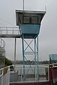
 Bridge control tower - geograph.org.uk - 5624711.jpg 640 × 426; 47 KB
-
 Bridge Garage - geograph.org.uk - 734352.jpg 479 × 640; 60 KB
-
 Bridge Garage in Ferry Road - geograph.org.uk - 1055617.jpg 640 × 480; 73 KB
-
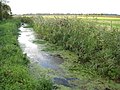
 Bridge over the ditch - geograph.org.uk - 5589190.jpg 640 × 426; 42 KB
-
 Bridge Road roundabout - geograph.org.uk - 4746532.jpg 640 × 513; 77 KB
-
 Bridge Road, Littlehampton - geograph.org.uk - 2810741.jpg 640 × 480; 87 KB
-
 Bridge supports, Littlehampton - geograph.org.uk - 1907410.jpg 480 × 640; 63 KB
-

-
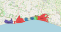 BrightonAndHoveBUA.png 1,618 × 850; 1.15 MB
-
 Broad Piece, Littlehampton - geograph.org.uk - 2810745.jpg 640 × 480; 51 KB
-
 Brook Barn Farm - geograph.org.uk - 3193026.jpg 2,136 × 1,189; 1.13 MB
-
 Brook Barn Farm - geograph.org.uk - 3523801.jpg 640 × 427; 39 KB
-

-
 Bungalows on Highdown Drive, Wick - geograph.org.uk - 5829432.jpg 2,014 × 1,490; 1.55 MB
-
 Buried groyne - geograph.org.uk - 4208314.jpg 640 × 428; 364 KB
-
 Bus passing in River Road - geograph.org.uk - 1055645.jpg 640 × 480; 62 KB
-
 Bus stop on Terminus Road - geograph.org.uk - 1055648.jpg 640 × 480; 74 KB
-
 Cafe and Chip Shop, Pier Road - geograph.org.uk - 885165.jpg 640 × 461; 93 KB
-

-

-

-

-
 Car park behind Littlehampton United Church - geograph.org.uk - 5116149.jpg 1,600 × 1,200; 395 KB
-
 Car park, Littlehampton Marina - geograph.org.uk - 5624704.jpg 640 × 426; 37 KB
-

-
 Cemetery buffer zone - geograph.org.uk - 1943637.jpg 640 × 428; 107 KB
-
 Chippie in Pier Road - geograph.org.uk - 3779970.jpg 480 × 640; 57 KB
-
 Church Approach - Maltravers Road - geograph.org.uk - 4441976.jpg 640 × 480; 78 KB
-
 Church St - geograph.org.uk - 5584093.jpg 640 × 426; 58 KB
-

-
 Clifton Rd - geograph.org.uk - 5573907.jpg 640 × 426; 53 KB
-
 Clifton Rd - geograph.org.uk - 5573908.jpg 640 × 426; 51 KB
-
 Clifton Road - New Road - geograph.org.uk - 4441914.jpg 640 × 480; 59 KB
-
 Clifton Road - New Road - geograph.org.uk - 4441915.jpg 640 × 480; 52 KB
-
 Clock Tower - geograph.org.uk - 5584029.jpg 426 × 640; 56 KB
-
 Clock Tower - geograph.org.uk - 5584031.jpg 640 × 426; 70 KB
-

-
 Clymping Beach - geograph.org.uk - 5108612.jpg 1,024 × 779; 172 KB
-
 Coastal debris on the Arun - geograph.org.uk - 1057990.jpg 640 × 480; 88 KB
-
 Coastguard Rd, Littlehampton BN17, UK - panoramio (1).jpg 1,674 × 1,256; 491 KB
-
 Coastguard Rd, Littlehampton BN17, UK - panoramio.jpg 1,674 × 1,256; 518 KB
-
 Coastguard Station by the East Pier - geograph.org.uk - 3359794.jpg 3,264 × 2,448; 4.49 MB
-
 Constable - Littlehampton - stormy day, 1888,0215.36.jpg 750 × 454; 140 KB
-
 Control building for swing bridge - geograph.org.uk - 5588801.jpg 426 × 640; 41 KB
-
 Corner of Norfolk Gardens - geograph.org.uk - 5693256.jpg 640 × 428; 189 KB
-
 Corner of Norfolk Gardens, Littlehampton - geograph.org.uk - 1138077.jpg 640 × 516; 103 KB
-
 Cornwall Road, Littlehampton - geograph.org.uk - 882600.jpg 640 × 382; 116 KB
-

-
 Cougar Osborne Ltd, Rope Walk - geograph.org.uk - 734392.jpg 479 × 640; 67 KB
-
 Countryside by Arundel Junction - geograph.org.uk - 4760812.jpg 640 × 426; 35 KB
-
 Courtwick Lane Wick - geograph.org.uk - 3156287.jpg 3,264 × 2,448; 4.02 MB
-

-
 Crazy golf, Littlehampton - geograph.org.uk - 5692995.jpg 640 × 428; 124 KB
-
 Crescent on Highdown Drive - geograph.org.uk - 4761692.jpg 800 × 600; 142 KB
-
 Cricket match in progress in 1933 - geograph.org.uk - 3146947.jpg 816 × 1,146; 129 KB
-

-
 Curious sculpture showing a recipe - geograph.org.uk - 3779967.jpg 480 × 640; 79 KB
-
 Curious seat on the promenade - geograph.org.uk - 3779973.jpg 640 × 480; 50 KB
-
 Curly-wurly seating on Littlehampton seafront - geograph.org.uk - 4865071.jpg 1,333 × 1,000; 1.12 MB
-

-
 Cute hairstyle (4877111710).jpg 480 × 640; 55 KB
-
 Cycle shop in Pier Road - geograph.org.uk - 3779998.jpg 480 × 640; 54 KB
-

-
 Derelict boats in the Arun - geograph.org.uk - 1057995.jpg 640 × 480; 100 KB
-
 Derelict Landing Stage, Littlehampton - geograph.org.uk - 885115.jpg 640 × 424; 90 KB
-
 Display within the Visitor Centre - geograph.org.uk - 3778785.jpg 640 × 480; 80 KB
-
-
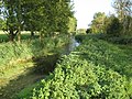
 Ditch, Floodplain of the River Arun - geograph.org.uk - 4760811.jpg 640 × 354; 39 KB
-
 Drainage ditch - geograph.org.uk - 5589127.jpg 640 × 426; 105 KB
-
 Drill Hall Littlehampton 2021 01.jpg 4,160 × 3,120; 3.05 MB
-
 Drill Hall Littlehampton 2021 02.jpg 4,160 × 3,120; 3.21 MB
-
 Duke Street - High Street - geograph.org.uk - 4441891.jpg 640 × 480; 70 KB
-
 Dull day on the river Arun - geograph.org.uk - 3193008.jpg 2,256 × 1,496; 808 KB
-
 Dune conservation area - geograph.org.uk - 4208327.jpg 640 × 428; 341 KB
-
 Early December in Surrey Street - geograph.org.uk - 3780011.jpg 640 × 480; 46 KB
-
 East Beach at Littlehampton - geograph.org.uk - 2959610.jpg 1,500 × 977; 306 KB
-
 East Beach at Littlehampton - geograph.org.uk - 2959613.jpg 1,500 × 1,000; 356 KB


.jpg)
.jpg)
.jpg)

.jpg)


_-_geograph.org.uk_-_3779971.jpg)
_-_geograph.org.uk_-_3779972.jpg)
_-_geograph.org.uk_-_3779999.jpg)


.jpg)


.jpg)


.jpg)


