Category:Llanafan Fawr
hamlet in Powys, Wales  | |||||
| Upload media | |||||
| Pronunciation audio | |||||
|---|---|---|---|---|---|
| Instance of | |||||
| Named after |
| ||||
| Location | Llanafanfawr, Powys, Wales | ||||
| Population |
| ||||
| Area |
| ||||
 | |||||
Cymraeg: Pentref bychan, cymuned a phlwyf ym Mrycheiniog, de Powys, yw Llanafan Fawr (ffurfiau amgen: Llanafan-fawr / Llanafan-Fawr). Mae'n gorwedd tua 5 milltir i'r gorllewin o dref Llanfair-ym-Muallt.
English: Llanafan Fawr is a small hamlet in Powys, Wales. The spa town of Llandrindod Wells is just 15 minutes drive away, and the market town of Builth Wells is about nine miles away.
Subcategories
This category has the following 2 subcategories, out of 2 total.
R
- Red Lion, Llanafan Fawr (2 F)
S
Media in category "Llanafan Fawr"
The following 40 files are in this category, out of 40 total.
-
 Across Esgair y Ffynnon - geograph.org.uk - 1423755.jpg 640 × 480; 51 KB
-
 B4358 near Ty-mawr Mill - geograph.org.uk - 627977.jpg 640 × 480; 82 KB
-
 Cribarth.jpg 3,872 × 2,592; 2.33 MB
-
 Footpath to Dol-y-felin - geograph.org.uk - 629462.jpg 640 × 480; 93 KB
-
 Lane near Cwm Clyd Isaf - geograph.org.uk - 629194.jpg 640 × 480; 103 KB
-
 Lane with cattle grid - geograph.org.uk - 627930.jpg 640 × 480; 80 KB
-
-
 Road junction on B4358 - geograph.org.uk - 629458.jpg 640 × 480; 44 KB
-
 Sheep pasture opposite Brynheulog - geograph.org.uk - 749673.jpg 640 × 480; 76 KB
-
 Sheepfold on Allt y Ddinas - geograph.org.uk - 830489.jpg 640 × 426; 71 KB
-
 Stream in flood - geograph.org.uk - 629619.jpg 640 × 480; 129 KB
-
 Track to Pen-y-rhiw from B4358 - geograph.org.uk - 628007.jpg 640 × 473; 84 KB
-
 A partially felled Irfon Forest - geograph.org.uk - 608524.jpg 640 × 480; 81 KB
-
 A small wooded hill, Glandulas - geograph.org.uk - 749690.jpg 636 × 378; 57 KB
-
 B4358 to Newbridge-on-Wye - geograph.org.uk - 628036.jpg 640 × 480; 60 KB
-
 Barns, at Gors-wen - geograph.org.uk - 1468679.jpg 640 × 445; 71 KB
-
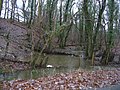
 Bridge across the Chwefri - geograph.org.uk - 1468649.jpg 640 × 480; 87 KB
-
 Bryn Ceinon - geograph.org.uk - 605267.jpg 640 × 480; 63 KB
-
 Bryn Cyncoed - geograph.org.uk - 1423752.jpg 640 × 480; 68 KB
-
 Cartref, Glandulas - geograph.org.uk - 749681.jpg 640 × 480; 95 KB
-
 Craig Chwefri Triangulation Pillar - geograph.org.uk - 629212.jpg 640 × 480; 48 KB
-
 Cribarth - geograph.org.uk - 750389.jpg 640 × 480; 62 KB
-
 Cribarth Quarry - geograph.org.uk - 749687.jpg 640 × 480; 64 KB
-
 Cwm Crogau - geograph.org.uk - 629191.jpg 640 × 480; 116 KB
-
 Dolderwen - geograph.org.uk - 750395.jpg 640 × 480; 132 KB
-
 Esgair Nefal - geograph.org.uk - 605274.jpg 640 × 480; 99 KB
-
 Gorneath - geograph.org.uk - 605286.jpg 640 × 480; 71 KB
-
 Gors Wen - geograph.org.uk - 605232.jpg 640 × 480; 75 KB
-
 Gwern-y-mynach farm - geograph.org.uk - 643248.jpg 640 × 480; 78 KB
-
 Hedgerow and path to Ysgubor y Cefn - geograph.org.uk - 749677.jpg 640 × 480; 106 KB
-
 Hill above Abernefal - geograph.org.uk - 605272.jpg 640 × 480; 58 KB
-
 Hills above Gors Wen - geograph.org.uk - 605241.jpg 640 × 480; 57 KB
-
 Hillside pasture near Beulah - geograph.org.uk - 749670.jpg 638 × 417; 61 KB
-
 House at Bwlchciliau - geograph.org.uk - 629200.jpg 640 × 480; 55 KB
-
 Lan Ganol from Gellitalgarth - geograph.org.uk - 629190.jpg 640 × 480; 51 KB
-
 Lletherddu - geograph.org.uk - 629461.jpg 640 × 480; 66 KB
-
-
 Road to Sarn Helen - geograph.org.uk - 629463.jpg 640 × 480; 76 KB
-
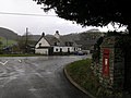
 Small Church on the B4358 - geograph.org.uk - 400433.jpg 640 × 480; 41 KB
-
 Ty Bach - geograph.org.uk - 608521.jpg 640 × 480; 77 KB


