Category:Llanarth, Monmouthshire
village and community in Monmouthshire, Wales, UK  | |||||
| Upload media | |||||
| Instance of | |||||
|---|---|---|---|---|---|
| Location | Monmouthshire, Wales | ||||
 | |||||
Cymraeg: Pentref bychan a chymuned yng ngogledd Sir Fynwy yw Llanarth (SO3710) neu Llan-arth neu fel a sgwennwyd yn 1136: 'Llanngarth'. Saif yn y bryniau ar ffordd fynydd tua hanner ffordd rhwng Y Fenni i'r gorllewin a Rhaglan i'r dwyrain.
English: Llanarth is a privately owned estate village within a conservation area in the Welsh county of Monmouthshire roughly halfway between Abergavenny and Raglan.
Subcategories
This category has the following 6 subcategories, out of 6 total.
Media in category "Llanarth, Monmouthshire"
The following 200 files are in this category, out of 391 total.
(previous page) (next page)-
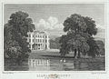
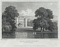
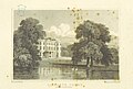 Neale(1818) p2.298 - Llanarth Court, Monmouthshire.jpg 1,824 × 1,227; 556 KB
-
 2010 Wales Monmouthshire Community Llanarth map.svg 512 × 682; 699 KB
-
 2024 Wales Monmouthshire Community Llanarth map.svg 512 × 682; 603 KB
-

-
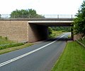
 A40 bridge on Clytha Road - geograph.org.uk - 3183081.jpg 640 × 425; 228 KB
-
-
 A40 towards Abergavenny - geograph.org.uk - 3184533.jpg 640 × 428; 221 KB
-
 A40 towards Abergavenny - geograph.org.uk - 3184571.jpg 640 × 432; 256 KB
-
 A40 towards Raglan - geograph.org.uk - 3184538.jpg 640 × 419; 226 KB
-
 A40 towards Raglan - geograph.org.uk - 3184565.jpg 640 × 427; 222 KB
-
 Above the River Usk - geograph.org.uk - 3365225.jpg 640 × 480; 132 KB
-

-
 Approaching Clytha Castle folly - geograph.org.uk - 3364662.jpg 640 × 480; 111 KB
-
 Arable land near Clytha - geograph.org.uk - 2988627.jpg 1,024 × 680; 241 KB
-
 Arable land near Coed Morgan - geograph.org.uk - 2986753.jpg 1,024 × 680; 228 KB
-
 Arched entrance, Clytha Park - geograph.org.uk - 2988606.jpg 1,024 × 680; 255 KB
-
 Autumn beech leaves - geograph.org.uk - 3223600.jpg 680 × 1,024; 423 KB
-

-
 B4598 Abergavenny Road - geograph.org.uk - 6225548.jpg 4,032 × 2,268; 5.73 MB
-
 B4598 layby in rural Monmouthshire - geograph.org.uk - 5390544.jpg 798 × 800; 152 KB
-
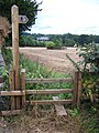
 Be careful crossing the road - geograph.org.uk - 3184477.jpg 517 × 640; 240 KB
-

-

-
 Bettws Newydd - geograph.org.uk - 3222279.jpg 1,024 × 680; 253 KB
-
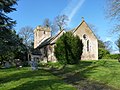
 Bettws Newydd church - geograph.org.uk - 3222271.jpg 680 × 1,024; 255 KB
-
 Betws Newydd - geograph.org.uk - 4521308.jpg 640 × 494; 84 KB
-
 Betws Newydd church, Monmouthshire - geograph.org.uk - 3364790.jpg 640 × 480; 68 KB
-
 Bluebell woods on Coed y Bwnydd hill - geograph.org.uk - 1869813.jpg 640 × 480; 145 KB
-
 Bluebells at Coed y Bwnydd in May - geograph.org.uk - 3479898.jpg 640 × 480; 168 KB
-
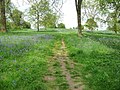
 Bluebells in Coed y Bwnydd - geograph.org.uk - 1869822.jpg 640 × 480; 170 KB
-

-
 Bluebells on the hillfort, Coed y Bwnydd - geograph.org.uk - 1869842.jpg 640 × 480; 140 KB
-

-

-
 Brooklands Garden Centre near Raglan - geograph.org.uk - 3049259.jpg 640 × 428; 64 KB
-
 Brown field near Llancayo, Monmouthshire - geograph.org.uk - 5390487.jpg 800 × 458; 122 KB
-
 Bryn Derwyn Country house - geograph.org.uk - 1539086.jpg 640 × 396; 94 KB
-
 Bryngwyn - geograph.org.uk - 3183093.jpg 640 × 413; 181 KB
-
 Bryngwyn church - geograph.org.uk - 2985664.jpg 1,024 × 680; 200 KB
-
 Bus stop on the road to Great Oak - geograph.org.uk - 3049246.jpg 640 × 470; 72 KB
-
 By Clytha Park - geograph.org.uk - 1630629.jpg 640 × 480; 226 KB
-
 Byway north of Hendy - geograph.org.uk - 3184383.jpg 640 × 440; 249 KB
-

-
 Cedar tree at Llanarth - geograph.org.uk - 4283523.jpg 531 × 800; 142 KB
-
 Cefn-coch - geograph.org.uk - 3184465.jpg 640 × 428; 247 KB
-
 Church Cottage, Bryngwyn, Monmouthshire - geograph.org.uk - 4575527.jpg 800 × 592; 126 KB
-

-

-

-
 Clytha Arms - geograph.org.uk - 3184557.jpg 640 × 409; 226 KB
-
-
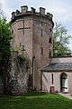
 Clytha Castle - geograph.org.uk - 1019732.jpg 640 × 431; 83 KB
-
 Clytha Castle - geograph.org.uk - 1290528.jpg 640 × 426; 79 KB
-
 Clytha Castle - geograph.org.uk - 4488741.jpg 531 × 800; 116 KB
-
 Clytha Castle - geograph.org.uk - 4488744.jpg 531 × 800; 82 KB
-
 Clytha Castle - geograph.org.uk - 4488771.jpg 680 × 1,024; 230 KB
-
 Clytha Castle folly - geograph.org.uk - 3364615.jpg 640 × 480; 71 KB
-
 Clytha Estate car park - geograph.org.uk - 4575796.jpg 800 × 507; 123 KB
-
 Clytha Estate picnic benches - geograph.org.uk - 4575806.jpg 777 × 800; 259 KB
-
-

-

-
 Clytha Hill - geograph.org.uk - 4559268.jpg 2,560 × 1,920; 3.54 MB
-
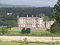
 Clytha Park - geograph.org.uk - 1290540.jpg 640 × 426; 97 KB
-
 Clytha Park - geograph.org.uk - 1630627.jpg 640 × 480; 237 KB
-
 Clytha Park - geograph.org.uk - 3184559.jpg 640 × 427; 202 KB
-
 Clytha Park Gate and Lodge - geograph.org.uk - 1630632.jpg 640 × 480; 227 KB
-
 Coed Morgan Farm - geograph.org.uk - 3184580.jpg 640 × 427; 219 KB
-
 Coed y Bwnydd - geograph.org.uk - 3223611.jpg 1,024 × 680; 205 KB
-
 Coed y Bwnydd hillfort in May - geograph.org.uk - 3479963.jpg 640 × 480; 157 KB
-
 Coed y Bwnydd hillfort under bluebells - geograph.org.uk - 1869834.jpg 640 × 480; 153 KB
-
 Coed y Bwnydd in April - geograph.org.uk - 2921794.jpg 640 × 480; 153 KB
-
 Coed y Bwnydd in May - geograph.org.uk - 3479986.jpg 640 × 480; 163 KB
-
 Coed y Bwnydd in mid May - geograph.org.uk - 2941790.jpg 640 × 480; 161 KB
-
 Coed y Bwnydd in winter - geograph.org.uk - 3811750.jpg 640 × 480; 144 KB
-
 Coed-y-Gelli, Llanarth - geograph.org.uk - 2342652.jpg 964 × 711; 148 KB
-
 Coed-y-gelli, Llanarth.jpg 3,024 × 4,032; 2.64 MB
-
 Cottage near Betws Newydd - geograph.org.uk - 3365135.jpg 640 × 480; 68 KB
-
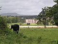
 Country house beside the River Usk - geograph.org.uk - 3365192.jpg 640 × 480; 89 KB
-
 Country road and Ysgyryd Fawr - geograph.org.uk - 3892524.jpg 1,024 × 680; 176 KB
-
 Country road passing Llanarth Court - geograph.org.uk - 4277296.jpg 800 × 531; 127 KB
-
 Country Road, Llanarth - geograph.org.uk - 4174490.jpg 1,600 × 1,063; 652 KB
-

-

-

-

-
 Dogs may swim here notice, Clytha Estate - geograph.org.uk - 4576029.jpg 800 × 600; 239 KB
-
 Donkey at Betws Newydd - geograph.org.uk - 3364889.jpg 640 × 480; 87 KB
-

-

-

-
 Electricity pylons crossing farmland - geograph.org.uk - 3891145.jpg 1,024 × 680; 180 KB
-

-

-
 Entrance to Clytha Park - geograph.org.uk - 3184562.jpg 640 × 401; 216 KB
-
 Entrance to Clytha Park - geograph.org.uk - 4488794.jpg 531 × 800; 123 KB
-
 Entrance to Llanarth Court, near Abergavenny - geograph.org.uk - 4230100.jpg 2,560 × 1,920; 2.2 MB
-

-
 Entrance to Raglan Garden Centre - geograph.org.uk - 3048947.jpg 640 × 463; 57 KB
-
 Entrance to Raglan Garden Centre - geograph.org.uk - 5614220.jpg 800 × 703; 170 KB
-

-
-
 Exit from Raglan Garden Centre - geograph.org.uk - 5614239.jpg 800 × 502; 97 KB
-

-

-
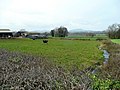
 Farm land - geograph.org.uk - 4643426.jpg 640 × 480; 184 KB
-
 Farm to the west of Bettws Newydd - geograph.org.uk - 1631664.jpg 640 × 480; 238 KB
-
 Farmland above Bettws Newydd - geograph.org.uk - 3223606.jpg 1,024 × 680; 280 KB
-
 Farmland above Pant Brook - geograph.org.uk - 2988641.jpg 1,024 × 680; 197 KB
-
 Farmland around Lower Berllwyd - geograph.org.uk - 3222275.jpg 1,024 × 680; 246 KB
-
 Farmland near Cefn Coch Farm - geograph.org.uk - 2986615.jpg 1,024 × 680; 212 KB
-
 Farmland near Cefn-coch - geograph.org.uk - 2765223.jpg 1,024 × 680; 171 KB
-
 Farmland near Coed Morgan - geograph.org.uk - 2986627.jpg 1,024 × 680; 248 KB
-
 Farmland near Llanddewi Rhydderch - geograph.org.uk - 2986662.jpg 1,024 × 680; 248 KB
-
 Farmland to the south-west of Bryngwyn - geograph.org.uk - 3220435.jpg 1,024 × 680; 202 KB
-

-
 Field corner near Betws Newydd - geograph.org.uk - 3364839.jpg 640 × 480; 110 KB
-
 Field edge - geograph.org.uk - 3364698.jpg 640 × 480; 81 KB
-
 Field entrance - geograph.org.uk - 3220459.jpg 1,024 × 680; 284 KB
-
 Fields near Raglan Garden Centre - geograph.org.uk - 2944702.jpg 2,592 × 1,944; 1.61 MB
-
 Fields of Crops - geograph.org.uk - 5656892.jpg 800 × 534; 80 KB
-
 Fields surrounding Llanarth estate.jpg 2,592 × 1,944; 728 KB
-
 First view of Llanarth with sign - geograph.org.uk - 552683.jpg 640 × 482; 123 KB
-
 Fishing bothy across the River Usk - geograph.org.uk - 3365229.jpg 640 × 480; 124 KB
-
 Footbridge beside the River Usk - geograph.org.uk - 3365228.jpg 640 × 480; 107 KB
-
 Footpath above Bettws Newydd - geograph.org.uk - 3223608.jpg 1,024 × 680; 283 KB
-
 Footpath across Coed y Bwnydd - geograph.org.uk - 1869849.jpg 640 × 480; 136 KB
-

-
 Footpath by the River Usk - geograph.org.uk - 6225547.jpg 4,032 × 2,268; 4.55 MB
-
 Footpath south - geograph.org.uk - 1619890.jpg 640 × 480; 257 KB
-
 Footpath South From Llanarth Church - geograph.org.uk - 2031395.jpg 1,122 × 1,496; 788 KB
-
 Footpath to The Grove - geograph.org.uk - 3184479.jpg 427 × 640; 173 KB
-
 Footpath to the Usk - geograph.org.uk - 1630639.jpg 640 × 480; 225 KB
-

-
 Fountain - geograph.org.uk - 945235.jpg 640 × 480; 100 KB
-

-

-
-
 Gatehouse to Llanarth Court - geograph.org.uk - 3184500.jpg 640 × 448; 192 KB
-
 Gatehouse to Llanarth Court - geograph.org.uk - 4277337.jpg 800 × 531; 136 KB
-
 Ger - Near Priory Wood - geograph.org.uk - 4521504.jpg 640 × 480; 131 KB
-

-
 Golden leaves - geograph.org.uk - 3223599.jpg 680 × 1,024; 446 KB
-
 Grazing land east of Whitehouse Farm - geograph.org.uk - 1630613.jpg 640 × 480; 224 KB
-
 Headland footpath - geograph.org.uk - 3891142.jpg 1,024 × 680; 228 KB
-

-
-
 House and green at Bryngwyn - geograph.org.uk - 3183108.jpg 460 × 640; 221 KB
-
 House at Pit - geograph.org.uk - 3184519.jpg 640 × 427; 200 KB
-
 House on the edge of Llanfair Kilgeddin - geograph.org.uk - 3943657.jpg 3,872 × 2,592; 3.95 MB
-
 How do I look^ - geograph.org.uk - 3184378.jpg 640 × 427; 255 KB
-
-
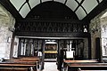 Interior of Bettws Newydd church - geograph.org.uk - 4489784.jpg 1,024 × 680; 243 KB
-
 Interior of Clytha Castle - geograph.org.uk - 4488772.jpg 531 × 800; 39 KB
-
 Interior of Clytha Castle - geograph.org.uk - 4488776.jpg 531 × 800; 52 KB
-
 Junction north of Coed Morgan - geograph.org.uk - 3184582.jpg 640 × 428; 225 KB
-

-
 Lane leading to Coed-y-Gelli, Llanarth - geograph.org.uk - 2342753.jpg 750 × 562; 133 KB
-
 Lane to Clytha - geograph.org.uk - 1631650.jpg 640 × 480; 249 KB
-

-

-
 Llanarth Court - geograph.org.uk - 107351.jpg 640 × 480; 79 KB
-
 Llanarth court - geograph.org.uk - 1671498.jpg 1,600 × 1,200; 687 KB
-
 Llanarth court - geograph.org.uk - 1671503.jpg 1,600 × 1,200; 712 KB
-
 Llanarth Court - geograph.org.uk - 1671523.jpg 1,600 × 1,200; 721 KB
-
 Llanarth Court - geograph.org.uk - 4277325.jpg 800 × 531; 115 KB
-
 Llanarth Court - geograph.org.uk - 4283521.jpg 800 × 531; 135 KB
-
 Llanarth Court Hospital - geograph.org.uk - 2344934.jpg 652 × 489; 111 KB
-
 Llanarth court, Monmouthshire.jpeg 700 × 508; 164 KB
-
 Llanarth Court, Monmouthshire.jpeg 750 × 595; 208 KB
-
 Llanarth main street.jpg 600 × 576; 144 KB
-
 Llanarth Post Office - geograph.org.uk - 552729.jpg 640 × 482; 78 KB
-
 Llanvapley church - geograph.org.uk - 2770242.jpg 1,024 × 680; 239 KB
-
 Llanvapley church - geograph.org.uk - 3852868.jpg 2,560 × 1,920; 1.98 MB
-
 Llanvapley church - geograph.org.uk - 3892546.jpg 1,024 × 680; 277 KB
-
 Llanvapley Church - geograph.org.uk - 4432130.jpg 3,648 × 2,736; 2.2 MB
-
 Llanwenarth - geograph.org.uk - 1671543.jpg 1,600 × 1,200; 749 KB
-
 Llwyn-deri Bridge - geograph.org.uk - 2986590.jpg 1,024 × 680; 240 KB
-
 Llwyn-deri Bridge - geograph.org.uk - 364579.jpg 640 × 480; 126 KB
-
 Looking along Ton Lane, Llanvapley - geograph.org.uk - 3852897.jpg 2,560 × 1,920; 2.1 MB
-

-

-

-
 Medieval rood screen detail - geograph.org.uk - 3364816.jpg 640 × 480; 105 KB
-
 Mid May in rural Monmouthshire - geograph.org.uk - 5390532.jpg 800 × 532; 146 KB
-

-
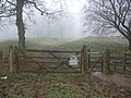
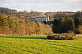
 Mist hangs over the Monmouthshire countryside - geograph.org.uk - 3224198.jpg 1,024 × 680; 272 KB
-

-
-
 Monmouth House, Llanvapley - geograph.org.uk - 4174627.jpg 1,600 × 1,063; 708 KB
-
 Monmouth House, Llanvapley - geograph.org.uk - 4174632.jpg 1,600 × 1,063; 698 KB
-
 Monmouthshire countryside - geograph.org.uk - 1631639.jpg 640 × 480; 243 KB
-

-

-

-
 Mossy bank - geograph.org.uk - 3365213.jpg 640 × 480; 153 KB
-
 Motte above Bettws Newydd - geograph.org.uk - 3220524.jpg 1,024 × 680; 285 KB
-
 Muddy field entrance - geograph.org.uk - 1630616.jpg 640 × 480; 235 KB
-
 Muddy track to Nant-chwith - geograph.org.uk - 1626953.jpg 640 × 480; 239 KB
-

_p2.298_-_Llanarth_Court,_Monmouthshire.jpg)


