Category:Llandow
village and community in Vale of Glamorgan, Wales   | |||||
| Upload media | |||||
| Instance of | |||||
|---|---|---|---|---|---|
| Location | Vale of Glamorgan, Wales | ||||
 | |||||
Cymraeg: Cymuned a phentref bychan yng nghanol Bro Morgannwg, de Cymru, yw Llandŵ (llurguniad Saesneg: Llandow). Gorwedd y pentref tua 15 milltir i'r de-orllewin o ddinas Caerdydd a thua tair milltir a hanner i'r gorllewin o'r Bont-faen.
Subcategories
This category has the following 6 subcategories, out of 6 total.
Media in category "Llandow"
The following 119 files are in this category, out of 119 total.
-
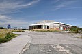 Abandoned Hangar - Llandow - geograph.org.uk - 1430532.jpg 640 × 425; 65 KB
-
 Avro Tudor 'Star Girl' crash memorial - geograph.org.uk - 2744378.jpg 1,200 × 900; 1.23 MB
-
 B4268 south of Pentre Meyrick - geograph.org.uk - 2321873.jpg 640 × 480; 49 KB
-

-
 Barn, Ty Fry Farm - geograph.org.uk - 700544.jpg 640 × 480; 77 KB
-
 Ben's Field, Llandow - geograph.org.uk - 913984.jpg 640 × 441; 74 KB
-
 Blister Hangars, Llandow Airfield - geograph.org.uk - 2749102.jpg 1,200 × 858; 825 KB
-
 Carne Arms - geograph.org.uk - 4777349.jpg 2,743 × 1,987; 997 KB
-
 Carne Cottages - geograph.org.uk - 4777358.jpg 3,264 × 2,448; 1.71 MB
-
 Comm.'s mast at Llandow - geograph.org.uk - 1032383.jpg 640 × 480; 58 KB
-
 Defunct Barn - Llandow - geograph.org.uk - 913966.jpg 640 × 437; 75 KB
-
 Duckpond, Llysworney - geograph.org.uk - 4777338.jpg 3,264 × 2,448; 2.87 MB
-
 Entering Llandow from the south east - geograph.org.uk - 1230194.jpg 640 × 425; 114 KB
-
 Entrance to Holy Trinity Church - geograph.org.uk - 4777560.jpg 2,448 × 2,448; 1.5 MB
-
 Farm road between Llandow and Clemenstone - geograph.org.uk - 913972.jpg 640 × 480; 105 KB
-
 Farm Sign - geograph.org.uk - 5209830.jpg 2,238 × 2,987; 1.45 MB
-

-
 Field boundary in the Vale of Glamorgan - geograph.org.uk - 2764652.jpg 4,000 × 3,000; 4.31 MB
-
 Field corner near Llanblethian - geograph.org.uk - 2764644.jpg 4,000 × 3,000; 4.11 MB
-
 Fields and footpath at Sigingstone - geograph.org.uk - 2764655.jpg 4,000 × 3,000; 3.4 MB
-
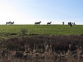 Fields and horses near Llanmihangel - geograph.org.uk - 2764664.jpg 4,000 × 3,000; 3.6 MB
-
 Fields and path near Llanmihangel - geograph.org.uk - 2764663.jpg 4,000 × 3,000; 3.55 MB
-
 Footpath and Stile - geograph.org.uk - 2759701.jpg 2,000 × 1,304; 2.23 MB
-
 Footpath in the Vale of Glamorgan - geograph.org.uk - 2764647.jpg 4,000 × 3,000; 2.73 MB
-
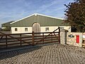 Four Acre Stables - geograph.org.uk - 5176015.jpg 3,264 × 2,448; 3.13 MB
-
 Greenhouses - geograph.org.uk - 5209854.jpg 3,264 × 2,448; 3.18 MB
-
 Holy Trinity Church, Llandow - geograph.org.uk - 4777552.jpg 3,264 × 2,448; 1.85 MB
-
 In harmony - Llandow - geograph.org.uk - 1426319.jpg 640 × 425; 107 KB
-

-
 Lane at New Breach Farm entrance - geograph.org.uk - 4298667.jpg 640 × 480; 93 KB
-
 Lane junction near Llandow - geograph.org.uk - 2047303.jpg 640 × 480; 38 KB
-
 Lane junction near Moorshead Farm - geograph.org.uk - 4298670.jpg 640 × 480; 54 KB
-
 Lane on site of old airfield - geograph.org.uk - 2047356.jpg 640 × 480; 46 KB
-
 Llandow Brook - geograph.org.uk - 1230201.jpg 640 × 425; 146 KB
-
 Llandow Brook - geograph.org.uk - 4777546.jpg 2,448 × 3,264; 2.34 MB
-
 Llandow Brook and village scene - geograph.org.uk - 1230212.jpg 640 × 425; 140 KB
-

-
 Llandow Kart Club - geograph.org.uk - 4397701.jpg 1,024 × 685; 185 KB
-
 Llandow Kart Club - geograph.org.uk - 4980222.jpg 3,264 × 2,448; 2.05 MB
-
 Llandow Kart Club Circuit map.jpg 580 × 400; 65 KB
-
 Llandow Rectory - geograph.org.uk - 1230278.jpg 640 × 453; 188 KB
-
 Llandow, UK - panoramio (1).jpg 2,592 × 1,936; 2.35 MB
-
 Llandow, UK - panoramio (2).jpg 2,592 × 1,936; 1.69 MB
-
 Llandow, UK - panoramio (3).jpg 2,592 × 1,936; 2.29 MB
-
 Llandow, UK - panoramio (4).jpg 2,592 × 1,936; 1.88 MB
-
 Llanmihangel Place - geograph.org.uk - 5176011.jpg 3,264 × 2,448; 2.6 MB
-
 Llantwit Major Road, B4270 - geograph.org.uk - 2047372.jpg 640 × 480; 54 KB
-

-
 Mix of materials at Llandow - geograph.org.uk - 1032457.jpg 640 × 480; 105 KB
-
 Moorshead Farm - geograph.org.uk - 4980368.jpg 3,264 × 2,448; 3.25 MB
-

-
 Old Control Tower - geograph.org.uk - 2655738.jpg 2,592 × 1,944; 1.18 MB
-

-
 Ordnance Survey Cut Mark - geograph.org.uk - 4901161.jpg 480 × 640; 95 KB
-
 Ordnance Survey Cut Mark - geograph.org.uk - 4901166.jpg 480 × 640; 120 KB
-
 Ordnance Survey Cut Mark - geograph.org.uk - 4901169.jpg 480 × 640; 94 KB
-
 Ordnance Survey Cut Mark - geograph.org.uk - 4901257.jpg 480 × 640; 131 KB
-
 Ordnance Survey Cut Mark - geograph.org.uk - 5743593.jpg 640 × 438; 132 KB
-
 Ordnance Survey Rivet - geograph.org.uk - 5743602.jpg 640 × 472; 120 KB
-

-
 Railway bridge at Llandow - geograph.org.uk - 2047320.jpg 640 × 480; 83 KB
-
 Railway Bridge at Llandow - geograph.org.uk - 4777577.jpg 3,264 × 2,448; 2.31 MB
-
 Railway line at Llandow - geograph.org.uk - 4777581.jpg 3,264 × 2,448; 2.49 MB
-
-
 Road junction near Nash Manor - geograph.org.uk - 2047395.jpg 640 × 480; 105 KB
-
-
 Sheepleys Farm - geograph.org.uk - 5209823.jpg 2,768 × 1,967; 938 KB
-
 Spring Field Nurseries - geograph.org.uk - 2047341.jpg 640 × 480; 69 KB
-
 Springfield Nurseries - geograph.org.uk - 5209863.jpg 3,264 × 2,448; 2.34 MB
-
 Springfield Nurseries, Llandow - geograph.org.uk - 1770628.jpg 640 × 480; 183 KB
-
 Springfield Nurseries, Llandow - geograph.org.uk - 1770634.jpg 640 × 480; 193 KB
-
 Stembridge Farm - geograph.org.uk - 4989520.jpg 3,264 × 2,448; 1.9 MB
-
 Stile and Waymarker - geograph.org.uk - 4777355.jpg 2,448 × 3,264; 2.33 MB
-
 Stream at Llandow - geograph.org.uk - 4777584.jpg 2,448 × 3,264; 2.23 MB
-

-
 Sutton Newydd - geograph.org.uk - 4869748.jpg 5,472 × 3,648; 6.13 MB
-
 Texaco Garage - geograph.org.uk - 4777346.jpg 3,264 × 2,448; 1.4 MB
-
 The B4268 north of Llysworney - geograph.org.uk - 2292603.jpg 2,880 × 1,913; 4.15 MB
-
 The Great Barn - geograph.org.uk - 5176013.jpg 3,264 × 2,448; 2.4 MB
-

-
 The Pink Pavilion - Llandow - geograph.org.uk - 3055230.jpg 1,600 × 1,079; 472 KB
-
 The Rectory, Llandow - geograph.org.uk - 4777536.jpg 3,264 × 2,448; 2.67 MB
-
 The Victoria Inn, Sigingstone - geograph.org.uk - 4298676.jpg 640 × 480; 56 KB
-

-
 Track to New Breach Farm, near Llanblethian - geograph.org.uk - 2238421.jpg 4,000 × 3,000; 2.8 MB
-
 Vale of Glamorgan Railway - geograph.org.uk - 5070063.jpg 2,448 × 3,264; 2.89 MB
-
 Vale of Glamorgan UK ward location - Llandow and Ewenny.png 1,000 × 643; 121 KB
-
 Victoria Inn, Siggingstone - geograph.org.uk - 4980365.jpg 3,264 × 2,448; 1.47 MB
-

-
 Wales Vale of Glamorgan Community Llandow map.svg 512 × 322; 401 KB
-
 Water Tower at Llandow Industrial Estate. - geograph.org.uk - 914014.jpg 640 × 480; 104 KB
-
 Weaver's - Llandow Industrial Estate - geograph.org.uk - 4980216.jpg 3,264 × 2,448; 2.53 MB
-
 Well used tarmac - Llandow - geograph.org.uk - 1430518.jpg 640 × 425; 69 KB
-
 Worked field, Llandow - geograph.org.uk - 1230580.jpg 640 × 425; 85 KB
-
 A monoculture of chrysanthemums - geograph.org.uk - 700552.jpg 640 × 480; 46 KB
-
 Approaching Llysworney from Colwinston - geograph.org.uk - 1119440.jpg 640 × 480; 104 KB
-
 Church Farm - geograph.org.uk - 700531.jpg 640 × 480; 72 KB
-
 Civic Amenity Site, Llandow - geograph.org.uk - 288847.jpg 640 × 426; 101 KB
-
 Cwrtnewydd - geograph.org.uk - 700543.jpg 640 × 480; 37 KB
-
 Entrance to Llandow Caravan Park - geograph.org.uk - 1430525.jpg 640 × 396; 108 KB
-
 Field of maize - Llandow - geograph.org.uk - 1429792.jpg 640 × 425; 122 KB
-
 Former airfield, now a karting centre - geograph.org.uk - 700562.jpg 640 × 480; 78 KB
-
 Greenhouse perspective - Llandow - geograph.org.uk - 1430133.jpg 640 × 425; 132 KB
-
 Hilton Farm - geograph.org.uk - 700501.jpg 640 × 480; 103 KB
-

-

-

-
 Llandow Rectory - geograph.org.uk - 700512.jpg 640 × 480; 97 KB
-
 Marlborough Grange Farm - geograph.org.uk - 700741.jpg 640 × 480; 72 KB
-
 Phone box on the B4270 - geograph.org.uk - 700747.jpg 480 × 640; 66 KB
-
 Sign for Llandow Trading Estate - geograph.org.uk - 700569.jpg 640 × 480; 41 KB
-
 Sign to Llandow Retail Park - geograph.org.uk - 700518.jpg 640 × 480; 38 KB
-
 Sign, Vale Business Park - geograph.org.uk - 700754.jpg 640 × 480; 102 KB
-
 Signpost near Moorshead Farm - geograph.org.uk - 700771.jpg 640 × 480; 52 KB
-

-
 The road to Llandow - geograph.org.uk - 700545.jpg 640 × 480; 103 KB
-
 The track diverges from Sutton Brook - geograph.org.uk - 700539.jpg 640 × 480; 49 KB
-
 Track beside Sutton Brook - geograph.org.uk - 700522.jpg 480 × 640; 96 KB
-
 Vale Business Park - geograph.org.uk - 700755.jpg 640 × 480; 47 KB


.jpg)
.jpg)
.jpg)
.jpg)


