Category:Llandygai
a village located in Gwynedd, United Kingdom  | |||||
| Upload media | |||||
| Instance of | |||||
|---|---|---|---|---|---|
| Named after |
| ||||
| Location | Gwynedd, Wales | ||||
 | |||||
Cymraeg: Mae Llandygái (weithiau Llandygai neu Llandegai) yn bentref ychydig i'r de-ddwyrain o ddinas Bangor yng Ngwynedd. Saif ar lan orllewinol Afon Ogwen, gyda phentref Tal-y-bont ar y lan ddwyreiniol. Yn ôl traddodiad, sefydlwyd Llandygái gan Sant Tegai/Tygái yn y 6ed ganrif.
Subcategories
This category has the following 6 subcategories, out of 6 total.
Media in category "Llandygai"
The following 200 files are in this category, out of 939 total.
(previous page) (next page)-
 1GL benchmark on wall at village entrance, Llandegai - geograph.org.uk - 2265691.jpg 3,000 × 4,000; 1.45 MB
-
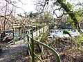 A bridge over Afon Ogwen, Tal-y-bont - geograph.org.uk - 2179937.jpg 4,000 × 3,000; 7.47 MB
-
 A collection of erratic boulders - geograph.org.uk - 5323802.jpg 640 × 480; 89 KB
-

-
 A glimpse into the tunnel - geograph.org.uk - 5437990.jpg 4,032 × 2,268; 3.95 MB
-
 A headstone in the abandoned cemetery, Tanysgafell - geograph.org.uk - 2675797.jpg 3,000 × 4,000; 5.52 MB
-
 A mighty oak has fallen - geograph.org.uk - 5581992.jpg 640 × 427; 111 KB
-
 A replica Telford milestone (Holyhead 26), Llandegai - geograph.org.uk - 2692360.jpg 3,000 × 4,000; 5.59 MB
-
 A section of the Parc Moelyci rock cannon, Sling - geograph.org.uk - 5218295.jpg 1,200 × 1,600; 889 KB
-
 A serious erosion problem - geograph.org.uk - 5858412.jpg 1,795 × 1,346; 1.02 MB
-

-
 A view of Pen yr Ole Wen from Llyn Idwal - panoramio.jpg 3,264 × 2,448; 894 KB
-
 A View of Tyn-y-maes - geograph.org.uk - 4804651.jpg 1,600 × 1,200; 431 KB
-
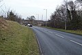
 A5 - geograph.org.uk - 4440115.jpg 640 × 426; 50 KB
-
 A5 - geograph.org.uk - 4440134.jpg 640 × 426; 78 KB
-
 A5 - geograph.org.uk - 4440179.jpg 640 × 426; 83 KB
-
 A5 approaching A55 junction - geograph.org.uk - 3694711.jpg 640 × 335; 53 KB
-
 A5 approaching the A55 - geograph.org.uk - 4440102.jpg 640 × 426; 54 KB
-
 A5 at Cefn-y-Coed - geograph.org.uk - 3694709.jpg 640 × 396; 33 KB
-
 A5 near Bryn - geograph.org.uk - 4180725.jpg 1,600 × 1,064; 656 KB
-
 A5 roundabout - geograph.org.uk - 6186726.jpg 2,048 × 1,536; 816 KB
-

-
 A5 to Bangor - geograph.org.uk - 4440113.jpg 640 × 426; 56 KB
-
 A5 to Bangor - geograph.org.uk - 4440126.jpg 640 × 426; 69 KB
-
 A5 to Bangor - geograph.org.uk - 4440151.jpg 640 × 426; 61 KB
-
 A55 North Wales Expressway at A5 junction - geograph.org.uk - 6109142.jpg 1,024 × 769; 117 KB
-
 A55 North Wales Expressway junction 11 - geograph.org.uk - 4192894.jpg 1,856 × 1,234; 338 KB
-
 A55, Bangor bypass - geograph.org.uk - 4440110.jpg 640 × 426; 60 KB
-
 Aber Cegin - geograph.org.uk - 4975789.jpg 1,000 × 545; 394 KB
-
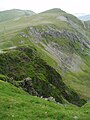
 Above Bwlch y Brecan - geograph.org.uk - 5676693.jpg 1,600 × 1,200; 400 KB
-
 Above Cwm Cywion - geograph.org.uk - 5422335.jpg 1,200 × 1,600; 458 KB
-
 Access to Llandygai Industrial Estate - geograph.org.uk - 4666216.jpg 6,000 × 4,000; 4.33 MB
-
 Afon Idwal - geograph.org.uk - 2877946.jpg 1,024 × 768; 207 KB
-
 Afon Idwal - geograph.org.uk - 2957307.jpg 640 × 480; 88 KB
-
 Afon Idwal - geograph.org.uk - 2957344.jpg 640 × 480; 61 KB
-
 Afon Idwal - geograph.org.uk - 6185041.jpg 1,536 × 2,048; 817 KB
-
 Afon Idwal descending from Cwm Idwal - geograph.org.uk - 3340222.jpg 1,600 × 1,067; 329 KB
-
 Afon Menai - geograph.org.uk - 4975715.jpg 1,000 × 801; 519 KB
-
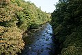
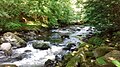
 Afon Ogwen - geograph.org.uk - 3013717.jpg 2,448 × 3,264; 3.97 MB
-
 Afon Ogwen - geograph.org.uk - 3013722.jpg 2,448 × 3,264; 3.34 MB
-
 Afon Ogwen - geograph.org.uk - 3788550.jpg 4,608 × 3,456; 5.29 MB
-
 Afon Ogwen - geograph.org.uk - 4180786.jpg 1,600 × 1,064; 854 KB
-
 Afon Ogwen - geograph.org.uk - 4415000.jpg 2,288 × 1,712; 839 KB
-
 Afon Ogwen - geograph.org.uk - 4524052.jpg 640 × 426; 71 KB
-
 Afon Ogwen - geograph.org.uk - 4673005.jpg 6,000 × 4,000; 6.34 MB
-
 Afon Ogwen - geograph.org.uk - 6008842.jpg 1,024 × 576; 224 KB
-
 Afon Ogwen by Pont Ogwen - geograph.org.uk - 4673013.jpg 6,000 × 4,000; 6.26 MB
-
 Afon Ogwen flowing under the A55 - geograph.org.uk - 4669162.jpg 6,000 × 4,000; 5.08 MB
-
 Afon Ogwen from the old railway bridge - geograph.org.uk - 5437992.jpg 4,032 × 2,268; 5.73 MB
-

-

-
 Along the North Wales coast - geograph.org.uk - 3716805.jpg 800 × 530; 334 KB
-
 Along the North Wales coast - geograph.org.uk - 3716845.jpg 800 × 530; 392 KB
-
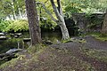
 An abandoned cemetery in the woods, Tanysgafell - geograph.org.uk - 2675778.jpg 4,000 × 3,000; 6.88 MB
-
 An abandoned cemetery in the woods, Tanysgafell - geograph.org.uk - 2675781.jpg 4,000 × 3,000; 6.9 MB
-
 An abandoned cemetery in the woods, Tanysgafell - geograph.org.uk - 2675787.jpg 4,000 × 3,000; 6.98 MB
-

-
 An old crane at Porth Penrhyn, Bangor - geograph.org.uk - 2331712.jpg 4,000 × 3,000; 1.47 MB
-
 Approach to Penrhyn Castle - geograph.org.uk - 3476198.jpg 640 × 480; 91 KB
-
 Approach to the Devil's Kitchen - geograph.org.uk - 4178104.jpg 993 × 1,024; 265 KB
-

-
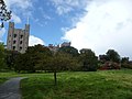 Approaching Penrhyn Castle - geograph.org.uk - 2945574.jpg 640 × 480; 65 KB
-
 Approaching Penrhyn Castle - geograph.org.uk - 3476569.jpg 640 × 480; 87 KB
-
 Arosfan bysys - Bus stop - geograph.org.uk - 6128226.jpg 564 × 640; 77 KB
-
 At Zipworld in Bethesda - geograph.org.uk - 5398847.jpg 640 × 480; 94 KB
-
 At Zipworld in Bethesda - geograph.org.uk - 5398855.jpg 640 × 480; 71 KB
-
 Autogyro Above Cwm Cywion - geograph.org.uk - 4901767.jpg 1,600 × 1,200; 139 KB
-
 Backwall of Cwm Idwal - geograph.org.uk - 2960302.jpg 640 × 480; 59 KB
-
 Bangor - panoramio (4).jpg 2,288 × 1,712; 1.12 MB
-
 Bangor - panoramio - Tanya Dedyukhina (2).jpg 2,816 × 2,112; 2.77 MB
-
 Bangor - panoramio.jpg 2,816 × 2,112; 2.65 MB
-
 Bangor Cricket Club - Changing Rooms - geograph.org.uk - 5864076.jpg 1,600 × 902; 444 KB
-
 Bangor Cricket Club - Nets - geograph.org.uk - 5864081.jpg 1,600 × 902; 237 KB
-
 Bangor from Porth Penrhyn - geograph.org.uk - 5024773.jpg 640 × 443; 68 KB
-
 Bangor Rugby Club - geograph.org.uk - 4669207.jpg 6,000 × 4,000; 7.35 MB
-
 Bangor Travelodge - geograph.org.uk - 4457059.jpg 640 × 426; 90 KB
-
 Beacon at end of Porth Penrhyn breakwater, Bangor - geograph.org.uk - 2917780.jpg 3,000 × 4,000; 1.46 MB
-
 Bench at Penrhyn Castle - geograph.org.uk - 5932795.jpg 1,024 × 683; 483 KB
-
 Benchmark at 1 Craig-y-pandy, Tregarth - geograph.org.uk - 2347392.jpg 3,000 × 4,000; 2.63 MB
-
 Benchmark at Dinas farm, Tregarth - geograph.org.uk - 5809248.jpg 1,200 × 1,600; 586 KB
-
 Benchmark at Glanrafon Bach, Mynydd Llandegai - geograph.org.uk - 5208326.jpg 1,200 × 1,600; 309 KB
-
 Benchmark in A5 Roadside wall, Tregarth - geograph.org.uk - 5195902.jpg 1,200 × 1,600; 448 KB
-
 Benchmark near Sling farmhouse, Sling - geograph.org.uk - 2348000.jpg 3,000 × 4,000; 1.43 MB
-
 Benchmark on boulder on unnamed green track, Sling - geograph.org.uk - 2840846.jpg 3,240 × 4,320; 2.79 MB
-
 Benchmark on Clwt Rhywiog, Rhyd-y-groes - geograph.org.uk - 3173577.jpg 3,240 × 4,320; 2.97 MB
-

-
 Benchmark on gatepost at Porth Penrhyn, Bangor - geograph.org.uk - 2475435.jpg 3,000 × 4,000; 1.37 MB
-
 Benchmark on old railway shed on Porth Penrhyn, Bangor - geograph.org.uk - 2246865.jpg 3,000 × 4,000; 1.46 MB
-
 Benchmark on Penrhyn Bridge, Bangor - geograph.org.uk - 2246851.jpg 3,000 × 4,000; 1.45 MB
-

-
 Benchmark on the B4409 Tregarth - geograph.org.uk - 6010258.jpg 1,200 × 1,600; 612 KB
-
 Benchmark on wall of detrunked section of the A5, Bryn - geograph.org.uk - 2666306.jpg 3,000 × 4,000; 4.91 MB
-
 Benchmark on wall opposite Ysgol Bodfeurig, Sling - geograph.org.uk - 2347997.jpg 3,000 × 4,000; 1.41 MB
-
 Bethesda, footbridge over the River Ogwen - geograph.org.uk - 5809496.jpg 2,560 × 1,600; 1.38 MB
-
 Beverley and Vilma - geograph.org.uk - 3566859.jpg 480 × 640; 70 KB
-
 Big pipe at Porth Penrhyn, Bangor - geograph.org.uk - 2917810.jpg 4,000 × 3,000; 6.51 MB
-
 Blaen-y-nant - geograph.org.uk - 2714783.jpg 1,944 × 2,592; 1.43 MB
-

-
 Blondin, Penrhyn Quarry - geograph.org.uk - 2607443.jpg 1,207 × 1,800; 453 KB
-

-

-

-

-
 Bollards at Porth Penrhyn, Bangor - geograph.org.uk - 6151748.jpg 1,200 × 1,600; 391 KB
-
 Bollards at the side of the road, Bethesda - geograph.org.uk - 6203285.jpg 1,200 × 1,600; 525 KB
-
 Boulder Field, Fronllwyd - geograph.org.uk - 6021367.jpg 1,600 × 1,200; 465 KB
-
 Boulder, Y Parc - geograph.org.uk - 5725116.jpg 1,600 × 1,200; 751 KB
-
 Boundary Wall, Moel Y Ci - geograph.org.uk - 4385908.jpg 1,600 × 1,200; 337 KB
-
 Box hedges at Penrhyn Castle - geograph.org.uk - 5934598.jpg 1,024 × 683; 724 KB
-
 Bridge at Porth Penrhyn - geograph.org.uk - 2157365.jpg 640 × 425; 347 KB
-
 Bridge in Tregarth - geograph.org.uk - 2924440.jpg 640 × 427; 77 KB
-
 Bridge near Tregarth - geograph.org.uk - 2912081.jpg 640 × 427; 112 KB
-
 Bridge near Tregarth - geograph.org.uk - 2924457.jpg 640 × 427; 115 KB
-
 Bridge on cycle route 82 - geograph.org.uk - 4673026.jpg 6,000 × 4,000; 4.75 MB
-
 Bridge over A4244 - geograph.org.uk - 2825943.jpg 1,944 × 2,592; 1.98 MB
-
 Buttercups - geograph.org.uk - 5800478.jpg 1,024 × 768; 369 KB
-
 By the A5 - geograph.org.uk - 4440144.jpg 640 × 426; 47 KB
-
 Cafe in Penrhyn Castle - geograph.org.uk - 5934297.jpg 1,024 × 683; 536 KB
-

-

-
 Capel Shiloh, Tregarth - geograph.org.uk - 5563213.jpg 2,999 × 3,223; 1.92 MB
-

-
 Carnedd Dafydd and Carnedd Llewellyn - geograph.org.uk - 3788603.jpg 4,608 × 3,456; 3.79 MB
-
 Carnedd y Filiast - geograph.org.uk - 3346907.jpg 1,600 × 1,200; 795 KB
-
 Carnedd y Filiast - geograph.org.uk - 3788586.jpg 4,608 × 3,456; 5.51 MB
-
 Carnedd y Filiast across Cwm Ceunant - geograph.org.uk - 3788590.jpg 4,608 × 3,456; 5.4 MB
-
 Carnedd y Filiast from near the top of the ridge - geograph.org.uk - 3788591.jpg 4,608 × 3,456; 4.58 MB
-
 Carnedd y Filiast from valley level - geograph.org.uk - 3788558.jpg 4,608 × 3,456; 5.27 MB
-
 Carnedd y Filiast summit wind shelter - geograph.org.uk - 3788598.jpg 4,608 × 3,456; 4.07 MB
-
 Carneddau Mountains, Snowdonia - geograph.org.uk - 4850737.jpg 2,560 × 1,920; 2.57 MB
-
 Castell y Geifr - geograph.org.uk - 4288376.jpg 640 × 480; 79 KB
-
 Castle of the Winds and Glyder Fach - geograph.org.uk - 3789325.jpg 4,608 × 3,456; 4.45 MB
-
 Cattle grid along Lord Penrhyn's Highway - geograph.org.uk - 3014611.jpg 1,075 × 917; 407 KB
-
 Cattle grid on Lord Penrhyn's Highway - geograph.org.uk - 3015837.jpg 3,249 × 1,887; 2.69 MB
-
 Cattle grid, Nant Ffrancon - geograph.org.uk - 4551375.jpg 640 × 431; 138 KB
-
 Cefn-y-Coed - geograph.org.uk - 4440122.jpg 640 × 426; 55 KB
-
 Ceiling above Grand Staircase - geograph.org.uk - 4648115.jpg 480 × 640; 75 KB
-
 Celebrating Blue Slate statue at Zip World, Bethesda - geograph.org.uk - 5978290.jpg 1,200 × 1,600; 437 KB
-
 Celtest on Tre'r-Felin - geograph.org.uk - 4180772.jpg 1,600 × 1,064; 586 KB
-
 Cen ar lechen - Lichen on slate - geograph.org.uk - 4694038.jpg 640 × 460; 64 KB
-
 Central Cliff of Clogwyn y Geifr - geograph.org.uk - 5858457.jpg 1,346 × 1,795; 1.31 MB
-

-
 Chwarel y Penrhyn Quarry and Carnedd y Filiast - geograph.org.uk - 4890611.jpg 1,079 × 809; 256 KB
-
 Close-up of stench pipe outlet on Erw Faen, Tregarth - geograph.org.uk - 6032100.jpg 1,200 × 1,600; 225 KB
-
 Close-up of stench pipe outlet on Tal Gae, Tregarth - geograph.org.uk - 6032050.jpg 1,200 × 1,600; 460 KB
-
 Cockler on a Quad - geograph.org.uk - 253679.jpg 640 × 396; 58 KB
-
 Coetmor Bridge - geograph.org.uk - 6040470.jpg 1,600 × 1,200; 601 KB
-
 Colour at Penrhyn Castle - geograph.org.uk - 3475565.jpg 640 × 480; 111 KB
-

-
 Concrete Lewis Gun Mounting (1), Nant Ffrancon - geograph.org.uk - 2380486.jpg 4,000 × 3,000; 7.29 MB
-
 Concrete Lewis Gun Mounting (2), Nant Ffrancon - geograph.org.uk - 2380493.jpg 4,000 × 3,000; 7.35 MB
-
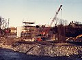 Constructing the A55 viaduct over Afon Ogwen - geograph.org.uk - 2412695.jpg 1,295 × 951; 250 KB
-
 Cornice on Y Garn - geograph.org.uk - 3549690.jpg 1,200 × 1,600; 252 KB
-
 Corrie across the Llyn - geograph.org.uk - 2465269.jpg 640 × 480; 130 KB
-

-
 Crane and concrete barge at Porth Penrhyn - geograph.org.uk - 4975794.jpg 1,000 × 691; 637 KB
-
 Criafolen- Mountain ash - geograph.org.uk - 6128233.jpg 564 × 640; 74 KB
-
 Crossing Pont Sarnau, Bethesda - geograph.org.uk - 2682836.jpg 4,000 × 3,000; 7.38 MB
-
 Crossing Pont Yr Ocar, Mynydd Llandegai - geograph.org.uk - 5719090.jpg 1,200 × 1,600; 655 KB
-
 Crossing the A4244 on Lôn Las Ogwen - geograph.org.uk - 5988967.jpg 4,032 × 3,024; 1.4 MB
-
 Crossing-keeper's cabin, Hen-durnpike - geograph.org.uk - 6090814.jpg 1,600 × 1,200; 438 KB
-
 Cwm Ceunant Copper Mine - geograph.org.uk - 4549488.jpg 1,976 × 2,634; 1.41 MB
-
 Cwm Ceunant from below - geograph.org.uk - 3788583.jpg 4,608 × 3,456; 5.88 MB
-
 Cwm Clyd - geograph.org.uk - 5222359.jpg 1,200 × 1,600; 411 KB
-
 Cwm Clyd, looking towards Tryfan - geograph.org.uk - 3549688.jpg 1,600 × 1,200; 483 KB
-
 Cwm Idwal - Easter 1959 - geograph.org.uk - 2579818.jpg 2,538 × 3,336; 4.21 MB
-
 Cwm Idwal - geograph.org.uk - 2960310.jpg 640 × 480; 49 KB
-
 Cwm Idwal - geograph.org.uk - 2960375.jpg 640 × 480; 73 KB
-
 Cwm Idwal - geograph.org.uk - 4288381.jpg 640 × 480; 68 KB
-
 Cwm-coch - geograph.org.uk - 4674269.jpg 6,000 × 4,000; 5.3 MB
-

-
 Cycle route 82 in Nant Ffrancon - geograph.org.uk - 4673869.jpg 6,000 × 4,000; 4.2 MB
-

-

-
 Dathlu'r llechan las - Celebrating blue slate - geograph.org.uk - 4895250.jpg 1,000 × 1,500; 1.49 MB
-
 Decorative pergola - geograph.org.uk - 5470992.jpg 480 × 640; 60 KB
-
 Descent from the Devils Kitchen - geograph.org.uk - 2465237.jpg 640 × 480; 109 KB
-
 Detour on the track to Tregarth - geograph.org.uk - 4669263.jpg 6,000 × 4,000; 4.61 MB
-
 Devil's Kitchen - Twll Du - geograph.org.uk - 3747682.jpg 640 × 480; 138 KB
-
 Devil's Kitchen- Twll Du - geograph.org.uk - 4288366.jpg 480 × 640; 110 KB
-
 Dickies Port Reception - geograph.org.uk - 5986264.jpg 5,184 × 3,456; 7.83 MB
-
 Diggers at rest at Hewdens plant hire - geograph.org.uk - 1308011.jpg 640 × 426; 131 KB
-
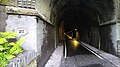
 Dinas Tunnel, Tregarth - geograph.org.uk - 5398084.jpg 1,600 × 1,200; 547 KB
-

-
 Disused Cemetery, Tanysgafell - geograph.org.uk - 5636094.jpg 1,600 × 1,200; 715 KB
-
 Disused Substation, Tregarth - geograph.org.uk - 4415072.jpg 2,288 × 1,712; 836 KB
-
 Disused water tap alcove, Sling - geograph.org.uk - 6103035.jpg 1,600 × 1,200; 512 KB
-
 Disused water tap alcove, Sling - geograph.org.uk - 6103038.jpg 1,600 × 1,200; 673 KB
-
 Disused water tap alcove, Tregarth - geograph.org.uk - 6059864.jpg 1,200 × 1,600; 597 KB
-
 Disused water tap alcove, Tregarth - geograph.org.uk - 6060557.jpg 1,600 × 1,200; 669 KB
-
 Disused Water Tap, Braich-talog - geograph.org.uk - 6090535.jpg 1,600 × 1,205; 435 KB
-
 Disused Water Tap, Tregarth - geograph.org.uk - 6005671.jpg 1,200 × 1,600; 669 KB
-
 Disused Water Tap, Tregarth - geograph.org.uk - 6005672.jpg 1,600 × 1,200; 434 KB
-
 Disused Water Tap, Tregarth - geograph.org.uk - 6005673.jpg 1,113 × 1,600; 424 KB
-
 Disused Water Tap, Tregarth - geograph.org.uk - 6010257.jpg 1,600 × 1,200; 619 KB
-
 Disused Water Tap, Tregarth - geograph.org.uk - 6033089.jpg 1,600 × 1,200; 620 KB
-
 Disused Water Tap, Tregarth - geograph.org.uk - 6033841.jpg 1,600 × 1,200; 652 KB
-
 Drilling rig - geograph.org.uk - 5467549.jpg 640 × 480; 67 KB
-
 Drive at Penrhyn Castle - geograph.org.uk - 4682610.jpg 640 × 480; 68 KB
-
 Dry stone wall along Lord Penrhyn's Highway - geograph.org.uk - 3014670.jpg 1,996 × 2,131; 1.87 MB


,_Llandegai_-_geograph.org.uk_-_2692360.jpg)


_on_a_de-trunked_section_of_the_Holyhead_Road,_Tal-y-bont_-_geograph.org.uk_-_2179966.jpg)


.jpg)
.jpg)


_-_geograph.org.uk_-_4961362.jpg)
_-_geograph.org.uk_-_4961581.jpg)
_-_geograph.org.uk_-_4961620.jpg)


_-_geograph.org.uk_-_6089696.jpg)


,_Nant_Ffrancon_-_geograph.org.uk_-_2380486.jpg)
,_Nant_Ffrancon_-_geograph.org.uk_-_2380493.jpg)


