Category:Llangristiolus
village and community in Anglesey, Wales, UK  | |||||
| Upload media | |||||
| Instance of | |||||
|---|---|---|---|---|---|
| Location | Isle of Anglesey, Wales | ||||
 | |||||
Cymraeg: Pentref yng nghanol Ynys Môn, ger Llangefni, yw Llangristiolus. Enwir y pentref ar ôl eglwys y plwyf, a gysegrir i Sant Cristiolus.
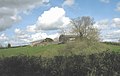
English: Llangristiolus is a village in the middle of Anglesey, southwest of Llangefni, and is named after Saint Cristiolus. The River Cefni flows through the village. The village is within a mile of the A5 and A55 roads.
Subcategories
This category has the following 8 subcategories, out of 8 total.
C
- Capel Horeb, Llangristiolus (2 F)
- Capel Mawr, Anglesey (6 F)
H
- Henblas Burial Chamber (2 F)
M
- Mynwent y Llwyn (3 F)
R
S
Media in category "Llangristiolus"
The following 200 files are in this category, out of 305 total.
(previous page) (next page)-
 A disused lime kiln by the A55 - geograph.org.uk - 897781.jpg 640 × 317; 39 KB
-
 A fragment of the Amlwch Line - geograph.org.uk - 4935549.jpg 640 × 480; 205 KB
-
-

-

-

-
 A5 towards Gaerwen - geograph.org.uk - 3392481.jpg 1,280 × 856; 219 KB
-
 Abandoned course of Afon Cefni - geograph.org.uk - 852955.jpg 640 × 343; 50 KB
-
 Ael-y-bryn Poultry Unit - geograph.org.uk - 5598593.jpg 1,600 × 1,200; 388 KB
-
 Afon Cefni - geograph.org.uk - 4580369.jpg 1,600 × 1,200; 696 KB
-
 Afon Cefni - geograph.org.uk - 4935525.jpg 640 × 480; 134 KB
-

-

-
 An unlikely route to the A5 - geograph.org.uk - 5212867.jpg 4,896 × 3,672; 6.82 MB
-
 Approaching the turning for Ty'n Pwll - geograph.org.uk - 887799.jpg 640 × 480; 115 KB
-
 Bend in the A5 Holyhead Road near Rhostrehwfa - geograph.org.uk - 6122098.jpg 4,000 × 3,000; 3.45 MB
-
 Bend in the road by Llanfawr - geograph.org.uk - 887773.jpg 640 × 480; 73 KB
-
 Block of woodland behind Ty'n Llwyn - geograph.org.uk - 893453.jpg 640 × 480; 143 KB
-
 Bocage landscape at Paradwys - geograph.org.uk - 802071.jpg 640 × 279; 47 KB
-
 Broken footbridge - geograph.org.uk - 893368.jpg 640 × 480; 119 KB
-
 Bryn Gors Farm - geograph.org.uk - 887792.jpg 640 × 400; 58 KB
-
 Bryn Twr folly castle - geograph.org.uk - 3470515.jpg 640 × 480; 45 KB
-
 Buildings at Morfa Brenin Farm - geograph.org.uk - 847030.jpg 640 × 480; 109 KB
-
 Buildings by grazing land - geograph.org.uk - 180813.jpg 640 × 480; 115 KB
-
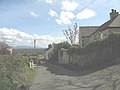
 Bungalows at Llangristiolus - geograph.org.uk - 4426307.jpg 2,478 × 1,770; 685 KB
-
 Bungalows at Llangristiolus - geograph.org.uk - 800844.jpg 640 × 480; 55 KB
-

-
 Carrog - geograph.org.uk - 801713.jpg 640 × 480; 110 KB
-
 Cattle and sheep near Llanfawr Hall - geograph.org.uk - 887688.jpg 640 × 272; 37 KB
-
 Cattle at Ystum Werddon - geograph.org.uk - 887677.jpg 640 × 376; 48 KB
-
 Cefn Cwmwd holiday cottages - geograph.org.uk - 932669.jpg 640 × 480; 141 KB
-
 Cefn-Cwmwd Trig Point - geograph.org.uk - 4617117.jpg 2,560 × 1,920; 2.9 MB
-
 Cefncwmwd Summit - geograph.org.uk - 4617101.jpg 2,560 × 1,920; 2.59 MB
-
 Chancel window of St Cristiolus Church - geograph.org.uk - 6092349.jpg 683 × 1,024; 193 KB
-

-
 Cottages near Pensarn - geograph.org.uk - 802107.jpg 640 × 320; 28 KB
-
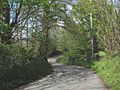
 Country road by Tan-yr-Allt Farm - geograph.org.uk - 801334.jpg 640 × 480; 115 KB
-
 Country road with passing places - geograph.org.uk - 887495.jpg 640 × 480; 50 KB
-
 Criw, Llangristiolus - geograph.org.uk - 801880.jpg 640 × 480; 95 KB
-

-

-
-
 Disused quarry near Ty'n Dryfol - geograph.org.uk - 1015717.jpg 640 × 480; 55 KB
-
-
 Eastbound A55, Anglesey - geograph.org.uk - 6012997.jpg 800 × 533; 537 KB
-

-
 Electricity transmission line - geograph.org.uk - 800830.jpg 640 × 480; 44 KB
-

-

-

-
 Farm buildings at Capel Farm - geograph.org.uk - 801369.jpg 640 × 404; 53 KB
-

-
 Farm road alongside the A55 - geograph.org.uk - 780121.jpg 640 × 480; 70 KB
-

-

-

-
 Farmland near Bodorgan - geograph.org.uk - 5212869.jpg 4,896 × 3,672; 6.59 MB
-
 Farmland near Rhostrehwfa - geograph.org.uk - 5212858.jpg 4,896 × 3,672; 6.83 MB
-
 Farmland north of Henblas - geograph.org.uk - 802870.jpg 640 × 480; 46 KB
-
 Farmland opposite Mona Airfield - geograph.org.uk - 819743.jpg 640 × 238; 18 KB
-
 Field at Llangristiolus - geograph.org.uk - 180230.jpg 640 × 480; 92 KB
-
 Fields at Llan-Fawr - geograph.org.uk - 6099162.jpg 1,280 × 960; 924 KB
-

-
 Fields Near Bryn-llwyd - geograph.org.uk - 5598590.jpg 1,600 × 1,200; 412 KB
-
 Footbridge over the Afon Cefni - geograph.org.uk - 4903175.jpg 640 × 481; 131 KB
-

-
 Footpath to the B 4422 - geograph.org.uk - 887490.jpg 640 × 480; 98 KB
-
 Garden-lake at Pen-y-bont - geograph.org.uk - 785137.jpg 640 × 480; 85 KB
-
 Gated farm road opposite Carrog - geograph.org.uk - 801858.jpg 640 × 345; 38 KB
-
 Glanrafon - geograph.org.uk - 852943.jpg 640 × 480; 145 KB
-
 Glyn-afon cottage - geograph.org.uk - 887878.jpg 640 × 456; 74 KB
-
-
 Grazing land west of the river - geograph.org.uk - 893399.jpg 640 × 480; 72 KB
-
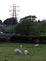 Grazing sheep and a pylon - geograph.org.uk - 180231.jpg 480 × 640; 71 KB
-
 Grazing sheep at Henblas - geograph.org.uk - 800151.jpg 640 × 480; 62 KB
-
 Grazing sheep at Nant Newydd Farm - geograph.org.uk - 877735.jpg 640 × 480; 34 KB
-

-

-
 Hangars at RAF Mona - geograph.org.uk - 2076500.jpg 1,024 × 620; 75 KB
-

-

-
 Holyhead 13 - geograph.org.uk - 5376846.jpg 1,024 × 683; 222 KB
-
 Holyhead 14 - geograph.org.uk - 5376399.jpg 1,024 × 683; 240 KB
-
 Holyhead 15 - geograph.org.uk - 5376394.jpg 1,024 × 683; 200 KB
-

-

-
-
 Houses on the hill by Horeb Chapel - geograph.org.uk - 801358.jpg 640 × 480; 57 KB
-
 Intruders amongst the flock - geograph.org.uk - 791228.jpg 550 × 640; 95 KB
-

-
 Land west of RAF Mona - geograph.org.uk - 995007.jpg 640 × 273; 27 KB
-
 Lane near Ty Gwyn - geograph.org.uk - 5212849.jpg 4,896 × 3,672; 6.67 MB
-
 Lane to Ty'n Dryfol Bach - geograph.org.uk - 799298.jpg 640 × 480; 47 KB
-

-
 Lime kiln at Lledwigan - geograph.org.uk - 1085966.jpg 640 × 351; 42 KB
-
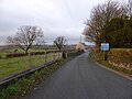
 Link road to Rhostrehwfa village - geograph.org.uk - 887504.jpg 640 × 480; 75 KB
-
 Llanfawr - a former farm - geograph.org.uk - 887724.jpg 640 × 480; 81 KB
-
 Llanfawr farm - geograph.org.uk - 4599094.jpg 4,320 × 3,240; 5.09 MB
-

-
 Llanfawr Newydd - geograph.org.uk - 887776.jpg 640 × 480; 46 KB
-
 Llangristiolus (2).jpg 3,968 × 2,976; 2.43 MB
-
 Lledwigan Farm - geograph.org.uk - 781045.jpg 640 × 480; 29 KB
-
 Lledwigan Standing Stone - geograph.org.uk - 1060832.jpg 640 × 440; 105 KB
-
 Lon Las Cefni - geograph.org.uk - 4935561.jpg 640 × 480; 125 KB
-
 Man-made lake east of Waen-hir bridge - geograph.org.uk - 887621.jpg 640 × 631; 96 KB
-
 Manure heap and its guardian - geograph.org.uk - 5212860.jpg 1,600 × 1,200; 472 KB
-

-
 Milestone - geograph.org.uk - 5376386.jpg 683 × 1,024; 262 KB
-
 Milestone - geograph.org.uk - 5376396.jpg 683 × 1,024; 237 KB
-
 Milestone - geograph.org.uk - 5376842.jpg 683 × 1,024; 210 KB
-
 Milestone at Mona - geograph.org.uk - 402661.jpg 640 × 480; 114 KB
-
 Minor junction on the A5 - geograph.org.uk - 887605.jpg 640 × 480; 72 KB
-
 Minor road approaching the A5 - geograph.org.uk - 5212807.jpg 4,896 × 3,672; 7.04 MB
-

-

-
 Minor road junction at Pensarn - geograph.org.uk - 802103.jpg 640 × 480; 81 KB
-

-

-
 Minor road near Rhostrehwfa - geograph.org.uk - 5212857.jpg 4,896 × 3,672; 6.63 MB
-
 Minor road south of Bryn Twr - geograph.org.uk - 780146.jpg 640 × 480; 100 KB
-
 Modern detached house at Rhostrehwfa - geograph.org.uk - 877711.jpg 640 × 388; 42 KB
-
 Mona Airfield Panorama - geograph.org.uk - 4200870.jpg 800 × 307; 45 KB
-
 Mona Coaching Inn - geograph.org.uk - 5431178.jpg 1,600 × 1,200; 401 KB
-

-
 Mynwent y Llwyn.jpg 4,000 × 3,000; 4.6 MB
-
 Nant Yr Odyn Hotel - geograph.org.uk - 4599063.jpg 4,320 × 3,240; 5.01 MB
-
 Nant yr Odyn Hotel - geograph.org.uk - 887739.jpg 640 × 480; 113 KB
-
 Narrow country lane north of Carrog Farm - geograph.org.uk - 801403.jpg 640 × 480; 124 KB
-

-

-
 Old Barn at Henblas Park. - geograph.org.uk - 439664.jpg 640 × 480; 80 KB
-
 Old Barn, Henblas, Llangristiolus - geograph.org.uk - 38538.jpg 640 × 480; 75 KB
-
 Old farm building at Twll-y-clawdd - geograph.org.uk - 893427.jpg 640 × 480; 103 KB
-
 Old lime kiln and pond (1) - geograph.org.uk - 4599075.jpg 4,320 × 3,240; 4.87 MB
-
 Old lime kiln and pond (2) - geograph.org.uk - 4599079.jpg 4,320 × 3,240; 4.92 MB
-
 Old lime kiln and pond (3) - geograph.org.uk - 4599086.jpg 4,320 × 3,240; 4.76 MB
-
 Old lime kiln and pond (4) - geograph.org.uk - 4599088.jpg 4,320 × 3,240; 4.49 MB
-

-

-

-
 Pasture land - geograph.org.uk - 38858.jpg 640 × 480; 52 KB
-

-
 Pen-y-bont cottage - geograph.org.uk - 785134.jpg 640 × 480; 105 KB
-

-
 Pont Bwcle - geograph.org.uk - 4903180.jpg 640 × 480; 152 KB
-

-
 Porthdy Paradwys - geograph.org.uk - 802040.jpg 640 × 480; 65 KB
-
 Poultry facility alongside the A55 - geograph.org.uk - 780119.jpg 640 × 338; 58 KB
-

-
 Pylon by the B4422 - geograph.org.uk - 802120.jpg 640 × 480; 64 KB
-
 Pylon on Bryn Ellyll - geograph.org.uk - 1015882.jpg 640 × 480; 51 KB
-

-

-

-
 Reclaiming scrubland near Bryn Coch - geograph.org.uk - 802093.jpg 640 × 422; 54 KB
-
 Red barn at Rhos Engan - geograph.org.uk - 800852.jpg 640 × 480; 71 KB
-

-
 Reservoir Cae-mawr - geograph.org.uk - 5431165.jpg 1,200 × 1,600; 351 KB
-
 Rhyd-lydan - geograph.org.uk - 5662824.jpg 640 × 452; 67 KB
-
 Rhyd-y-Foty cottage - geograph.org.uk - 799313.jpg 640 × 480; 113 KB
-
-

-
-
 Road junction near Bodorgan - geograph.org.uk - 5212865.jpg 4,896 × 3,672; 6.65 MB
-
 Roadside cottages at Pant Paradwys - geograph.org.uk - 802051.jpg 640 × 480; 55 KB
-

-
 Roadside house near Bryn Twr - geograph.org.uk - 780135.jpg 640 × 480; 114 KB
-
 Roadside Post box - geograph.org.uk - 180863.jpg 640 × 480; 164 KB
-
 Rough grazing land - geograph.org.uk - 898184.jpg 640 × 294; 32 KB
-

-

-
 Sharp bend - geograph.org.uk - 4599098.jpg 4,320 × 3,240; 5.2 MB
-

-

-
 Sharp bend in the track near Parc Sais - geograph.org.uk - 887883.jpg 640 × 480; 141 KB
-

-

-

-

-
 Single track road and ditch - geograph.org.uk - 5212862.jpg 4,896 × 3,672; 6.58 MB
-

-

-
 Sloping land above Malltraeth Marsh - geograph.org.uk - 877740.jpg 640 × 364; 40 KB
-
 St Cristiolus Church - geograph.org.uk - 6092343.jpg 1,024 × 683; 153 KB
-
 St Cristiolus Church - geograph.org.uk - 6092346.jpg 1,024 × 683; 151 KB
-
 St Cristiolus's belltower - geograph.org.uk - 6098928.jpg 1,280 × 1,462; 1.09 MB
-
 St Cristiolus's church entrance - geograph.org.uk - 6099056.jpg 1,280 × 1,403; 1.17 MB
-
 St Cristiolus's Church, Llangristiolus - geograph.org.uk - 6098782.jpg 1,280 × 960; 906 KB
-
 Stone built barn at Bryn Gors - geograph.org.uk - 887795.jpg 640 × 480; 74 KB
-

-
 Stream near Rhyd-y-Foty - geograph.org.uk - 799317.jpg 640 × 480; 80 KB
-
 Tan-yr-Allt Farm, Llangristiolus - geograph.org.uk - 801331.jpg 640 × 369; 47 KB
-
 Tarred section of the Lon Dywod lane - geograph.org.uk - 893448.jpg 640 × 480; 82 KB
-

-
 The A5 Holyhead Road near Llangristiolus - geograph.org.uk - 6122112.jpg 4,000 × 3,000; 2.72 MB
-

-
 The A55 for Holyhead - geograph.org.uk - 228750.jpg 640 × 480; 57 KB
-
 The A55 heading for Bangor - geograph.org.uk - 3904847.jpg 2,592 × 1,944; 1.31 MB
-
 The A55 North Wales Expressway - geograph.org.uk - 4156545.jpg 1,600 × 1,078; 1.03 MB
-
 The A55 North Wales Expressway - geograph.org.uk - 4156553.jpg 1,600 × 1,200; 1.03 MB


_-_geograph.org.uk_-_802079.jpg)


.jpg)


_-_geograph.org.uk_-_4599075.jpg)
_-_geograph.org.uk_-_4599079.jpg)
_-_geograph.org.uk_-_4599086.jpg)
_-_geograph.org.uk_-_4599088.jpg)


_from_a_crawling_bus_on_a_congested_A5114_-_geograph.org.uk_-_420348.jpg)