Category:Llanwenarth
village in Monmouthshire, Wales  Pont dŵr Llanwenarth | |||||
| Upload media | |||||
| Instance of | |||||
|---|---|---|---|---|---|
| Location | Monmouthshire, Wales | ||||
 | |||||
Subcategories
This category has only the following subcategory.
L
Media in category "Llanwenarth"
The following 27 files are in this category, out of 27 total.
-
 'Wysg Fawr' or the Usk in flood - geograph.org.uk - 355868.jpg 640 × 480; 149 KB
-
 Below Sugar Loaf - geograph.org.uk - 447535.jpg 640 × 461; 80 KB
-
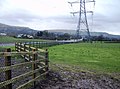
 Farmland near Llanwenarth - geograph.org.uk - 447541.jpg 640 × 446; 110 KB
-
 Lamb & Flag, Llanwenarth (geograph 6353904).jpg 1,600 × 1,118; 419 KB
-
 Churchyard Cross, St Peter's, Llanwenarth, Llanfoist Fawr.jpg 2,976 × 3,968; 3.03 MB
-
 Llanwenarth Aqueduct - geograph.org.uk - 108209.jpg 640 × 480; 218 KB
-
 Llanwenarth Citra Village Hall, Monmouthshire (geograph 6354816).jpg 1,600 × 1,116; 389 KB
-
 Llanwenarth Hotel - geograph.org.uk - 1420418.jpg 640 × 480; 148 KB
-
 New bridge over A465 - geograph.org.uk - 268059.jpg 640 × 480; 114 KB
-

-
 Roadworks along A465 - geograph.org.uk - 268058.jpg 480 × 640; 104 KB
-

-
 The Usk - geograph.org.uk - 461717.jpg 640 × 426; 125 KB
-
 Usk Bridge over Dolau Meadows - geograph.org.uk - 355839.jpg 640 × 480; 147 KB
-
 Abergavenny - geograph.org.uk - 294521.jpg 640 × 480; 74 KB
-
 Car Park below Sugar Loaf - geograph.org.uk - 447448.jpg 640 × 437; 84 KB
-
 Dualling nearly complete - geograph.org.uk - 738056.jpg 638 × 475; 98 KB
-
 Dualling nearly complete - geograph.org.uk - 738074.jpg 638 × 475; 105 KB
-
 Dualling nearly complete - geograph.org.uk - 738081.jpg 480 × 635; 93 KB
-

-
 Farmland near Abergavenny - geograph.org.uk - 510887.jpg 640 × 480; 122 KB
-
 Monmouthshire Golf Course - geograph.org.uk - 302203.jpg 640 × 428; 253 KB
-
 Monmouthshire Golf Course - geograph.org.uk - 302207.jpg 640 × 474; 333 KB
-

-
 The Usk River, Abergavenny - geograph.org.uk - 255370.jpg 640 × 480; 112 KB
-
 Towards the Brecon Beacons - geograph.org.uk - 447436.jpg 640 × 480; 105 KB
-


.jpg)

.jpg)


