Category:Locally listed buildings in Brighton and Hove
Brighton and Hove City Council maintains a list of locally listed buildings: "a building, structure or feature that, whilst not statutorily listed by the Secretary of State, is important due to its architectural, historic or archaeological significance". The list was updated in April 2015 and can be seen here.
Subcategories
This category has the following 143 subcategories, out of 143 total.
1
- 100 High Street, Rottingdean (3 F)
- 18 Wellington Road, Brighton (3 F)
2
- 2–3 Pavilion Buildings, Brighton (14 F)
5
- 5 King's Gardens, Hove (3 F)
6
- 64 Western Road, Hove (3 F)
- 65 The Droveway, Hove (3 F)
8
- 80 Stoneham Road, Aldrington (6 F)
A
- ABC Cinema, Brighton (7 F)
- The Admiral pub, Brighton (6 F)
- Aldrington House (12 F)
- Ancient Mariner pub, Hove (6 F)
- Astra House, Brighton (8 F)
B
- The Bear Inn, Brighton (5 F)
- Blakers Park clock tower (14 F)
- Brighthelm Garden of Rest (7 F)
- St Matthias Church, Brighton (7 F)
- Brunswick Square Gardens, Hove (19 F)
C
- Cardinal Newman School, Hove (5 F)
- Cleveland Arms, Brighton (4 F)
- Courtenay Gate, Hove (38 F)
D
- Downs Hotel, Woodingdean (11 F)
- Dubarry Building, Hove (21 F)
E
- Eaton Manor, Hove (4 F)
F
- Fiveways pub, Brighton (4 F)
- Foredown Tower (13 F)
- Furze Croft, Hove (4 F)
G
- George Payne pub, Hove (9 F)
- Gloucester Mews, Brighton (4 F)
- Grand Avenue Mansions, Hove (6 F)
- Grand Central pub, Brighton (16 F)
- Gwydyr Mansions (12 F)
H
- Harewood Court, Hove (5 F)
- Heart and Hand pub, Brighton (8 F)
- Hobgoblin pub, Brighton (9 F)
- Hove Cemetery chapels (14 F)
- Hove Cemetery lodges (6 F)
- Hove Magistrates Court (8 F)
- Hove Museum and Art Gallery (14 F)
- Hove Recreation Ground (6 F)
I
- Imperial Arcade, Brighton (25 F)
- Islingword Inn, Brighton (12 F)
J
- Jolly Brewer, Brighton (6 F)
K
- Kipling Gardens, Rottingdean (12 F)
L
- Ladies Mile Inn, Patcham (14 F)
- Lansdowne Place Hotel, Hove (7 F)
- Leicester Lodge, Hove (4 F)
- Lewes Road Bus Garage (22 F)
M
- Marine Gate, Brighton (40 F)
- Medina House (11 F)
- Mercia House, Hove (6 F)
- Milligan House, Brighton (5 F)
- Mitre House, Brighton (7 F)
- Molly Malone's, Brighton (8 F)
- Montefiore Hospital, Hove (13 F)
- Montreal Arms, Brighton (17 F)
- St Andrew's Church, Moulsecoomb (12 F)
O
- Old Fire Station, Portslade (3 F)
- Oxford Street Chapel, Brighton (11 F)
P
- Park Gate, Hove (3 F)
- Patcham clock tower (8 F)
- Patcham Peace Gardens (13 F)
- Fountain Centre, Patcham (16 F)
- Poets Corner pub, Hove (8 F)
- Portslade Brewery (20 F)
- Portslade Town Hall (6 F)
- Preston Farm Dairy, Hove (5 F)
Q
- Queen Victoria, Rottingdean (7 F)
- Queens Head, Brighton (12 F)
R
- Racehorse Inn, Brighton (8 F)
- Railway Hotel, Brighton (2 F)
- Railway Inn, Portslade (5 F)
- Rose Hill Tavern, Brighton (12 F)
- Royal Standard, Brighton (10 F)
S
- St Peter's School, Portslade (3 F)
T
- Tennyson Court, Hove (9 F)
- The Albion pub, Hove (5 F)
- The Alibi pub, Hove (5 F)
- The Brunswick pub, Hove (8 F)
- The Ginger Pig, Hove (6 F)
- The Long Man, Patcham (5 F)
- The Richmond pub, Brighton (5 F)
- The Station Inn, Hove (9 F)
U
V
W
- Western Hotel, Hove (13 F)
- Whychcote, Portslade (5 F)
Media in category "Locally listed buildings in Brighton and Hove"
The following 183 files are in this category, out of 183 total.
-
 1 and 2 Southdown Road, Portslade (November 2015).JPG 1,800 × 1,200; 443 KB
-
 1 St Catherine's Terrace, Kingsway, Hove (January 2017).JPG 2,000 × 3,000; 1.38 MB
-
 1 St Catherine’s Terrace, Kingsway, Hove (September 2013) (1).JPG 1,200 × 2,200; 1.03 MB
-
 1 St Catherine’s Terrace, Kingsway, Hove (September 2013) (2).JPG 1,400 × 2,000; 622 KB
-
 100 Western Road, Hove (April 2016).JPG 1,600 × 2,600; 706 KB
-
 101 Conway Street, Hove (March 2020).JPG 2,000 × 2,400; 1.74 MB
-
 101 Conway Street, Hove (November 2015).JPG 3,200 × 3,600; 2.64 MB
-
 101–133 Conway Street, Hove (March 2020).JPG 2,000 × 3,008; 2.55 MB
-
 10–32 Viaduct Road, Brighton (March 2014) (1).JPG 3,600 × 2,200; 1.32 MB
-
 10–32 Viaduct Road, Brighton (March 2014) (2).JPG 3,400 × 2,600; 1.61 MB
-
 10–32 Viaduct Road, Brighton (March 2014) (3).JPG 3,000 × 2,000; 1,018 KB
-
 120–124 Vale Avenue, Patcham (December 2016).JPG 2,400 × 1,800; 1 MB
-
 120–124 Vale Avenue, Patcham (February 2014).JPG 2,600 × 2,200; 1.21 MB
-
 13–21 Palmeira Avenue, Hove (April 2016).JPG 4,200 × 3,000; 4.12 MB
-
 142 Western Road, Brighton (December 2016) (1).jpg 2,000 × 2,000; 1.53 MB
-
 142 Western Road, Brighton (December 2016) (2).JPG 1,800 × 1,800; 654 KB
-
 143 Western Road, Brighton (December 2016).JPG 1,600 × 1,800; 511 KB
-
 14–22 Palmeira Avenue, Hove (April 2016).JPG 3,800 × 2,200; 2.69 MB
-
 15 South Street, Portslade (February 2013).JPG 1,800 × 1,600; 849 KB
-
 17 Montpelier Road, Brighton (March 2014).JPG 1,400 × 2,800; 1.04 MB
-
 172 New Church Road, Aldrington (December 2016).JPG 1,000 × 1,000; 186 KB
-
 18 and 20 Drove Road, Portslade (November 2015).JPG 2,500 × 1,800; 721 KB
-
 18–20 Drove Road, Portslade (February 2013).JPG 2,592 × 1,944; 1.63 MB
-
 18–22 Nevill Road, Rottingdean (December 2016).JPG 2,400 × 1,800; 1.03 MB
-
 19–21 Clermont Road, Preston, Brighton (November 2015).JPG 3,400 × 2,400; 1.25 MB
-
 1–4 Challoners Mews, The Green, Rottingdean (December 2016).JPG 2,800 × 1,600; 1.26 MB
-
 1–5 Dean Court Road, Rottingdean (December 2016) (1).JPG 3,000 × 2,000; 1.71 MB
-
 1–5 Dean Court Road, Rottingdean (December 2016) (2).JPG 3,000 × 2,200; 2.08 MB
-
 1–6 Meadow Vale, Ovingdean Road, Ovingdean (December 2016) (1).JPG 3,200 × 1,600; 1.4 MB
-
 1–6 Meadow Vale, Ovingdean Road, Ovingdean (December 2016) (2).JPG 3,000 × 1,600; 1.27 MB
-
 1–8 Court Ord Cottages, Rottingdean (December 2016) (1).JPG 1,800 × 1,200; 525 KB
-
 1–8 Court Ord Cottages, Rottingdean (December 2016) (2).JPG 3,000 × 1,800; 1.27 MB
-
 20 Brunswick Street West, Hove (April 2016) (1).JPG 2,800 × 2,200; 1.12 MB
-
 20 Brunswick Street West, Hove (April 2016) (2).JPG 4,000 × 2,800; 1.93 MB
-
 25 and 27 Sackville Road, Hove (December 2016) (1).JPG 2,600 × 1,800; 932 KB
-
 25 and 27 Sackville Road, Hove (December 2016) (2).JPG 1,800 × 1,400; 535 KB
-
 26 Oxford Street, Brighton (November 2015).JPG 1,400 × 2,400; 625 KB
-
 277–283 Mile Oak Road, Mile Oak (November 2015) (1).JPG 2,000 × 1,400; 603 KB
-
 277–283 Mile Oak Road, Mile Oak (November 2015) (2).JPG 2,500 × 1,400; 574 KB
-
 29–30 Boundary Road, Portslade (February 2013).JPG 1,400 × 1,600; 682 KB
-
 3 Bedford Place, Brighton (July 2010).JPG 800 × 1,900; 404 KB
-
 31a Western Road, Hove (April 2016).JPG 1,600 × 3,200; 913 KB
-
 35 Brunswick Street West, Hove (April 2016).JPG 2,600 × 2,800; 1.28 MB
-
 39 Chesham Road, Kemptown, Brighton (February 2014) (1).JPG 3,400 × 2,000; 1.31 MB
-
 39 Chesham Road, Kemptown, Brighton (February 2014) (2).JPG 2,700 × 2,200; 1.14 MB
-
 39 Dean Court Road, Rottingdean (December 2016) (1).JPG 2,200 × 2,000; 1.17 MB
-
 39 Dean Court Road, Rottingdean (December 2016) (2).JPG 3,200 × 2,000; 1.47 MB
-
 39 Dean Court Road, Rottingdean (December 2016) (3).JPG 2,400 × 1,600; 1.17 MB
-
 41 Dean Court Road, Rottingdean (December 2016).JPG 3,000 × 1,600; 1.56 MB
-
 479 and 481 Mile Oak Road, Mile Oak (November 2015).JPG 1,600 × 2,000; 627 KB
-
 48 and 48a Highdown Road, Seven Dials, Brighton and Hove (August 2016) (1).JPG 1,600 × 1,600; 393 KB
-
 48 and 48a Highdown Road, Seven Dials, Brighton and Hove (August 2016) (2).JPG 1,800 × 1,800; 492 KB
-
 4–20 Wellington Road, Portslade (November 2015).JPG 2,400 × 1,400; 530 KB
-
 4–32 Lauriston Road, Preston, Brighton (November 2015).JPG 4,000 × 2,400; 1.71 MB
-
 5 Wyndham Street, Kemptown, Brighton (December 2016).jpg 2,000 × 2,200; 447 KB
-
 50 and 52 Foredown Road, Downs Park, Portslade (November 2015).JPG 2,550 × 1,500; 768 KB
-
 50 and 52 Greenways, Ovingdean (December 2016) (1).JPG 2,400 × 1,800; 1.05 MB
-
 50 and 52 Greenways, Ovingdean (December 2016) (2).JPG 2,000 × 1,600; 1.03 MB
-
 50 and 52 Greenways, Ovingdean (December 2016) (3).JPG 3,200 × 2,400; 2.39 MB
-
 50 and 52 Greenways, Ovingdean (December 2016) (4).JPG 2,200 × 1,800; 1.37 MB
-
 50–59 Western Road, Hove (April 2016).JPG 3,800 × 2,400; 1.81 MB
-
 6 Locks Hill, Portslade (Former School) (February 2013).JPG 2,400 × 1,600; 1.1 MB
-
 82 St James's Street, Brighton (December 2016).JPG 1,600 × 2,400; 607 KB
-
 85 George Street, Hove (December 2016).JPG 1,200 × 2,400; 512 KB
-
 87 Abinger Road, Portslade (February 2013).JPG 1,400 × 1,000; 288 KB
-
 8–10 Dean Court Road, Rottingdean (December 2016).JPG 2,800 × 2,000; 781 KB
-
 Adelaide Crescent Gardens and Palmeira Square Gardens, Hove (May 2013).JPG 1,800 × 2,200; 765 KB
-
 Adelaide Crescent, Palmeira Square and Gardens, Hove (June 2016).JPG 3,200 × 2,400; 2.37 MB
-
 Adelaide Crescent, Palmeira Square and Gardens, Hove.JPG 2,400 × 1,800; 1.26 MB
-
 Alma Cottage, South Street - geograph org uk - 630098 (Cropped).jpg 450 × 370; 31 KB
-
 Alma Cottage, South Street - geograph.org.uk - 630098.jpg 640 × 479; 64 KB
-
 Arundel House, The Drive, Hove (April 2016) (1).JPG 3,100 × 3,800; 3.42 MB
-
 Arundel House, The Drive, Hove (April 2016) (2).jpg 2,400 × 3,400; 2.51 MB
-
 Barclays Bank, North St. Brighton - geograph.org.uk - 3290220.jpg 1,600 × 1,200; 435 KB
-
 Barclays Bank, North Street, Brighton.JPG 1,800 × 1,600; 942 KB
-
 Beacon Court, Greenways, Ovingdean (August 2014).JPG 3,600 × 2,600; 1.9 MB
-
 Beacon Court, Greenways, Ovingdean (December 2016).JPG 3,200 × 2,000; 1.45 MB
-
 Bollards at St Nicholas' Churchyard, Dyke Road, Brighton (December 2016).jpg 2,800 × 1,600; 1.93 MB
-
 Boundary Stone at Elm Grove, Brighton (September 2018).JPG 2,000 × 2,000; 1.88 MB
-
 Boundary Wall at The Rotyngs, Falmer Road, Rottingdean (December 2016) (1).JPG 1,800 × 1,400; 618 KB
-
 Boundary Wall at The Rotyngs, Falmer Road, Rottingdean (December 2016) (2).JPG 2,400 × 3,000; 1.68 MB
-
 Boundary Wall at The Rotyngs, Falmer Road, Rottingdean (December 2016) (3).JPG 3,200 × 1,200; 1.03 MB
-
 Boundary Wall at The Rotyngs, Falmer Road, Rottingdean (December 2016) (4).JPG 2,400 × 1,200; 992 KB
-
 Bow Street Runner Inn, Brunswick Street West, Hove (July 2010).JPG 1,400 × 2,400; 693 KB
-

-
 Cardinal Newman Catholic School - geograph.org.uk - 216658.jpg 479 × 640; 112 KB
-
 Cardinal Newman Catholic School - geograph.org.uk - 226891.jpg 640 × 469; 165 KB
-
 Cattle Arch near Victoria Road, Portslade (November 2015) (1).JPG 2,000 × 1,200; 447 KB
-
 Cattle Arch near Victoria Road, Portslade (November 2015) (2).JPG 1,600 × 1,800; 605 KB
-
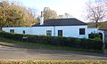
 Chapel (former) at Portslade Cemetery, Trafalgar Road, Portslade (November 2015).JPG 1,800 × 1,800; 513 KB
-
 Chapel at Portslade Cemetery, Trafalgar Road, Portslade (November 2015) (1).JPG 2,200 × 1,800; 685 KB
-
 Chapel at Portslade Cemetery, Trafalgar Road, Portslade (November 2015) (2).JPG 1,800 × 2,000; 596 KB
-
 Chapel at Portslade Cemetery.JPG 2,592 × 1,944; 1.41 MB
-
 Church Room (former National School), Ovingdean Road, Ovingdean (December 2016) (1).JPG 2,400 × 1,800; 1.57 MB
-
 Church Room (former National School), Ovingdean Road, Ovingdean (December 2016) (2).JPG 2,800 × 2,000; 1.49 MB
-
 Church Room (former National School), Ovingdean Road, Ovingdean (December 2016) (3).JPG 2,800 × 2,200; 2.17 MB
-

-
 Clifton Terrace Gardens, Clifton Terrace, Montpelier, Brighton (December 2016) (1).JPG 3,200 × 2,200; 1.77 MB
-
 Clifton Terrace Gardens, Clifton Terrace, Montpelier, Brighton (December 2016) (2).JPG 3,200 × 2,400; 2.19 MB
-

-

-
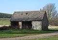
 Court Barn, The Green, Rottingdean (December 2016).JPG 2,800 × 2,000; 1.67 MB
-
 Crown House (formerly Crown Works), Crown Road, Portslade (February 2013).JPG 2,400 × 1,600; 1.06 MB
-
 Dairy, The Droveway - geograph.org.uk - 1555282.jpg 640 × 480; 66 KB
-
 Dolphin Cottage, 22 Crown Street, Brighton (July 2010).JPG 700 × 1,700; 288 KB
-
 Dyke Road Park, Dyke Road, Brighton (August 2014).JPG 2,000 × 1,200; 393 KB
-

-

-

-

-
 Flint wall at Hove Manor, Hove Street, Hove (January 2017).JPG 2,600 × 2,000; 1.41 MB
-
 Fonthill Road Railway Bridge - geograph.org.uk - 583877.jpg 640 × 479; 132 KB
-
 Former Smithy, Ovingdean Road, Ovingdean (December 2016) (1).JPG 3,000 × 2,000; 1.68 MB
-
 Former Smithy, Ovingdean Road, Ovingdean (December 2016) (2).JPG 2,800 × 1,800; 1.45 MB
-
 Former Smithy, Ovingdean Road, Ovingdean (December 2016) (3).JPG 2,600 × 1,800; 1.24 MB
-

-
 Former Tram Shelter, Ditchling Road, Brighton (November 2015) (2).JPG 3,400 × 3,200; 1.76 MB
-
 Gate Piers at 8 and 9 Cavendish Place, Brighton (January 2017).JPG 800 × 2,200; 448 KB
-
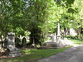 General View of Brighton Extra Mural Cemetery.JPG 2,592 × 1,944; 1.39 MB
-
 Hove Lawns and Courtney Gate, Kingsway, Hove (February 2013).JPG 2,500 × 1,500; 833 KB
-
 Hove old fire station, Hove Street - geograph.org.uk - 1631947.jpg 640 × 427; 228 KB
-
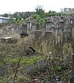 Jewish Cemetery, Florence Place, Round Hill, Brighton.JPG 1,800 × 2,000; 991 KB
-

-

-
 Kingsway Western Bowls Pavilion, Western Esplanade, Hove (August 2013) (1).JPG 2,200 × 1,200; 622 KB
-
 Kingsway Western Bowls Pavilion, Western Esplanade, Hove (August 2013) (2).JPG 2,400 × 1,600; 949 KB
-
 Land off Manor Road, Portslade (Former Portslade Manor Gardens) (November 2015).JPG 2,400 × 1,600; 674 KB
-
 Loxdale, Locks Hill, Portslade (February 2013).JPG 1,900 × 1,900; 996 KB
-
 Manor Cottage, Manor Road, Portslade (November 2015) (1).JPG 2,500 × 1,500; 614 KB
-
 Manor Cottage, Manor Road, Portslade (November 2015) (2).JPG 2,200 × 1,600; 644 KB
-
 Mews at Garnet House, St George's Road, Kemptown, Brighton (December 2016).JPG 2,200 × 2,200; 1.08 MB
-
 Mile End Cottages, Ladies Mile Road, Patcham (December 2016).JPG 1,900 × 1,700; 700 KB
-
 Old Cart Lodge and Barn, The Green, Rottingdean (December 2016).JPG 2,600 × 1,600; 1.28 MB
-
 Old Police Station, St Andrew's Road, Portslade (February 2013).JPG 2,400 × 1,800; 1.07 MB
-
 Park Crescent Gardens, Union Road, Round Hill, Brighton (November 2015).JPG 4,200 × 3,000; 4.29 MB
-
 Park Road Hall, Park Road, Rottingdean.JPG 2,400 × 1,800; 1.15 MB
-
 Patcham House School (original building), Old London Road, Patcham (December 2016).JPG 1,800 × 1,400; 586 KB
-
 Petrol Pumps at 19 Bath Street, West Hill, Brighton (December 2016) (1).JPG 1,400 × 2,600; 692 KB
-
 Petrol Pumps at 19 Bath Street, West Hill, Brighton (December 2016) (2).JPG 1,500 × 1,500; 422 KB
-
 Railings at King's Esplanade, Hove (January 2017).JPG 3,200 × 2,400; 1.58 MB
-
 Railings at King's Esplanade, Hove (September 2013).JPG 2,500 × 1,500; 732 KB
-
 Railings at King's Lawn, Hove (September 2013).JPG 2,200 × 1,000; 486 KB
-
 Railings at King's Lawn, Kingsway, Hove (January 2017).jpg 3,000 × 2,000; 2.31 MB
-
 Railway Bridge at Fonthill Road, Hove (November 2015).JPG 3,000 × 2,000; 1.11 MB
-
 Railway Bridge on Fonthill Road, Hove - geograph.org.uk - 461390.jpg 640 × 480; 119 KB
-
 Reading Room, High Street, Rottingdean (December 2016) (1).JPG 2,800 × 2,000; 1.03 MB
-
 Reading Room, High Street, Rottingdean (December 2016) (2).JPG 1,800 × 1,500; 603 KB
-
 Reading Room, High Street, Rottingdean (January 2010).JPG 1,300 × 1,100; 410 KB
-
 Sellaby House, Old Shoreham Road, Southern Cross, Portslade (November 2015).JPG 2,000 × 1,200; 500 KB
-
 Shelter on Hove Seafront (August 2013).JPG 2,400 × 1,600; 770 KB
-

-

-

-

-
 St Aubyn's Mansions - geograph.org.uk - 1142666.jpg 640 × 480; 104 KB
-
 St Aubyn's Mansions, King’s Esplanade, Hove (September 2011) (1).JPG 1,600 × 1,300; 631 KB
-
 St Aubyn's Mansions, King’s Esplanade, Hove (September 2011) (2).JPG 2,200 × 1,600; 1.09 MB
-
 St Nicholas Church, Brighton 09.JPG 1,600 × 1,200; 687 KB
-
 St Nicholas' Churchyard - geograph.org.uk - 1421082.jpg 480 × 640; 106 KB
-
 St Nicholas' Churchyard - geograph.org.uk - 1421111.jpg 640 × 488; 139 KB
-
 St Nicholas' Churchyard - geograph.org.uk - 1421120.jpg 480 × 640; 149 KB
-
 St Nicholas' Churchyard - geograph.org.uk - 1421131.jpg 640 × 480; 165 KB
-
 St Nicholas' Churchyard, Brighton (June 2010).JPG 2,400 × 1,400; 853 KB
-
 St Nicholas' Graveyard and Garden of Rest, Brighton (June 2010).JPG 2,592 × 1,944; 1.4 MB
-
 St Nicholas's Churchyard - geograph.org.uk - 1118026.jpg 640 × 480; 105 KB
-
 St Richard's Flats, Church Road, Portslade (December 2019).JPG 3,600 × 2,200; 1.56 MB
-
 St Richard's Flats, Church Road, Portslade (February 2013).jpg 2,500 × 1,500; 1.03 MB
-
 Temple Heights and Windlesham House, Temple Gardens, Brighton (July 2010).JPG 2,200 × 1,600; 867 KB
-

-
 The Hollingbury, Roedean Road, Hollingdean, Brighton (January 2015).JPG 1,800 × 1,600; 591 KB
-
 The Olde Barn, Ovingdean Road, Ovingdean (August 2014).JPG 3,600 × 2,000; 1.71 MB
-
 Upper Cottages, Ovingdean Road, Ovingdean (August 2014).JPG 2,800 × 2,200; 1.28 MB
-
 Upper Cottages, Ovingdean Road, Ovingdean (December 2016).JPG 2,600 × 1,800; 1.32 MB
-
 Village Barn and The Barn, Church Hill, Patcham (December 2012).JPG 2,400 × 1,600; 1.07 MB
-
 Village Barn and The Barn, Church Hill, Patcham (December 2016).JPG 2,600 × 1,600; 818 KB
-
 Walls at Foredown Tower, Foredown Road, Portslade (November 2015).JPG 2,400 × 1,600; 786 KB
-
 Walls at High Street and Mile Oak Road, Portslade (February 2013).JPG 2,200 × 1,400; 1.7 MB
-
 Walls at High Street and Windlesham Close, Portslade (February 2013).JPG 2,500 × 1,200; 845 KB
-
 White Lodge, The Cliff, Roedean (August 2014) (1).JPG 2,200 × 1,600; 637 KB
-
 White Lodge, The Cliff, Roedean (August 2014) (2).JPG 2,400 × 1,800; 826 KB
-
 Whiteway Centre, Whiteway Lane, Rottingdean (August 2010).JPG 2,400 × 1,400; 1.91 MB
-
 Whiteway Centre, Whiteway Lane, Rottingdean (December 2016).JPG 2,400 × 1,200; 1.2 MB
-
 Windlesham Mansions, 12 Davigdor Road, Hove (August 2016).JPG 1,800 × 1,600; 619 KB
.JPG)
.JPG)
_(1).JPG)
_(2).JPG)
.JPG)
.JPG)
.JPG)
.JPG)
_(1).JPG)
_(2).JPG)
_(3).JPG)
.JPG)
.JPG)
.JPG)
_(1).jpg)
_(2).JPG)
.JPG)
.JPG)
.JPG)
.JPG)
.JPG)
.JPG)
.JPG)
.JPG)
.JPG)
.JPG)
_(1).JPG)
_(2).JPG)
_(1).JPG)
_(2).JPG)
_(1).JPG)
_(2).JPG)
_(1).JPG)
_(2).JPG)
_(1).JPG)
_(2).JPG)
.JPG)
_(1).JPG)
_(2).JPG)
.JPG)
.JPG)
.JPG)
.JPG)
_(1).JPG)
_(2).JPG)
_(1).JPG)
_(2).JPG)
_(3).JPG)
.JPG)
.JPG)
_(1).JPG)
_(2).JPG)
.JPG)
.JPG)
.jpg)
.JPG)
_(1).JPG)
_(2).JPG)
_(3).JPG)
_(4).JPG)
.JPG)
_(February_2013).JPG)
.JPG)
.JPG)
.JPG)
.JPG)
.JPG)
.JPG)

.jpg)

_(1).JPG)
_(2).jpg)


.jpg)
.JPG)
_(1).JPG)
_(2).JPG)
_(4).JPG)
.JPG)
.JPG)


_(1).JPG)
_(2).JPG)
_at_Portslade_Cemetery,_Trafalgar_Road,_Portslade_(November_2015).JPG)
_(1).JPG)
_(2).JPG)

,_Ovingdean_Road,_Ovingdean_(December_2016)_(1).JPG)
,_Ovingdean_Road,_Ovingdean_(December_2016)_(2).JPG)
,_Ovingdean_Road,_Ovingdean_(December_2016)_(3).JPG)
,_Trafalgar_Court,_North_Laine,_Brighton_(November_2015).jpg)
_(1).JPG)
_(2).JPG)
.jpg)

.JPG)
,_Crown_Road,_Portslade_(February_2013).JPG)

.JPG)
_(1).JPG)
_(2).JPG)
_(3).JPG)
.JPG)
.JPG)

_(1).JPG)
_(2).JPG)
_(3).JPG)
,_Locks_Hill,_Portslade_(August_2010).JPG)
_(2).JPG)

.JPG)


_(1).JPG)
_(2).JPG)
_(1).JPG)
_(2).JPG)
_(November_2015).JPG)
.JPG)
_(1).JPG)
_(2).JPG)
.JPG)
.JPG)
.JPG)
.JPG)
.JPG)

,_Old_London_Road,_Patcham_(December_2016).JPG)
_(1).JPG)
_(2).JPG)
.JPG)
.JPG)
.JPG)
.jpg)
.JPG)

_(1).JPG)
_(2).JPG)
.JPG)
.JPG)
.JPG)
,_The_Green,_Rottingdean_(August_2019).JPG)
,_The_Green,_Rottingdean_(December_2016)_(1).JPG)
,_The_Green,_Rottingdean_(December_2016)_(2).JPG)
,_The_Green,_Rottingdean_(December_2016)_(3).JPG)

_(1).JPG)
_(2).JPG)


.JPG)
.JPG)

.JPG)
.jpg)
.JPG)
.jpg)
.JPG)
.JPG)
.JPG)
.JPG)
.JPG)
.JPG)
.JPG)
.JPG)
.JPG)
_(1).JPG)
_(2).JPG)
.JPG)
.JPG)
.JPG)
.JPG)
.JPG)
_(3).JPG)
.JPG)
.JPG)