Category:Location maps of Slovenia
Countries of Europe: Albania · Andorra · Armenia‡ · Austria · Azerbaijan‡ · Belarus · Belgium · Bosnia and Herzegovina · Bulgaria · Croatia · Cyprus‡ · Czech Republic · Denmark · Estonia · Finland · France‡ · Georgia‡ · Germany · Greece · Hungary · Iceland · Republic of Ireland · Italy · Kazakhstan‡ · Latvia · Liechtenstein · Lithuania · Luxembourg · Malta · Moldova · Monaco · Montenegro · Netherlands‡ · North Macedonia · Norway · Poland · Portugal‡ · Romania · Russia‡ · San Marino · Serbia · Slovakia · Slovenia · Spain‡ · Sweden · Switzerland · Turkey‡ · Ukraine · United Kingdom · Vatican City
Specific status: Gibraltar – Limited recognition: Abkhazia‡ · Kosovo
‡: partly located in Europe
Specific status: Gibraltar – Limited recognition: Abkhazia‡ · Kosovo
‡: partly located in Europe
Slovenščina: Lokacijski zemljevidi Slovenije.
 |
This category should only contain blank "Location maps" created for geo-location purposes which follow a same uniform standard, and have been created with a Geographic information system (GIS) software program using a compatible equirectangular or conical projection and for which the geographic coordinate system is known. For more information or questions see the wikiproject: German Wikipedia:Kartenwerkstatt/Positionskarten and this discussion page. |
Subcategories
This category has only the following subcategory.
Media in category "Location maps of Slovenia"
The following 7 files are in this category, out of 7 total.
-
 LocationmapSlovenia.png 800 × 592; 53 KB
-
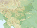
 Relief map of Slovenia.png 1,888 × 1,434; 4.94 MB
-
 Relief Map of Slovenia.svg 356 × 240; 2.69 MB
-
 Reliefkarte Slowenien.png 2,709 × 2,085; 8.59 MB
-
 Slovenia (no subdivisions) location map.svg 1,159 × 857; 34 KB
-
 Slovenia location map with traditional regions.svg 1,160 × 859; 89 KB
-
 Slovenia location map.svg 1,159 × 857; 618 KB


_location_map.svg)

