Category:Location maps of provinces of Belgium
Media in category "Location maps of provinces of Belgium"
The following 12 files are in this category, out of 12 total.
-
 Belgium Antwerp location map.svg 494 × 382; 54 KB
-
 Belgium East Flanders location map.svg 468 × 442; 105 KB
-
 Belgium Flemish Brabant (+Brussels) location map.svg 575 × 276; 124 KB
-
 Belgium Flemish Brabant location map.svg 575 × 276; 108 KB
-
 Belgium Hainaut location map.svg 763 × 603; 121 KB
-
 Belgium Limburg location map.svg 433 × 472; 40 KB
-
 Belgium Liège location map.svg 651 × 501; 141 KB
-
 Belgium Luxembourg location map.svg 511 × 650; 108 KB
-
 Belgium Namur location map.svg 500 × 583; 93 KB
-
 Belgium Walloon Brabant location map.svg 424 × 210; 51 KB
-
 Belgium West Flanders location map.svg 430 × 457; 99 KB
-
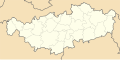
 Luxembourg belge location map.svg 1,003 × 874; 184 KB


_location_map.svg)


