Category:Locator maps of Alsace
Administrative regions and territorial collectivity of Metropolitan France (‡ since start of 2016):
Auvergne-Rhône-Alpes‡ · Bourgogne-Franche-Comté‡ · Brittany · Centre-Val de Loire · Corsica · Grand Est‡ · Hauts-de-France‡ · Île-de-France · Normandy‡ · New Aquitaine‡ · Occitania‡ · Pays de la Loire · Provence-Alpes-Côte d'Azur
Former administrative regions of Metropolitan France (until end of 2015):
Alsace · Aquitaine · Auvergne · Burgundy · Champagne-Ardenne · Franche-Comté · Languedoc-Roussillon · Limousin · Lorraine · Midi-Pyrénées · Nord-Pas-de-Calais · Lower Normandy · Upper Normandy · Picardy · Poitou-Charentes · Rhône-Alpes
Overseas departments and regions: Guadeloupe · Martinique · French Guiana · Réunion · Mayotte
Overseas collectivities: Saint Barthélemy · Saint-Martin · Saint Pierre and Miquelon · French Polynesia · Wallis and Futuna · French Southern and Antarctic Lands+
Sui generis territories: New Caledonia · Clipperton Island+

Subcategories
This category has only the following subcategory.
*
Media in category "Locator maps of Alsace"
The following 25 files are in this category, out of 25 total.
-
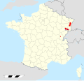
 Alsace in France.svg 1,041 × 997; 1.65 MB
-
 Alsace map.png 200 × 189; 29 KB
-
 Alsace-hist-location.svg 686 × 774; 801 KB
-
 Alsace-Loc.png 161 × 236; 11 KB
-
 Alsace-Position.png 257 × 256; 19 KB
-
 Bassin houiller Franche-Comté-Alsace.svg 2,000 × 1,922; 829 KB
-
 Carte Alsace 2018.png 2,000 × 1,922; 629 KB
-
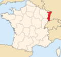 France - Alsace.png 1,184 × 1,112; 207 KB
-
 Hist-alsace-in-europe.svg 547 × 366; 715 KB
-
 Map of Alsace.png 891 × 899; 23 KB
-
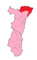
 MapHaut-Rhin1stconstituency.png 213 × 349; 5 KB
-
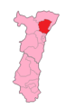
 MapofBas-Rhin's1stconstituency.png 213 × 349; 5 KB
-
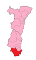
 MapofBas-Rhin's2ndconstituency.png 213 × 349; 5 KB
-
 MapofBas-Rhin's4thConstituency.png 213 × 349; 5 KB
-
 MapofBas-Rhin's6thConstituency.png 213 × 349; 5 KB
-
 MapofBas-Rhin's8thConstituency.png 213 × 349; 5 KB
-
 MapofBasRhin's3rdConstituency.png 213 × 349; 5 KB
-
 MapofBasRhin's7thconstituency.png 213 × 349; 5 KB
-
 MapofBasRhin's9thConstituency.png 213 × 349; 5 KB
-
 MapofHaut-Rhin's3rdConstituency.png 213 × 349; 5 KB
-
 MapofHaut-Rhin's4thConstituency.png 213 × 349; 5 KB
-
 MapofHaut-Rhin's5thconstituency.png 213 × 349; 5 KB
-
 MapofHaut-Rhin's6thconstituency.png 213 × 349; 5 KB
-
 MapofHaut-Rhn's2ndconstituency.png 213 × 349; 5 KB
-
 Rimex-France location Alsace.svg 765 × 720; 638 KB


