Category:Locator maps of Bezirk Waidhofen an der Thaya
Media in category "Locator maps of Bezirk Waidhofen an der Thaya"
The following 32 files are in this category, out of 32 total.
-
 Dietmanns im Bezirk WT.PNG 645 × 645; 24 KB
-
 Dietmanns in WT.png 646 × 578; 19 KB
-
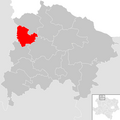
 Dobersberg im Bezirk WT.PNG 645 × 645; 24 KB
-
 Dobersberg in WT.png 646 × 578; 19 KB
-
 Gastern im Bezirk WT.PNG 645 × 645; 24 KB
-
 Gastern in WT.png 646 × 578; 19 KB
-
 Gemeinden im Bezirk Waidhofen an der Thaya.png 1,351 × 780; 136 KB
-
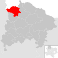
 Groß-Siegharts im Bezirk WT.PNG 645 × 645; 24 KB
-
 Groß-Siegharts in WT.png 646 × 578; 19 KB
-
 Karlstein an der Thaya im Bezirk WT.PNG 645 × 645; 24 KB
-
 Karlstein an der Thaya in WT.png 646 × 578; 19 KB
-
 Kautzen im Bezirk WT.PNG 645 × 645; 24 KB
-
 Kautzen in WT.png 646 × 578; 19 KB
-
 Leere Karte Gemeinden im Bezirk WT.PNG 645 × 645; 24 KB
-
 Ludweis-Aigen im Bezirk WT.PNG 645 × 645; 24 KB
-
 Ludweis-Aigen in WT.png 646 × 578; 19 KB
-
 Pfaffenschlag bei Waidhofen an der Thaya im Bezirk WT.PNG 645 × 645; 24 KB
-
 Pfaffenschlag bei Waidhofen an der Thaya in WT.png 646 × 578; 19 KB
-
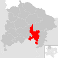
 Raabs an der Thaya im Bezirk WT.PNG 645 × 645; 24 KB
-
 Raabs an der Thaya in WT.png 646 × 578; 19 KB
-
 Thaya im Bezirk WT.PNG 645 × 645; 24 KB
-
 Thaya in WT.png 646 × 578; 19 KB
-
 Vitis im Bezirk WT.PNG 645 × 645; 24 KB
-
 Vitis in WT.png 646 × 578; 19 KB
-
 Waidhofen an der Thaya im Bezirk WT.PNG 645 × 645; 24 KB
-
 Waidhofen an der Thaya in WT.png 646 × 578; 19 KB
-
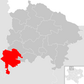
 Waidhofen an der Thaya-Land im Bezirk WT.PNG 645 × 645; 24 KB
-
 Waidhofen an der Thaya-Land in WT.png 646 × 578; 19 KB
-
 Waldkirchen an der Thaya im Bezirk WT.PNG 645 × 645; 24 KB
-
 Waldkirchen an der Thaya in WT.png 646 × 578; 19 KB
-
 Windigsteig im Bezirk WT.PNG 645 × 645; 24 KB
-
 Windigsteig in WT.png 646 × 578; 19 KB


