Category:Locator maps of Darjeeling
Media in category "Locator maps of Darjeeling"
The following 10 files are in this category, out of 10 total.
-
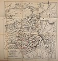
 BAYLEY(1838) Map of the Country between Titaleea and Dorjeling.jpg 2,907 × 4,160; 2.6 MB
-
 Darjeeling1924.jpg 1,273 × 1,027; 212 KB
-
 Darĝiling.jpg 400 × 447; 20 KB
-
 Everest 1858.jpg 1,500 × 1,046; 228 KB
-
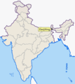
 Map darjeeling.png 400 × 447; 31 KB
-
 Map darjiling.png 400 × 447; 25 KB
-

-
 Sikkim map 1898.jpg 2,853 × 3,039; 3.76 MB
-
 Txu-pclmaps-oclc-181831961-darjeeling-78-a-1923.jpg 3,674 × 5,870; 2.61 MB
-
 Txu-pclmaps-oclc-181831961-darjeeling-78-a-1937.jpg 3,650 × 4,984; 2.77 MB
_Map_of_the_Country_between_Titaleea_and_Dorjeling.jpg)


.jpg)


