Category:Locator maps of communes in Pays de la Loire
Administrative regions and territorial collectivity of Metropolitan France (‡ since start of 2016):
Auvergne-Rhône-Alpes‡ · Bourgogne-Franche-Comté‡ · Brittany · Centre-Val de Loire · Corsica · Grand Est‡ · Hauts-de-France‡ · Île-de-France · Normandy‡ · New Aquitaine‡ · Occitania‡ · Pays de la Loire · Provence-Alpes-Côte d'Azur
Former administrative regions of Metropolitan France (until end of 2015):
Alsace · Nord-Pas-de-Calais
Overseas departments and regions: Guadeloupe · Martinique · French Guiana · Réunion · Mayotte
Sui generis territories: New Caledonia
Subcategories
This category has only the following subcategory.
Media in category "Locator maps of communes in Pays de la Loire"
The following 27 files are in this category, out of 27 total.
-
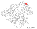
 Location Sainte-Reine-de-Bretagne.svg 400 × 320; 12 KB
-
 Location Sautron.svg 400 × 320; 12 KB
-
 Location Savenay.svg 400 × 320; 12 KB
-
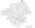
 Location Sion-les-Mines.svg 400 × 320; 12 KB
-
 Location Soudan.svg 400 × 320; 12 KB
-
 Location Soulvache.svg 400 × 320; 12 KB
-
 Location Sucé-sur-Erdre.svg 400 × 320; 12 KB
-
 Location Sévérac.svg 400 × 320; 12 KB
-
 Location Teillé.svg 400 × 320; 12 KB
-
 Location Thouaré-sur-Loire.svg 400 × 320; 12 KB
-
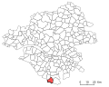 Location Touvois.svg 400 × 320; 12 KB
-
 Location Trans-sur-Erdre.svg 400 × 320; 12 KB
-
 Location Treffieux.svg 400 × 320; 12 KB
-
 Location Treillières.svg 400 × 320; 12 KB
-
 Location Trignac.svg 400 × 320; 12 KB
-
 Location Vallet.svg 400 × 320; 12 KB
-
 Location Varades.svg 400 × 320; 12 KB
-
 Location Vay.svg 400 × 320; 12 KB
-
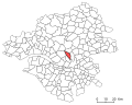
 Location Vertou.svg 400 × 320; 12 KB
-
 Location Vieillevigne.svg 400 × 320; 12 KB
-
 Location Vigneux-de-Bretagne.svg 400 × 320; 12 KB
-
 Location Villepot.svg 400 × 320; 12 KB
-
 Location Vritz.svg 400 × 320; 12 KB
-
 Location Vue.svg 400 × 320; 12 KB
-
 Remouillé Canton Communauté de communes locator map.svg 426 × 316; 45 KB
-
 Situation B.png 98 × 114; 4 KB
-
 Situation de Saint Philbert de Grand Lieu.jpg 600 × 536; 214 KB


