Category:Locator maps of communities in Denbighshire
Media in category "Locator maps of communities in Denbighshire"
The following 39 files are in this category, out of 39 total.
-
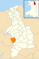
 Wales Denbighshire Community Aberwheeler map.svg 512 × 773; 560 KB
-
 Wales Denbighshire Community Betws Gwerfil Goch map.svg 512 × 773; 560 KB
-
 Wales Denbighshire Community Bodelwyddan map.svg 512 × 773; 560 KB
-
 Wales Denbighshire Community Bodfari map.svg 512 × 773; 560 KB
-
 Wales Denbighshire Community Bryneglwys map.svg 512 × 773; 560 KB
-
 Wales Denbighshire Community Cefnmeiriadog map.svg 512 × 773; 560 KB
-
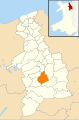
 Wales Denbighshire Community Clocaenog map.svg 512 × 773; 560 KB
-
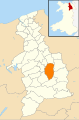
 Wales Denbighshire Community Corwen map.svg 512 × 773; 560 KB
-
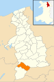
 Wales Denbighshire Community Cwm map.svg 512 × 773; 560 KB
-
 Wales Denbighshire Community Cyffylliog map.svg 512 × 773; 560 KB
-
 Wales Denbighshire Community Cynwyd map.svg 512 × 773; 560 KB
-
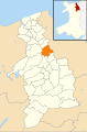
 Wales Denbighshire Community Denbigh map.svg 512 × 773; 560 KB
-
 Wales Denbighshire Community Derwen map.svg 512 × 773; 560 KB
-
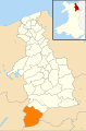
 Wales Denbighshire Community Dyserth map.svg 512 × 773; 560 KB
-
 Wales Denbighshire Community Efenechtyd map.svg 512 × 773; 560 KB
-
 Wales Denbighshire Community Gwyddelwern map.svg 512 × 773; 560 KB
-
 Wales Denbighshire Community Henllan map.svg 512 × 773; 560 KB
-
 Wales Denbighshire Community Llanarmon-yn-Ial map.svg 512 × 773; 560 KB
-
 Wales Denbighshire Community Llanbedr Dyffryn Clwyd map.svg 512 × 773; 560 KB
-
 Wales Denbighshire Community Llandegla map.svg 512 × 773; 560 KB
-
 Wales Denbighshire Community Llandrillo map.svg 512 × 773; 560 KB
-
 Wales Denbighshire Community Llandyrnog map.svg 512 × 773; 560 KB
-
 Wales Denbighshire Community Llanelidan map.svg 512 × 773; 560 KB
-
 Wales Denbighshire Community Llanfair Dyffryn Clwyd map.svg 512 × 773; 560 KB
-
 Wales Denbighshire Community Llanferres map.svg 512 × 773; 560 KB
-
 Wales Denbighshire Community Llangollen map.svg 512 × 773; 560 KB
-
 Wales Denbighshire Community Llangynhafal map.svg 512 × 773; 560 KB
-
 Wales Denbighshire Community Llanrhaeadr-Yng-Nghinmeirch map.svg 512 × 773; 560 KB
-
 Wales Denbighshire Community Llantysilio map.svg 512 × 773; 560 KB
-
 Wales Denbighshire Community Llanynys map.svg 512 × 773; 560 KB
-
 Wales Denbighshire Community Nantglyn map.svg 512 × 773; 560 KB
-
 Wales Denbighshire Community Prestatyn map.svg 512 × 773; 560 KB
-
 Wales Denbighshire Community Rhuddlan map.svg 512 × 773; 560 KB
-
 Wales Denbighshire Community Rhyl map.svg 512 × 773; 560 KB
-
 Wales Denbighshire Community Ruthin map.svg 512 × 773; 560 KB
-
 Wales Denbighshire Community St Asaph map.svg 512 × 773; 560 KB
-
 Wales Denbighshire Community Trefnant map.svg 512 × 773; 560 KB
-
 Wales Denbighshire Community Tremeirchion map.svg 512 × 773; 560 KB
-
 Wales Denbighshire Community Waen map.svg 512 × 773; 560 KB


