Category:Locator maps of counties of Maine
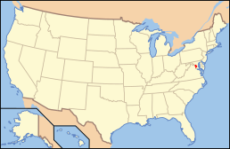
States of the United States: Alabama · Alaska · Arizona · Arkansas · California · Colorado · Connecticut · Delaware · Florida · Georgia · Hawaii · Idaho · Illinois · Indiana · Iowa · Kansas · Kentucky · Louisiana · Maine · Maryland · Massachusetts · Michigan · Minnesota · Mississippi · Missouri · Montana · Nebraska · Nevada · New Hampshire · New Jersey · New Mexico · New York · North Carolina · North Dakota · Ohio · Oklahoma · Oregon · Pennsylvania · Rhode Island · South Carolina · South Dakota · Tennessee · Texas · Utah · Vermont · Virginia · Washington · West Virginia · Wisconsin · Wyoming
| NO WIKIDATA ID FOUND! Search for Locator maps of counties of Maine on Wikidata | |
| Upload media |
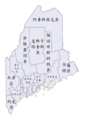
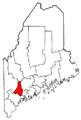
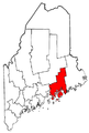
English: Locator maps for counties in Maine.
Media in category "Locator maps of counties of Maine"
The following 42 files are in this category, out of 42 total.
-
 Maine administrative map-zh.jpg 528 × 541; 147 KB
-
 Maine Counties 1.png 604 × 865; 33 KB
-
 Maine Counties 2.png 604 × 865; 32 KB
-
 Maine Counties 3.PNG 604 × 865; 32 KB
-
 Maine Counties 4.png 604 × 865; 33 KB
-
 Maine Locator Map.PNG 220 × 325; 6 KB
-
 Maine-counties-map-hans.png 1,304 × 1,728; 403 KB
-
 Maine-counties-map-hant.png 1,304 × 1,728; 416 KB
-
 Maine-counties-map-tw.png 1,304 × 1,728; 410 KB
-
 Maine-counties-map.gif 604 × 865; 26 KB
-
 Map of Maine highlighting Androscoggin County.png 202 × 300; 10 KB
-
 Map of Maine highlighting Androscoggin County.svg 3,252 × 4,876; 131 KB
-
 Map of Maine highlighting Aroostook County.png 202 × 300; 10 KB
-
 Map of Maine highlighting Aroostook County.svg 3,252 × 4,876; 131 KB
-
 Map of Maine highlighting Cumberland County.png 202 × 300; 10 KB
-
 Map of Maine highlighting Cumberland County.svg 3,252 × 4,876; 131 KB
-
 Map of Maine highlighting Franklin County.png 202 × 300; 10 KB
-
 Map of Maine highlighting Franklin County.svg 3,252 × 4,876; 131 KB
-
 Map of Maine highlighting Hancock County.png 202 × 300; 10 KB
-
 Map of Maine highlighting Hancock County.svg 3,252 × 4,876; 131 KB
-
 Map of Maine highlighting Kennebec County.png 202 × 300; 10 KB
-
 Map of Maine highlighting Kennebec County.svg 3,252 × 4,876; 131 KB
-
 Map of Maine highlighting Knox County.png 202 × 300; 10 KB
-
 Map of Maine highlighting Knox County.svg 3,252 × 4,876; 131 KB
-
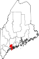
 Map of Maine highlighting Lincoln County.png 402 × 600; 19 KB
-
 Map of Maine highlighting Lincoln County.svg 3,252 × 4,876; 131 KB
-
 Map of Maine highlighting Oxford County.png 202 × 300; 10 KB
-
 Map of Maine highlighting Oxford County.svg 3,252 × 4,876; 131 KB
-
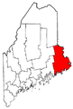
 Map of Maine highlighting Penobscot County.png 202 × 300; 10 KB
-
 Map of Maine highlighting Penobscot County.svg 3,252 × 4,876; 131 KB
-
 Map of Maine highlighting Piscataquis County.png 202 × 300; 10 KB
-
 Map of Maine highlighting Piscataquis County.svg 3,252 × 4,876; 131 KB
-
 Map of Maine highlighting Sagadahoc County.png 202 × 300; 10 KB
-
 Map of Maine highlighting Sagadahoc County.svg 3,252 × 4,876; 131 KB
-
 Map of Maine highlighting Somerset County.png 202 × 300; 10 KB
-
 Map of Maine highlighting Somerset County.svg 3,252 × 4,876; 131 KB
-
 Map of Maine highlighting Waldo County.png 202 × 300; 10 KB
-
 Map of Maine highlighting Waldo County.svg 3,252 × 4,876; 131 KB
-
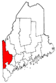
 Map of Maine highlighting Washington County.png 202 × 300; 10 KB
-
 Map of Maine highlighting Washington County.svg 3,252 × 4,876; 131 KB
-
 Map of Maine highlighting York County.png 202 × 300; 10 KB
-
 Map of Maine highlighting York County.svg 3,252 × 4,876; 131 KB


