Category:Locator maps of municipalities in Landkreis Schweinfurt
Media in category "Locator maps of municipalities in Landkreis Schweinfurt"
The following 39 files are in this category, out of 39 total.
-
 Bergrheinfeld in SW.svg 569 × 630; 1.2 MB
-
 Bürgerwald in SW.svg 569 × 630; 1.2 MB
-
 Dingolshausen in SW.svg 569 × 630; 1.2 MB
-
 Dittelbrunn in SW.svg 569 × 630; 1.2 MB
-
 Donnersdorf in SW.svg 569 × 630; 1.2 MB
-
 Euerbach in SW.svg 569 × 630; 1.2 MB
-
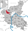
 Frankenwinheim in SW.svg 569 × 630; 1.2 MB
-
 Geiersberg (Gemeindefreies Gebiet) in SW.svg 569 × 630; 1.2 MB
-
 Geldersheim in SW.svg 569 × 630; 1.2 MB
-
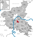
 Gerolzhofen in SW.svg 569 × 630; 1.2 MB
-
 Gochsheim in SW.svg 569 × 630; 1.2 MB
-
 Grafenrheinfeld in SW.svg 569 × 630; 1.2 MB
-
 Grettstadt in SW.svg 569 × 630; 1.2 MB
-
 Hundelshausen (Bayern) in SW.svg 569 × 630; 1.2 MB
-
 Kolitzheim in SW.svg 569 × 630; 1.2 MB
-
 Lülsfeld in SW.svg 569 × 630; 1.2 MB
-
 Michelau im Steigerwald in SW.svg 569 × 630; 1.2 MB
-
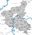 Municipalities in SW.svg 569 × 630; 1.2 MB
-
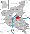
 Niederwerrn in SW.svg 569 × 630; 1.2 MB
-
 Nonnenkloster (Unterfranken) in SW.svg 569 × 630; 1.2 MB
-
 Oberschwarzach in SW.svg 569 × 630; 1.2 MB
-
 Poppenhausen in SW.svg 569 × 630; 1.2 MB
-
 Röthlein in SW.svg 569 × 630; 1.2 MB
-
 Schonungen in SW.svg 569 × 630; 1.2 MB
-
 Schwanfeld in SW.svg 569 × 630; 1.2 MB
-
 Schwebheim in SW.svg 569 × 630; 1.2 MB
-
 Sennfeld in SW.svg 569 × 630; 1.2 MB
-
 Stadtlauringen in SW.svg 569 × 630; 1.2 MB
-
 Stollbergerforst in SW.svg 569 × 630; 1.2 MB
-
 Sulzheim in SW.svg 569 × 630; 1.2 MB
-
 Verwaltungsgemeinschaft Gerolzhofen in SW.svg 569 × 630; 1.2 MB
-
 Verwaltungsgemeinschaft Schwanfeld in SW.svg 569 × 630; 1.2 MB
-
 Vollburg in SW.svg 569 × 630; 1.2 MB
-
 Waigolshausen in SW.svg 569 × 630; 1.2 MB
-
 Wasserlosen in SW.svg 569 × 630; 1.2 MB
-
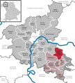
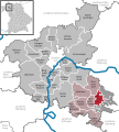
 Werneck in SW.svg 569 × 630; 1.2 MB
-
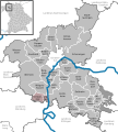
 Wipfeld in SW.svg 569 × 630; 1.2 MB
-
 Wustvieler Forst in SW.svg 569 × 630; 1.2 MB
-
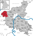
 Üchtelhausen in SW.svg 569 × 630; 1.2 MB


_in_SW.svg)


_in_SW.svg)


_in_SW.svg)


