Category:Locator maps of municipalities of Veracruz
Media in category "Locator maps of municipalities of Veracruz"
The following 132 files are in this category, out of 132 total.
-
 Acajete.svg 1,728 × 1,879; 1.31 MB
-
 Acatlán en Veracruz.svg 1,184 × 1,062; 1.61 MB
-
 Acatlán.svg 1,728 × 1,879; 1.31 MB
-
 Agua Dulce en Veracruz.svg 1,184 × 1,062; 2.01 MB
-
 Agua Dulce.svg 1,728 × 1,879; 1.32 MB
-
 Alto Lucero en Veracruz.svg 1,184 × 1,062; 2.01 MB
-
 Amatitlán.svg 1,766 × 1,925; 1.31 MB
-
 Amatlán de los Reyes.svg 1,766 × 1,925; 1.31 MB
-
 Angel R. Cabada en Veracruz.svg 1,184 × 1,062; 2.01 MB
-
 Antigua La.svg 1,766 × 1,925; 1.31 MB
-
 Ayahualulco.svg 1,766 × 1,925; 1.31 MB
-
 Banderilla en Veracruz.svg 1,184 × 1,062; 2.01 MB
-
 Banderilla.svg 1,766 × 1,925; 1.31 MB
-
 Benito Juarez en Veracruz.svg 1,184 × 1,062; 2.01 MB
-
 Calcahualco.svg 1,766 × 1,925; 1.31 MB
-
 Camarón de Tejeda.svg 1,766 × 1,925; 1.31 MB
-
 Carrillo Puerto en Veracruz.svg 1,184 × 1,062; 2.01 MB
-
 Carrillo Puerto.svg 1,766 × 1,925; 1.31 MB
-
 Castillo de Teayo en Veracruz.svg 1,184 × 1,062; 2.01 MB
-
 Chacaltianguis.svg 1,766 × 1,925; 1.31 MB
-
 Chiconamel.svg 1,766 × 1,925; 1.31 MB
-
 Choapas Las.svg 1,766 × 1,925; 1.32 MB
-
 Citlaltepetl en Veracruz.svg 1,184 × 1,062; 2.01 MB
-
 Citlaltépetl.svg 1,766 × 1,925; 1.31 MB
-
 Coatzacoalcos.svg 1,766 × 1,925; 1.34 MB
-
 Coetzala.svg 1,766 × 1,925; 1.31 MB
-
 Colindancias de Jamapa Veracruz.jpg 668 × 614; 126 KB
-
 Coscomatepec en Veracruz.svg 1,184 × 1,062; 2.01 MB
-
 Cosoleacaque.svg 1,766 × 1,925; 1.31 MB
-
 Cotaxtla en Veracruz.svg 1,184 × 1,062; 2.01 MB
-
 Cotaxtla.svg 1,766 × 1,925; 1.31 MB
-
 Coxquihui.svg 1,766 × 1,925; 1.31 MB
-
 Cuichapa.svg 1,766 × 1,925; 1.31 MB
-
 Gutiérrez Zamora.svg 1,766 × 1,925; 1.31 MB
-
 Higo El.svg 1,766 × 1,925; 1.31 MB
-
 Huiloapan de Cuauhtémoc.svg 1,766 × 1,925; 1.31 MB
-
 Ilamatlán.svg 1,766 × 1,925; 1.31 MB
-
 Ixhuacán de los Reyes.svg 1,766 × 1,925; 1.31 MB
-
 Ixhuatlancillo.svg 1,766 × 1,925; 1.31 MB
-
 Ixhuatlán del Café.svg 1,766 × 1,925; 1.31 MB
-
 Ixhuatlán del Sureste.svg 1,766 × 1,925; 1.31 MB
-
 Limites Tantoyuca.png 576 × 589; 308 KB
-
 Localizacion Tres Valles.jpg 1,376 × 1,434; 250 KB
-
 Localización Tres Valles.svg 222 × 228; 1.4 MB
-
 Límites de Rafael Lucio.jpg 732 × 640; 98 KB
-
 Manlio Fabio Altamirano en Veracruz.svg 1,184 × 1,062; 2.01 MB
-
 Mapa de Cosamaloapan.jpg 450 × 450; 16 KB
-
 Mapacoatza.png 423 × 346; 34 KB
-
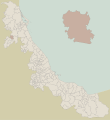
 Mexico Veracruz Acajete location map.svg 2,404 × 2,504; 2.47 MB
-
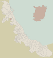
 Mexico Veracruz Acatlan location map.svg 2,404 × 2,504; 2.42 MB
-
 Mexico Veracruz Actopan location map.svg 2,404 × 2,504; 2.42 MB
-
 Mexico Veracruz Agua Dulce location map.svg 2,404 × 2,504; 2.46 MB
-
 Mexico Veracruz Amatlan location map.svg 2,404 × 2,504; 2.46 MB
-
 Mexico Veracruz Angel R. Cabada location map.svg 2,404 × 2,504; 2.46 MB
-
 Mexico Veracruz Atoyac location map.svg 2,404 × 2,504; 2.42 MB
-
 Mexico Veracruz Benito Juarez location map.svg 2,404 × 2,504; 2.42 MB
-
 Mexico Veracruz Camaron de Tejada location map.svg 2,404 × 2,504; 2.42 MB
-
 Mexico Veracruz Camerino Z. Mendoza location map.svg 2,404 × 2,504; 2.46 MB
-
 Mexico Veracruz Castillo de Teayo location map.svg 2,404 × 2,504; 2.42 MB
-
 Mexico Veracruz Chalma location map.svg 2,404 × 2,504; 2.42 MB
-
 Mexico Veracruz Coatzacoalcos location map.svg 2,404 × 2,504; 2.42 MB
-
 Mexico Veracruz Cosoleacaque location map.svg 2,404 × 2,504; 2.42 MB
-
 Mexico Veracruz Cotaxtla location map.svg 2,404 × 2,504; 2.46 MB
-
 Mexico Veracruz Coxquihui location map.svg 2,404 × 2,504; 2.42 MB
-
 Mexico Veracruz Cuitlahuac location map.svg 2,404 × 2,504; 2.42 MB
-
 Mexico Veracruz El Higo location map.svg 2,404 × 2,504; 2.42 MB
-
 Mexico Veracruz Emiliano Zapata location map.svg 2,404 × 2,504; 2.42 MB
-
 Mexico Veracruz Ixhuatlan del Cafe location map.svg 2,404 × 2,504; 2.42 MB
-
 Mexico Veracruz Ixhuatlan del Sureste location map.svg 2,404 × 2,504; 2.42 MB
-
 Mexico Veracruz Ixtaczoquitlan location map.svg 2,404 × 2,504; 2.42 MB
-
 Mexico Veracruz Jesus Carranza location map.svg 2,404 × 2,504; 2.46 MB
-
 Mexico Veracruz Juan Rodriguez Clara location map.svg 2,404 × 2,504; 2.42 MB
-
 Mexico Veracruz La Perla location map.svg 2,404 × 2,504; 2.42 MB
-
 Mexico Veracruz Las Vigas location map.svg 2,404 × 2,504; 2.42 MB
-
 Mexico Veracruz Los Reyes location map.svg 2,404 × 2,504; 2.42 MB
-
 Mexico Veracruz Martinez de la Torre location map.svg 2,404 × 2,504; 2.46 MB
-
 Mexico Veracruz Mixtla de Altamirano location map.svg 2,404 × 2,504; 2.42 MB
-
 Mexico Veracruz Nanchital location map.svg 2,404 × 2,504; 2.42 MB
-
 Mexico Veracruz Naolinco location map.svg 2,404 × 2,504; 2.42 MB
-
 Mexico Veracruz Naranjos Amatlan location map.svg 2,404 × 2,504; 2.46 MB
-
 Mexico Veracruz Oluta location map.svg 2,404 × 2,504; 2.42 MB
-
 Mexico Veracruz Panuco location map.svg 2,404 × 2,504; 2.46 MB
-
 Mexico Veracruz Papantla location map.svg 2,404 × 2,504; 2.42 MB
-
 Mexico Veracruz Perote location map.svg 2,404 × 2,504; 2.46 MB
-
 Mexico Veracruz Platon Sanchez location map.svg 2,404 × 2,504; 2.46 MB
-
 Mexico Veracruz Playa Vicente location map.svg 2,404 × 2,504; 2.42 MB
-
 Mexico Veracruz Pueblo Viejo location map.svg 2,404 × 2,504; 2.46 MB
-
 Mexico Veracruz Rafael Lucio location map.svg 2,404 × 2,504; 2.47 MB
-
 Mexico Veracruz Santiago Sochiapan location map.svg 2,404 × 2,504; 2.42 MB
-
 Mexico Veracruz Tamiahua location map.svg 2,404 × 2,504; 2.42 MB
-
 Mexico Veracruz Tampico Alto location map.svg 2,404 × 2,504; 2.46 MB
-
 Mexico Veracruz Tantoyuca location map.svg 2,404 × 2,504; 2.42 MB
-
 Mexico Veracruz Tempoal location map.svg 2,404 × 2,504; 2.42 MB
-
 Mexico Veracruz Tezonapa location map.svg 2,404 × 2,504; 2.42 MB
-
 Mexico Veracruz Tierra Blanca location map.svg 2,404 × 2,504; 2.47 MB
-
 Mexico Veracruz Tlacotalpan location map.svg 2,404 × 2,504; 2.42 MB
-
 Mexico Veracruz Tlapacoyan location map.svg 2,404 × 2,504; 2.42 MB
-
 Mexico Veracruz Totutla location map.svg 2,404 × 2,504; 2.47 MB
-
 Mexico Veracruz Tuxpan location map.svg 2,404 × 2,504; 2.47 MB
-
 Mexico Veracruz Ursulo Galvan location map.svg 2,404 × 2,504; 2.47 MB
-
 Mexico Veracruz Vega de Alatorre location map.svg 2,404 × 2,504; 2.47 MB
-
 Mexico Veracruz Villa Aldama location map.svg 2,404 × 2,504; 2.46 MB
-
 Mexico Veracruz Xalapa location map.svg 2,404 × 2,504; 2.42 MB
-
 Mexico Veracruz Xico location map.svg 2,404 × 2,504; 2.42 MB
-
 Mexico Veracruz Xoxocotla location map.svg 2,404 × 2,504; 2.42 MB
-
 Mexico Veracruz Yanga location map.svg 2,404 × 2,504; 2.47 MB
-
 Mexico Veracruz Zontecomatlan location map.svg 2,404 × 2,504; 2.46 MB
-
 Mexico Veracruz Zozocolco de Hidalgo location map.svg 2,404 × 2,504; 2.42 MB
-
 Mp Actopan.svg 1,728 × 1,879; 1.32 MB
-
 Mp Alvarado.svg 1,766 × 1,925; 1.38 MB
-
 Mp Aquila.svg 1,766 × 1,925; 1.31 MB
-
 Mp Benito Juárez.svg 1,766 × 1,925; 1.31 MB
-
 Mp Castillo de Teayo.svg 1,766 × 1,925; 1.31 MB
-
 Mp Cazones de Herrera.svg 1,766 × 1,925; 1.31 MB
-
 Mp Chalma.svg 1,766 × 1,925; 1.31 MB
-
 Mp Coatepec.svg 1,766 × 1,925; 1.31 MB
-
 Mp Coscomatepec.svg 1,766 × 1,925; 1.31 MB
-
 Mp Mecatlán.svg 1,766 × 1,925; 1.31 MB
-
 Mp Tlaltetela.svg 512 × 558; 985 KB
-
 Municipios de Veracruz.svg 2,404 × 2,504; 2.46 MB
-
 Panuco en Veracruz.svg 1,184 × 1,062; 2.01 MB
-
 Santiago Sochiapan en Veracruz.svg 1,184 × 1,062; 2.01 MB
-
 Tampico Alto en Veracruz.svg 1,184 × 1,062; 2.01 MB
-
 Tantoyuca.gif 375 × 326; 19 KB
-
 Ver-Playa-Vicente.png 246 × 271; 18 KB
-
 Ver-reg1-panuco.PNG 326 × 342; 26 KB
-
 Ver-reg1-puebloviejo.PNG 326 × 342; 25 KB
-
 Ver-reg1-tampicoalto.PNG 326 × 342; 25 KB
-
 Ver-reg1-tempoal.PNG 326 × 342; 25 KB
-
 Xoxocotla en Veracruz.svg 1,184 × 1,062; 2.01 MB
-
 Zozocolco Localización.svg 222 × 228; 1.38 MB
-
 Ángel R. Cabada.svg 1,766 × 1,925; 1.33 MB


