Category:Locator maps of the Kerguelen Islands
Media in category "Locator maps of the Kerguelen Islands"
The following 30 files are in this category, out of 30 total.
-
 Altazin-pos.png 632 × 600; 148 KB
-
 Boynes-pos.png 632 × 600; 148 KB
-
 Courbet-pos.png 2,110 × 2,002; 340 KB
-
 Gaby-pos.png 632 × 600; 148 KB
-
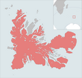 Grande Terre-pos.png 2,110 × 2,002; 362 KB
-
 Ile de l Ouest-pos.PNG 2,110 × 2,002; 340 KB
-
 Ile du Port-pos.png 2,110 × 2,002; 340 KB
-
 Ile Longue-pos.png 2,110 × 2,002; 340 KB
-
 Ile Saint-Lanne Gramont-pos.png 2,110 × 2,002; 340 KB
-
 IleAustralia-pos.png 632 × 600; 123 KB
-
 IleFoch-pos.png 2,110 × 2,002; 343 KB
-
 IleHowe-pos.png 2,110 × 2,002; 340 KB
-
 IlePrinceMonaco-pos.png 2,110 × 2,002; 343 KB
-
 Kerguelen BaieNorvegienne.PNG 2,110 × 2,002; 341 KB
-
 Kerguelen GolfeBaleiniers.PNG 2,110 × 2,002; 332 KB
-
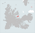
 Kerguelen GolfeMorbihan.PNG 2,110 × 2,002; 342 KB
-
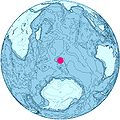
 Kerguelen Plateau Location.jpg 548 × 545; 123 KB
-
 Kerguelen-Location.JPG 872 × 872; 119 KB
-
 Kerguelen-pos mk.png 5,613 × 5,783; 1.15 MB
-
 Kerguelen-pos.jpg 1,485 × 1,530; 170 KB
-
 Kerguelen-pos.png 1,485 × 1,530; 121 KB
-
 Kerguelen-position.png 782 × 385; 21 KB
-
 MontRoss-pos.png 649 × 589; 60 KB
-
 Nuageuses-Kerguelen.png 2,110 × 2,002; 341 KB
-
 Orthographic projection centred over Kerguelen Island.png 488 × 487; 21 KB
-
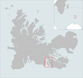
 Port-aux-Francais-pos.png 649 × 589; 60 KB
-
 Presqu'île ronarc'h-pos.png 632 × 600; 147 KB
-
 PrqSocdeGeo-pos.png 2,110 × 2,002; 344 KB
-
 Île de Croÿ locator map.svg 1,840 × 1,915; 519 KB
-
 Île-haute-kerguelen.png 2,110 × 2,002; 155 KB


