Category:Loch Ken

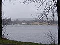
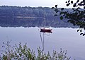
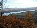
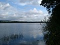
Loch Ken is 9-mile long freshwater loch in Dumfries and Galloway, Scotland.
It lies in the Glenkens, where it is fed from the north by the Water of Ken and from the west by the Dee.
It continues as the Dee south from Glenlochar, where the water is held back by the Glenlochar Barrage. Part of the Galloway hydro-electric power scheme, the barrage regulates the river's flow.
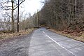
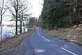
Villages around Loch Ken include Glenlochar at the south, Laurieston and Mossdale on the west side of the loch, and Crossmichael and Parton on the east.
The village of New Galloway lies one mile to its north.
The parish church of Balmaghie is also by the loch.
Loch Ken and River Dee Marshes was designated a Ramsar site on August 21, 1992.
lake in Dumfries and Galloway, Scotland, UK, outflows to the River Dee  | |||||
| Upload media | |||||
| Instance of | |||||
|---|---|---|---|---|---|
| Location | Dumfries and Galloway, Scotland | ||||
| Inflows |
| ||||
| Outflows |
| ||||
| Basin country | |||||
 | |||||
Media in category "Loch Ken"
The following 72 files are in this category, out of 72 total.
-
 A calm day at Loch Ken - geograph.org.uk - 6016823.jpg 1,024 × 683; 365 KB
-
 Anglers at Loch Ken (geograph 6016801).jpg 1,024 × 683; 437 KB
-
 Benshinnie - Southwest Slopes - geograph.org.uk - 723001.jpg 640 × 480; 116 KB
-
 Cadger's Loop, Loch Ken - geograph.org.uk - 71275.jpg 640 × 480; 104 KB
-
 Farmland, cottage gardens and Loch Ken - geograph.org.uk - 444896.jpg 640 × 480; 145 KB
-
 Field next to Loch Ken, Crossmichael - geograph.org.uk - 650161.jpg 640 × 428; 81 KB
-
 Frost flowers by the shore of Loch Ken - geograph.org.uk - 6016807.jpg 694 × 1,024; 508 KB
-
 Galloway Sailing Centre - geograph.org.uk - 690441.jpg 640 × 480; 97 KB
-
-
 Gateside - geograph.org.uk - 690620.jpg 640 × 480; 62 KB
-
 Glenlaggan - Loch Ken - geograph.org.uk - 670852.jpg 640 × 480; 89 KB
-
 Glenlaggan Lodges - geograph.org.uk - 755223.jpg 640 × 480; 72 KB
-
 Glenlochar Barrage - geograph.org.uk - 57936.jpg 640 × 480; 97 KB
-

-
 Kenmure Castle and Kenmure Holms, Kells, Kirkcudbrightshire.jpg 2,592 × 1,944; 2.11 MB
-
 Lay-by at Loch Ken - geograph.org.uk - 5728253.jpg 2,910 × 1,872; 1.69 MB
-
 Lay-by at Loch Ken - geograph.org.uk - 5728254.jpg 2,976 × 1,984; 4.6 MB
-
 Lay-by at Loch Ken - geograph.org.uk - 5728255.jpg 2,925 × 1,906; 1.46 MB
-
 Local Area Information Board - geograph.org.uk - 5728252.jpg 2,976 × 1,984; 2.51 MB
-
 Loch Ken (30862664508).jpg 7,360 × 4,912; 18.43 MB
-
 Loch Ken (46570030981).jpg 4,899 × 7,349; 22.44 MB
-
 Loch Ken (47225761742).jpg 7,360 × 4,912; 38.15 MB
-
 Loch Ken (47739932471).jpg 7,346 × 4,607; 12.67 MB
-
 Loch Ken - geograph.org.uk - 1464894.jpg 640 × 455; 62 KB
-
 Loch Ken - geograph.org.uk - 321506.jpg 640 × 476; 188 KB
-
 Loch Ken - geograph.org.uk - 418060.jpg 640 × 480; 125 KB
-
 Loch Ken - geograph.org.uk - 447365.jpg 640 × 427; 74 KB
-
 Loch Ken - geograph.org.uk - 462680.jpg 640 × 480; 87 KB
-
 Loch Ken - geograph.org.uk - 5728247.jpg 2,909 × 1,887; 1,016 KB
-
 Loch Ken - geograph.org.uk - 5728248.jpg 2,976 × 1,984; 3.33 MB
-
 Loch Ken - geograph.org.uk - 5728249.jpg 2,976 × 1,984; 3.66 MB
-
 Loch Ken - geograph.org.uk - 5728256.jpg 2,913 × 1,902; 1,005 KB
-
 Loch Ken - geograph.org.uk - 5728258.jpg 2,976 × 1,984; 2.62 MB
-
 Loch Ken - geograph.org.uk - 5728259.jpg 2,907 × 1,870; 772 KB
-
 Loch Ken - geograph.org.uk - 5728260.jpg 2,976 × 1,984; 3.51 MB
-
 Loch Ken - geograph.org.uk - 5728261.jpg 2,976 × 1,984; 3.5 MB
-
 Loch Ken - geograph.org.uk - 5728262.jpg 2,907 × 1,896; 879 KB
-
 Loch Ken - geograph.org.uk - 5728263.jpg 2,912 × 1,917; 1.22 MB
-
 Loch Ken - geograph.org.uk - 5728270.jpg 2,976 × 1,984; 2.85 MB
-
 Loch Ken - geograph.org.uk - 5728273.jpg 2,976 × 1,984; 3.01 MB
-
 Loch Ken - geograph.org.uk - 5728275.jpg 2,976 × 1,984; 2.84 MB
-
 Loch Ken - geograph.org.uk - 5908582.jpg 3,680 × 2,456; 6.1 MB
-
 Loch Ken - geograph.org.uk - 5985057.jpg 2,592 × 1,944; 1.3 MB
-
 Loch Ken - geograph.org.uk - 5985064.jpg 2,592 × 1,944; 904 KB
-
 Loch Ken - geograph.org.uk - 6015041.jpg 2,450 × 3,675; 7.37 MB
-
 Loch Ken - geograph.org.uk - 6016820.jpg 1,024 × 683; 332 KB
-
 Loch Ken - geograph.org.uk - 6078896.jpg 2,797 × 1,867; 7.53 MB
-
 Loch Ken - geograph.org.uk - 6137311.jpg 5,142 × 3,225; 7.36 MB
-
 Loch Ken - River Dee - geograph.org.uk - 5728250.jpg 1,864 × 2,859; 787 KB
-
 Loch Ken 2003.JPG 1,600 × 1,200; 685 KB
-
 Loch Ken Marshes - geograph.org.uk - 963895.jpg 640 × 480; 119 KB
-

-
 Loch Ken, looking north - geograph.org.uk - 1618838.jpg 640 × 472; 86 KB
-
 Loch Ken, looking south - geograph.org.uk - 1618835.jpg 640 × 473; 93 KB
-
 Loch Ken, looking southwards - geograph.org.uk - 71265.jpg 640 × 480; 78 KB
-
 Loch Ken.jpg 640 × 480; 63 KB
-
 Lochside Point. - geograph.org.uk - 519585.jpg 480 × 640; 85 KB
-
 Looking Towards Parton - geograph.org.uk - 321936.jpg 640 × 431; 91 KB
-
 Lowran Bridge - geograph.org.uk - 5728246.jpg 2,976 × 1,984; 4.5 MB
-
 Moss Covered Dry Stane Dyke - geograph.org.uk - 5728240.jpg 2,976 × 1,984; 4.45 MB
-
 Reflections on Loch Ken.jpg 3,626 × 1,936; 6.3 MB
-
 Road to Mossdale - geograph.org.uk - 5728245.jpg 2,976 × 1,984; 4.98 MB
-
 Road to Mossdale - geograph.org.uk - 5728269.jpg 2,976 × 1,984; 4.53 MB
-
 Road to New Galloway - geograph.org.uk - 5728234.jpg 2,976 × 1,984; 4.88 MB
-
 Road to New Galloway - geograph.org.uk - 5728243.jpg 2,976 × 1,984; 5.27 MB
-
 The Loch Ken Pike caught by gamekeeper John Murray in 1774.jpg 258 × 193; 41 KB
-
 The Road to Mossdale - geograph.org.uk - 5728264.jpg 2,976 × 1,984; 1.67 MB
-
 The Tail End of Loch Ken - geograph.org.uk - 650157.jpg 640 × 428; 125 KB
-
 Towards the Loch Ken Viaduct - geograph.org.uk - 321928.jpg 640 × 480; 109 KB
-
 Winter Scene - geograph.org.uk - 321943.jpg 640 × 448; 110 KB
-
 Loch Ken Panorama - geograph.org.uk - 546493.jpg 640 × 131; 46 KB
-


.jpg)


.jpg)
.jpg)
.jpg)
.jpg)


