Category:Lochrutton
Wikimedia list article | |||||
| Upload media | |||||
| Instance of | |||||
|---|---|---|---|---|---|
| Location |
| ||||
| |||||
Lochrutton is a Civil Parish in Kirkcudbrightshire.
For placenames in Lochrutton see: http://www.kirkcudbright.co/places.asp?ID=18
Subcategories
This category has the following 3 subcategories, out of 3 total.
H
- Hills Tower (6 F)
L
- Lochfoot (3 F)
- Lochrutton Loch (10 F)
Media in category "Lochrutton"
The following 74 files are in this category, out of 74 total.
-
 A lay-by near Henderland Farm - geograph.org.uk - 1017411.jpg 640 × 480; 96 KB
-
 A mound of winter cattle fodder - geograph.org.uk - 1073777.jpg 640 × 480; 149 KB
-
 A75 eastbound - geograph.org.uk - 462457.jpg 640 × 480; 70 KB
-
 A75 near Lochfoot - geograph.org.uk - 1325342.jpg 640 × 480; 89 KB
-
 Abune the Brae - geograph.org.uk - 530936.jpg 428 × 640; 108 KB
-
 After the rain - geograph.org.uk - 535370.jpg 640 × 443; 94 KB
-
 Arnmannoch, Bogrie Lane fields - geograph.org.uk - 687616.jpg 640 × 480; 71 KB
-
 Ash and hazel embraced - geograph.org.uk - 1073814.jpg 640 × 480; 155 KB
-
 Auchenfranco - geograph.org.uk - 687820.jpg 640 × 433; 97 KB
-
 Barlae Hill - geograph.org.uk - 529772.jpg 640 × 397; 120 KB
-
 Barnbackle Farm - geograph.org.uk - 1324789.jpg 640 × 480; 59 KB
-
 Beef cattle under cover - geograph.org.uk - 1073772.jpg 640 × 480; 135 KB
-
 Beyond the Wire - geograph.org.uk - 1082718.jpg 640 × 323; 43 KB
-
 Blue skies - geograph.org.uk - 433316.jpg 640 × 400; 64 KB
-
 Cairn on Bettyknowes Hill - geograph.org.uk - 1073764.jpg 640 × 480; 113 KB
-
 Cargenbank - geograph.org.uk - 913132.jpg 640 × 313; 63 KB
-
 Carswadda farmhouse - geograph.org.uk - 1073861.jpg 640 × 480; 140 KB
-
 Cattle grid on farm track - geograph.org.uk - 1073808.jpg 640 × 480; 137 KB
-
 Cloud at Bourock - geograph.org.uk - 413854.jpg 640 × 428; 72 KB
-
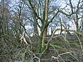
 Derelict trees - geograph.org.uk - 1073873.jpg 640 × 480; 132 KB
-
 Driveway to Barfil - geograph.org.uk - 166994.jpg 640 × 480; 83 KB
-
 Drummore Farm - geograph.org.uk - 383448.jpg 636 × 446; 113 KB
-
 Early Misty Morning at Bourock - geograph.org.uk - 412778.jpg 640 × 426; 73 KB
-
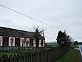 East Brae Cottage Bed and Breakfast - geograph.org.uk - 726039.jpg 640 × 480; 48 KB
-
 Evening sunshine - geograph.org.uk - 462494.jpg 640 × 480; 68 KB
-
 Farm implement in Carswadda farmyard - geograph.org.uk - 1073867.jpg 640 × 480; 132 KB
-

-
 Farm track from Carswadda - geograph.org.uk - 1073830.jpg 640 × 480; 141 KB
-
 Feeding Station - geograph.org.uk - 263624.jpg 640 × 480; 180 KB
-
 Fencing on open grazing land - geograph.org.uk - 1073756.jpg 640 × 480; 143 KB
-
 Field behind Bourock - geograph.org.uk - 535346.jpg 640 × 440; 117 KB
-
 Field near Abune the Brae - geograph.org.uk - 263637.jpg 640 × 480; 217 KB
-
 Flocks of Starlings - geograph.org.uk - 670661.jpg 640 × 428; 50 KB
-
 Foreside farm - geograph.org.uk - 610245.jpg 639 × 479; 59 KB
-
 Frosty Fields - geograph.org.uk - 638718.jpg 640 × 283; 303 KB
-
 Gateway to beef enclosure - geograph.org.uk - 1073788.jpg 640 × 480; 134 KB
-
 Gorse and pasture - geograph.org.uk - 383449.jpg 640 × 416; 96 KB
-
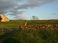
 Grazing near Brae Farm. - geograph.org.uk - 1017430.jpg 640 × 480; 101 KB
-
 Hay Making - geograph.org.uk - 535337.jpg 636 × 447; 182 KB
-
 Hills Cottage - geograph.org.uk - 875146.jpg 640 × 390; 64 KB
-
 Horses at Lochanhead - geograph.org.uk - 610250.jpg 640 × 480; 54 KB
-
 Icy track on Bettyknowes Hill - geograph.org.uk - 1073753.jpg 640 × 480; 139 KB
-
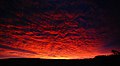 Impressive Sunrise - geograph.org.uk - 670706.jpg 640 × 350; 37 KB
-
 In Memory Of ... - geograph.org.uk - 454263.jpg 416 × 640; 140 KB
-
 Loch Rutton and Dumfries - geograph.org.uk - 1766089.jpg 3,872 × 2,592; 2.86 MB
-
 Lochan Burn - geograph.org.uk - 185166.jpg 640 × 426; 135 KB
-
 Lochfoot - geograph.org.uk - 181894.jpg 633 × 640; 71 KB
-
 Lochfoot from Lochrutton - geograph.org.uk - 181919.jpg 640 × 480; 45 KB
-
 Lochfoot Water Treatment Works - geograph.org.uk - 1324907.jpg 640 × 480; 112 KB
-
 Lochrutton Church - geograph.org.uk - 449002.jpg 640 × 411; 111 KB
-
 Lochrutton Church - geograph.org.uk - 454271.jpg 640 × 428; 116 KB
-
 Looking northeast - geograph.org.uk - 462482.jpg 640 × 535; 44 KB
-
 Meikle Barfil - geograph.org.uk - 687641.jpg 640 × 480; 81 KB
-
 Minor Road at Bourock - geograph.org.uk - 263598.jpg 480 × 640; 644 KB
-
 Minor Road Near Merklandwell - geograph.org.uk - 263622.jpg 640 × 480; 192 KB
-

-
 Old Military Road at Rigfoot - geograph.org.uk - 1324785.jpg 640 × 480; 84 KB
-
 Old Tree - geograph.org.uk - 449030.jpg 640 × 428; 116 KB
-
 Onlookers - geograph.org.uk - 529814.jpg 640 × 468; 117 KB
-
 Ornate Gravestone - geograph.org.uk - 449013.jpg 428 × 640; 141 KB
-
 Pink Footed Geese - geograph.org.uk - 649295.jpg 640 × 429; 58 KB
-
 Road End - geograph.org.uk - 1082676.jpg 640 × 395; 96 KB
-

-
 Slacks Farm - geograph.org.uk - 1324842.jpg 640 × 480; 53 KB
-
 Snow Clouds at Bourock - geograph.org.uk - 648311.jpg 640 × 421; 63 KB
-

-
 Sunset near to Abune the Brae - geograph.org.uk - 413835.jpg 640 × 309; 57 KB
-
 Swan on the banks of the Loch - geograph.org.uk - 689481.jpg 640 × 444; 45 KB
-
 The Paddy Line - geograph.org.uk - 721309.jpg 640 × 404; 56 KB
-
 The Paddy Line 1. - geograph.org.uk - 721332.jpg 640 × 339; 44 KB
-
 The road past Hillcrest - geograph.org.uk - 1774305.jpg 800 × 600; 125 KB
-
 Track Leading to Abune the Brae - geograph.org.uk - 263633.jpg 640 × 480; 170 KB
-
 View north - geograph.org.uk - 462473.jpg 640 × 480; 45 KB
-
 Woodland strip in winter guise - geograph.org.uk - 1073823.jpg 640 × 480; 136 KB


