Category:Lockwood, North Yorkshire
civil parish in North Yorkshire, England, UK  | |||||
| Upload media | |||||
| Instance of | |||||
|---|---|---|---|---|---|
| Location | Redcar and Cleveland, North Yorkshire, North East England, England | ||||
| Different from | |||||
 | |||||
English: Lockwood is a civil parish in the Redcar & Cleveland unitary authority of North Yorkshire, England.
Subcategories
This category has the following 9 subcategories, out of 9 total.
C
- Charltons (12 F)
H
K
- Kilton Thorpe (32 F)
L
- Lockwood Beck Reservoir (5 F)
M
- Margrove Park (12 F)
S
Media in category "Lockwood, North Yorkshire"
The following 200 files are in this category, out of 216 total.
(previous page) (next page)-
 "Dismantled railway" - geograph.org.uk - 6157272.jpg 640 × 427; 75 KB
-
 A Tidy Landscape - geograph.org.uk - 3702579.jpg 4,000 × 3,000; 3.51 MB
-
 A171 approaching Lingdale turning - geograph.org.uk - 2703500.jpg 640 × 480; 36 KB
-
 A171 at Smeathorns (1975) - geograph.org.uk - 3733517.jpg 1,241 × 817; 305 KB
-
 A171 heading east, Smeathorns - geograph.org.uk - 2710957.jpg 640 × 480; 54 KB
-
 A171 towards Whitby - geograph.org.uk - 2703503.jpg 640 × 480; 59 KB
-
 A171 towards Whitby - geograph.org.uk - 2710951.jpg 800 × 489; 58 KB
-
 A171 towards Whitby - geograph.org.uk - 2710964.jpg 640 × 480; 58 KB
-
 Above the old Quarry at Slapewath. - geograph.org.uk - 4438021.jpg 640 × 365; 64 KB
-
 Although roofed none of these buildings are in use - geograph.org.uk - 3843767.jpg 3,501 × 1,565; 1.28 MB
-
 Approaching Stubdale Farm - geograph.org.uk - 5909980.jpg 1,600 × 1,200; 541 KB
-
 At the bus stop, Slapewath - geograph.org.uk - 2648292.jpg 640 × 428; 109 KB
-
 Beacon near Birk Brow Road - geograph.org.uk - 1721038.jpg 2,048 × 1,536; 1,003 KB
-
 Beacon on Birk Brow Road - geograph.org.uk - 2410235.jpg 1,024 × 824; 146 KB
-
 Birk Brow Beacon - geograph.org.uk - 3606276.jpg 640 × 480; 143 KB
-
 Birk Brow Beacon on Low Moor - geograph.org.uk - 6287698.jpg 4,987 × 3,697; 2.81 MB
-
 Birk Brow car park at the top of Birk Brow Bank (A171) - geograph.org.uk - 2637302.jpg 3,648 × 2,736; 2.08 MB
-
 Birk Brow Road - geograph.org.uk - 1723014.jpg 3,084 × 2,056; 2.45 MB
-

-
 Black Howes - geograph.org.uk - 4153627.jpg 1,600 × 1,200; 541 KB
-
 Boundary stone - geograph.org.uk - 6116365.jpg 640 × 427; 101 KB
-
 Boundary stone - geograph.org.uk - 6116366.jpg 640 × 427; 118 KB
-
 Boundary stone - geograph.org.uk - 6116371.jpg 640 × 427; 123 KB
-
 Boundary stone - geograph.org.uk - 6116375.jpg 640 × 427; 96 KB
-
 Boundary Stone - geograph.org.uk - 6116380.jpg 640 × 427; 119 KB
-
 Boundary stone - geograph.org.uk - 6116384.jpg 640 × 427; 116 KB
-
 Boundary stone - geograph.org.uk - 6116386.jpg 640 × 427; 95 KB
-
 Boundary stone - geograph.org.uk - 6116392.jpg 640 × 427; 94 KB
-
 Boundary stone - geograph.org.uk - 6116396.jpg 640 × 427; 100 KB
-
 Boundary Stone - geograph.org.uk - 6116400.jpg 640 × 427; 111 KB
-
 Boundary stone - geograph.org.uk - 6116406.jpg 640 × 427; 117 KB
-
 Boundary stone - geograph.org.uk - 6116408.jpg 640 × 427; 100 KB
-
 Boundary stone - geograph.org.uk - 6117016.jpg 640 × 427; 110 KB
-
 Boundary Stone - geograph.org.uk - 6117024.jpg 640 × 427; 97 KB
-
 Boundary stone - geograph.org.uk - 6117030.jpg 640 × 427; 90 KB
-
 Boundary stone - geograph.org.uk - 6117034.jpg 640 × 427; 108 KB
-
 Boundary stone - geograph.org.uk - 6117042.jpg 640 × 427; 92 KB
-
 Boundary stone - geograph.org.uk - 6117044.jpg 640 × 427; 94 KB
-
 Boundary stone - geograph.org.uk - 6117281.jpg 640 × 427; 105 KB
-
 Boundary stone - geograph.org.uk - 6117682.jpg 640 × 427; 98 KB
-
 Boundary stone - geograph.org.uk - 6117688.jpg 640 × 427; 101 KB
-
 Boundary stone - geograph.org.uk - 6117696.jpg 640 × 427; 80 KB
-
 Boundary stone - geograph.org.uk - 6117700.jpg 640 × 427; 105 KB
-
 Boundary stone - geograph.org.uk - 6117704.jpg 640 × 427; 92 KB
-
 Boundary stone - geograph.org.uk - 6117711.jpg 640 × 427; 96 KB
-
 Bridleway through Cow Close Beck - geograph.org.uk - 3843450.jpg 2,192 × 3,920; 3.23 MB
-
 Brown Hill from the White Cross junction - geograph.org.uk - 2189501.jpg 800 × 600; 149 KB
-
 Buck Rush Farm - geograph.org.uk - 1720627.jpg 2,048 × 1,536; 2.17 MB
-
 Buck Rush Farm - geograph.org.uk - 3959627.jpg 1,600 × 1,200; 785 KB
-
 Burning the heather - geograph.org.uk - 2312618.jpg 800 × 533; 160 KB
-
 Bus stop at White Cross junction - geograph.org.uk - 3604241.jpg 640 × 480; 188 KB
-
 Carrs Tilery, Margrove Park - geograph.org.uk - 2788925.jpg 414 × 640; 130 KB
-

-
 Cleveland Street Walk east of Slapewath - geograph.org.uk - 5912717.jpg 1,600 × 1,200; 782 KB
-
 Cleveland Street Walk near Hutton Wood - geograph.org.uk - 5912721.jpg 1,600 × 1,200; 731 KB
-
 Communication Masts, Low Moor - geograph.org.uk - 2336077.jpg 1,280 × 960; 367 KB
-
 Cow Close Wood, SSSI in NYM NP - geograph.org.uk - 3843417.jpg 2,192 × 3,920; 2.77 MB
-
 Debris strewn footpath in Castle Wood (2) - geograph.org.uk - 3709235.jpg 4,000 × 3,000; 5.02 MB
-
 Debris strewn footpath in Castle Wood - geograph.org.uk - 3709222.jpg 4,000 × 3,000; 5.21 MB
-
-
 Divergence of bridleways - geograph.org.uk - 5610771.jpg 1,500 × 903; 1.26 MB
-
 Dog Rose and Sheep, South Lane Farm - geograph.org.uk - 193449.jpg 640 × 480; 93 KB
-

-
 Farm buildings, Kilton - geograph.org.uk - 3979320.jpg 640 × 480; 55 KB
-
 Farmland and woodland, Claphow Whin - geograph.org.uk - 3979399.jpg 640 × 480; 63 KB
-
 Farmland below Gerrick - geograph.org.uk - 3843468.jpg 3,920 × 2,204; 2.08 MB
-
 Farmland off Kilton Lane - geograph.org.uk - 3979341.jpg 640 × 480; 78 KB
-
 Farmland south of Kilton Lane - geograph.org.uk - 3979353.jpg 640 × 480; 77 KB
-
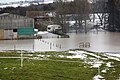
 Flooding at Stank House Farm (^1) - geograph.org.uk - 1723090.jpg 3,084 × 2,056; 3.19 MB
-
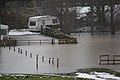
 Flooding at Stank House Farm (^2) - geograph.org.uk - 1723098.jpg 3,084 × 2,056; 2.81 MB
-
 Flooding at Stank House Farm (^3) - geograph.org.uk - 1723104.jpg 3,084 × 2,056; 2.23 MB
-
 Footbridge over Beck in Woods - geograph.org.uk - 3709268.jpg 4,000 × 3,000; 5.57 MB
-
 Footpath to Merrys Wood - geograph.org.uk - 3707580.jpg 4,000 × 3,000; 2.5 MB
-
 Former Station - geograph.org.uk - 3845000.jpg 3,920 × 2,204; 2.61 MB
-
 Freebrough Framed - geograph.org.uk - 3843429.jpg 3,052 × 1,413; 676 KB
-
 Freebrough Hill - geograph.org.uk - 1140039.jpg 640 × 427; 33 KB
-
 Freebrough Hill - geograph.org.uk - 4153613.jpg 1,600 × 1,200; 409 KB
-
 Freebrough Hill - geograph.org.uk - 4500396.jpg 640 × 360; 111 KB
-
 Freebrough Hill and Dimmingdale - geograph.org.uk - 6272198.jpg 640 × 360; 97 KB
-
 Frozen pools along Quakers' Causeway - geograph.org.uk - 5610598.jpg 1,500 × 1,125; 1.29 MB
-
 Gerrick Grange Farmhouse - geograph.org.uk - 3843761.jpg 3,920 × 2,204; 2.78 MB
-
 Gerrick Lane - geograph.org.uk - 1739148.jpg 2,048 × 1,536; 1.27 MB
-
 Gorse-covered hillside, east of Smeathorns Lane - geograph.org.uk - 4426302.jpg 1,024 × 768; 234 KB
-
 Grazing, Kilton Hall - geograph.org.uk - 3979324.jpg 640 × 480; 86 KB
-
 Greenhills Farm across fields - geograph.org.uk - 3707574.jpg 4,000 × 3,000; 3.05 MB
-
 Guisborough 3 - geograph.org.uk - 1899138.jpg 1,200 × 1,600; 456 KB
-
 Guisborough 4 - geograph.org.uk - 1896838.jpg 1,200 × 1,600; 572 KB
-
 Guisborough 7 - geograph.org.uk - 1899109.jpg 1,200 × 1,600; 573 KB
-
 Guisborough 8 - geograph.org.uk - 1899078.jpg 1,200 × 1,600; 516 KB
-
 Havelock Stone - geograph.org.uk - 6116347.jpg 640 × 427; 79 KB
-
 Heading east over Gerrick Moor - geograph.org.uk - 2710969.jpg 640 × 480; 37 KB
-
 Heartbreak Hill - geograph.org.uk - 4325753.jpg 640 × 360; 47 KB
-
 Heartbreak Hill - geograph.org.uk - 4325755.jpg 640 × 360; 72 KB
-
-
 Hedge ^ Trough - geograph.org.uk - 3842696.jpg 3,920 × 2,204; 2.67 MB
-
 Hob Cross - geograph.org.uk - 1886351.jpg 2,112 × 2,816; 2.67 MB
-
 Jackson Stone - geograph.org.uk - 6117011.jpg 640 × 427; 93 KB
-
 Job Cross - geograph.org.uk - 5062890.jpg 1,936 × 2,592; 2.94 MB
-
 Job Cross - geograph.org.uk - 6272182.jpg 640 × 360; 92 KB
-
 Job Cross Road - geograph.org.uk - 5908925.jpg 1,600 × 1,200; 406 KB
-
 Jolly Sailor Inn - geograph.org.uk - 6151728.jpg 640 × 360; 69 KB
-
 Kilton Beck - geograph.org.uk - 3958898.jpg 1,600 × 1,200; 1.11 MB
-
 Kilton Lane - geograph.org.uk - 1728051.jpg 3,088 × 2,056; 2.57 MB
-
 Kilton Lane - geograph.org.uk - 3979327.jpg 640 × 480; 66 KB
-
 Kilton Lane - geograph.org.uk - 3979342.jpg 640 × 480; 94 KB
-
 Kilton Lane - geograph.org.uk - 3979348.jpg 640 × 480; 74 KB
-
 Kilton Lane - geograph.org.uk - 3979361.jpg 640 × 480; 78 KB
-
 Kilton Lane heading west - geograph.org.uk - 3979356.jpg 640 × 480; 48 KB
-
 Kilton Lane toward Brotton - geograph.org.uk - 3702572.jpg 4,000 × 3,000; 2.99 MB
-
 Kilton Thorpe Lane - geograph.org.uk - 3979335.jpg 640 × 480; 65 KB
-
 Kilton Thorpe Lane in winter - geograph.org.uk - 1720555.jpg 2,048 × 1,536; 1.33 MB
-
 Leaden Well - geograph.org.uk - 6116354.jpg 640 × 427; 99 KB
-

-
 Lockwood Beck Farm - geograph.org.uk - 239828.jpg 640 × 383; 36 KB
-
 Lockwood Beck Farm next to the A171 - geograph.org.uk - 2637317.jpg 3,648 × 2,736; 1.81 MB
-
 Lockwood Beck from near Smeathorns Road - geograph.org.uk - 5323272.jpg 2,000 × 1,269; 469 KB
-
 Lockwood Beck Reservoir - geograph.org.uk - 5323270.jpg 2,000 × 1,272; 368 KB
-
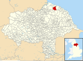 Lockwood, North Yorkshire UK parish locator map.svg 1,425 × 1,037; 4.3 MB
-
 Lumpsey Mine - geograph.org.uk - 4682571.jpg 640 × 415; 114 KB
-
 Margrove Woods - geograph.org.uk - 4153616.jpg 1,200 × 1,600; 962 KB
-
 Medieval Hamlet - geograph.org.uk - 3843726.jpg 3,920 × 2,204; 2.68 MB
-
 Merrys Wood - geograph.org.uk - 2639715.jpg 640 × 480; 159 KB
-
 Mill Lane - geograph.org.uk - 3979306.jpg 640 × 480; 111 KB
-
 Moor burning, Stanghow Moor - geograph.org.uk - 5949230.jpg 640 × 360; 52 KB
-
 Moorland heather near Black Howes - geograph.org.uk - 1602838.jpg 640 × 480; 74 KB
-
 Moorland trekkers in a snow storm - geograph.org.uk - 1721074.jpg 2,048 × 1,536; 1.32 MB
-
 Moorsholm Church Hall and village sign - geograph.org.uk - 5431061.jpg 5,184 × 3,888; 4.53 MB
-
 Moorsholm Docks - geograph.org.uk - 5932455.jpg 640 × 427; 127 KB
-
 Moorsholm Moor - geograph.org.uk - 5610576.jpg 1,500 × 945; 1.15 MB
-
 Near Dimmingdale Farm - geograph.org.uk - 4153608.jpg 1,600 × 1,200; 615 KB
-
 Near Gerrick - geograph.org.uk - 3959641.jpg 1,600 × 1,200; 455 KB
-
 Near Job Cross - geograph.org.uk - 5063574.jpg 2,592 × 1,936; 1.74 MB
-
 New ^ Old - geograph.org.uk - 3843361.jpg 3,920 × 2,204; 2.64 MB
-
-
 Old Boundary Marker (geograph 6652211).jpg 768 × 1,024; 205 KB
-
 Old Boundary Marker (geograph 6652216).jpg 768 × 1,024; 288 KB
-
 Old Boundary Marker (geograph 6652266).jpg 768 × 1,024; 137 KB
-

-

-

-

-

-

-

-
 Old Boundary Marker near Aysdale Gate Farmhouse (geograph 7421601).jpg 2,248 × 4,000; 3.2 MB
-

-
 Old Boundary Marker near Tidkinhow Farm (geograph 7422189).jpg 2,248 × 4,000; 3.09 MB
-

-

-
 Old Boundary Marker on Brown Hill (geograph 7027278).jpg 428 × 571; 99 KB
-
 Old Boundary Marker on Brown Hill - geograph.org.uk - 6083827.jpg 374 × 327; 59 KB
-

-
-
 Old Castle Hill stone row - geograph.org.uk - 5681302.jpg 1,600 × 990; 894 KB
-
 Old Mile Post - geograph.org.uk - 1896824.jpg 1,600 × 1,200; 497 KB
-
 Old Milepost - geograph.org.uk - 1899082.jpg 1,600 × 1,200; 490 KB
-
 Old Milepost - geograph.org.uk - 1899116.jpg 1,600 × 1,200; 577 KB
-
 Old Milepost - geograph.org.uk - 1899141.jpg 1,600 × 1,200; 676 KB
-
 On Freebrough Road looking to Freebrough Hill - geograph.org.uk - 5431055.jpg 5,184 × 3,888; 4.52 MB
-
 Path near Hob Cross - geograph.org.uk - 5862417.jpg 2,048 × 1,536; 964 KB
-
 Public bridleway to Priestcrofts - geograph.org.uk - 1728007.jpg 3,088 × 2,056; 2.76 MB
-
 Quaker's Causeway - geograph.org.uk - 4153626.jpg 1,200 × 1,600; 843 KB
-
 Quakers Causeway ( Track ) - geograph.org.uk - 1886453.jpg 2,816 × 2,112; 2.56 MB
-
 Quakers Causeway ( Track ) heading southeast - geograph.org.uk - 1886494.jpg 2,816 × 2,112; 2.58 MB
-
 Quakers' Causeway - geograph.org.uk - 2073898.jpg 2,048 × 1,536; 1.28 MB
-
 Road across Stanghow Ridge - geograph.org.uk - 1721012.jpg 2,048 × 1,536; 1.25 MB
-
 Road from Castleton over Brown Hill - geograph.org.uk - 1948778.jpg 2,427 × 1,820; 2.03 MB
-
 Road Junction, Three Howes Rigg - geograph.org.uk - 3693820.jpg 2,476 × 1,355; 256 KB
-
 Road to Castleton - geograph.org.uk - 1948840.jpg 2,816 × 2,112; 2.76 MB
-
 Roofless Barns at Gerrick Grange - geograph.org.uk - 3843750.jpg 3,920 × 2,204; 2.36 MB
-
 Round the bend - geograph.org.uk - 3842694.jpg 3,920 × 2,204; 2.39 MB
-
 Sharp bend on Birk Brow Road - geograph.org.uk - 2703498.jpg 640 × 480; 124 KB
-
 Ships waiting near Teesside - geograph.org.uk - 1631282.jpg 640 × 428; 22 KB
-
 Shooting butts on Gerrick Moor - geograph.org.uk - 5909978.jpg 1,600 × 1,200; 523 KB
-
 Single track rail line toward Brotton - geograph.org.uk - 3707468.jpg 4,000 × 3,000; 3.38 MB
-
-
 Slimy Bridge - geograph.org.uk - 3843441.jpg 2,192 × 3,920; 2.76 MB
-
 Smeathorns Road near Castle Hill - geograph.org.uk - 2075499.jpg 2,048 × 1,536; 908 KB
-

-
 Snow at Kilton Hill - geograph.org.uk - 1720665.jpg 2,048 × 1,536; 1.83 MB
-
 South Skelton Ironstone Mine - geograph.org.uk - 5915356.jpg 640 × 360; 107 KB
-
 Spoil tip near Stank House Farm - geograph.org.uk - 1723119.jpg 3,084 × 2,056; 3.56 MB
-
 Standing Stone - geograph.org.uk - 5192585.jpg 640 × 427; 102 KB
-
 Standing Stone on Tumulus - geograph.org.uk - 1196230.jpg 640 × 427; 315 KB
-
 Stanghow Moor - geograph.org.uk - 2780521.jpg 1,024 × 768; 254 KB
-
 Stanghow Moor - geograph.org.uk - 5501089.jpg 2,048 × 1,536; 1,010 KB
-
 Stanghow Road - geograph.org.uk - 3979402.jpg 640 × 480; 62 KB
-
 Sunley’s Daughter - geograph.org.uk - 5883431.jpg 640 × 360; 101 KB
-
 Swindale Lane - geograph.org.uk - 1723040.jpg 3,084 × 2,056; 2.83 MB
-

-
 The eastern flanks of Freeborough Hill - geograph.org.uk - 2441101.jpg 1,600 × 688; 122 KB
-
 The foot of Birk Brow - geograph.org.uk - 2694972.jpg 800 × 600; 129 KB
-
 The old A171 at Skate Beck Bridge - geograph.org.uk - 6151726.jpg 640 × 427; 185 KB
-
 The road over Danby Low Road - geograph.org.uk - 2657754.jpg 800 × 600; 203 KB
-
 The Station Hotel - geograph.org.uk - 3845005.jpg 3,920 × 2,204; 2.07 MB
-
 The view from Low Moor - geograph.org.uk - 2336081.jpg 1,280 × 960; 440 KB
-
 Three Howes Rigg - geograph.org.uk - 4153630.jpg 1,600 × 1,200; 484 KB
-
 Tidkinhow Farm - geograph.org.uk - 2893070.jpg 1,217 × 912; 880 KB
-
 Tomgate Moor - geograph.org.uk - 5062871.jpg 2,592 × 1,936; 1.71 MB
-
 Track on Gerrick Moor looking west - geograph.org.uk - 5908943.jpg 1,600 × 1,200; 541 KB


_-_geograph.org.uk_-_3733517.jpg)


_-_geograph.org.uk_-_2637302.jpg)


_-_geograph.org.uk_-_3709235.jpg)


_-_geograph.org.uk_-_1723090.jpg)
_-_geograph.org.uk_-_1723098.jpg)
_-_geograph.org.uk_-_1723104.jpg)


_for_Teesside,_right_(east)_for_Scarborough_-_geograph.org.uk_-_4426282.jpg)


.jpg)
.jpg)
.jpg)
.jpg)


.jpg)

.jpg)


.jpg)


_-_geograph.org.uk_-_1886453.jpg)
_heading_southeast_-_geograph.org.uk_-_1886494.jpg)


