Category:London in the 16th century
Ceremonial counties of England: Berkshire · Cambridgeshire · Cheshire · East Riding of Yorkshire · Greater London · Lancashire ·
City-counties:
Former historic counties: Huntingdonshire · Sussex · Yorkshire
Other former counties:
City-counties:
Former historic counties: Huntingdonshire · Sussex · Yorkshire
Other former counties:
Wikimedia category | |||||
| Upload media | |||||
| Instance of | |||||
|---|---|---|---|---|---|
| Category combines topics | |||||
| Follows |
| ||||
| Followed by | |||||
| 16th century | |||||
century .jpg) | |||||
| Instance of | |||||
| Part of | |||||
| Has part(s) | |||||
| Point in time |
| ||||
| Start time |
| ||||
| End time |
| ||||
| Follows | |||||
| Followed by | |||||
| London | |||||
capital and largest city of England and the United Kingdom     .svg)   | |||||
| Pronunciation audio | |||||
| Instance of |
| ||||
| Location |
| ||||
| Located in or next to body of water | |||||
| Official language | |||||
| Head of government |
| ||||
| Inception |
| ||||
| Significant event |
| ||||
| Highest point |
| ||||
| Population |
| ||||
| Area |
| ||||
| Elevation above sea level |
| ||||
| Replaces | |||||
| IATA airport code |
| ||||
| Different from | |||||
| official website | |||||
 | |||||
Subcategories
This category has the following 11 subcategories, out of 11 total.
*
Media in category "London in the 16th century"
The following 30 files are in this category, out of 30 total.
-
 ONL (1887) 2.000f - A Play in a London Inn Yard, in the Time of Queen Elizabeth.jpg 2,637 × 1,866; 2.24 MB
-

-
 A history of mediæval and modern Europe for secondary schools (1920) (14741414766).jpg 2,224 × 1,520; 774 KB
-
 Armarda Thanksgiving at St Paul's.png 647 × 524; 506 KB
-
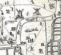
 Copperplate map Bishopsgate.jpg 703 × 1,874; 605 KB
-
 Copperplate map Bridewell.jpg 760 × 940; 281 KB
-
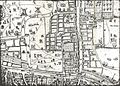
 Copperplate map E City.jpg 3,029 × 2,282; 3.04 MB
-
 Copperplate map Finsbury Field.jpg 1,222 × 1,089; 578 KB
-
 Copperplate map Fleet.jpg 582 × 1,671; 399 KB
-
 Copperplate map London Stone.jpg 499 × 317; 98 KB
-
 Copperplate map Moorfields crop.jpg 1,949 × 1,533; 1.14 MB
-
 Copperplate map Moorfields.jpg 3,006 × 2,164; 2.28 MB
-
 Copperplate map St Brides.jpg 210 × 245; 42 KB
-
 Copperplate map St Pauls.jpg 671 × 828; 285 KB
-
 Copperplate map W City.jpg 3,029 × 2,230; 2.48 MB
-
 Elizabethan People - Archery Match.jpg 1,386 × 2,215; 895 KB
-
 Fisher's Folly.jpg 989 × 1,036; 791 KB
-
 Frauen-Trachtenbuch 082.jpg 1,262 × 1,983; 122 KB
-

-
 London in 1543 by Wyngaerde Eastminster.jpg 392 × 272; 134 KB
-

-
 Old Bartholomew Fair at Smithfield ILN0-1923-0519-0020.jpg 2,365 × 1,741; 1.7 MB
-
 Panorama of London in 1543 Wyngaerde Section 1.jpg 3,000 × 1,911; 2.15 MB
-
 Panorama of London in 1543 Wyngaerde Section 2.jpg 3,000 × 1,839; 2.11 MB
-
 Panorama of London in 1543 Wyngaerde Section 3 (cropped).jpg 2,048 × 1,213; 521 KB
-
 Panorama of London in 1543 Wyngaerde Section 3.jpg 3,000 × 1,833; 2.16 MB
-
 St Mary Somerset Wyngaerde panorama.jpg 800 × 615; 146 KB
-
 Westminster in the time of Henry VIII (key).png 1,600 × 1,360; 3.06 MB
-
 Westminster in the time of Henry VIII.png 3,500 × 2,285; 15.82 MB
-
 Whitefriars on the Wyngaerde panorama.jpg 800 × 495; 111 KB
_2.000f_-_A_Play_in_a_London_Inn_Yard,_in_the_Time_of_Queen_Elizabeth.jpg)
_(14741414766).jpg)


_(14597940917).jpg)


.jpg)


.png)


.jpg)