Category:Loose, Kent
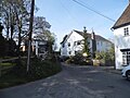
English: Loose is a village some south of Maidstone, Kent, situated at the head of the Loose Valley. The fast flowing River Loose which rises near Langley runs through the centre of the village and once supported a paper making industry, evidence of which can still be found today. An area around the village is also known as Loose but the village itself is based in the Loose valley and extends along Busbridge Road towards Tovil.
village and civil parish in Maidstone, Kent, England  | |||||
| Upload media | |||||
| Instance of | |||||
|---|---|---|---|---|---|
| Location | Maidstone, Kent, South East England, England | ||||
 | |||||
Subcategories
This category has the following 5 subcategories, out of 5 total.
Media in category "Loose, Kent"
The following 200 files are in this category, out of 262 total.
(previous page) (next page)-
 A pair of Cottages by a maize field - geograph.org.uk - 2850260.jpg 640 × 430; 97 KB
-
 A very old yew tree - geograph.org.uk - 5423200.jpg 4,000 × 3,000; 4.67 MB
-
 A yew which is 1,500 years old - geograph.org.uk - 5423199.jpg 4,000 × 3,000; 4.7 MB
-
 A229 - B2163 crossroads - geograph.org.uk - 3030755.jpg 640 × 428; 106 KB
-
 A229 heading north - geograph.org.uk - 2846011.jpg 640 × 430; 63 KB
-
 All Saints' Churchyard - geograph.org.uk - 2779432.jpg 640 × 430; 86 KB
-
 Allotments at Loose Kent - geograph.org.uk - 447023.jpg 640 × 480; 111 KB
-
 Approaching Loose - geograph.org.uk - 2779387.jpg 640 × 430; 45 KB
-
 Approaching Loose from the south - geograph.org.uk - 4044905.jpg 4,000 × 3,000; 4.47 MB
-
 Autumnal colours, Loose Valley - geograph.org.uk - 2779384.jpg 640 × 430; 92 KB
-
 Barcham Green Development, Pickering Street, Loose - geograph.org.uk - 2338070.jpg 3,072 × 2,304; 1.26 MB
-
 Blossoming Orchard, Loose - geograph.org.uk - 2344755.jpg 3,072 × 2,304; 1.36 MB
-
 Bridge Street, Loose - geograph.org.uk - 4841877.jpg 3,264 × 2,448; 1.82 MB
-
 Brooks Field, Loose - geograph.org.uk - 2344751.jpg 3,072 × 2,304; 1.28 MB
-
 Bus Stop at Linton Corner - geograph.org.uk - 3388731.jpg 4,608 × 3,456; 3.71 MB
-
 Bus stop on Heath Road, Coxheath - geograph.org.uk - 4946357.jpg 1,536 × 2,048; 1.66 MB
-
 Busbridge Road, Loose - geograph.org.uk - 3552832.jpg 3,488 × 2,616; 2.27 MB
-
 Busbridge Road, Loose Hill - geograph.org.uk - 4943080.jpg 2,048 × 1,536; 1.55 MB
-
 Cape Cottages - geograph.org.uk - 2779427.jpg 640 × 430; 67 KB
-
 Carman's Close - geograph.org.uk - 2845940.jpg 640 × 430; 82 KB
-
 Chip Shop and Houses on Linton Road, Linton - geograph.org.uk - 3386447.jpg 4,608 × 3,456; 3.42 MB
-
 Church House - geograph.org.uk - 2779421.jpg 640 × 430; 85 KB
-
 Church House - geograph.org.uk - 2779424.jpg 640 × 430; 75 KB
-
 Church House - geograph.org.uk - 2782572.jpg 640 × 430; 88 KB
-
 Church House, Loose, Kent, England.jpg 3,667 × 2,605; 5.9 MB
-
 Church House, Loose, Kent.jpg 4,917 × 3,419; 8.11 MB
-
 Church of All Saints - geograph.org.uk - 2779434.jpg 640 × 430; 70 KB
-
 Church of All Saints - geograph.org.uk - 2782571.jpg 640 × 471; 82 KB
-
 Church St - geograph.org.uk - 2779403.jpg 640 × 430; 60 KB
-
 Church Street, Loose - geograph.org.uk - 4841827.jpg 3,264 × 2,448; 1.69 MB
-
 Church Street, Loose - geograph.org.uk - 4841881.jpg 3,264 × 2,448; 2.68 MB
-
 Church Street, Loose - geograph.org.uk - 4943008.jpg 2,048 × 1,536; 1.51 MB
-
 Churchhouse.jpg 740 × 497; 71 KB
-
 Close up of the wording on Loose War Memorial - geograph.org.uk - 3818886.jpg 4,000 × 3,000; 4.06 MB
-

-
 Congregational Church - geograph.org.uk - 2846016.jpg 640 × 430; 63 KB
-
 Congregational Church, Linton Road, Linton - geograph.org.uk - 3386456.jpg 4,608 × 3,456; 3.48 MB
-
 Congregational Church, Loose - geograph.org.uk - 1131322.jpg 640 × 481; 76 KB
-
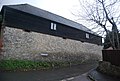 Converted barn, High Banks - geograph.org.uk - 2782579.jpg 640 × 430; 83 KB
-
 Cornwallis Academy, Linton (2) - geograph.org.uk - 3387065.jpg 4,608 × 3,456; 3.49 MB
-
 Cottage - Flickr - sarchi.jpg 1,200 × 1,600; 564 KB
-
 Cottage by Loose Stream - geograph.org.uk - 780779.jpg 480 × 640; 110 KB
-
 Cottage in Old Loose Hill - geograph.org.uk - 4044916.jpg 4,000 × 3,000; 4.35 MB
-
 Cottages in Loose - geograph.org.uk - 780723.jpg 640 × 480; 92 KB
-
 Cottages, Church St - geograph.org.uk - 2779431.jpg 640 × 430; 48 KB
-
 Cottages, High Banks - geograph.org.uk - 2782592.jpg 640 × 430; 46 KB
-
 Cottages, West Lawn Farm - geograph.org.uk - 2777934.jpg 640 × 430; 111 KB
-
 Countryside near Loose - geograph.org.uk - 2846029.jpg 640 × 430; 42 KB
-
 Entering Boughton Monchelsea - geograph.org.uk - 3030781.jpg 640 × 480; 107 KB
-
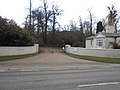 Entrance to Linton Park Estate (1) - geograph.org.uk - 3387068.jpg 4,608 × 3,456; 3.4 MB
-
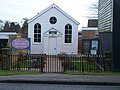
 Exclusive Brethren Meeting Room, Linton Road, Loose - geograph.org.uk - 3386422.jpg 4,608 × 3,456; 3.54 MB
-
 Farmland by Hubbard's Lane - geograph.org.uk - 2846033.jpg 640 × 430; 78 KB
-
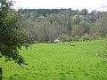
 Farmland south of Loose - geograph.org.uk - 2846028.jpg 640 × 430; 46 KB
-
 Field and Lake, Loose Valley - geograph.org.uk - 2336935.jpg 3,072 × 2,304; 1.28 MB
-
 Field by Salts Lane - geograph.org.uk - 2865186.jpg 640 × 480; 70 KB
-
 Field south of Loose - geograph.org.uk - 2846027.jpg 640 × 430; 57 KB
-
-

-
 Florence Cottage - geograph.org.uk - 2779407.jpg 640 × 430; 64 KB
-
 Florence Cottage garden in Loose - geograph.org.uk - 5421136.jpg 4,000 × 3,000; 4.86 MB
-
 Florence House - geograph.org.uk - 2779401.jpg 640 × 430; 50 KB
-
 Florence House - geograph.org.uk - 780767.jpg 640 × 480; 87 KB
-
 Footpath by a hop field - geograph.org.uk - 2845938.jpg 640 × 430; 94 KB
-
 Footpath heading north - geograph.org.uk - 2841971.jpg 640 × 430; 102 KB
-
 Footpath in the Loose Valley - geograph.org.uk - 2779383.jpg 640 × 430; 88 KB
-
 Footpath off Busridge Rd - geograph.org.uk - 2782600.jpg 640 × 430; 145 KB
-
 Footpath through the orchard - geograph.org.uk - 2782604.jpg 640 × 430; 96 KB
-
 Footpath to Broughton Monchelsea - geograph.org.uk - 2846031.jpg 640 × 430; 68 KB
-
 Footpath to Hubbard's Lane - geograph.org.uk - 2846036.jpg 640 × 430; 80 KB
-
 Footpath to Loose - geograph.org.uk - 2777928.jpg 640 × 430; 139 KB
-
 Footpath to Loose - geograph.org.uk - 2777930.jpg 640 × 430; 127 KB
-
 Footpath to Loose - geograph.org.uk - 2841963.jpg 640 × 430; 78 KB
-
 Footpath west from Loose - geograph.org.uk - 2782614.jpg 640 × 430; 100 KB
-
 Former Orchard, Loose - geograph.org.uk - 2344758.jpg 3,072 × 2,304; 1.21 MB
-
 Grazing by Pimp's Court - geograph.org.uk - 781021.jpg 640 × 480; 77 KB
-
 Greystone, Loose - geograph.org.uk - 2865107.jpg 640 × 480; 81 KB
-
 Half-timbered house in Loose - geograph.org.uk - 3818891.jpg 4,000 × 3,000; 4.12 MB
-
 Half-timbered house in Loose - geograph.org.uk - 3914934.jpg 4,000 × 3,000; 4.14 MB
-
 Half-timbered house in Loose - geograph.org.uk - 5421101.jpg 4,000 × 3,000; 4.87 MB
-
 Half-timbered house in Loose - geograph.org.uk - 5421104.jpg 4,000 × 3,000; 5 MB
-
 Half-timbered house in Loose - geograph.org.uk - 5778905.jpg 4,000 × 3,000; 4.83 MB
-
 Hanson Drive, Linton - geograph.org.uk - 3386471.jpg 4,608 × 3,456; 3.49 MB
-
 Hanson Drive, Loose - geograph.org.uk - 4841758.jpg 3,264 × 2,448; 2.61 MB
-
 Haste Hill Rd - geograph.org.uk - 2850247.jpg 640 × 430; 67 KB
-
 Haste Hill Road, Boughton Monchelsea - geograph.org.uk - 3627217.jpg 3,488 × 2,616; 2.16 MB
-
 Haste Hill Road, Boughton Monchelsea - geograph.org.uk - 4841910.jpg 3,264 × 2,448; 1.34 MB
-
 Haste Hill Road, Boughton Monchelsea - geograph.org.uk - 4841920.jpg 3,264 × 2,448; 1.49 MB
-
 Heath Rd - geograph.org.uk - 2841941.jpg 640 × 430; 77 KB
-
 Heath Road, near Boughton Monchelsea - geograph.org.uk - 3627206.jpg 3,488 × 2,616; 2.11 MB
-
 Herts Crescent, Loose - geograph.org.uk - 4841780.jpg 3,264 × 2,448; 2.01 MB
-
 High Banks, Loose - geograph.org.uk - 4841820.jpg 3,264 × 2,448; 2.69 MB
-
 High Banks, Loose - geograph.org.uk - 4841831.jpg 3,264 × 2,448; 1.66 MB
-
 High Banks, Loose - geograph.org.uk - 4941826.jpg 2,048 × 1,536; 1.45 MB
-
 High Banks, Loose - geograph.org.uk - 4943015.jpg 2,048 × 1,536; 1.53 MB
-
 Holmesdale Close - geograph.org.uk - 2846014.jpg 640 × 430; 104 KB
-
 Holmesdale Close, Loose - geograph.org.uk - 1968027.jpg 2,048 × 1,536; 1.25 MB
-
 Holmesdale Close, Loose - geograph.org.uk - 4841765.jpg 3,264 × 2,448; 2.62 MB
-
 Hop field - geograph.org.uk - 2841934.jpg 640 × 430; 65 KB
-
 Hop field - geograph.org.uk - 2841953.jpg 640 × 430; 56 KB
-
 Hop field - geograph.org.uk - 2841957.jpg 640 × 430; 85 KB
-
 Hop field south of Loose - geograph.org.uk - 2841969.jpg 640 × 430; 87 KB
-
 Hop field south of Loose - geograph.org.uk - 2841977.jpg 640 × 430; 90 KB
-
 Houses in the Loose Valley - geograph.org.uk - 4383167.jpg 4,000 × 3,000; 4 MB
-
 Houses on Linton Road, Linton - geograph.org.uk - 3386435.jpg 4,608 × 3,456; 3.63 MB
-
 Houses, Vale Rd - geograph.org.uk - 2782607.jpg 640 × 430; 52 KB
-
 Hubbard's Lane - geograph.org.uk - 2850235.jpg 640 × 430; 52 KB
-
 Hubbard's Lane - geograph.org.uk - 2850245.jpg 640 × 430; 96 KB
-
-
 Hubbards Lane, Boughton Monchelsea - geograph.org.uk - 3627212.jpg 3,488 × 2,616; 2.17 MB
-
 Hubbards Lane, Boughton Monchelsea - geograph.org.uk - 3627214.jpg 3,488 × 2,616; 2.17 MB
-
 Hubbards Lane, Boughton Monchelsea - geograph.org.uk - 4841914.jpg 3,264 × 2,448; 1.2 MB
-
 King George V Playing Field, Loose - geograph.org.uk - 2336899.jpg 3,072 × 2,304; 1.24 MB
-
 King George V Recreation Area, Loose - geograph.org.uk - 4186922.jpg 3,104 × 2,328; 2.18 MB
-
 Kirkdale Cottages, Loose - geograph.org.uk - 3818872.jpg 4,000 × 3,000; 4.11 MB
-
 Kirkdale Path towards Kirkdale Cottages, Loose - geograph.org.uk - 4563020.jpg 1,024 × 683; 284 KB
-
 Kirkdale, Loose - geograph.org.uk - 4841874.jpg 2,448 × 3,264; 1.55 MB
-
 Linton Road, Loose - geograph.org.uk - 1968010.jpg 2,048 × 1,536; 1.32 MB
-
 Linton Road, Loose - geograph.org.uk - 1968031.jpg 2,048 × 1,536; 1.27 MB
-
 Linton Road, Loose - geograph.org.uk - 1968034.jpg 2,048 × 1,536; 1.29 MB
-
 Linton Road, Loose - geograph.org.uk - 4841761.jpg 3,264 × 2,448; 1.54 MB
-
 Linton Road, Loose - geograph.org.uk - 4841775.jpg 3,264 × 2,448; 1.48 MB
-
 Linton Road, Loose - geograph.org.uk - 4841786.jpg 3,264 × 2,448; 1.48 MB
-
 Linton Road, Loose - geograph.org.uk - 4951694.jpg 2,048 × 1,536; 1.51 MB
-
 Looking towards the site of Upper Mill, Loose Valley - geograph.org.uk - 4383180.jpg 4,000 × 3,000; 4.01 MB
-
 Loose - geograph.org.uk - 780755.jpg 640 × 480; 147 KB
-
 Loose causeway.jpg 712 × 534; 89 KB
-
 Loose Church and village, near Maidstone, England-LCCN2002697022.jpg 3,711 × 2,810; 2.54 MB
-
 Loose Church and village, near Maidstone, England-LCCN2002697022.tif 3,711 × 2,810; 29.84 MB
-
 Loose Church Centre - geograph.org.uk - 2779428.jpg 430 × 640; 70 KB
-
 Loose Road - geograph.org.uk - 2049207.jpg 427 × 640; 73 KB
-
 Loose Telephone Exchange, Loose Road - geograph.org.uk - 3917159.jpg 3,104 × 2,328; 1.23 MB
-
 Loose Valley - geograph.org.uk - 781006.jpg 640 × 480; 128 KB
-
 Loose village sign - geograph.org.uk - 3819313.jpg 4,000 × 3,000; 4.15 MB
-
 Loose Village Sign - geograph.org.uk - 780744.jpg 480 × 640; 121 KB
-

-
 Loose War Memorial - geograph.org.uk - 3818883.jpg 4,000 × 3,000; 4.17 MB
-
 Loose War Memorial - geograph.org.uk - 4841886.jpg 2,448 × 3,264; 1.96 MB
-
 Loose war memorial and church centre - geograph.org.uk - 3030642.jpg 640 × 480; 101 KB
-
 Loosehill.jpg 712 × 534; 77 KB
-
 Maize stubble - geograph.org.uk - 2850257.jpg 640 × 430; 102 KB
-
 Mc Alpine Crescent - geograph.org.uk - 2846017.jpg 640 × 430; 83 KB
-
 McAlpine Crescent, Loose - geograph.org.uk - 1968018.jpg 2,048 × 1,536; 1.21 MB
-
 McAlpine Crescent, Loose - geograph.org.uk - 4841772.jpg 3,264 × 2,448; 1.64 MB
-
 Mill Falls, Loose Valley - geograph.org.uk - 4383186.jpg 4,000 × 3,000; 4.07 MB
-
 Mill pond and River Loose in Loose - geograph.org.uk - 2779411.jpg 640 × 430; 71 KB
-
 Mill St - geograph.org.uk - 2782589.jpg 640 × 430; 69 KB
-
 Mill Street, Loose - geograph.org.uk - 4841869.jpg 3,264 × 2,448; 1.97 MB
-
 Mill Street, Loose - geograph.org.uk - 4943048.jpg 2,048 × 1,536; 1.52 MB
-

-
 New housing, A229 - geograph.org.uk - 2846020.jpg 640 × 430; 78 KB
-
 Northleigh Close, Loose - geograph.org.uk - 4794398.jpg 2,272 × 1,704; 651 KB
-
 Nu-Venture T348.JPG 2,202 × 2,074; 797 KB
-
 Old Drive into Kirkdale Path, Loose - geograph.org.uk - 4563035.jpg 1,024 × 683; 229 KB
-
 Old Loose Hill - geograph.org.uk - 2167651.jpg 640 × 480; 127 KB
-
 Old Loose Hill - geograph.org.uk - 2344753.jpg 3,072 × 2,304; 1.32 MB
-
 Old Loose Hill, Loose - geograph.org.uk - 1725633.jpg 3,488 × 2,616; 2.09 MB
-
 Old Loose Hill, Loose - geograph.org.uk - 3627223.jpg 3,488 × 2,616; 2.26 MB
-
 Old Loose Hill, Loose - geograph.org.uk - 4841783.jpg 3,264 × 2,448; 1.88 MB
-
 Old Loose Hill, Loose - geograph.org.uk - 4841807.jpg 3,264 × 2,448; 2.85 MB
-
 Old Loose Hill, Loose - geograph.org.uk - 4841894.jpg 3,264 × 2,448; 1.92 MB
-
 Old Loose Hill, Loose - geograph.org.uk - 4942989.jpg 2,048 × 1,536; 965 KB
-
 Old Loose Road at the junction of High Banks - geograph.org.uk - 4941836.jpg 2,048 × 1,536; 1.43 MB
-
 Old Loose Road, Loose - geograph.org.uk - 4951697.jpg 2,048 × 1,536; 1.13 MB
-
 Old sign, Busbridge Road, Loose - geograph.org.uk - 3552834.jpg 3,488 × 2,616; 2.36 MB
-
 Orchard by Busridge Rd - geograph.org.uk - 2782601.jpg 640 × 430; 91 KB
-
 Orchard by Heath Rd - geograph.org.uk - 2841530.jpg 640 × 430; 88 KB
-
 Orchard on the edge of Loose - geograph.org.uk - 2782609.jpg 640 × 430; 78 KB
-
 Orchard West of Loose - geograph.org.uk - 780694.jpg 640 × 480; 152 KB
-
 Orchard, Heath Road, Linton - geograph.org.uk - 3344831.jpg 4,608 × 3,456; 3.54 MB
-
 Park Avenue - geograph.org.uk - 2841948.jpg 640 × 391; 53 KB
-
 Path alongside Stream - geograph.org.uk - 1131354.jpg 640 × 481; 86 KB
-
 Pickering Street, Loose - geograph.org.uk - 2336890.jpg 3,072 × 2,304; 1.35 MB
-
 Poplars, Hubbard's Lane - geograph.org.uk - 2846035.jpg 640 × 430; 68 KB
-

-
 Pre-Worboys Maidstone Rural District sign, High Banks, Loose - geograph.org.uk - 4841803.jpg 2,448 × 3,264; 3.19 MB
-
 Pre-Worboys sign on High Banks, Loose - geograph.org.uk - 4951696.jpg 2,048 × 1,536; 1.49 MB
-
 Randalls Row, Loose - geograph.org.uk - 4841862.jpg 3,264 × 2,448; 1.81 MB
-

-

-
 River Loose - geograph.org.uk - 2779385.jpg 640 × 430; 107 KB
-
 Rose Cottages, Old Loose Hill - geograph.org.uk - 3030668.jpg 640 × 480; 146 KB
-
 Rose Cottages, Old Loose Hill, Loose - geograph.org.uk - 1498284.jpg 640 × 480; 114 KB
-
 Rosemount Close, Loose - geograph.org.uk - 4841790.jpg 3,264 × 2,448; 1.69 MB
-
 Salts Avenue - geograph.org.uk - 2846024.jpg 640 × 430; 77 KB
-
 Salts Avenue - geograph.org.uk - 2846026.jpg 640 × 430; 45 KB
-
 Salts Avenue off the A229 - geograph.org.uk - 2846023.jpg 640 × 430; 75 KB
-
 Salts Avenue, Loose - geograph.org.uk - 3627218.jpg 3,488 × 2,616; 2.25 MB
-
 Salts Avenue, Loose - geograph.org.uk - 3627220.jpg 3,488 × 2,616; 2.17 MB
-
 Salts Lane, Loose - geograph.org.uk - 2337278.jpg 3,072 × 2,304; 1.34 MB
-
 Salts Lane, Loose - geograph.org.uk - 4841908.jpg 3,264 × 2,448; 1.83 MB
-
 Shell Petrol Station at Linton Corner - geograph.org.uk - 3387071.jpg 4,608 × 3,456; 3.64 MB
-
 Spring by Loose - geograph.org.uk - 780702.jpg 640 × 480; 134 KB
-
 Stables and Houses off Salts Lane, Loose - geograph.org.uk - 2337291.jpg 3,072 × 2,304; 1.32 MB
-
 Steps on Footpath - geograph.org.uk - 1131133.jpg 481 × 640; 88 KB
-
 Stream, Loose Valley Conservation Area - geograph.org.uk - 2337270.jpg 3,072 × 2,304; 1.48 MB
-
 Stream, Weir, Lake - Loose Valley - geograph.org.uk - 2337243.jpg 3,072 × 2,304; 1.35 MB
-
 Streamside Loose - geograph.org.uk - 780992.jpg 640 × 480; 124 KB
-
 Telephone box taken over by nature, near Boughton Monchelsea - geograph.org.uk - 3627207.jpg 2,616 × 3,488; 1.93 MB
-
 Terraced houses, Kirkdale - geograph.org.uk - 2779391.jpg 640 × 430; 86 KB
-
 The 1,500 year old yew in Loose Churchyard - geograph.org.uk - 5778904.jpg 4,000 × 3,000; 4.75 MB


_-_geograph.org.uk_-_3387065.jpg)


_-_geograph.org.uk_-_3387068.jpg)


