Category:Lorentz HBS (Arnhem)
| Object location | | View all coordinates using: OpenStreetMap |
|---|
 | |||||
| Upload media | |||||
| Instance of | |||||
|---|---|---|---|---|---|
| Named after | |||||
| Location | Arnhem, Gelderland, Netherlands | ||||
| Street address |
| ||||
| Located on street | |||||
| Heritage designation |
| ||||
 | |||||
|
This is a category about rijksmonument number 516846
|
| Address |
|
Media in category "Lorentz HBS (Arnhem)"
The following 6 files are in this category, out of 6 total.
-
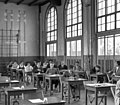 1959 Lorentz HBS eindexamen.jpg 2,387 × 2,084; 437 KB
-
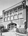
 1959 Lorentz HBS ingang.jpg 2,545 × 2,040; 404 KB
-
 Arnhem Rijksmonument 516846 HBS Schoolstraat 33 gevel boven entree.JPG 3,648 × 2,736; 3.28 MB
-
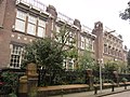 Arnhem Rijksmonument 516846 HBS Schoolstraat 33.JPG 3,648 × 2,736; 3.6 MB
-
 Exterieur VOORGEVEL, INGANGSPARTIJ - Arnhem - 20339612 - RCE.jpg 947 × 1,200; 264 KB
-
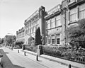 Overzicht voorgevel - Arnhem - 20359693 - RCE.jpg 1,200 × 956; 294 KB


