Category:Lunedale
civil parish in County Durham, England  | |||||
| Upload media | |||||
| Instance of | |||||
|---|---|---|---|---|---|
| Location | County Durham, North East England, England | ||||
 | |||||
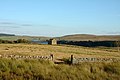
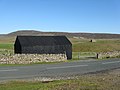
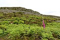
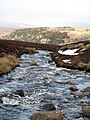
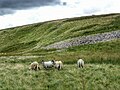
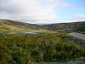
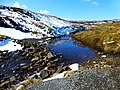
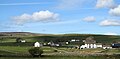
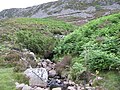
Lunedale is a dale or valley in County Durham, England, a side dale of Teesdale. It is also the name of a civil parish which covers most of the north side of the dale.
Subcategories
This category has the following 10 subcategories, out of 10 total.
B
C
- Cronkley Bridge (2 F)
G
- Grassholme Reservoir (43 F)
H
- Hagworm Hill, County Durham (2 F)
- Harter Fell, County Durham (7 F)
L
- Laithkirk Viaduct (6 F)
R
T
- Thringarth (5 F)
Media in category "Lunedale"
The following 200 files are in this category, out of 645 total.
(previous page) (next page)-
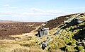
 A barn by the Pennine Way above Lunedale - geograph.org.uk - 2774690.jpg 800 × 557; 118 KB
-
-
 A barn near Wythes Hill - geograph.org.uk - 2775055.jpg 600 × 800; 213 KB
-
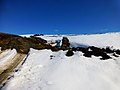
 A fine cairn on How Top - geograph.org.uk - 2676484.jpg 640 × 480; 46 KB
-
 A green line across the moor - geograph.org.uk - 6143061.jpg 4,320 × 3,240; 2.05 MB
-
 A long straight wall - geograph.org.uk - 4391013.jpg 3,240 × 4,320; 3.45 MB
-
 A paved section of the Pennine Way - geograph.org.uk - 5544147.jpg 1,200 × 1,600; 663 KB
-
 A view of Bowbank - geograph.org.uk - 6272231.jpg 4,765 × 3,493; 4.2 MB
-
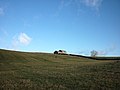
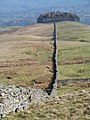
 A view of Kirkcarrion - geograph.org.uk - 6272236.jpg 5,184 × 3,888; 5.34 MB
-
 A view of Selset Reservoir - geograph.org.uk - 2396299.jpg 640 × 480; 65 KB
-
 Abandoned Methodist Chapel on the B6276 - geograph.org.uk - 4855167.jpg 1,800 × 1,013; 1.8 MB
-
 Above Selset Reservoir - geograph.org.uk - 6272247.jpg 5,053 × 3,789; 4.59 MB
-
 Access Bridge over the By Way to Selset Reservoir Dam - geograph.org.uk - 3259766.jpg 3,648 × 2,736; 2.45 MB
-
 Access to Mickle Fell - geograph.org.uk - 4694992.jpg 2,252 × 1,944; 1.16 MB
-
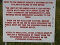 Access to the Warcop Ranges - geograph.org.uk - 4694981.jpg 2,592 × 1,944; 1.19 MB
-
 Across High Clove Hill - geograph.org.uk - 1260918.jpg 640 × 480; 71 KB
-
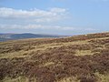
 Across Lunedale - geograph.org.uk - 6100792.jpg 4,555 × 2,311; 4.5 MB
-
 Across the lake to Stake Hill - geograph.org.uk - 4392242.jpg 4,320 × 3,240; 2.9 MB
-
 Across the Tees from High House - geograph.org.uk - 5362542.jpg 4,320 × 3,240; 4.44 MB
-
 Across the Tees to Ravens scar. - geograph.org.uk - 4008309.jpg 640 × 480; 60 KB
-
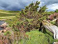 Aged Juniper Tree - geograph.org.uk - 4643910.jpg 640 × 480; 140 KB
-
 Agricultural Building at Far Beck Bridge - geograph.org.uk - 6100734.jpg 4,458 × 2,472; 3.69 MB
-
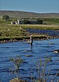 Angler in The River Tees - geograph.org.uk - 6272106.jpg 3,716 × 5,129; 4.95 MB
-
 Animal trap - geograph.org.uk - 518364.jpg 640 × 480; 115 KB
-
 Approaching Grains o' th' Beck - geograph.org.uk - 6100738.jpg 4,608 × 3,456; 5.47 MB
-
 Approaching Mickle Fell - geograph.org.uk - 4642329.jpg 4,608 × 3,456; 3.64 MB
-
-
 Arngill Beck - geograph.org.uk - 2757468.jpg 640 × 480; 79 KB
-
 Arngill Beck - geograph.org.uk - 3704012.jpg 1,500 × 1,027; 1.51 MB
-
 Ascending Bink Moss - geograph.org.uk - 4639159.jpg 4,572 × 2,855; 1.75 MB
-
 Ascending Bink Moss - geograph.org.uk - 4639167.jpg 4,608 × 3,456; 3.55 MB
-
 Ascending Mickle Fell - geograph.org.uk - 4642341.jpg 4,608 × 3,456; 3.75 MB
-
 Atop Scarsett Rigg - geograph.org.uk - 2676490.jpg 640 × 480; 68 KB
-
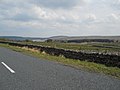
 B6276 - geograph.org.uk - 4624981.jpg 4,608 × 3,456; 3.65 MB
-
 B6276 heading east - geograph.org.uk - 4887587.jpg 1,500 × 957; 1.11 MB
-
 Bare tree with Grassholme Reservoir beyond - geograph.org.uk - 4224403.jpg 1,500 × 1,000; 1.62 MB
-
 Barn above Lune Head Beck - geograph.org.uk - 3009869.jpg 600 × 800; 88 KB
-
 Barn above Selset Reservoir - geograph.org.uk - 6100780.jpg 4,200 × 2,357; 4.13 MB
-
 Barn and pasture, Harter Fell - geograph.org.uk - 4696760.jpg 1,024 × 678; 139 KB
-
 Barn at Wythes Hill Farm - geograph.org.uk - 6100798.jpg 4,282 × 2,726; 4.14 MB
-
 Barn near Pennine Way - geograph.org.uk - 2186845.jpg 2,000 × 1,114; 1.8 MB
-
 Barn on Cross Hill - geograph.org.uk - 2653351.jpg 3,264 × 2,448; 4.32 MB
-
 Barn, wall and rough grazing north of Selset Reservoir - geograph.org.uk - 3665157.jpg 1,500 × 1,000; 1.24 MB
-
 Barns, old and new in the Lune Forest - geograph.org.uk - 2653274.jpg 3,264 × 2,448; 4.26 MB
-
 Beck near Hanging Seal - geograph.org.uk - 5487457.jpg 1,024 × 768; 231 KB
-
 Beck on Lune head Moss - geograph.org.uk - 5486843.jpg 1,024 × 768; 251 KB
-
 Bed-le-Moor Hill - geograph.org.uk - 5955124.jpg 1,600 × 1,067; 210 KB
-
-
 Bink Moss - geograph.org.uk - 3398602.jpg 3,072 × 2,304; 3.4 MB
-
 Birk Rigg bridleway - geograph.org.uk - 2760944.jpg 3,072 × 2,304; 1.11 MB
-
 Blea Beck - geograph.org.uk - 5716945.jpg 3,240 × 4,320; 3.45 MB
-
 Bleabeck Force - geograph.org.uk - 4703788.jpg 3,630 × 2,420; 2.79 MB
-
 Bleabeck Force - geograph.org.uk - 5409923.jpg 600 × 800; 134 KB
-
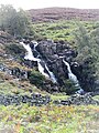 Bleabeck Force - geograph.org.uk - 5544083.jpg 1,200 × 1,600; 829 KB
-
 Bleabeck Force - geograph.org.uk - 5716959.jpg 4,301 × 3,111; 3.51 MB
-
 Bog with ruined building - geograph.org.uk - 5335720.jpg 1,499 × 886; 981 KB
-
 Boots on Bink Moss - geograph.org.uk - 4295580.jpg 640 × 480; 68 KB
-
 Border Crossing - geograph.org.uk - 3399275.jpg 600 × 450; 41 KB
-
 Boundary of MOD Range, Warcop - geograph.org.uk - 3436954.jpg 1,500 × 996; 1.32 MB
-
 Bowbank - geograph.org.uk - 3776585.jpg 1,500 × 851; 896 KB
-
 Bowbank - geograph.org.uk - 4858956.jpg 1,066 × 800; 222 KB
-
 Bowbank Fell - geograph.org.uk - 5955151.jpg 1,600 × 1,067; 285 KB
-
 Bowbank House - geograph.org.uk - 4858960.jpg 953 × 715; 188 KB
-
 Bowbank village - geograph.org.uk - 5955155.jpg 1,600 × 1,000; 350 KB
-
 Bowbank, Teesdale - geograph.org.uk - 4745643.jpg 2,592 × 1,944; 1.36 MB
-
 Bridge across The River Tees - geograph.org.uk - 2011017.jpg 600 × 450; 286 KB
-
 Bridge over Blea Beck - geograph.org.uk - 2503327.jpg 640 × 480; 70 KB
-
 Bridge over Green Grain - geograph.org.uk - 4295765.jpg 800 × 600; 144 KB
-
 Bridleway across Birk Rigg - geograph.org.uk - 3586677.jpg 2,642 × 1,722; 1.32 MB
-
 Bridleway materialises on Collin Hill - geograph.org.uk - 5800500.jpg 4,608 × 2,835; 4.55 MB
-
 Building near Close House Quarry - geograph.org.uk - 934153.jpg 640 × 480; 89 KB
-
 Building north of Lune Head Beck - geograph.org.uk - 3274630.jpg 1,500 × 1,125; 1.57 MB
-
 Butts by the wall on Howside - geograph.org.uk - 2676476.jpg 640 × 480; 53 KB
-
 Byre on Wemmergill Pasture - geograph.org.uk - 5805113.jpg 5,120 × 3,200; 3.62 MB
-
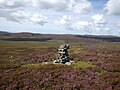
 Cairn Beside Track - geograph.org.uk - 3401991.jpg 3,072 × 2,304; 2.64 MB
-
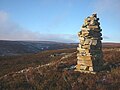
 Cairn on High Bink - geograph.org.uk - 4639182.jpg 4,608 × 3,456; 3.72 MB
-
 Cairn on Ley Seat - geograph.org.uk - 5486608.jpg 1,024 × 768; 192 KB
-
 Cairn with peat banks beyond - geograph.org.uk - 5334161.jpg 1,500 × 872; 1.04 MB
-
 Cairn, upper reaches of Hargill Beck - geograph.org.uk - 4295831.jpg 800 × 600; 134 KB
-
 Cairn, upper reaches of Hargill Beck - geograph.org.uk - 4296132.jpg 640 × 480; 87 KB
-
 Calf Holm - geograph.org.uk - 1723903.jpg 3,648 × 2,736; 4.53 MB
-
 Carlbeck Bridge - geograph.org.uk - 2510361.jpg 1,024 × 768; 218 KB
-
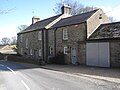
 Carlbeck Community Centre, Lunedale - geograph.org.uk - 2510379.jpg 1,024 × 768; 232 KB
-

-
 Cattle grazing on ridge - geograph.org.uk - 3775580.jpg 1,500 × 953; 982 KB
-
 Cattle Grid on the B6276 - geograph.org.uk - 5486596.jpg 1,024 × 768; 139 KB
-
 Climbing Ley Seat Edge - geograph.org.uk - 2878399.jpg 640 × 480; 83 KB
-
 Closehouse Fish Lake - geograph.org.uk - 6143183.jpg 4,299 × 2,999; 1.51 MB
-
 Closehouse Mine - geograph.org.uk - 6143159.jpg 4,319 × 2,928; 2.34 MB
-
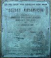 Commemorative plaque, Selset Reservoir - geograph.org.uk - 2777287.jpg 838 × 960; 356 KB
-
 Confluence of King’s Pot Sike ^ Philip Reed Beck - geograph.org.uk - 2117544.jpg 2,000 × 1,123; 2.52 MB
-

-
 Confluence of the Tees and Harwood Beck - geograph.org.uk - 5544171.jpg 1,600 × 982; 451 KB
-
 Conneypot Beck - geograph.org.uk - 5486834.jpg 1,024 × 768; 212 KB
-
 Convenient crossing point on Wemmergill Beck - geograph.org.uk - 5805051.jpg 5,472 × 3,648; 6.39 MB
-
 Converted Coach House - geograph.org.uk - 6100777.jpg 3,256 × 3,040; 3.11 MB
-
 Converted Coach House Wemmergill Hall - geograph.org.uk - 4858885.jpg 1,066 × 800; 295 KB
-
 Cronkley - geograph.org.uk - 1179848.jpg 640 × 480; 79 KB
-
 Cronkley Farm - geograph.org.uk - 2181687.jpg 2,000 × 1,207; 2.04 MB
-
 Cronkley Farm - geograph.org.uk - 4008264.jpg 640 × 480; 46 KB
-
 Cronkley Farm - geograph.org.uk - 4644191.jpg 640 × 480; 88 KB
-
 Cronkley Fell - geograph.org.uk - 2122115.jpg 640 × 480; 82 KB
-
 Cronkley Fell summit and trig point - geograph.org.uk - 2760947.jpg 3,072 × 2,304; 1.23 MB
-
 Cronkley Fell trig point - geograph.org.uk - 5364285.jpg 4,320 × 3,240; 2.74 MB
-
 Cronkley Pasture - geograph.org.uk - 4644170.jpg 640 × 480; 104 KB
-

-
 Cronkley Scar from the Pennine Way - geograph.org.uk - 2010904.jpg 600 × 450; 247 KB
-
 Crossthwaite Common north-east of Harter Fell - geograph.org.uk - 2508826.jpg 1,024 × 768; 216 KB
-
 Cumbria and County Durham Border - geograph.org.uk - 6100725.jpg 3,581 × 1,679; 2.4 MB
-
 Cumbria nd County Durham Border - geograph.org.uk - 4857785.jpg 917 × 687; 134 KB
-
 Curious fenced area on moorland - geograph.org.uk - 5326192.jpg 1,500 × 806; 927 KB
-
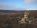
 Currick amid embedded rocks - geograph.org.uk - 5334107.jpg 1,500 × 955; 1.12 MB
-
 Curry Stool on Bink Moss - geograph.org.uk - 850888.jpg 640 × 480; 162 KB
-
 Danger path - geograph.org.uk - 1058225.jpg 640 × 427; 58 KB
-

-
 Dirty Pool - geograph.org.uk - 1260870.jpg 640 × 480; 104 KB
-
-
 Disused Quarry near Lune Head Farm - geograph.org.uk - 4858316.jpg 945 × 709; 172 KB
-
 Disused railway viaduct near Mickleton - geograph.org.uk - 2779500.jpg 3,072 × 2,304; 1.06 MB
-
 Dow Crag - geograph.org.uk - 2878246.jpg 640 × 480; 84 KB
-
 Dow Crag - geograph.org.uk - 6110217.jpg 1,600 × 983; 613 KB
-
 Dow Crag from county boundary - geograph.org.uk - 3274921.jpg 1,500 × 968; 1.4 MB
-
 Dow Hill - geograph.org.uk - 1636250.jpg 640 × 417; 89 KB
-
 Dry Beck between Noon Hill and White Rigg - geograph.org.uk - 3586817.jpg 3,648 × 2,736; 2.55 MB
-
 Dry valley above Bowbank - geograph.org.uk - 1204839.jpg 640 × 427; 70 KB
-
 Drystone dykes at Bowbank - geograph.org.uk - 5850243.jpg 1,600 × 1,067; 297 KB
-
 Dwellings near Low Nook - geograph.org.uk - 6100912.jpg 4,608 × 3,456; 5.15 MB
-
 East towards the Lune - geograph.org.uk - 5364639.jpg 4,320 × 3,240; 4.46 MB
-
 Eastern slope of Noon Hill - geograph.org.uk - 2496406.jpg 1,500 × 1,013; 1.22 MB
-

-
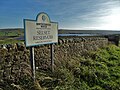
 Entrance to Mickleton - geograph.org.uk - 3203604.jpg 640 × 444; 55 KB
-
 Estate road and Green Grain - geograph.org.uk - 3704107.jpg 1,500 × 977; 1.34 MB
-
 Estate road at White Band - geograph.org.uk - 5334189.jpg 1,500 × 1,125; 1.47 MB
-
 Estate road below Noon Hill - geograph.org.uk - 3229597.jpg 1,500 × 994; 1.18 MB
-
 Estate road climbing beside Green Grain - geograph.org.uk - 3704090.jpg 1,500 × 1,125; 1.32 MB
-
 Estate road with cattle grid - geograph.org.uk - 5325124.jpg 1,500 × 855; 996 KB
-
 Estate road with peat banks - geograph.org.uk - 5334000.jpg 1,500 × 915; 1.29 MB
-
 Falcon Clints - geograph.org.uk - 4643747.jpg 640 × 480; 113 KB
-
 Farm building, Wythes Hill - geograph.org.uk - 2676465.jpg 640 × 480; 60 KB
-
 Farm Buildings for Scarhead Farm - geograph.org.uk - 4858863.jpg 1,066 × 800; 230 KB
-
 Farm road at Wythes Hill - geograph.org.uk - 4392278.jpg 3,240 × 4,320; 3.03 MB
-
 Farmhouse and Road Junction at Bed-le-Moor Hill - geograph.org.uk - 4858899.jpg 1,066 × 800; 232 KB
-
 Farmhouse at Grassholme Farm - geograph.org.uk - 3259794.jpg 3,648 × 2,736; 3.54 MB
-
 Fell Dike Sike - geograph.org.uk - 1690572.jpg 640 × 480; 97 KB
-
 Fellside ruin near Birk Rigg - geograph.org.uk - 5364310.jpg 3,240 × 4,320; 3.87 MB
-
 Fence across moorland - geograph.org.uk - 5325144.jpg 1,500 × 795; 824 KB
-
 Fence at western end of Mickle Fell plateau - geograph.org.uk - 5835546.jpg 1,500 × 962; 1.36 MB
-
 Fence by Merry Gill - geograph.org.uk - 2676473.jpg 640 × 480; 70 KB
-
 Fence line crossing Benty Hill - geograph.org.uk - 6101955.jpg 1,600 × 1,200; 667 KB
-
 Fence near Bink Moss - geograph.org.uk - 2796007.jpg 640 × 480; 72 KB
-
 Fence on north side of Mickle Fell - geograph.org.uk - 5144114.jpg 1,499 × 945; 1.13 MB
-
 Fence with gate on Pind Hill - geograph.org.uk - 4253005.jpg 1,500 × 1,016; 1.66 MB
-
 Fenced Off Grouse Shooting Butt - geograph.org.uk - 3401937.jpg 3,068 × 2,298; 3.33 MB
-
 Field Barn near Cross Hill - geograph.org.uk - 4858357.jpg 1,066 × 800; 249 KB
-
 Field barn, Lunedale - geograph.org.uk - 6143029.jpg 4,320 × 3,240; 1.63 MB
-
 Field beside River Lune - geograph.org.uk - 2690135.jpg 1,500 × 1,125; 1.16 MB
-
 Fields on north side of River Lune - geograph.org.uk - 5027041.jpg 1,500 × 832; 1,017 KB
-
 Fields west of the Pennine Way - geograph.org.uk - 2510493.jpg 1,024 × 769; 219 KB
-
 Fish Lake - geograph.org.uk - 3046664.jpg 1,500 × 927; 1.13 MB
-
-
 Fish Lake dam - geograph.org.uk - 2757608.jpg 640 × 480; 83 KB
-
 Flag Down - geograph.org.uk - 4642263.jpg 4,608 × 3,456; 3.27 MB
-
 Flooded shake hole on slope of Bink Moss - geograph.org.uk - 3704048.jpg 1,500 × 1,000; 1.19 MB
-
 Following the fence across Dry Gill - geograph.org.uk - 4295796.jpg 640 × 480; 82 KB
-
 Following the fence west of Bink Moss - geograph.org.uk - 4295783.jpg 800 × 600; 127 KB
-
 Footbridge on Lune Head Moss - geograph.org.uk - 5487082.jpg 1,024 × 768; 234 KB
-
 Footbridge on the Pennine Way - geograph.org.uk - 5544126.jpg 1,200 × 1,600; 726 KB
-
 Footbridge over Blea Beck - geograph.org.uk - 5544078.jpg 1,200 × 1,311; 665 KB
-
 Footbridge over Connypot Beck - geograph.org.uk - 3168572.jpg 1,500 × 1,016; 1.17 MB
-
 Footbridge over Connypot Beck - geograph.org.uk - 5486832.jpg 1,024 × 768; 208 KB
-
 Footbridge over Long Grain - geograph.org.uk - 5336917.jpg 1,200 × 1,600; 594 KB
-
 Footbridge, Connypot Beck - geograph.org.uk - 4642292.jpg 4,608 × 3,456; 3.47 MB
-
 Footbridge, Force Beck - geograph.org.uk - 4642308.jpg 4,608 × 2,938; 3.32 MB
-
 Force Beck - geograph.org.uk - 3169221.jpg 1,500 × 1,125; 1.26 MB
-
 Force Beck - geograph.org.uk - 4642313.jpg 4,608 × 3,456; 3.73 MB
-
 Ford At Hargill Beck - geograph.org.uk - 3399231.jpg 3,072 × 2,304; 4.11 MB
-
 Ford at Lune Head Farm - geograph.org.uk - 5719294.jpg 4,032 × 3,024; 2.24 MB
-
 Ford to cross Blea Beck - geograph.org.uk - 3585480.jpg 3,648 × 2,736; 2.03 MB
-
 Forest in Teesdale - geograph.org.uk - 5364580.jpg 4,320 × 2,112; 1.54 MB
-
 Former Chapel - geograph.org.uk - 6100761.jpg 4,440 × 2,743; 5.21 MB
-
 Former Primitive Methodist Chapel - geograph.org.uk - 4858893.jpg 1,066 × 800; 297 KB
-
 Foster Hush on Stainmore Common - geograph.org.uk - 2653153.jpg 3,264 × 2,448; 5.33 MB
-
 Foster's Hush - geograph.org.uk - 5408734.jpg 1,024 × 768; 322 KB
-
 Fox Earths - geograph.org.uk - 1690449.jpg 640 × 480; 139 KB
-
 Fox Earths - geograph.org.uk - 2593752.jpg 1,500 × 1,125; 1.77 MB
-
 Fox Earths Gill - geograph.org.uk - 2503277.jpg 640 × 480; 129 KB
-

-
 Gate on Pennine Way - geograph.org.uk - 4391006.jpg 4,320 × 3,240; 3.55 MB
-
 Gateway for Grassholme Lane - geograph.org.uk - 3259802.jpg 3,648 × 2,736; 2.7 MB
-
 Gentians and rocks at Thistle Green - geograph.org.uk - 5778871.jpg 2,000 × 1,500; 2.53 MB
-
 Geologists at play - geograph.org.uk - 6143138.jpg 4,320 × 3,240; 2.13 MB
-
 Goal Syke - geograph.org.uk - 4642297.jpg 4,608 × 3,456; 3.48 MB
-
 Grains O th' Beck Farm - geograph.org.uk - 4858386.jpg 919 × 691; 197 KB
-
 Grassholme Farm from Pennine Way - geograph.org.uk - 2510511.jpg 1,024 × 769; 238 KB
-
 Grassholme Reservoir - geograph.org.uk - 4392234.jpg 4,320 × 2,160; 1.46 MB
-
 Grassholme Reservoir - geograph.org.uk - 4887612.jpg 1,500 × 1,125; 1.27 MB
-
 Grassholme Reservoir, Lunesdale - geograph.org.uk - 4696778.jpg 1,024 × 678; 185 KB
-
 Grassy slope on north side of B6276 - geograph.org.uk - 3703455.jpg 1,500 × 1,000; 1.12 MB
-
 Green Drain - geograph.org.uk - 4639150.jpg 4,608 × 3,456; 3.75 MB
-
 Green Drain - geograph.org.uk - 4639153.jpg 4,608 × 3,456; 3.73 MB


