Category:Lurganville
English: Lurganville is a townland of 601 acres in the Electoral Division of Moira, in Civil Parish of Moira, in the Barony of Iveagh Lower, Upper Half, in the County of Down
Media in category "Lurganville"
The following 10 files are in this category, out of 10 total.
-
-
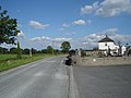
 Crossroads at Lurganville - geograph.org.uk - 2013944.jpg 640 × 480; 87 KB
-
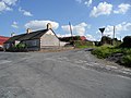
 Disused garage at Lurganville - geograph.org.uk - 2015060.jpg 640 × 480; 85 KB
-
 Flyover, Lurganville near Moira - geograph.org.uk - 3017204.jpg 640 × 405; 95 KB
-

-

-
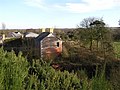 Lurganville Townland - geograph.org.uk - 680578.jpg 640 × 479; 73 KB
-
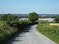 Nuthill Road, Lurganville - geograph.org.uk - 2013947.jpg 640 × 480; 96 KB
-
 The M1, Lurganville near Moira (1) - geograph.org.uk - 3017097.jpg 640 × 352; 74 KB
-
 The M1, Lurganville near Moira (2) - geograph.org.uk - 3017186.jpg 640 × 353; 73 KB


_-_geograph.org.uk_-_3017097.jpg)
_-_geograph.org.uk_-_3017186.jpg)