Category:Luston
village in United Kingdom  | |||||
| Upload media | |||||
| Instance of | |||||
|---|---|---|---|---|---|
| Location | Herefordshire, West Midlands, England | ||||
 | |||||
Cymraeg: Pentref a chymuned yn Lloegr ydy Luston. Mae wedi'i leoli 3km i'r gogledd o Leominster ar y B 4361. Mae'r pentref yn y leoliad y 'Holy Well' sy'n roedd yn darparu dŵr i'r pentref am mlynyddoed lawer. (→Luston)
English: Luston is a village and civil parish in north Herefordshire. It is approximately three miles north of Leominster on the B4361 road. The parish contains the main village and the hamlets of Nordan and The Broad which are south of the main village. The population of the civil parish at the 2011 census was 541. (→Luston)
Nederlands: Luston is een plaats en civil parish in het Engelse graafschap Herefordshire. In 2001 telde het civil parish 518 inwoners. Luston komt in het Domesday Book (1086) voor als 'Lustone'. (→Luston)
Polski: Luston – osada i civil parish w Anglii, w hrabstwie Herefordshire. W 2011 roku civil parish liczyła 541 mieszkańców. Luston jest wspomniana w Domesday Book (1086) jako Lustone. (→Luston)

Media in category "Luston"
The following 112 files are in this category, out of 112 total.
-

-
 Advert for farm shop south of Luston - geograph.org.uk - 4455664.jpg 1,600 × 1,200; 1.28 MB
-
 Another pond at Blackpole - geograph.org.uk - 1272390.jpg 640 × 480; 127 KB
-
 Arable field - geograph.org.uk - 5549015.jpg 1,024 × 768; 251 KB
-
 Arable field near Luston - geograph.org.uk - 5549009.jpg 1,024 × 768; 283 KB
-
 B4361 at Luston - geograph.org.uk - 4239760.jpg 1,600 × 1,065; 468 KB
-
 B4361 near Lady Meadow Farm - geograph.org.uk - 6313972.jpg 800 × 600; 69 KB
-
 B4361 north of Luston - geograph.org.uk - 4458578.jpg 1,600 × 962; 1.08 MB
-
 B4361 towards Ludlow - geograph.org.uk - 6313931.jpg 800 × 600; 66 KB
-
 B4361, Luston - geograph.org.uk - 6313963.jpg 640 × 480; 73 KB
-
 Barn, Quarry Farm - geograph.org.uk - 6313933.jpg 800 × 600; 72 KB
-
 Barns, Nordan - geograph.org.uk - 2380489.jpg 640 × 359; 233 KB
-
 Berrington ^ Eye Railway Station - geograph.org.uk - 6168183.jpg 3,648 × 2,056; 3.59 MB
-
 Black and White house at Luston - geograph.org.uk - 1286627.jpg 640 × 477; 56 KB
-
 Bury Farm, Luston - geograph.org.uk - 6313936.jpg 800 × 600; 109 KB
-
 Cawley Hall (Eye) - geograph.org.uk - 6140426.jpg 3,648 × 2,056; 3.55 MB
-
 Cawley Hall, Eye - geograph.org.uk - 221665.jpg 640 × 480; 55 KB
-
 Converted farm buildings at Luston - geograph.org.uk - 2912801.jpg 640 × 480; 94 KB
-
 Croase Farm - geograph.org.uk - 1286677.jpg 640 × 480; 107 KB
-
 Crop field near The Homestead - geograph.org.uk - 1272342.jpg 640 × 480; 88 KB
-
 Dunprowlin - geograph.org.uk - 2391700.jpg 640 × 480; 361 KB
-
 Entering Luston - geograph.org.uk - 6313934.jpg 800 × 600; 81 KB
-
 Entrance drive to The Homestead - geograph.org.uk - 1290868.jpg 640 × 480; 111 KB
-
 Entrance to Little Crows - geograph.org.uk - 1287452.jpg 640 × 480; 118 KB
-
 Entrance to Nordan Hall - geograph.org.uk - 1290841.jpg 640 × 480; 146 KB
-
 Entrance To Oaker Farm - geograph.org.uk - 1758933.jpg 640 × 480; 147 KB
-
 Entrance way off the B4361 - geograph.org.uk - 1290838.jpg 640 × 480; 112 KB
-
 Eye Lane - geograph.org.uk - 6140427.jpg 3,648 × 2,056; 3.67 MB
-
 Eye Village Hall - geograph.org.uk - 4381251.jpg 800 × 600; 117 KB
-
 Farm track near Blackpole - geograph.org.uk - 1272353.jpg 640 × 480; 108 KB
-
 Farmland at Little Crows - geograph.org.uk - 1287447.jpg 640 × 469; 69 KB
-
 Farmland near Quarry Coppice - geograph.org.uk - 1287503.jpg 640 × 480; 150 KB
-
 Farmland near The Riddle - geograph.org.uk - 1287444.jpg 640 × 480; 119 KB
-
 Farmland north of Blackpole - geograph.org.uk - 1272372.jpg 640 × 480; 94 KB
-
 Farmland south of Croase Farm - geograph.org.uk - 1287440.jpg 640 × 480; 116 KB
-
 Farmland west of Luston - geograph.org.uk - 1286664.jpg 640 × 480; 146 KB
-
 Field north of Leominster - geograph.org.uk - 6251932.jpg 640 × 443; 43 KB
-
 Footbridge near Luston - geograph.org.uk - 1285462.jpg 640 × 480; 103 KB
-
 Footpath junction west of Luston - geograph.org.uk - 1286645.jpg 640 × 480; 147 KB
-
 Footpath to Luston - geograph.org.uk - 1287426.jpg 640 × 480; 139 KB
-

-

-
-

-
 Grazing land near The Homestead - geograph.org.uk - 1290858.jpg 640 × 480; 151 KB
-
 Grazing near Nordan Farm - geograph.org.uk - 6313930.jpg 800 × 600; 65 KB
-
 House at Blackpole - geograph.org.uk - 1272375.jpg 640 × 480; 116 KB
-
 Houses on Townsend Park, Luston - geograph.org.uk - 6313961.jpg 800 × 600; 75 KB
-
 Housing Estate, Luston - geograph.org.uk - 1401284.jpg 640 × 480; 177 KB
-
 Junction Pump - geograph.org.uk - 4381272.jpg 800 × 600; 81 KB
-
 Lane At The Riddle - geograph.org.uk - 1758934.jpg 640 × 480; 230 KB
-
 Lane Near The Riddle - geograph.org.uk - 1758938.jpg 640 × 480; 173 KB
-
 Lilac Grove, Luston - geograph.org.uk - 4458532.jpg 1,600 × 1,600; 1.98 MB
-
 Luston - geograph.org.uk - 2380470.jpg 640 × 480; 265 KB
-
 Luston - geograph.org.uk - 2380485.jpg 640 × 480; 216 KB
-
 Luston - geograph.org.uk - 2457485.jpg 640 × 480; 291 KB
-
 Luston - Old Building By The B4361 - geograph.org.uk - 1401281.jpg 640 × 480; 201 KB
-
 Luston Chapel - geograph.org.uk - 1279098.jpg 640 × 480; 140 KB
-
 Luston Methodist Chapel - geograph.org.uk - 4334703.jpg 640 × 480; 295 KB
-
 Luston, Herefordshire, by the B4361.jpg 640 × 369; 84 KB
-
 Main line at Blackpole - geograph.org.uk - 1272397.jpg 640 × 480; 125 KB
-

-
 Newly cultivated ground, Luston - geograph.org.uk - 2380488.jpg 640 × 359; 201 KB
-
 Nordan Farm - geograph.org.uk - 1290849.jpg 640 × 471; 114 KB
-
 Nordan Farm - geograph.org.uk - 6313928.jpg 800 × 600; 68 KB
-
 Nordan Hall (Eyton) - geograph.org.uk - 6118810.jpg 3,648 × 2,736; 3.78 MB
-
 Nordan Hall - geograph.org.uk - 2912816.jpg 640 × 480; 133 KB
-
 Oil seed rape crop at Hill Farm - 2 - geograph.org.uk - 1287512.jpg 640 × 480; 153 KB
-
 Oil seed rape crop at Hill Farm - 3 - geograph.org.uk - 1287516.jpg 640 × 480; 152 KB
-
 Oil seed rape crop at Hill Farm - geograph.org.uk - 1287508.jpg 640 × 480; 124 KB
-
 Old Ludlow Road View - geograph.org.uk - 4381281.jpg 800 × 600; 120 KB
-
 Old Tap at Luston - geograph.org.uk - 5829164.jpg 2,048 × 1,360; 1.45 MB
-
 Ordnance Survey Rivet - geograph.org.uk - 5329298.jpg 376 × 640; 87 KB
-
 Phone box and bridge, Luston - geograph.org.uk - 4458568.jpg 1,600 × 1,200; 1.63 MB
-
 Private road at Luston Fields - geograph.org.uk - 5548917.jpg 1,024 × 768; 208 KB
-
 Pub sign, Luston - geograph.org.uk - 2380478.jpg 635 × 391; 220 KB
-
 Public footpath east of Luston - geograph.org.uk - 1279118.jpg 640 × 480; 108 KB
-
 Public footpath to Little Crows - 2 - geograph.org.uk - 1287435.jpg 640 × 480; 126 KB
-
 Public footpath to Little Crows - geograph.org.uk - 1287429.jpg 640 × 469; 146 KB
-
 Public footpath west of Luston - geograph.org.uk - 1286637.jpg 640 × 480; 172 KB
-
 Road junction on southern edge of Luston - geograph.org.uk - 4458520.jpg 1,600 × 1,200; 1.57 MB
-
 Road through Luston - geograph.org.uk - 5548910.jpg 1,024 × 768; 274 KB
-
 Road works on the B4361, Luston - geograph.org.uk - 6313939.jpg 800 × 600; 115 KB
-
 Rolling Countryside Near Quarry Farm - geograph.org.uk - 1401277.jpg 640 × 480; 214 KB
-
 Sheep by Berrington ^ Eye Railway Station - geograph.org.uk - 6168186.jpg 3,648 × 2,056; 3.21 MB
-
 Sign for the Balance Inn, Luston - geograph.org.uk - 6313958.jpg 550 × 640; 52 KB
-
 Smithy, Luston - geograph.org.uk - 2380481.jpg 640 × 480; 289 KB
-
 Solitary tree by B4361 south of Luston - geograph.org.uk - 4458512.jpg 1,600 × 1,201; 1.29 MB
-

-
 Stubble field at Luston - geograph.org.uk - 5548907.jpg 1,024 × 768; 278 KB
-
 The Balance Inn - geograph.org.uk - 1286520.jpg 640 × 468; 79 KB
-
 The Balance Inn at Luston - geograph.org.uk - 2334149.jpg 640 × 480; 65 KB
-
 The Balance Inn, Luston - geograph.org.uk - 6313940.jpg 800 × 600; 75 KB
-
 The Balance Inn, Luston and a bus stop - geograph.org.uk - 4458559.jpg 1,600 × 1,200; 1.54 MB
-
 The Homestead - geograph.org.uk - 1290865.jpg 640 × 480; 98 KB
-
 The Village of Luston - geograph.org.uk - 5722163.jpg 3,264 × 2,448; 1.73 MB
-
 Towards Mortimer's Cross - geograph.org.uk - 1561018.jpg 640 × 480; 53 KB
-
 Track junction near Blackpole - geograph.org.uk - 1272348.jpg 640 × 480; 72 KB
-
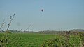
 Virgin Hot Air Balloon at Luston - geograph.org.uk - 5801720.jpg 4,096 × 2,730; 5.29 MB
-
 Virgin Hot Air Balloon near Luston - geograph.org.uk - 6148828.jpg 3,648 × 2,056; 2.65 MB
-
 B4361 Approaching Quarry Farm - geograph.org.uk - 1401275.jpg 640 × 480; 203 KB
-
 B4361 At Nordan Hall - geograph.org.uk - 1401274.jpg 640 × 480; 191 KB
-
 B4361 In Luston - geograph.org.uk - 1401278.jpg 640 × 480; 186 KB
-
 B4361 Near Lady Meadow - geograph.org.uk - 1401304.jpg 640 × 480; 199 KB
-
 Blocked Footpath Notices - geograph.org.uk - 1401251.jpg 640 × 480; 269 KB
-
 Cottage By The B4361 - geograph.org.uk - 1401283.jpg 640 × 480; 170 KB
-
 Cottages By The B4361 - geograph.org.uk - 1401272.jpg 640 × 480; 166 KB
-

-
 Luston - geograph.org.uk - 60490.jpg 640 × 480; 94 KB
-
 Near Luston - geograph.org.uk - 82080.jpg 640 × 480; 81 KB
-
 Near Luston - geograph.org.uk - 82575.jpg 640 × 480; 67 KB
-
 Near Luston - geograph.org.uk - 82578.jpg 640 × 480; 64 KB


_-_geograph.org.uk_-_6140426.jpg)


_-_geograph.org.uk_-_6118810.jpg)


