Category:Lydford-on-Fosse
English: Lydford-on-Fosse is a village and civil parish in the Mendip district of Somerset, England. The parish includes the hamlet of East Lydford.
village in Somerset, England, UK  | |||||
| Upload media | |||||
| Instance of | |||||
|---|---|---|---|---|---|
| Location | Mendip, Somerset, South West England, England | ||||
 | |||||
Subcategories
This category has the following 2 subcategories, out of 2 total.
E
- East Lydford (6 F)
W
Media in category "Lydford-on-Fosse"
The following 96 files are in this category, out of 96 total.
-
 'Fair View' - geograph.org.uk - 5896719.jpg 1,024 × 807; 248 KB
-
 'Toy Farm' - geograph.org.uk - 5896445.jpg 1,024 × 845; 170 KB
-
 A37 - geograph.org.uk - 252815.jpg 640 × 480; 79 KB
-
 A37 northbound - geograph.org.uk - 3004138.jpg 640 × 480; 81 KB
-
 A37 northbound - geograph.org.uk - 3004154.jpg 640 × 451; 69 KB
-
 A37 northbound - geograph.org.uk - 3004169.jpg 640 × 439; 39 KB
-
 A37 northbound - geograph.org.uk - 3004173.jpg 640 × 448; 51 KB
-
 A37 northbound - geograph.org.uk - 3004182.jpg 640 × 480; 52 KB
-
 A37 northbound - geograph.org.uk - 3004192.jpg 640 × 369; 49 KB
-
 A37 northbound - geograph.org.uk - 3004205.jpg 640 × 453; 69 KB
-
 A37 northbound - geograph.org.uk - 3004219.jpg 640 × 480; 64 KB
-
 Autumn trees by the river Brue - geograph.org.uk - 2138906.jpg 1,024 × 681; 190 KB
-
 Autumnal colours - geograph.org.uk - 2138915.jpg 1,024 × 537; 99 KB
-
 Autumnal colours - geograph.org.uk - 4862504.jpg 640 × 426; 54 KB
-
 B3153, Keinton Mandeville - geograph.org.uk - 5650734.jpg 1,024 × 683; 320 KB
-
 Bales and barn - geograph.org.uk - 5437007.jpg 640 × 381; 41 KB
-
 Bales and barn - geograph.org.uk - 5668296.jpg 640 × 425; 52 KB
-
 Barn and bales - geograph.org.uk - 5557799.jpg 640 × 326; 39 KB
-
 Barn and bales - geograph.org.uk - 5696534.jpg 640 × 426; 65 KB
-
 Barns - geograph.org.uk - 5452733.jpg 640 × 426; 32 KB
-
 Bothering to visit the square - geograph.org.uk - 5650791.jpg 1,024 × 683; 434 KB
-
 Bridge over River Brue at West Lydford - geograph.org.uk - 5896489.jpg 1,024 × 768; 241 KB
-
 Buildings at Rubbery Farm - geograph.org.uk - 2868833.jpg 640 × 367; 48 KB
-
 Construction, Keinton Mandeville - geograph.org.uk - 5650733.jpg 1,024 × 683; 344 KB
-
 Cooper's Farm - geograph.org.uk - 5896747.jpg 1,024 × 779; 197 KB
-
 Cross Keys and Village Store - geograph.org.uk - 3371225.jpg 640 × 426; 72 KB
-

-
 Dial's Gate Lane - geograph.org.uk - 5896752.jpg 1,024 × 808; 201 KB
-
 Ditch and hedge - geograph.org.uk - 5778402.jpg 640 × 377; 48 KB
-
 East Lydford - geograph.org.uk - 6054896.jpg 1,024 × 681; 126 KB
-
 East Lydford, Church of St. Mary - geograph.org.uk - 2931631.jpg 900 × 696; 557 KB
-
 Entrance gate, Fosse Farm - geograph.org.uk - 5896726.jpg 1,024 × 838; 259 KB
-
 Farm track, east of Dial's Gate Lane - geograph.org.uk - 5896730.jpg 1,024 × 801; 182 KB
-
 Farmland at East Lydford - geograph.org.uk - 2521215.jpg 640 × 381; 125 KB
-
 Farmland by Lydford Lane - geograph.org.uk - 4862503.jpg 640 × 426; 55 KB
-
 Farmland near East Lydford - geograph.org.uk - 5557794.jpg 640 × 426; 47 KB
-
 Farmland, Toy Farm - geograph.org.uk - 4862501.jpg 640 × 426; 52 KB
-
 Field - geograph.org.uk - 6054895.jpg 1,024 × 681; 148 KB
-
 Field near East Lydford - geograph.org.uk - 5904494.jpg 1,024 × 681; 100 KB
-
 Field near wheathill - geograph.org.uk - 5822171.jpg 1,024 × 681; 95 KB
-
 Field, Lydford - geograph.org.uk - 5650741.jpg 1,024 × 683; 306 KB
-
 Field, Wheathill - geograph.org.uk - 4768764.jpg 3,072 × 1,425; 589 KB
-
 Fields, Lydford - geograph.org.uk - 5650747.jpg 1,024 × 683; 253 KB
-
 Fosse Way - geograph.org.uk - 4772785.jpg 640 × 480; 49 KB
-
 Grazing land, Wheathill - geograph.org.uk - 5114287.jpg 640 × 426; 31 KB
-
 Hay barn - geograph.org.uk - 4862496.jpg 640 × 426; 56 KB
-
 Hedge - geograph.org.uk - 5557798.jpg 640 × 426; 54 KB
-
 Hedge, Perry's Bridge - geograph.org.uk - 4936271.jpg 640 × 426; 41 KB
-
 High Street, West Lydford - geograph.org.uk - 5896491.jpg 1,024 × 794; 231 KB
-
 House on the A37, Lydford on Fosse - geograph.org.uk - 5706050.jpg 2,266 × 1,676; 1.37 MB
-
 Houses in Lydford-on-Fosse - geograph.org.uk - 5896463.jpg 1,024 × 783; 172 KB
-
 Large field - geograph.org.uk - 4862507.jpg 600 × 640; 44 KB
-
 Lydford stores.jpg 640 × 450; 70 KB
-
 Lydford-on-Fosse day nursery - geograph.org.uk - 5706051.jpg 2,304 × 1,728; 820 KB
-
 Near East Lydford - geograph.org.uk - 5184419.jpg 640 × 426; 47 KB
-
 Near East Lydford - geograph.org.uk - 5436999.jpg 640 × 426; 41 KB
-
 Near East Lydford - geograph.org.uk - 5904486.jpg 1,024 × 681; 93 KB
-
 Newclose Farm - geograph.org.uk - 5114295.jpg 640 × 455; 38 KB
-

-
 Old Rectory Cottage - geograph.org.uk - 5896493.jpg 1,024 × 768; 180 KB
-
 Old School House, West Lydford - geograph.org.uk - 5896492.jpg 1,024 × 791; 207 KB
-
 Park Wood, Hornblotton - geograph.org.uk - 4449731.jpg 800 × 533; 168 KB
-
 Petol station at Lydford-on-Fosse - geograph.org.uk - 5896467.jpg 1,024 × 780; 161 KB
-
 Poultry shed - geograph.org.uk - 5391948.jpg 640 × 426; 42 KB
-
 Railway bridge near East Lydford - geograph.org.uk - 5896451.jpg 1,024 × 768; 192 KB
-
 River Brue at West Lydford - geograph.org.uk - 2139091.jpg 1,024 × 813; 336 KB
-

-

-

-
 Rubbery Farm - geograph.org.uk - 5114291.jpg 640 × 426; 37 KB
-
 Rubbery Farm - geograph.org.uk - 5391953.jpg 640 × 426; 38 KB
-
 Scrapyard - geograph.org.uk - 4862505.jpg 640 × 426; 60 KB
-
 Sheep grazing - geograph.org.uk - 5557793.jpg 640 × 354; 52 KB
-
 Somerset pasture - geograph.org.uk - 5557791.jpg 640 × 612; 63 KB
-

-

-
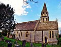
 St Peter's Church, West Lydford - geograph.org.uk - 5896474.jpg 1,024 × 791; 178 KB
-
 Terraced cottages on the B3153 - geograph.org.uk - 5896455.jpg 1,024 × 770; 190 KB
-
 The Home Farm - geograph.org.uk - 5510111.jpg 640 × 426; 38 KB
-
 The Home Farm - geograph.org.uk - 5557796.jpg 640 × 426; 53 KB
-
 Tree in a hedge - geograph.org.uk - 4862499.jpg 640 × 426; 57 KB
-
 Tree in a hedge - geograph.org.uk - 5696538.jpg 640 × 426; 64 KB
-
 Trees and farmland near the Fosse Way - geograph.org.uk - 4768707.jpg 1,920 × 1,130; 449 KB
-
 View to East Lydford - geograph.org.uk - 5696539.jpg 640 × 426; 54 KB
-
 View towards Rubbery Farm - geograph.org.uk - 4936257.jpg 640 × 358; 24 KB
-
 Village hall, West Lydford - geograph.org.uk - 5896476.jpg 1,024 × 769; 218 KB
-
 War memorial, West Lydford - geograph.org.uk - 5896487.jpg 1,024 × 768; 211 KB
-
 Westwood Villas - geograph.org.uk - 5896738.jpg 1,024 × 768; 136 KB
-
 Woodland and farmland - geograph.org.uk - 5184416.jpg 640 × 497; 41 KB
-
 A37 road junction - geograph.org.uk - 1805779.jpg 640 × 427; 73 KB
-
 Bridge on Macmillan Way - geograph.org.uk - 542804.jpg 640 × 480; 145 KB
-
 Fields near Babcary - geograph.org.uk - 542805.jpg 640 × 480; 90 KB
-
 Macmillan Way - geograph.org.uk - 542802.jpg 640 × 480; 130 KB
-

-
 Rubbery Farm - geograph.org.uk - 542803.jpg 640 × 480; 97 KB
-
 Stile access to Babcary Meadows - geograph.org.uk - 542827.jpg 640 × 480; 154 KB


_-_geograph.org.uk_-_2310537.jpg)


