Category:Madron
civil parish and village in west Cornwall, England  | |||||
| Upload media | |||||
| Instance of | |||||
|---|---|---|---|---|---|
| Location | Cornwall, South West England, England | ||||
| Different from | |||||
 | |||||
Deutsch: Madron ist ein Ort und eine Gemeinde im District Penwith der Grafschaft Cornwall in England. Die Gemeinde umfasst die Siedlungen Tredinnick, Lower Ninnes, New Mill, Newbridge und Tregavarah. Insgesamt grenzt sie an sieben Gemeinden des Districts.
English: Madron is a village and civil parish in west Cornwall in the United Kingdom. The parish encompasses the villages of Tredinnick, Lower Ninnes, New Mill, Newbridge and Tregavarah and is bounded by the parishes of Sancreed and St Just to the west, by Zennor and Morvah to the north, by the sea and the parish of Paul in the south and by the parishes of Gulval and Penzance to the east.
Subcategories
This category has the following 25 subcategories, out of 25 total.
B
- Bodrifty Iron Age Settlement (5 F)
- Boscathnoe Cross (4 F)
- Boswarthen Cross (6 F)
C
- Carfury (14 F)
- Chûn Castle (18 F)
L
- Lanyon (Madron) (5 F)
- Lanyon Quoit (80 F)
- Lesingey Round (9 F)
M
- Madron Carn (18 F)
- Mên Scryfa (11 F)
- Mên-an-Tol (54 F)
- Mulfra Quoit (16 F)
N
P
- Parc an Growes Cross (2 F)
S
T
- Tregavarah (3 F)
- Trembath Cross (3 F)
- Trevaylor (9 F)
W
- Madron Well, Cornwall (32 F)
Media in category "Madron"
The following 200 files are in this category, out of 256 total.
(previous page) (next page)-
 1882 cottage at Bosullow, Cornwall.jpg 3,024 × 4,032; 2.9 MB
-
 A Cornish wall - geograph.org.uk - 5596006.jpg 1,024 × 768; 285 KB
-
 A country bus stop - geograph.org.uk - 6266469.jpg 1,024 × 768; 277 KB
-
 A few small repairs... - geograph.org.uk - 37382.jpg 640 × 480; 90 KB
-
 A path through the maize near Trengwainton Farm - geograph.org.uk - 4748697.jpg 1,600 × 1,200; 426 KB
-
 A30 towards Land's End - geograph.org.uk - 5464338.jpg 640 × 480; 109 KB
-
 Approaching Madron by Footpath - geograph.org.uk - 916073.jpg 640 × 427; 122 KB
-
 Approaching the Nine Maidens Stone Circle - geograph.org.uk - 5143835.jpg 1,024 × 768; 233 KB
-
 B3311 Near Castle Gate Farm Cornwall - geograph.org.uk - 5020902.jpg 640 × 443; 48 KB
-
 Badger's Cross - geograph.org.uk - 2052321.jpg 640 × 480; 59 KB
-
 Bedstraw Mite.jpg 1,463 × 2,273; 740 KB
-

-
 Bone Valley - junction with Gear Lane.jpg 3,024 × 4,032; 6.2 MB
-
 Bosulval - geograph.org.uk - 912919.jpg 480 × 640; 64 KB
-
 Boswarva - geograph.org.uk - 1528990.jpg 640 × 427; 88 KB
-
 Boswednan - Penwith Gate (01).jpg 2,401 × 1,419; 1.62 MB
-
 Boswednan - Penwith Gate (02).jpg 3,456 × 2,285; 2.67 MB
-
 Boundary Stone between Madron and Zennor (01).jpg 3,024 × 4,032; 5.63 MB
-
 Boundary Stone between Madron and Zennor (02).jpg 3,024 × 4,032; 4.42 MB
-
 Boundary Stone between Madron and Zennor (03).jpg 3,024 × 4,032; 5.33 MB
-
 Bracken ^ gorse on Mulfra Hill - geograph.org.uk - 4623057.jpg 1,600 × 1,200; 589 KB
-
 Break My Neck Farm - geograph.org.uk - 1617192.jpg 640 × 480; 69 KB
-
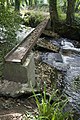
 Bridge on the boundary - geograph.org.uk - 673317.jpg 593 × 445; 100 KB
-
 Bridge over Trevaylor Stream, Gear Hill, New Mill - geograph.org.uk - 4879635.jpg 1,600 × 1,281; 283 KB
-
 Bridleway between Boswarva and Madron - geograph.org.uk - 1933759.jpg 480 × 640; 122 KB
-
 Brook Cottage - geograph.org.uk - 4623028.jpg 1,600 × 1,200; 468 KB
-
 Buryas Bridge.jpg 3,024 × 4,032; 4.86 MB
-

-
 Car park and toilets at Chysauster - geograph.org.uk - 2051508.jpg 640 × 480; 66 KB
-
 Castle An Dinas Quarry - geograph.org.uk - 5909222.jpg 1,024 × 768; 165 KB
-
 Cecidophyes rouhollah on cleavers.jpg 3,024 × 4,032; 2.5 MB
-
 Churned out - geograph.org.uk - 1849479.jpg 640 × 483; 127 KB
-
 Chyandour Stream.jpg 3,024 × 4,032; 5.59 MB
-
 Chysauster - geograph.org.uk - 5985697.jpg 4,592 × 3,448; 4.22 MB
-
 Chysauster - geograph.org.uk - 5985700.jpg 4,592 × 3,448; 3.99 MB
-
 Chysauster Farm - geograph.org.uk - 1389666.jpg 640 × 480; 72 KB
-
 Chysauster Iron Age Village - geograph.org.uk - 5743297.jpg 702 × 1,024; 127 KB
-
 Chûn Castle from the west - geograph.org.uk - 5143765.jpg 1,024 × 768; 270 KB
-
 Cornish hedges and banks, Gear Hill, south of New Mill - geograph.org.uk - 4879658.jpg 1,600 × 1,200; 453 KB
-
 Cornish hedges and walls, Try Valley - geograph.org.uk - 4879604.jpg 1,600 × 1,200; 505 KB
-
 Country lane at Tremethick Cross - geograph.org.uk - 6245120.jpg 4,032 × 3,024; 2.3 MB
-
 Courtyard house at Chysauster - geograph.org.uk - 5895283.jpg 640 × 480; 76 KB
-
 Courtyard house, Chysauster Ancient Settlement - geograph.org.uk - 5146367.jpg 1,024 × 768; 346 KB
-

-

-
 Ding Done Mine - geograph.org.uk - 5595995.jpg 768 × 1,024; 180 KB
-
 Ding Dong Mine - geograph.org.uk - 5595054.jpg 1,024 × 768; 261 KB
-
 Direction Sign - Signpost on Bosullow Common - geograph.org.uk - 6098267.jpg 687 × 1,024; 440 KB
-
 Disused building in Try Valley - geograph.org.uk - 5519958.jpg 640 × 480; 63 KB
-
 Disused trough - geograph.org.uk - 673291.jpg 593 × 445; 93 KB
-
 Dripping Leaves - geograph.org.uk - 3146865.jpg 424 × 640; 168 KB
-
 En Route Towards Mulfra Hill - geograph.org.uk - 4488275.jpg 2,560 × 1,920; 2.62 MB
-
 Entrance to Trengwainton Gardens - geograph.org.uk - 5324257.jpg 4,000 × 3,000; 4.07 MB
-
 Entrance to Trewidden Gardens - geograph.org.uk - 5464332.jpg 640 × 480; 105 KB
-
 Entrance to Truthall CP School - geograph.org.uk - 1617189.jpg 640 × 480; 65 KB
-
 Faceless - geograph.org.uk - 2367496.jpg 566 × 598; 331 KB
-
 Farm buildings at Great Bosullow - geograph.org.uk - 1932058.jpg 640 × 480; 88 KB
-
 Farm shop at Fox Farm - geograph.org.uk - 2051438.jpg 640 × 480; 87 KB
-
 Field above Tolver - geograph.org.uk - 2100272.jpg 640 × 480; 96 KB
-

-
 Field Steps ^ Stile. - panoramio.jpg 2,248 × 4,000; 4.14 MB
-
 Fields in Try Valley - geograph.org.uk - 5519969.jpg 640 × 480; 59 KB
-
 Flooded track near Brook Cottage - geograph.org.uk - 4623034.jpg 1,600 × 1,200; 422 KB
-
 Foot path to Trengwainton farm - geograph.org.uk - 6264982.jpg 1,024 × 768; 259 KB
-
 Footbridge - geograph.org.uk - 3142387.jpg 640 × 427; 142 KB
-
 Footpath near Gear Hill - geograph.org.uk - 3548457.jpg 1,600 × 1,200; 606 KB
-
 Footpath near Lanyon Farm - geograph.org.uk - 5596000.jpg 1,024 × 768; 291 KB
-
 Footpath on Mulfra Hill - geograph.org.uk - 4623051.jpg 1,600 × 1,200; 565 KB
-
 Footpath On The Edge Of Madron - geograph.org.uk - 4488610.jpg 2,560 × 1,920; 2.15 MB
-
 Footpath Stile. - panoramio (1).jpg 4,000 × 3,000; 4.85 MB
-
 Fore Street (B3312) in Madron - geograph.org.uk - 5384659.jpg 4,000 × 3,000; 2.75 MB
-
 Four Parish Boundary Stone - geograph.org.uk - 5143945.jpg 1,024 × 768; 285 KB
-
 Four Parish Stone, Cornwall.jpg 3,024 × 4,032; 6.51 MB
-
 Frosted Orange larva (1).jpg 1,612 × 2,149; 860 KB
-
 Frosted Orange larva (2).jpg 441 × 588; 144 KB
-

-

-
 Gateway to Rosemorran - geograph.org.uk - 2051483.jpg 640 × 480; 92 KB
-
 Gear Lane and Gear Hill Junction.jpg 2,026 × 3,108; 1.46 MB
-
 Girder across the stream - geograph.org.uk - 3142404.jpg 427 × 640; 135 KB
-
 Guide Post at SW 451341.jpg 3,024 × 4,032; 4.27 MB
-
 Gulval Cricket Club field - geograph.org.uk - 2100279.jpg 640 × 480; 62 KB
-
 Harvested field at Chysauster - geograph.org.uk - 5743540.jpg 1,024 × 700; 139 KB
-

-
 Heathland flora on Carnaquidden Downs - geograph.org.uk - 2052171.jpg 640 × 473; 108 KB
-
 Heathland near Brook Cottage - geograph.org.uk - 4623020.jpg 1,600 × 1,200; 531 KB
-
 Higher Boskinning resident.jpg 3,024 × 4,032; 4.62 MB
-

-
 House by a lane - geograph.org.uk - 912951.jpg 640 × 480; 249 KB
-
 In Trevaylor, footpath sign and accommodation - geograph.org.uk - 4879672.jpg 1,600 × 1,200; 397 KB
-
 Junction of lanes south of Carfury - geograph.org.uk - 3632193.jpg 1,024 × 702; 167 KB
-
-
 Junction with the A3071 - geograph.org.uk - 6245118.jpg 4,032 × 3,024; 1.93 MB
-
 Kenegie Manor holiday bungalows Penzance - geograph.org.uk - 4363435.jpg 2,256 × 1,496; 1.63 MB
-
 Kenegie Manor holiday bungalows Penzance - geograph.org.uk - 4363436.jpg 2,256 × 1,496; 1.37 MB
-
 Kennels of the Western Hunt at Madron - geograph.org.uk - 1416943.jpg 640 × 480; 109 KB
-
 Lanyon Farm - geograph.org.uk - 5595283.jpg 1,024 × 768; 272 KB
-
 Lanyon Quoit and distant view of the Ding Dong Mine - geograph.org.uk - 4913660.jpg 1,600 × 1,064; 301 KB
-
 Large roadside stone - geograph.org.uk - 5595252.jpg 800 × 600; 158 KB
-
 Lawn and ha-ha, Trengwainton Gardens - geograph.org.uk - 4879721.jpg 1,600 × 1,200; 380 KB
-

-
 Lesser Celandine in Trevaylor woods - geograph.org.uk - 2313707.jpg 427 × 640; 142 KB
-

-

-
 Looking over the fields to Penzance - geograph.org.uk - 4748695.jpg 4,896 × 3,672; 6.52 MB
-
 Madron - Former Mill 01.jpg 2,983 × 3,447; 7.84 MB
-
 Madron - Former Mill 02.jpg 3,024 × 3,399; 8.08 MB
-
 Madron - Former Mill 03.jpg 2,874 × 3,624; 7.31 MB
-
 Madron - Penwith field gate.jpg 2,501 × 2,413; 2.19 MB
-
 Madron - road junction near Morvah (1).jpg 3,024 × 4,032; 3.83 MB
-
 Madron - road junction near Morvah (2).jpg 3,456 × 4,608; 3.22 MB
-
 Madron - road junction near Morvah (3).jpg 3,024 × 4,032; 3.25 MB
-
 Madron Methodist Chapel - geograph.org.uk - 5595258.jpg 1,024 × 768; 221 KB
-

-
 Madron, St. Maddern Church - geograph.org.uk - 4995200.jpg 3,610 × 2,345; 4.23 MB
-
 Madron, St. Maddern Church lych gate and Daniel's School - geograph.org.uk - 4995204.jpg 3,678 × 2,456; 4.66 MB
-

-
 Madron, St. Maddern Church, The Armstrong family monument 1 - geograph.org.uk - 4995224.jpg 3,738 × 2,594; 7.38 MB
-
 Madron, St. Maddern Church, The Armstrong family monument 2 - geograph.org.uk - 4995228.jpg 3,678 × 2,456; 6.68 MB
-
 Malacosoma neustria, Madron.jpg 3,024 × 4,032; 5.57 MB
-
 Milestone - Madron 3 - geograph.org.uk - 5293400.jpg 402 × 640; 109 KB
-

-
 Minor road junction at Trezelah - geograph.org.uk - 2052285.jpg 640 × 480; 53 KB
-
 Modern barn at Lower Trewern - geograph.org.uk - 1933296.jpg 640 × 480; 70 KB
-
 Mulfra - geograph.org.uk - 3469129.jpg 640 × 480; 94 KB
-
 Mulfra Hill - geograph.org.uk - 4488268.jpg 2,560 × 1,920; 2.29 MB
-
 Nine Maidens (Boskednan) stone circle - geograph.org.uk - 5143865.jpg 1,024 × 768; 305 KB
-
 Nine Maidens (Boskednan) stone circle - geograph.org.uk - 5143910.jpg 1,024 × 768; 348 KB
-
 Nine Maidens Stone Circle - geograph.org.uk - 5595248.jpg 1,024 × 768; 293 KB
-
 Nine Maidens Stone Circle - geograph.org.uk - 5595250.jpg 800 × 534; 129 KB
-
 No milk today - geograph.org.uk - 2046108.jpg 531 × 453; 201 KB
-

-

-
 Old iron field gates - geograph.org.uk - 1933826.jpg 640 × 480; 98 KB
-

-
 Old Milestone on Bosullow Common - geograph.org.uk - 5623424.jpg 424 × 583; 189 KB
-
 Old stone-built shed - geograph.org.uk - 5595032.jpg 1,024 × 768; 274 KB
-

-

-

-

-
 On the boundary - geograph.org.uk - 1230172.jpg 518 × 636; 99 KB
-
 Ordnance Survey Cut Mark - geograph.org.uk - 5293921.jpg 640 × 352; 99 KB
-
 Ordnance Survey Cut Mark - geograph.org.uk - 5293944.jpg 640 × 332; 106 KB
-
 Ordnance Survey Flush Bracket (1571) - geograph.org.uk - 5293919.jpg 455 × 640; 134 KB
-
 Ordnance Survey Flush Bracket 1570 - geograph.org.uk - 5431003.jpg 4,000 × 3,000; 4.28 MB
-
 Ordnance Survey Flush Bracket 1571 - geograph.org.uk - 5430978.jpg 4,000 × 3,000; 5.09 MB
-
 Outer limits - geograph.org.uk - 1232650.jpg 461 × 558; 129 KB
-
 Pasture at Trezelah - geograph.org.uk - 2052294.jpg 640 × 480; 57 KB
-
 Path below Mulfra Hill - geograph.org.uk - 5142440.jpg 1,024 × 768; 236 KB
-
 Path on Gulval Downs near Rogers Tower - geograph.org.uk - 5909235.jpg 1,024 × 768; 242 KB
-

-
 Path to Chysauster from car park - geograph.org.uk - 5985668.jpg 4,592 × 3,448; 4.71 MB
-
 Path to Chysauster from Rogers Tower - geograph.org.uk - 5909227.jpg 1,024 × 768; 290 KB
-
 Path to Madron Well Chapel - geograph.org.uk - 3721589.jpg 1,056 × 793; 898 KB
-
 Path to Madron Well Chapel - geograph.org.uk - 3721592.jpg 1,056 × 793; 1.16 MB
-
 Path to Madron Well Chapel - geograph.org.uk - 3721593.jpg 1,056 × 793; 1.12 MB
-
 Penwith madron.png 217 × 208; 32 KB
-
 Penzance - St Clare boundary stone (1).jpg 3,024 × 4,032; 7.85 MB
-
 Penzance - St Clare boundary stone (2).jpg 3,024 × 4,032; 7.91 MB
-
 Penzance bound - geograph.org.uk - 1232668.jpg 521 × 557; 98 KB
-
 Pond in Trengwainton Garden - geograph.org.uk - 4879709.jpg 1,200 × 1,600; 528 KB
-
 Pond in Trengwainton Gardens - geograph.org.uk - 5324255.jpg 4,000 × 3,000; 4.74 MB
-
-
 Puccinia umbilici on navelwort.jpg 3,024 × 2,897; 2.96 MB
-
 Replanted woodland, Trengwainton Garden - geograph.org.uk - 4879710.jpg 1,200 × 1,600; 651 KB
-
 Road (B3312) leaving Madron - geograph.org.uk - 5384647.jpg 4,000 × 3,000; 2.69 MB
-
 Road approaching Lanyon Farm - geograph.org.uk - 5596008.jpg 1,024 × 768; 268 KB
-
 Road at Landithy, Madron with the Church of St Maddern ahead - geograph.org.uk - 5384637.jpg 4,000 × 3,000; 4.26 MB
-
 Road junction and boundary stone near Upper Kerrowe - geograph.org.uk - 4879569.jpg 1,600 × 1,200; 227 KB
-
 Road junction at Badger's Cross - geograph.org.uk - 2052303.jpg 640 × 480; 61 KB
-
 Road junction at Higher Gear - geograph.org.uk - 2051502.jpg 640 × 480; 57 KB
-
 Road junction north of New Mill - geograph.org.uk - 4879616.jpg 1,600 × 1,198; 466 KB
-
 Road near Higher Boswarva - geograph.org.uk - 5384669.jpg 4,000 × 3,000; 5.04 MB
-
 Ruined farm building, Try Valley - geograph.org.uk - 4879587.jpg 1,600 × 1,200; 192 KB
-
 Sculpture "Dragon's tail" in Trengwainton Gardens - geograph.org.uk - 4879801.jpg 1,200 × 1,600; 572 KB
-
 Silage making at Dakota Farm - geograph.org.uk - 5595984.jpg 1,024 × 768; 283 KB
-
 Silage making in November - geograph.org.uk - 5595275.jpg 800 × 600; 152 KB
-
 Silhouetted Ding Dong Mine - geograph.org.uk - 5595059.jpg 1,024 × 683; 86 KB
-
 Skimmel Bridge - geograph.org.uk - 1373756.jpg 640 × 427; 114 KB
-
 Slate toposcope, The Terrace, Trengwainton Gardens - geograph.org.uk - 4879793.jpg 1,200 × 1,600; 440 KB
-
 Slow down on this narrow road - geograph.org.uk - 4879612.jpg 1,600 × 1,200; 304 KB
-
 Slug lunch - geograph.org.uk - 3146719.jpg 424 × 640; 201 KB
-
 Small pond at Bodrifty - geograph.org.uk - 1617179.jpg 640 × 480; 122 KB
-
 Soft fruit cultivation at Fox Farm - geograph.org.uk - 2051442.jpg 640 × 480; 113 KB
-
 Solitary tree by road, Try Valley - geograph.org.uk - 4879593.jpg 1,600 × 1,200; 244 KB
-

-
 Standing out - geograph.org.uk - 2514007.jpg 640 × 467; 90 KB
-
 Stenophylax permistus 2.jpg 2,386 × 3,047; 1.16 MB
-

-
 Stone outbuilding, Gear Hill, New Mill - geograph.org.uk - 4879651.jpg 1,600 × 1,200; 467 KB
-
 Stone platform, Lanyon Farm - geograph.org.uk - 5595285.jpg 1,024 × 768; 350 KB
-
 Stone walls and stone houses, New Mill - geograph.org.uk - 4879626.jpg 1,600 × 1,067; 274 KB
-
 Stream below Boswarva - geograph.org.uk - 72334.jpg 640 × 480; 215 KB
-
 The A30 at Buryas Bridge - geograph.org.uk - 6245116.jpg 4,032 × 3,024; 2.12 MB
-
 The dam of Drift Reservoir - geograph.org.uk - 3827701.jpg 1,536 × 1,152; 895 KB
-
 The entrance to Higher Trye - geograph.org.uk - 4625504.jpg 1,600 × 1,200; 512 KB
-
 The lane at Higher Trye - geograph.org.uk - 4625499.jpg 4,896 × 3,672; 7.16 MB
-
 The Old Toll House (1).jpg 3,888 × 2,592; 3.46 MB
-
 The other end - geograph.org.uk - 2198945.jpg 724 × 543; 264 KB


.jpg)
.jpg)
.jpg)
.jpg)
.jpg)


.jpg)
_in_Madron_-_geograph.org.uk_-_5384659.jpg)


.jpg)
.jpg)


.jpg)
.jpg)
.jpg)


_stone_circle_-_geograph.org.uk_-_5143865.jpg)
_stone_circle_-_geograph.org.uk_-_5143910.jpg)


_-_geograph.org.uk_-_5293919.jpg)


.jpg)
.jpg)


_leaving_Madron_-_geograph.org.uk_-_5384647.jpg)


.jpg)
