Category:Magheradartin
English: Magheradartin is a townland of 415 acres in the Electoral Division of Ballyworfy, in Civil Parish of Royal Hillsborough, in the Barony of Iveagh Lower, Upper Half, in the County of Down
Media in category "Magheradartin"
The following 4 files are in this category, out of 4 total.
-
 Magheradartin Townland - geograph.org.uk - 1484663.jpg 640 × 480; 61 KB
-
 Magheradartin Townland - geograph.org.uk - 1484666.jpg 640 × 480; 93 KB
-
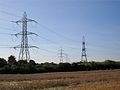 Pylons at Magheradartin - geograph.org.uk - 1484628.jpg 640 × 480; 58 KB
-
 Red berry tree at Magheradartin - geograph.org.uk - 1484708.jpg 640 × 480; 132 KB


