Category:Mahlis
| Object location | | View all coordinates using: OpenStreetMap |
|---|
human settlement in Germany   | |||||
| Upload media | |||||
| Instance of |
| ||||
|---|---|---|---|---|---|
| Location | Wermsdorf, Nordsachsen, Saxony, Germany | ||||
| Elevation above sea level |
| ||||
 | |||||
Subcategories
This category has the following 4 subcategories, out of 4 total.
B
- Bahnhof Mahlis (6 F)
H
- Herrenhaus Mahlis (12 F)
P
- Protestant Church (Mahlis) (16 F)
W
- Windmühle Mahlis (15 F)
Media in category "Mahlis"
The following 15 files are in this category, out of 15 total.
-
 Abratzky Mahlis.jpg 3,430 × 2,278; 801 KB
-
 BHG-Mahlis.jpg 4,288 × 2,848; 967 KB
-
 Dorfmitte Mahlis.jpg 8,268 × 2,437; 855 KB
-
 Mahlis 001.jpg 6,016 × 3,384; 8.3 MB
-
 Mahlis August-Bebel-Strasse 3-01.jpg 5,241 × 3,931; 15.85 MB
-
 Mahlis August-Bebel-Strasse 3.jpg 5,069 × 3,802; 12.19 MB
-
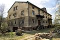
 Mahlis Ehem. Schule.jpg 5,333 × 4,000; 12.31 MB
-
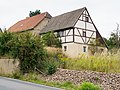
 Mahlis Gasthof Laubental.jpg 5,333 × 4,000; 7.93 MB
-
 Mahlis Groeppendorfer Strasse 29.jpg 5,161 × 3,871; 9.11 MB
-
 Mahlis Oschatzer Strasse 101-01.jpg 4,409 × 3,307; 5.47 MB
-
 Mahlis Oschatzer Strasse 101.jpg 5,333 × 4,000; 12.28 MB
-
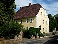
 Mahlis Pfarrhaus.jpg 4,000 × 5,333; 9.31 MB
-
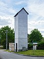 Mahlis Schlauchturm.jpg 4,000 × 5,333; 6.99 MB
-
 MahlisPfarrhs.JPG 2,864 × 2,144; 1.28 MB
-
 Ortsplan Mahlis.jpg 1,368 × 1,179; 223 KB


