Category:Maisach

municipality of Germany    | |||||
| Upload media | |||||
| Instance of |
| ||||
|---|---|---|---|---|---|
| Part of |
| ||||
| Named after | |||||
| Location | Fürstenfeldbruck, Upper Bavaria, Bavaria, Germany | ||||
| Head of government |
| ||||
| Population |
| ||||
| Area |
| ||||
| Elevation above sea level |
| ||||
| Different from | |||||
| official website | |||||
 | |||||
Subcategories
This category has the following 4 subcategories, out of 4 total.
B
C
D
T
Media in category "Maisach"
The following 17 files are in this category, out of 17 total.
-
 Bergkirchen an der Maisach.jpg 12,461 × 3,146; 30.85 MB
-
 DEU Maisach COA.svg 512 × 559; 5 KB
-
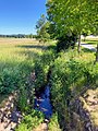 Erlbach (Maisach).jpg 3,024 × 4,032; 4.46 MB
-
 Feld bei Neu-Esting - geo.hlipp.de - 35161.jpg 640 × 480; 36 KB
-
 Maisach - Blick auf Fliegerhorst - geo.hlipp.de - 25843.jpg 640 × 480; 48 KB
-
 Maisach - Blick auf Fliegerhorst - geo.hlipp.de - 25844.jpg 640 × 480; 28 KB
-
 Maisach - Orteingang - geo.hlipp.de - 25845.jpg 640 × 480; 64 KB
-
 Maisach 14,0-km Maisach-Ort.jpg 800 × 600; 192 KB
-
 Maisach 33,0-km Weissenzell.jpg 800 × 600; 224 KB
-
 Maisach in ffb.svg 435 × 330; 103 KB
-
 Maisach in FFB.svg 446 × 390; 976 KB
-
 MAISACH ROTTBACH nieder.png 480 × 360; 5 KB
-
 MAISACH ROTTBACH nieder.svg 512 × 427; 21 KB
-
 Maisach-Advent-2021.jpg 3,840 × 960; 2.03 MB
-
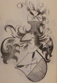 Wappen der Herren von Maisach.PNG 390 × 567; 392 KB
-
 Wappen Maisach.png 361 × 375; 14 KB
-
 Weg bei Gernlinden - geo.hlipp.de - 25834.jpg 640 × 480; 58 KB
.jpg)


