Category:Malew

parish of the Isle of Man  | |||||
| Upload media | |||||
| Instance of |
| ||||
|---|---|---|---|---|---|
| Location |
| ||||
| official website | |||||
 | |||||
Subcategories
This category has the following 7 subcategories, out of 7 total.
Media in category "Malew"
The following 200 files are in this category, out of 398 total.
(previous page) (next page)-

-
 18th Green Castletown Golf Course - geograph.org.uk - 3109106.jpg 800 × 600; 122 KB
-
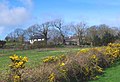
 A Ballasalla Farm House - geograph.org.uk - 1816842.jpg 640 × 428; 42 KB
-
 A cosy nook for the view^ - geograph.org.uk - 3109060.jpg 800 × 600; 155 KB
-
 A Davison's ice cream van - geograph.org.uk - 5055115.jpg 640 × 427; 76 KB
-
 A John Deere 6155R - geograph.org.uk - 5055351.jpg 640 × 427; 58 KB
-

-
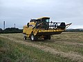 A New Holland combine harvester - geograph.org.uk - 2596507.jpg 3,296 × 2,472; 1.96 MB
-

-

-
 A26, approaching St Mark's - geograph.org.uk - 1845732.jpg 800 × 600; 91 KB
-
 A26, between Braaid and St Mark's - geograph.org.uk - 1845723.jpg 800 × 600; 234 KB
-
 A3 entering Foxdale - geograph.org.uk - 1854482.jpg 800 × 600; 152 KB
-
 A3 Foxdale Road approaching A36 junction - geograph.org.uk - 1854463.jpg 800 × 600; 142 KB
-
 A3 Foxdale Road approaching Ballahott - geograph.org.uk - 1854407.jpg 800 × 600; 144 KB
-
 A3 Foxdale Road approaching Ballamodha - geograph.org.uk - 1854438.jpg 640 × 480; 125 KB
-
 A3 Foxdale Road approaching Foxdale - geograph.org.uk - 1854471.jpg 800 × 600; 126 KB
-
 A3 Foxdale Road, Ballamodha - geograph.org.uk - 1854453.jpg 800 × 600; 140 KB
-
 A3 South - geograph.org.uk - 1954949.jpg 1,024 × 768; 73 KB
-
 A5 Ballalonney - geograph.org.uk - 1957472.jpg 1,024 × 768; 161 KB
-
 A5 Ballasalla - geograph.org.uk - 1845787.jpg 800 × 600; 96 KB
-
 A5 Level crossing at Ballasalla - geograph.org.uk - 3107042.jpg 4,608 × 3,456; 4.4 MB
-
 Abbey Church Ballasalla - geograph.org.uk - 2738158.jpg 2,472 × 3,296; 1.77 MB
-
 Abbey Church House Ballasalla - geograph.org.uk - 2738173.jpg 3,296 × 2,472; 1.88 MB
-
 Activity trail in South Barrule forest - geograph.org.uk - 6195142.jpg 683 × 1,024; 225 KB
-
-
 Airport Road, Derbyhaven - geograph.org.uk - 5726890.jpg 1,600 × 1,065; 478 KB
-
 Allis Chalmers Combine Harvester - geograph.org.uk - 5055406.jpg 640 × 427; 70 KB
-
 Another Davison's ice cream van - geograph.org.uk - 5055144.jpg 640 × 427; 74 KB
-
 Ape Mann adventure park (1) - geograph.org.uk - 6195145.jpg 683 × 1,024; 333 KB
-
 Ape Mann adventure park (2) - geograph.org.uk - 6195148.jpg 716 × 1,024; 314 KB
-
 Athol Bridge - geograph.org.uk - 1844842.jpg 800 × 600; 325 KB
-

-
 Baled grass awaiting collection - geograph.org.uk - 5080343.jpg 1,024 × 768; 130 KB
-
 Ballachrink, sheep grazing - geograph.org.uk - 4616937.jpg 1,024 × 768; 145 KB
-
 Ballagarey Methodist Chapel - geograph.org.uk - 3627475.jpg 640 × 480; 47 KB
-
 Ballahott, cattle grazing - geograph.org.uk - 4617150.jpg 1,024 × 768; 153 KB
-
 Ballasalla - Houses on the Main Road A5 - geograph.org.uk - 5478857.jpg 1,440 × 1,080; 960 KB
-
 Ballasalla - New Flats - geograph.org.uk - 5478833.jpg 1,440 × 1,080; 961 KB
-
 Ballasalla - St Mary's Church - geograph.org.uk - 5477504.jpg 1,440 × 1,080; 976 KB
-
 Ballasalla pumping station - geograph.org.uk - 5412255.jpg 640 × 427; 77 KB
-
 Ballasalla Road - geograph.org.uk - 1980024.jpg 2,816 × 2,112; 1.09 MB
-
 Ballasalla Roundabout - geograph.org.uk - 1979989.jpg 2,816 × 2,112; 1.05 MB
-
 Ballasalla station - geograph.org.uk - 6177003.jpg 5,202 × 3,465; 4.92 MB
-
 Barley field, east of Ballasalla - geograph.org.uk - 5080363.jpg 1,024 × 768; 178 KB
-
 Barley field, north-east of Ballaquaggan Farm - geograph.org.uk - 5084552.jpg 1,024 × 768; 162 KB
-
 Barns at Ballaquaggan Farm - geograph.org.uk - 5084547.jpg 1,024 × 768; 188 KB
-
-

-

-
-

-

-

-

-

-

-

-

-

-

-

-

-

-

-

-

-

-

-

-

-

-

-

-

-

-

-

-

-

-

-

-
-

-

-

-

-

-

-

-

-

-

-

-

-

-

-

-
-

-

-

-

-

-

-
 Beach at Scarlett Point - geograph.org.uk - 4429540.jpg 424 × 640; 57 KB
-
 Beech Grove, Ballasalla - geograph.org.uk - 5076803.jpg 1,024 × 615; 158 KB
-
 Bend in the A3 by Malew Church - geograph.org.uk - 1854386.jpg 800 × 600; 113 KB
-
 Billown, cattle grazing - geograph.org.uk - 4615707.jpg 1,024 × 768; 140 KB
-
 Blue faced Leicester sheep - geograph.org.uk - 5058992.jpg 640 × 427; 65 KB
-
 Boating Pond in Silverdale Glen - geograph.org.uk - 5742734.jpg 640 × 424; 71 KB
-
 Breakers ^ Black Rocks - geograph.org.uk - 4429433.jpg 640 × 424; 80 KB
-
 Bridge over the Silver Burn river - geograph.org.uk - 3114416.jpg 600 × 800; 113 KB
-
 Brown cows - geograph.org.uk - 3167051.jpg 2,592 × 1,936; 1.23 MB
-
 Bungalows on Meadow Court, Ballasalla - geograph.org.uk - 5727296.jpg 1,600 × 1,065; 360 KB
-
 Castletown Bay in a gale force 9 - geograph.org.uk - 2597665.jpg 3,296 × 2,472; 1.91 MB
-
 Castletown from Scarlett - geograph.org.uk - 4759941.jpg 1,600 × 789; 315 KB
-
 Castletown Golf Course - geograph.org.uk - 4842870.jpg 640 × 480; 77 KB
-
 Castletown Golf Links Hotel - geograph.org.uk - 3109032.jpg 800 × 600; 94 KB
-
 Castletown Golf Links Hotel - geograph.org.uk - 5726900.jpg 1,600 × 1,065; 557 KB
-
 Castletown Golf Links Hotel and beyond - a 120 ° panorama - geograph.org.uk - 3108987.jpg 3,840 × 1,080; 1.07 MB
-

-
 Castletown, Great Meadow - geograph.org.uk - 4615747.jpg 1,024 × 768; 186 KB
-
 Celtic cross in Ballasalla - geograph.org.uk - 2118807.jpg 600 × 800; 190 KB
-
 Change here for Ronaldsway Airport - geograph.org.uk - 3114371.jpg 800 × 600; 178 KB
-
 Clifftop and Raad ny Foillan - geograph.org.uk - 3409467.jpg 640 × 424; 66 KB
-
 Clifftop Near Santon Gorge - geograph.org.uk - 3409460.jpg 640 × 424; 85 KB
-
 Coastal Pasture Near Ballasalla - geograph.org.uk - 3935682.jpg 640 × 436; 41 KB
-
 Coastal Path and Final Approach - geograph.org.uk - 3410520.jpg 640 × 424; 74 KB
-
 Coastal path at Castaltown Golf Links - geograph.org.uk - 5726908.jpg 1,600 × 1,065; 612 KB
-
 Coastal Path at Derby Haven - geograph.org.uk - 5726886.jpg 1,600 × 1,065; 621 KB
-
 Coastal Path at Poyllvaaish - geograph.org.uk - 5727151.jpg 1,600 × 1,065; 619 KB
-
 Coastal path at Ronaldsway airport - geograph.org.uk - 5726882.jpg 1,600 × 1,065; 584 KB
-
 Coastal path at Scarlett - geograph.org.uk - 5727119.jpg 1,600 × 1,065; 656 KB
-
 Coastal path towards Close ny Chollagh - geograph.org.uk - 5727125.jpg 1,600 × 1,065; 478 KB
-

-
 Colourful coastguard station at Scarlett Point - geograph.org.uk - 2737043.jpg 1,024 × 768; 150 KB
-
 Confluence With The Silver Burn - geograph.org.uk - 5742716.jpg 424 × 640; 98 KB
-
 Cooilcam Farm^ - geograph.org.uk - 3935661.jpg 640 × 436; 75 KB
-
 Cottage by the railway - geograph.org.uk - 3138008.jpg 2,592 × 1,936; 1.8 MB
-
 Cottages beside St Mark's church - geograph.org.uk - 3620881.jpg 640 × 480; 64 KB
-
 David Brown cropmaster tractor - geograph.org.uk - 5059281.jpg 640 × 427; 102 KB
-
 Dead Ahead - geograph.org.uk - 3116546.jpg 600 × 800; 123 KB
-
 Deep in the plantation - geograph.org.uk - 1579989.jpg 427 × 640; 72 KB
-
 Derby Fort and beyond - geograph.org.uk - 1444820.jpg 640 × 360; 62 KB
-
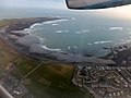
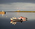 Derbyhaven bay, Isle of Man - geograph.org.uk - 1977099.jpg 1,024 × 851; 98 KB
-
 Derbyhaven Beach - geograph.org.uk - 3408682.jpg 640 × 424; 56 KB
-

-
 Derelict building at Scarlett Point - geograph.org.uk - 4295718.jpg 640 × 465; 76 KB
-
 Derelict building at St Mark's (1) - geograph.org.uk - 3654840.jpg 640 × 480; 80 KB
-
 Derelict building at St Mark's (2) - geograph.org.uk - 3657282.jpg 640 × 480; 123 KB
-
 Derelict building near Scarlett Point - geograph.org.uk - 5727122.jpg 1,600 × 1,065; 511 KB
-
 Derelict Cottage at Cringle Reservoir - geograph.org.uk - 3634213.jpg 640 × 480; 161 KB
-
 Derelict cottage beside railway line - geograph.org.uk - 4881157.jpg 640 × 427; 78 KB
-
 Derelict farmhouse - geograph.org.uk - 6278086.jpg 1,024 × 768; 235 KB
-
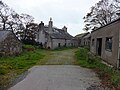
 Derelict house in Grenaby - geograph.org.uk - 6278083.jpg 1,024 × 768; 315 KB
-
 Derelict outbuildings - geograph.org.uk - 6278090.jpg 1,024 × 768; 208 KB
-
 Deserted Derbyhaven - geograph.org.uk - 3408688.jpg 640 × 424; 48 KB
-

-
 Disaster on the bend - geograph.org.uk - 2591852.jpg 3,296 × 2,472; 2.05 MB
-
 Disused and derelict farm buildings - geograph.org.uk - 4295748.jpg 640 × 471; 76 KB
-
 Disused buildings at Scarlett Point - geograph.org.uk - 4299123.jpg 640 × 480; 78 KB
-
 Disused fibre glass containers - geograph.org.uk - 3109420.jpg 800 × 600; 103 KB
-
 Disused quarry at Billown - geograph.org.uk - 1070993.jpg 640 × 427; 203 KB
-
 Dreswick Point Lighthouse - geograph.org.uk - 2145570.jpg 1,024 × 768; 211 KB
-

-
 Eairy Dam - geograph.org.uk - 4616957.jpg 1,024 × 768; 188 KB
-
 Eairy Valley - geograph.org.uk - 1990531.jpg 2,816 × 2,112; 1.02 MB
-
 Easyjet Airbus 319-111 G- EZII - geograph.org.uk - 6200258.jpg 1,024 × 768; 162 KB
-

-
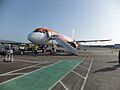 Easyjet Airbus 320 - G-EZWF - Ronaldsway IOM - geograph.org.uk - 6194890.jpg 1,024 × 768; 131 KB
-
-
 Entrance to Corlea Plantation - geograph.org.uk - 2145419.jpg 1,024 × 768; 266 KB
-
 Factory units on Castletown Road - geograph.org.uk - 2633395.jpg 640 × 480; 59 KB
-
 Far from the sea - geograph.org.uk - 4300042.jpg 640 × 480; 61 KB
-
 Farm Access Road off the A5 - geograph.org.uk - 5479119.jpg 1,440 × 1,080; 1.3 MB
-
 Farm buildings at Scarlett Point - geograph.org.uk - 3636449.jpg 640 × 480; 90 KB
-
 Farm buildings near Ballahick - geograph.org.uk - 5727650.jpg 1,600 × 1,065; 359 KB
-
 Farm Track at Railway Crossing - geograph.org.uk - 5478862.jpg 1,440 × 1,080; 1.08 MB
-
 Farm track near Ballaquaggan - geograph.org.uk - 5727711.jpg 1,600 × 1,065; 458 KB
-
 Farm track off Queen Street, Castletown - geograph.org.uk - 5727108.jpg 1,600 × 1,065; 567 KB
-
 Farmall McCormick tractor - geograph.org.uk - 5055890.jpg 640 × 427; 105 KB
-
 Farmland near Ballaglonney - geograph.org.uk - 5727721.jpg 1,600 × 1,065; 456 KB
-
 Farmland near Ballaquaggan - geograph.org.uk - 5727716.jpg 1,600 × 1,065; 513 KB
-
 Farmland on the west bank of Santon Burn - geograph.org.uk - 5084569.jpg 1,024 × 768; 174 KB
-
 Farmland south of Ballaquaggan Farm - geograph.org.uk - 5080377.jpg 1,024 × 768; 155 KB
-
 Farmland south of Ballaswang Crossing - geograph.org.uk - 5084562.jpg 1,024 × 768; 182 KB
-

-
 Fields of grass - geograph.org.uk - 3167043.jpg 2,592 × 1,936; 1.22 MB
-
 Footbridge Ford and Redundant Stile - geograph.org.uk - 5742614.jpg 640 × 424; 62 KB
-

-
 Footbridge over the Santon Burn - geograph.org.uk - 5478873.jpg 1,440 × 1,080; 1.46 MB
-
 Footpath - geograph.org.uk - 2033552.jpg 1,600 × 1,200; 561 KB
-
 Footpath leading off South Barrule - geograph.org.uk - 1317899.jpg 640 × 480; 73 KB
-
 Footpath Leading to Arrogon Veg - geograph.org.uk - 5478882.jpg 1,440 × 1,080; 1.45 MB
-
 Footpath to Poyll Vaaish - geograph.org.uk - 4429585.jpg 640 × 424; 59 KB
-
 Footpath to Stoney Mountain Plantation - geograph.org.uk - 6278073.jpg 768 × 1,024; 279 KB
-
 Ford across the Silver Burn - geograph.org.uk - 3148753.jpg 3,648 × 2,736; 6.84 MB
-
 Ford at Rushen Abbey - geograph.org.uk - 2739909.jpg 3,296 × 2,472; 2 MB
-
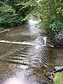
 Ford on the Silver Burn - geograph.org.uk - 5742693.jpg 640 × 424; 109 KB


_-_geograph.org.uk_-_6195145.jpg)
_-_geograph.org.uk_-_6195148.jpg)


_(100)_-_geograph.org.uk_-_2122036.jpg)
_(101)_-_geograph.org.uk_-_2122048.jpg)
_(102)_-_geograph.org.uk_-_2122065.jpg)
_(103)_-_geograph.org.uk_-_2122079.jpg)
_(104)_-_geograph.org.uk_-_2122083.jpg)
_(105)_-_geograph.org.uk_-_2122094.jpg)
_(106)_-_geograph.org.uk_-_2122102.jpg)
_(107)_-_geograph.org.uk_-_2122108.jpg)
_(108)_-_geograph.org.uk_-_2122122.jpg)
_(109)_-_geograph.org.uk_-_2122127.jpg)
_(110)_-_geograph.org.uk_-_2122135.jpg)
_(111)_-_geograph.org.uk_-_2122158.jpg)
_(112)_-_geograph.org.uk_-_2122179.jpg)
_(113)_-_geograph.org.uk_-_2122188.jpg)
_(114)_-_geograph.org.uk_-_2122193.jpg)
_(57)_-_geograph.org.uk_-_2118377.jpg)
_(58)_-_geograph.org.uk_-_2118380.jpg)
_(59)_-_geograph.org.uk_-_2118388.jpg)
_(60)_-_geograph.org.uk_-_2118394.jpg)
_(61)_-_geograph.org.uk_-_2118402.jpg)
_(62)_-_geograph.org.uk_-_2118407.jpg)
_(63)_-_geograph.org.uk_-_2118610.jpg)
_(64)_-_geograph.org.uk_-_2118616.jpg)
_(65)_-_geograph.org.uk_-_2119714.jpg)
_(66)_-_geograph.org.uk_-_2119724.jpg)
_(67)_-_geograph.org.uk_-_2119726.jpg)
_(68)_-_geograph.org.uk_-_2119731.jpg)
_(69)_-_geograph.org.uk_-_2119735.jpg)
_(70)_-_geograph.org.uk_-_2119744.jpg)
_(71)_-_geograph.org.uk_-_2119747.jpg)
_(72)_-_geograph.org.uk_-_2119750.jpg)
_(73)_-_geograph.org.uk_-_2119751.jpg)
_(74)_-_geograph.org.uk_-_2119756.jpg)
_(75)_-_geograph.org.uk_-_2119758.jpg)
_(76)_-_geograph.org.uk_-_2119760.jpg)
_(77)_-_geograph.org.uk_-_2119762.jpg)
_(78)_-_geograph.org.uk_-_2119765.jpg)
_(79)_-_geograph.org.uk_-_2119767.jpg)
_(80)_-_geograph.org.uk_-_2119769.jpg)
_(81)_-_geograph.org.uk_-_2119772.jpg)
_(82)_-_geograph.org.uk_-_2119774.jpg)
_(83)_-_geograph.org.uk_-_2119777.jpg)
_(84)_-_geograph.org.uk_-_2119781.jpg)
_(85)_-_geograph.org.uk_-_2121427.jpg)
_(86)_-_geograph.org.uk_-_2121431.jpg)
_(87)_-_geograph.org.uk_-_2121438.jpg)
_(88)_-_geograph.org.uk_-_2121441.jpg)
_(89)_-_geograph.org.uk_-_2121445.jpg)
_(90)_-_geograph.org.uk_-_2121450.jpg)
_(91)_-_geograph.org.uk_-_2121471.jpg)
_(92)_-_geograph.org.uk_-_2121489.jpg)
_(93)_-_geograph.org.uk_-_2121955.jpg)
_(94)_-_geograph.org.uk_-_2121965.jpg)
_(95)_-_geograph.org.uk_-_2121972.jpg)
_(96)_-_geograph.org.uk_-_2121986.jpg)
_(97)_-_geograph.org.uk_-_2121993.jpg)
_(98)_-_geograph.org.uk_-_2121999.jpg)
_(99)_-_geograph.org.uk_-_2122010.jpg)


_-_geograph.org.uk_-_3654840.jpg)
_-_geograph.org.uk_-_3657282.jpg)


_-_geograph.org.uk_-_6194934.jpg)


