Category:Manordeilo and Salem
Main Wikipedia article: Manordeilo and Salem.

community in Carmarthenshire, Wales, UK | |||||
| Upload media | |||||
| Instance of | |||||
|---|---|---|---|---|---|
| Location | Carmarthenshire, Wales | ||||
| Population |
| ||||
| Area |
| ||||
 | |||||
Subcategories
This category has the following 4 subcategories, out of 4 total.
Media in category "Manordeilo and Salem"
The following 183 files are in this category, out of 183 total.
-
 A40 at Cwmifor - geograph.org.uk - 4306068.jpg 1,920 × 1,070; 309 KB
-
 A40 between Llandeilo and Rhosmaen - geograph.org.uk - 4531949.jpg 1,920 × 1,333; 423 KB
-
 A40 near Cwmifor - geograph.org.uk - 4532009.jpg 1,920 × 1,112; 523 KB
-
 A40, Cwmifor - geograph.org.uk - 5528574.jpg 1,280 × 851; 336 KB
-
 A483 meets the A40 - geograph.org.uk - 2641863.jpg 3,367 × 2,542; 1.06 MB
-
 Access road - geograph.org.uk - 6285866.jpg 640 × 480; 71 KB
-
 Afon Myddyfi Ford - geograph.org.uk - 6137274.jpg 3,042 × 2,454; 2.35 MB
-
 Approaching a bend on the B4302 - geograph.org.uk - 2395615.jpg 640 × 480; 93 KB
-
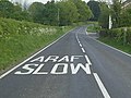 Araf-Slow on the B4302 - geograph.org.uk - 2395618 (cropped).jpg 306 × 229; 19 KB
-
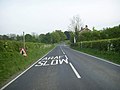 Araf-Slow on the B4302 - geograph.org.uk - 2395618.jpg 640 × 480; 55 KB
-
 Banc y Berllan Farm - geograph.org.uk - 6083514.jpg 2,048 × 1,536; 743 KB
-
 Bridge at Glandwr - geograph.org.uk - 1016824.jpg 640 × 427; 221 KB
-
 Building conversion, Soar - geograph.org.uk - 2814098.jpg 640 × 480; 80 KB
-
 Castell-Howel - geograph.org.uk - 1016831.jpg 640 × 427; 167 KB
-
 Cattle near Brynwgan - geograph.org.uk - 4003295.jpg 1,024 × 680; 368 KB
-
 Cefnllwydcoed - geograph.org.uk - 1016875.jpg 640 × 427; 192 KB
-
 Cemetery with a view - geograph.org.uk - 3460298.jpg 1,024 × 680; 210 KB
-
 Ceuffordd hynafol - Ancient holloway. - geograph.org.uk - 5142182.jpg 640 × 480; 154 KB
-
 Church - geograph.org.uk - 1016788.jpg 427 × 640; 217 KB
-
 Church - geograph.org.uk - 1019090.jpg 640 × 427; 173 KB
-
 Country road approaching Castell-Howel - geograph.org.uk - 4002473.jpg 1,024 × 680; 326 KB
-
 Country road near Castell-Howel - geograph.org.uk - 4003197.jpg 1,024 × 680; 325 KB
-
 Country road west of Pen-y-Banc - geograph.org.uk - 4001072.jpg 1,024 × 680; 353 KB
-
 Country road west of Salem - geograph.org.uk - 4002465.jpg 1,024 × 680; 317 KB
-
 Crossroads at Maeslyn - geograph.org.uk - 1016845.jpg 640 × 427; 211 KB
-
 Cwmpedol - geograph.org.uk - 6095182.jpg 1,024 × 768; 197 KB
-
 Farm at Hermon - geograph.org.uk - 3460319.jpg 1,024 × 680; 257 KB
-
 Farmland near Bryneithen - geograph.org.uk - 4003281.jpg 800 × 531; 124 KB
-
 Farmland near Cefnrhiwlas - geograph.org.uk - 4003191.jpg 1,024 × 680; 296 KB
-
 Farmland near Chapel Isaac - geograph.org.uk - 4002459.jpg 1,024 × 680; 280 KB
-
 Farmland near Pantybedw - geograph.org.uk - 4002471.jpg 1,024 × 680; 285 KB
-
 Farmland near Pen-y-Banc - geograph.org.uk - 4001053.jpg 1,024 × 680; 252 KB
-
 Farmland opposite the Mount - geograph.org.uk - 4002463.jpg 1,024 × 680; 313 KB
-
 Farmland to the south of Salem - geograph.org.uk - 4003315.jpg 1,024 × 680; 247 KB
-
 Feeder at Pantybedw - geograph.org.uk - 1016833.jpg 640 × 427; 181 KB
-
 Field at Pant-y-clai - geograph.org.uk - 1016820.jpg 640 × 427; 210 KB
-
 Field near Bancyddraenen - geograph.org.uk - 3457484.jpg 1,024 × 680; 242 KB
-
 Fields at Cwmifor - geograph.org.uk - 5529303.jpg 1,280 × 851; 310 KB
-
 Flood plain - geograph.org.uk - 3824322.jpg 3,257 × 1,907; 715 KB
-
 Flood plain - geograph.org.uk - 3824329.jpg 3,023 × 1,868; 676 KB
-
 Ford on Afon Myddyfi - geograph.org.uk - 4002479.jpg 800 × 531; 175 KB
-
 From under the road - geograph.org.uk - 1306504.jpg 640 × 480; 194 KB
-
 Ger - Near Plas Taliaris Mansion - geograph.org.uk - 4119592.jpg 640 × 480; 70 KB
-
 Ger Brynteilo - Near Brynteilo - geograph.org.uk - 5644058.jpg 640 × 480; 104 KB
-
 Ger Glan'r wyth Isaf - Near Glan'r wyth isaf - geograph.org.uk - 6095267.jpg 1,024 × 768; 207 KB
-
 Ger Glanbrydan - Near Glanbrydan - geograph.org.uk - 5250630.jpg 640 × 480; 163 KB
-
 Ger Nant Wallter - Near Nant Wallter - geograph.org.uk - 5151069.jpg 640 × 480; 133 KB
-
 Ger Pistyll Gwyn - Near Pistyll Gwyn - geograph.org.uk - 5662623.jpg 640 × 480; 67 KB
-
 Glanbrydan Farm - geograph.org.uk - 6083650.jpg 2,048 × 1,536; 589 KB
-
 Glandwr - geograph.org.uk - 1019118.jpg 640 × 427; 205 KB
-
 Glanrhyd Saeson - geograph.org.uk - 6083653.jpg 2,048 × 1,536; 1.06 MB
-
 Going under the road - geograph.org.uk - 1306509.jpg 640 × 480; 190 KB
-
 Gât fach ar lwybr - A small gate on path - geograph.org.uk - 6032662.jpg 1,024 × 767; 229 KB
-

-
 Heol Capel Isaac - Capel Isaac Road - geograph.org.uk - 5659457.jpg 640 × 480; 102 KB
-

-
 House along a lane - geograph.org.uk - 1307902.jpg 640 × 480; 118 KB
-
 House for sale - geograph.org.uk - 3457536.jpg 1,024 × 680; 232 KB
-
 Junction at Ty-newydd - geograph.org.uk - 1016695.jpg 640 × 427; 173 KB
-
 Lane at Cefnrhiwlas - geograph.org.uk - 1019599.jpg 640 × 427; 185 KB
-
 Lane by Pont Dulais - geograph.org.uk - 4531956.jpg 2,549 × 1,702; 771 KB
-
 Large field for ponies - geograph.org.uk - 1306513.jpg 640 × 480; 127 KB
-
 Lay-by on the B4302 - geograph.org.uk - 2400852.jpg 640 × 480; 67 KB
-
 Llwybr Afon Dulais - Afon Dulais Path - geograph.org.uk - 5151078.jpg 640 × 480; 172 KB
-
 Llwybr Bryn Ifor - Bryn Ifor Path - geograph.org.uk - 5659408.jpg 640 × 480; 147 KB
-
 Llwybr Brynio Fach - Brynio Fach Path - geograph.org.uk - 6095239.jpg 1,024 × 768; 241 KB
-
 Llwybr Brynio Fawr - Brynio Fawr Path - geograph.org.uk - 6095233.jpg 1,024 × 768; 375 KB
-
 Llwybr Cae Mawr - Cae Mawr Footpath - geograph.org.uk - 5250646.jpg 640 × 480; 121 KB
-
 Llwybr Croes Faen Uchaf Path - geograph.org.uk - 5151050.jpg 640 × 480; 139 KB
-
 Llwybr Cwm y Rhidyll - Cwm y Rhidyll Path - geograph.org.uk - 6095246.jpg 1,024 × 768; 345 KB
-
 Llwybr cyhoeddus yn Soar - A public path at Soar - geograph.org.uk - 6032707.jpg 1,024 × 768; 353 KB
-
 Llwybr Dolau-hirion - Dolau-hirion Path - geograph.org.uk - 5659410.jpg 640 × 480; 136 KB
-

-

-

-
 Llwybr glanafon - Riverside path - geograph.org.uk - 5659444.jpg 640 × 480; 138 KB
-
 Llwybr Glanrhyd - Glanrhyd Path - geograph.org.uk - 5086295.jpg 640 × 480; 131 KB
-
 Llwybr Glanyrafon - Glanyrafon Path - geograph.org.uk - 5659418.jpg 640 × 480; 149 KB
-
 Llwybr Glanyrafon - Glanyrafon Path - geograph.org.uk - 5659424.jpg 640 × 480; 151 KB
-
-
-
 Llwybr New Inn - New Inn Path - geograph.org.uk - 6095168.jpg 1,024 × 768; 345 KB
-
 Llwybr Penhill - Penhill Footpath - geograph.org.uk - 5250672.jpg 640 × 480; 171 KB
-

-
 Llwybr Rhiw - Rhiw Path - geograph.org.uk - 5662586.jpg 640 × 480; 72 KB
-
 Llwybr Trefwre - Trefwre Path - geograph.org.uk - 6095180.jpg 1,024 × 768; 301 KB
-
 Llwybr tuag at Degfan - A path towards Tegfan - geograph.org.uk - 6032667.jpg 1,024 × 768; 341 KB
-
 Llwybr y Ffrwd - Ffrwd Path - geograph.org.uk - 5662610.jpg 640 × 480; 92 KB
-
 Llwyncelyn - geograph.org.uk - 1019088.jpg 640 × 427; 214 KB
-
 Maenordeilo - Manordeilo - geograph.org.uk - 5250823.jpg 640 × 480; 74 KB
-
 Maesllyn - geograph.org.uk - 1019125.jpg 640 × 427; 161 KB
-
 Marine Buoy - geograph.org.uk - 3822489.jpg 1,202 × 1,184; 264 KB
-
 Marine Buoy - geograph.org.uk - 3822494.jpg 1,636 × 2,473; 661 KB
-
 Melin Rhosmaen - Rhosmaen Mill - geograph.org.uk - 6095252.jpg 1,024 × 768; 177 KB
-
 Mid Wales farmland - geograph.org.uk - 4001059.jpg 800 × 531; 125 KB
-
 Myrtle Hill - geograph.org.uk - 1016872.jpg 640 × 427; 204 KB
-
 Nant Cwm-cyfyng - geograph.org.uk - 5659436.jpg 640 × 480; 144 KB
-
 Nant Gurrey-fach - geograph.org.uk - 1019589.jpg 640 × 427; 256 KB
-
 Nantyffin - geograph.org.uk - 1019505.jpg 640 × 427; 180 KB
-
 New house at Soar - geograph.org.uk - 1016869.jpg 640 × 427; 171 KB
-
 Oak by the lane - geograph.org.uk - 1069732.jpg 640 × 480; 119 KB
-
 Old Sunday School - geograph.org.uk - 3631324.jpg 640 × 480; 69 KB
-
 On the outskirts of Cwmifor - geograph.org.uk - 6083635.jpg 2,048 × 1,536; 430 KB
-
 Ordnance Survey Cut Mark - geograph.org.uk - 3607194.jpg 480 × 640; 109 KB
-
 Ordnance Survey Cut Mark - geograph.org.uk - 3631094.jpg 480 × 640; 108 KB
-
 Ordnance Survey Cut Mark - geograph.org.uk - 3631102.jpg 480 × 640; 102 KB
-
 Ordnance Survey Cut Mark - geograph.org.uk - 3631108.jpg 480 × 640; 116 KB
-
 Ordnance Survey Cut Mark - geograph.org.uk - 3631117.jpg 480 × 640; 119 KB
-
 Ordnance Survey Cut Mark - geograph.org.uk - 5171166.jpg 640 × 409; 100 KB
-
 Ordnance Survey Cut Mark - geograph.org.uk - 5171167.jpg 640 × 470; 99 KB
-
 Ordnance Survey Cut Mark - geograph.org.uk - 5171169.jpg 640 × 481; 85 KB
-
 Ordnance Survey Cut Mark - geograph.org.uk - 5171170.jpg 640 × 483; 104 KB
-
 Ordnance Survey Cut Mark - geograph.org.uk - 5171172.jpg 640 × 548; 115 KB
-
 Ordnance Survey Cut Mark - geograph.org.uk - 5171190.jpg 640 × 474; 133 KB
-
 Ordnance Survey Cut Mark - geograph.org.uk - 5171191.jpg 640 × 524; 107 KB
-
 Ordnance Survey Cut Mark - geograph.org.uk - 5196564.jpg 640 × 442; 40 KB
-
 Ordnance Survey Cut Mark - geograph.org.uk - 5196567.jpg 471 × 640; 134 KB
-
 Ordnance Survey Cut Mark - geograph.org.uk - 5197606.jpg 640 × 406; 91 KB
-
 Ordnance Survey Cut Mark - geograph.org.uk - 5197611.jpg 640 × 375; 106 KB
-
 Ordnance Survey Cut Mark - geograph.org.uk - 5197615.jpg 640 × 408; 96 KB
-
 Ordnance Survey Cut Mark - geograph.org.uk - 5197619.jpg 640 × 384; 100 KB
-
 Ordnance Survey Cut Mark - geograph.org.uk - 5197621.jpg 640 × 404; 59 KB
-
 Ordnance Survey Cut Mark - geograph.org.uk - 5216443.jpg 640 × 358; 120 KB
-
 Ordnance Survey Rivet - geograph.org.uk - 5196561.jpg 457 × 640; 91 KB
-
 Ordnance Survey Rivet - geograph.org.uk - 5197620.jpg 640 × 562; 123 KB
-
 Pant-soar - geograph.org.uk - 1019554.jpg 640 × 427; 219 KB
-
 Parc Pantglas - Pantglas Park - geograph.org.uk - 6095157.jpg 1,024 × 767; 247 KB
-
 Pasture at Bwlch-y-llidiart - geograph.org.uk - 1019089.jpg 640 × 427; 222 KB
-
 Pasture at Dolwerth - geograph.org.uk - 1019499.jpg 640 × 427; 205 KB
-
 Pasture at Hafod - geograph.org.uk - 1019123.jpg 640 × 427; 194 KB
-
 Pasture land - geograph.org.uk - 6083526.jpg 2,048 × 1,536; 461 KB
-
 Pasture land near Llwynpiod - geograph.org.uk - 1069728.jpg 640 × 480; 99 KB
-
 Pasture near Bryn-Ifor - geograph.org.uk - 1019066.jpg 640 × 427; 205 KB
-
 Pasture near Castell-Howel - geograph.org.uk - 1019121.jpg 640 × 427; 215 KB
-
 Pasture north of Pant-y-clai - geograph.org.uk - 1019116.jpg 640 × 427; 183 KB
-
 Pen-y-banc - geograph.org.uk - 5644051.jpg 640 × 480; 84 KB
-
 Pentre New Inn - New Inn village - geograph.org.uk - 6095163.jpg 1,024 × 768; 221 KB
-
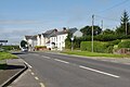
 Pentre Rhosmaen Rhosmaen village - geograph.org.uk - 6095153.jpg 1,024 × 768; 179 KB
-

-
 Pont Dulais - geograph.org.uk - 1037014.jpg 640 × 480; 69 KB
-
 Pont Pen-y-banc - Pen-y-banc Bridge - geograph.org.uk - 5644016.jpg 640 × 480; 119 KB
-
 Reservoir north of Salem - geograph.org.uk - 1019568.jpg 640 × 427; 200 KB
-
 Rhodfa Glanbrydan - Glanbrydan Avenue - geograph.org.uk - 5250636.jpg 640 × 480; 161 KB
-
 River Towy flood plain near Rhosmaen - geograph.org.uk - 4312767.jpg 640 × 480; 102 KB
-
 River Tywi - geograph.org.uk - 6083657.jpg 2,048 × 1,536; 1.15 MB
-
 Road - panoramio (119).jpg 2,048 × 2,048; 871 KB
-
 Road above Pont Rhydd-y-march - geograph.org.uk - 3460354.jpg 680 × 1,024; 305 KB
-
 Road approaching Glandwr - geograph.org.uk - 4001069.jpg 1,024 × 680; 344 KB
-
 Road approaching Panty-clai - geograph.org.uk - 4001064.jpg 800 × 531; 146 KB
-
 Road at Cefnllwydcoed - geograph.org.uk - 4003267.jpg 1,024 × 680; 381 KB
-
 Road entering Pen-y-Banc - geograph.org.uk - 4001046.jpg 1,024 × 680; 234 KB
-
 Road to Pen-y-Banc - geograph.org.uk - 4002461.jpg 800 × 531; 122 KB
-
 Rough pasture at Soar - geograph.org.uk - 1019561.jpg 640 × 427; 204 KB
-
 Roundabout, Llandeilo - geograph.org.uk - 2400774.jpg 640 × 480; 72 KB
-
 Silage at Mount Pleasant - geograph.org.uk - 1019065.jpg 640 × 427; 162 KB
-
 Silage field near Closglas - geograph.org.uk - 4003320.jpg 1,024 × 680; 274 KB
-
 Spring idyll - geograph.org.uk - 1306479.jpg 640 × 480; 162 KB
-
 Sunday School by Pantyffynnon - geograph.org.uk - 4462014.jpg 800 × 532; 175 KB
-
 Taliaris Hill - geograph.org.uk - 3254900.jpg 1,600 × 1,200; 580 KB
-
 Taliaris War Memorial - geograph.org.uk - 4675645.jpg 1,200 × 900; 298 KB
-
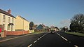
 The A40 at Manordeilo - geograph.org.uk - 3460276.jpg 1,024 × 680; 172 KB
-
 The B4302 near Rhosmaen - geograph.org.uk - 4003304.jpg 1,024 × 680; 241 KB
-
 The Hangout - geograph.org.uk - 6285864.jpg 640 × 480; 71 KB
-
 The meandering Afon Twyi - geograph.org.uk - 2945023.jpg 1,024 × 680; 167 KB
-
 The Plough Inn, Rhosmaen, Carms - geograph.org.uk - 4609479.jpg 640 × 480; 39 KB
-
 The winding road - geograph.org.uk - 1037029.jpg 640 × 480; 121 KB
-
 Towards Llwynpartridge - geograph.org.uk - 1016691.jpg 640 × 427; 183 KB
-
 Tree and tower near Cwmifor - geograph.org.uk - 4532007.jpg 3,436 × 1,477; 752 KB
-
 Tree-line shady road - geograph.org.uk - 4002467.jpg 1,024 × 680; 402 KB
-

-
-
 Tuag at y Rhiw - Towards Rhiw - geograph.org.uk - 5662598.jpg 640 × 480; 77 KB
-
 Under the lane - geograph.org.uk - 1306518.jpg 640 × 480; 170 KB
-
-
 Valley near Salem - geograph.org.uk - 4002475.jpg 1,024 × 680; 270 KB
-
 View over Nant Erddyl - geograph.org.uk - 1042662.jpg 640 × 480; 81 KB
-
 View to Pen-y-Banc - geograph.org.uk - 4001041.jpg 1,024 × 680; 298 KB
-
 View to the Black Mountain - geograph.org.uk - 3460341.jpg 1,024 × 680; 186 KB
-
 Wales Carmarthenshire Community Manordeilo and Salem map.svg 512 × 399; 1.12 MB
-
 We're expanding - geograph.org.uk - 1019120.jpg 640 × 427; 205 KB
-
 Wet cows above Cefnrhiwlas - geograph.org.uk - 1019596.jpg 640 × 427; 195 KB
-
 Wet field above Cefnrhiwlas - geograph.org.uk - 1016878.jpg 640 × 427; 209 KB
-
 Wind Turbine west of Taliaris - geograph.org.uk - 5561946.jpg 1,152 × 864; 202 KB


.jpg)


.jpg)


