Category:Mappe-Monde by Guillaume Delisle (18th century)
Media in category "Mappe-Monde by Guillaume Delisle (18th century)"
The following 22 files are in this category, out of 22 total.
-
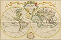 Delisle Mappe-Monde 1700 UTA.jpg 3,450 × 2,259; 1.47 MB
-

-

-

-

-
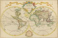 Delisle - Mappe-Monde.png 1,978 × 1,300; 4.43 MB
-
 Map - Special Collections University of Amsterdam - OTM- HB-KZL 31-01-27.tif 7,672 × 5,962; 130.86 MB
-
 Guillaume Delisle, Mappemonde a l'usage du Roy (FL80386390 2718614).jpg 18,416 × 13,312; 263.96 MB
-
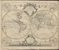
 1720 map of the world - Mappemonde a l'usage du Roy.jpg 17,195 × 11,715; 26.96 MB
-
 Mappemonde - l'usage du Roy par Guillaume Delisle Premier geographe de Sm.png 7,732 × 5,070; 63.26 MB
-
 Mappemonde a l'usage du roy LOC 2005627023.jpg 8,264 × 5,573; 7.93 MB
-
 Mappemonde a l'usage du roy LOC 2005627023.tif 8,264 × 5,573; 131.77 MB
-
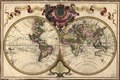
 Mappemonde a l'usage du Roy Par Guillaume Delisle Premier.jpg 1,024 × 692; 156 KB
-

-
 Guillaume Delisle, Mappe monde (FL80386290 2718607).jpg 15,840 × 13,424; 238.24 MB
-
 1730 map of the world by Guillaume de L'Isle.tif 7,183 × 6,027; 247.74 MB
-
-
-

-
-

-


.jpg)


.jpg)


.jpg)


