Category:Maps about Peace of Westphalia
Media in category "Maps about Peace of Westphalia"
The following 22 files are in this category, out of 22 total.
-

-
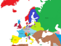
 Avrupa harita 1648.png 1,894 × 1,367; 195 KB
-
 Brockhaus' Konversations-Lexikon (1892) (14594679187).jpg 1,622 × 2,536; 1.01 MB
-
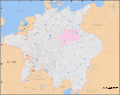 Electorate of Saxony within the Holy Roman Empire 1648.svg 2,283 × 1,810; 2.12 MB
-
 Europa 1648 klar.png 1,106 × 846; 456 KB
-
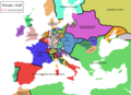
 Europa, 1648 copy.jpg 800 × 577; 303 KB
-
 Europe après les Traités de Westphalie - 1648.png 870 × 691; 40 KB
-
 Europe map 1648 ko.PNG 1,894 × 1,367; 134 KB
-
 Europe map 1648-es.png 1,894 × 1,367; 141 KB
-
 Europe map 1648.PNG 1,894 × 1,367; 195 KB
-
 Germany 1648 after the Peace of Westphalia.jpg 3,221 × 2,498; 4.38 MB
-
 Germany at the Peace of Westphalia (1648).jpg 4,014 × 3,110; 4.19 MB
-
 Holy Roman Empire 1648-sr.svg 2,283 × 1,810; 3.01 MB
-
 Holy Roman Empire 1648.svg 2,283 × 1,810; 3.07 MB
-
 Mediæval and modern history (1920) (14587106210).jpg 1,626 × 2,282; 819 KB
-
 Mediæval and modern history (1920) (14771449184).jpg 1,588 × 2,274; 747 KB
-
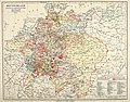
 Meyers b4 s0870a.jpg 2,048 × 1,667; 776 KB
-
 Meyers Hist Handatlas 1911 Nr 31.jpg 3,791 × 2,966; 2.39 MB
-
 Spruner-Menke Handatlas 1880 Karte 45.jpg 10,449 × 8,673; 27.38 MB
-
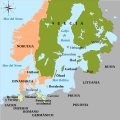 SueciaDeWestfalia1648.svg 734 × 729; 454 KB
-
 Historical atlas of modern Europe 1903 (135895383).jpg 9,176 × 7,025; 65.95 MB
-
 Historical atlas of modern Europe 1903 (135895430).jpg 9,163 × 6,915; 66.08 MB
_(14586908880).jpg)

_(14594679187).jpg)


.jpg)


_(14587106210).jpg)
_(14771449184).jpg)


.jpg)
.jpg)