Category:Maps of 's-Hertogenbosch
Wikimedia category | |||||
| Upload media | |||||
| Instance of | |||||
|---|---|---|---|---|---|
| Category combines topics | |||||
| 's-Hertogenbosch | |||||
capital city of North Brabant, the Netherlands  St. John's Cathedral   .svg) | |||||
| Pronunciation audio | |||||
| Instance of |
| ||||
| Location | 's-Hertogenbosch, North Brabant, Netherlands | ||||
| Located in or next to body of water | |||||
| Inception |
| ||||
| Significant event |
| ||||
| Population |
| ||||
| Area |
| ||||
| Elevation above sea level |
| ||||
| Different from | |||||
| official website | |||||
 | |||||
Subcategories
This category has the following 11 subcategories, out of 11 total.
Media in category "Maps of 's-Hertogenbosch"
The following 25 files are in this category, out of 25 total.
-
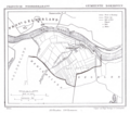
 Guicciardini Map of 's-Hertogenbosch.png 1,947 × 1,523; 4.66 MB
-
 Ammerzoden-Bokhoven, 1669.png 766 × 355; 193 KB
-
 Bokhoven-Blaeu-1665.jpg 678 × 770; 349 KB
-
 1865 Bokhoven.png 1,569 × 1,357; 216 KB
-
 2013-sHertogenbosch.jpg 2,793 × 2,096; 3.63 MB
-
 BAG woonplaatsen - Gemeente 's-Hertogenbosch.png 2,419 × 2,419; 951 KB
-
 BisdomshertogenboschLocatie.png 270 × 360; 6 KB
-
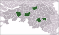 BrabantStadLocatie.png 276 × 169; 11 KB
-
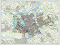
 Gem-sHertogenbosch-2014Q1.jpg 5,536 × 4,144; 10.03 MB
-
 Gem-sHertogenbosch-OpenTopo.jpg 8,685 × 5,079; 7.84 MB
-
 Kaartje Rosmalen.jpg 2,976 × 3,968; 3.81 MB
-
 Manesson-Travaux-de-Mars 9658.tif 3,432 × 5,192; 51.02 MB
-
 Map - NL - 's-Hertogenbosch (2009).svg 625 × 575; 2.33 MB
-
 Map - NL - Maasdonk - Wijk 02 Vinkel - Buurt 00 Vinkel.svg 375 × 375; 15 KB
-

-
 Map - NL - Municipality code 0796 (2019).svg 300 × 160; 445 KB
-
 Map NL 's-Hertogenbosch-Engelen-Bokhoven.png 889 × 606; 33 KB
-
 Maximakanaal.png 707 × 752; 757 KB
-
 Randweg west DB.jpg 1,106 × 821; 75 KB
-
 Routekaart 220Xpress.jpg 3,968 × 2,976; 2.67 MB
-
 S-Hertogenbosch-topografie.jpg 2,315 × 2,010; 3.39 MB
-
 SHertogenbosch-centrum-OpenTopo.jpg 7,736 × 5,804; 11.34 MB
-
 SHertogenbosch-plaats-OpenTopo.jpg 3,215 × 2,507; 4.83 MB
-
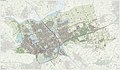
 SHertogenbosch-stad-2014Q1.jpg 3,215 × 2,471; 4.57 MB
-
 WLANL - Sandra Voogt - Maquette van de stad 's-Hertogenbosch.jpg 1,600 × 1,071; 1.59 MB


.svg)


.svg)


