Category:Maps of Šilalė District Municipality
Subcategories
This category has the following 2 subcategories, out of 2 total.
Š
- Šilalė in maps (6 F)
Media in category "Maps of Šilalė District Municipality"
The following 6 files are in this category, out of 6 total.
-
 Silale district location.png 623 × 503; 20 KB
-
 Silale district location.svg 1,095 × 821; 116 KB
-
 Silale dst.svg 1,000 × 800; 717 KB
-
 Silale in Lithuania.svg 1,095 × 821; 524 KB
-
 Silales rajono zemelapis.png 1,009 × 695; 160 KB
-
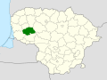
 Šilalės rajono savivaldybė.svg 954 × 660; 109 KB


