Category:Maps of 12th-century Arabia

English: Category for maps showing the history of the Arabian Peninsula in the 12th century AD (roughly AH 600-AH 700).
Not to be confused with genuinely old maps (Old maps of...).
Not to be confused with genuinely old maps (Old maps of...).
Media in category "Maps of 12th-century Arabia"
The following 4 files are in this category, out of 4 total.
-
 Ayyubid.png 667 × 621; 37 KB
-
 Iszlám világ 1200k.jpg 2,339 × 1,654; 544 KB
-
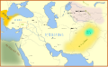 Seljuq Empire1100. he.svg 642 × 396; 254 KB
-
 Seljuq Empire1100.svg 642 × 396; 253 KB


