Category:Maps of 19th-century Arabia

English: Category for maps showing the history of the Arabian Peninsula in the 19th century AD (roughly AH 1215-AH 1317).
Old maps belong into: Category:19th-century maps of Arabia or its subcategories.
The modern states of Arabia were founded in the 20th century. Please sort maps accordingly.
Old maps belong into: Category:19th-century maps of Arabia or its subcategories.
The modern states of Arabia were founded in the 20th century. Please sort maps accordingly.
Subcategories
This category has the following 3 subcategories, out of 3 total.
1
M
- Maps of the First Saudi State (21 F)
- Maps of Muhammad Ali dynasty (23 F)
Media in category "Maps of 19th-century Arabia"
The following 34 files are in this category, out of 34 total.
-
 The First Saudi State Greatest Extent.png 3,366 × 3,135; 14.72 MB
-
 Map of North and West Africa in 1815 AD.png 7,816 × 3,960; 1.71 MB
-
 Battle Of AL Radhima (Arabic).jpg 1,080 × 601; 71 KB
-
 خريطة الإمارة الخالدية الثانية.jpg 1,080 × 604; 138 KB
-
 سلطنة عمان 1856.jpg 428 × 599; 130 KB
-
 Emirate of Jabal Shammar.png 528 × 615; 7 KB
-
 Ottoman Empire - Basra Vilayet.png 4,455 × 4,840; 1.71 MB
-
 Alrasheed hail english.png 608 × 596; 185 KB
-
 Bani Khalid Invades Diriyah (Arabic).jpg 1,080 × 601; 85 KB
-
 Banu Khalid-ar.png 2,225 × 1,495; 882 KB
-
 Banu Khalid.png 2,225 × 1,495; 733 KB
-
 Diriyah Invades Bani Khalid (Arabic).jpg 1,080 × 599; 87 KB
-
 Empire of Oman-es.svg 750 × 1,450; 198 KB
-
 Empire of Oman-hu.svg 750 × 1,450; 195 KB
-
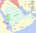
 Empire of Oman.png 2,700 × 3,264; 3.79 MB
-
 Empire of Oman.svg 750 × 1,450; 224 KB
-
 Empire of Oman2-es.svg 959 × 1,340; 443 KB
-
 Imamate of Ibn Mu'ammar (Mu'ammarids in Dir'iyyah).png 3,292 × 2,143; 1.27 MB
-
 Map of Al Qawasim.jpg 1,080 × 1,308; 39 KB
-
 Map of Emirate of Jabal Shammar.jpg 1,080 × 1,107; 77 KB
-
 Muhemet Ali Empire 1805 - 1953 (AD).png 821 × 440; 36 KB
-
 Ottoman Egypt.png 4,986 × 5,975; 20.92 MB
-
 Ottoman Empire Administrative Divisions, Karassi Sanjak.png 435 × 371; 33 KB
-
 Ottoman Empire Administrative Divisions.png 4,455 × 4,840; 2.1 MB
-
 Sa mapa3.png 226 × 288; 13 KB
-
 Sa mapa4.png 228 × 288; 14 KB
-
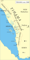 Tihama-asir.png 611 × 1,200; 150 KB
-
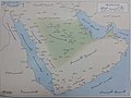
 Wahhab map.jpg 1,257 × 1,164; 454 KB
-
 الدولة العثمانية تقسيمات.png 4,455 × 4,840; 2.21 MB
-
 بدون اسم78 20221220183422.png 2,048 × 2,048; 498 KB
-
 خرائط الدولة السعودية التاريخية 16.jpg 2,900 × 2,256; 208 KB
-
 خرائط الدولة السعودية التاريخية 17.jpg 2,868 × 2,160; 188 KB
-
 خريطة وادي سرحان التي تسكنه قيلة الشرارات لرحاله مستشرقين لاكثر من 300 عام1.jpg 743 × 1,034; 159 KB
-
 وادي سرحان بالخرائط العثمانيه1.jpg 899 × 699; 143 KB


.jpg)


.jpg)


.jpg)


.png)


.png)


