Category:Maps of 6th-century Arabia

English: Category for maps showing the history of the Arabian Peninsula in the 6th century AD (roughly BH 123-BH 20).
Not to be confused with genuinely old maps (Old maps of...).
Not to be confused with genuinely old maps (Old maps of...).
Media in category "Maps of 6th-century Arabia"
The following 10 files are in this category, out of 10 total.
-
 Arabian Peninsula-565-es.svg 1,104 × 1,030; 1.12 MB
-
 Arabian Peninsula-565-pt.svg 341 × 348; 12 KB
-
 Eastern & Central Arabia in the 6th-century.png 1,496 × 820; 671 KB
-
 Ghassanid kingdom-ar.jpg 202 × 213; 18 KB
-
 Ghassanid kingdom.jpg 202 × 213; 18 KB
-
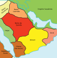
 Kindite Kingdom, ca. 500.png 1,573 × 1,270; 1.35 MB
-
 LakhmidsVassal.png 819 × 599; 12 KB
-
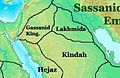 NE 565ad-Lakhmid.jpg 329 × 215; 26 KB
-
 خرائط الدولة السعودية التاريخية 4.jpg 3,008 × 2,284; 237 KB
-
 وادي سرحان وخريطه انجليزيه.jpg 850 × 628; 142 KB


