Category:Maps of Aberdeen (Scotland)
Category Maps of Aberdeen for media related to location and political maps related to Aberdeen, Scotland.
Subcategories
This category has the following 3 subcategories, out of 3 total.
Media in category "Maps of Aberdeen (Scotland)"
The following 55 files are in this category, out of 55 total.
-
 Aberdeen (location).png 236 × 226; 47 KB
-
 Aberdeen (Location).png 553 × 933; 177 KB
-
 Aberdeen - City of Aberdeen dot.png 1,802 × 2,589; 189 KB
-
 Aberdeen Central (Scottish Parliament constituency).svg 206 × 234; 61 KB
-
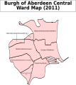 Aberdeen Central B Ward Map 2011.svg 653 × 731; 82 KB
-
 Aberdeen Central.PNG 955 × 1,102; 22 KB
-
 Aberdeen City, Aberdeenshire, Angus, Moray 1999.svg 596 × 747; 820 KB
-
 Aberdeen City, Aberdeenshire, Angus, Moray 2011.svg 599 × 746; 809 KB
-
 Aberdeen City, Aberdeenshire, Angus, Moray.svg 603 × 753; 671 KB
-
 Aberdeen council.PNG 2,733 × 3,411; 208 KB
-
 Aberdeen Donside (Scottish Parliament constituency).svg 206 × 234; 61 KB
-
 Aberdeen Map 24 1 14 Wiki.jpg 1,653 × 2,338; 407 KB
-
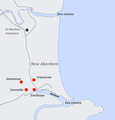 Aberdeen Medieval Friaries.png 1,668 × 1,738; 203 KB
-
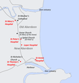 Aberdeen Medieval Hospitals.png 1,668 × 1,738; 266 KB
-
 Aberdeen new routes map.svg 1,425 × 1,189; 638 KB
-
 Aberdeen North ScottishParliamentConstituency.PNG 955 × 1,102; 22 KB
-
 Aberdeen outline map.png 600 × 524; 102 KB
-
 Aberdeen South ScottishParliamentConstituency.PNG 955 × 1,102; 22 KB
-
 Aberdeen Trades Hospitals 2 Wiki.jpg 4,530 × 4,747; 2.08 MB
-
 Aberdeen UK blank map.svg 1,425 × 1,189; 671 KB
-
 Aberdeen UK location map.svg 1,425 × 1,189; 630 KB
-
 Aberdeen UK parish map (blank).svg 1,425 × 1,189; 720 KB
-
 Aberdeen UK relief location map.jpg 2,003 × 1,670; 213 KB
-
 Aberdeen UK ward map (blank).svg 1,425 × 1,189; 823 KB
-
 Aberdeen UK ward map 2017 (blank).svg 1,425 × 1,189; 796 KB
-
 Aberdeen UK ward map 2017 numbered.png 1,425 × 1,189; 210 KB
-
 Aberdeen WikiShootMe.png 1,920 × 856; 1.18 MB
-
 Aberdeen-Hospitals 1200 1600.jpg 1,401 × 1,372; 413 KB
-
 Aberdeen.svg 595 × 842; 50 KB
-
 AberdeenNorth2024Constituency.svg 512 × 747; 1.64 MB
-
 AberdeenSouth2024Constituency.svg 512 × 747; 1.64 MB
-
 AberdeenSouthConstituency.svg 278 × 412; 336 KB
-
 Chanonry Old Aberdeen Hospitals.jpg 1,653 × 2,338; 463 KB
-
 Chanonry Plan 14 2 14.jpg 1,653 × 2,338; 611 KB
-
 Deeside Drove Roads.jpg 2,338 × 1,653; 330 KB
-
 Dyce Bucksburn Danestone.png 719 × 600; 80 KB
-
 Location map Scotland Aberdeen.png 632 × 678; 285 KB
-
 Location map United Kingdom Aberdeen Central.png 796 × 740; 397 KB
-
 Location map United Kingdom Aberdeen.png 97 × 91; 15 KB
-
 Map of Aberdeen Boundary Stones with SVG numbering.svg 2,856 × 1,631; 3.86 MB
-
 Map of Aberdeen Boundary Stones.png 3,046 × 1,740; 2.71 MB
-
 NHSgrampian.png 2,733 × 3,411; 230 KB
-

-
 North East.PNG 2,733 × 4,002; 224 KB
-
 NorthWestScotlandNumberd.PNG 955 × 1,102; 27 KB
-
 Ordnance Survey One-Inch Sheet 40 Aberdeen, Published 1959.jpg 8,220 × 10,003; 10.21 MB
-
 Ordnance Survey One-Inch Sheet 40 Aberdeen, Published 1969.jpg 8,287 × 9,857; 34.01 MB
-
 Ordnance Survey Sheet NJ 90 Aberdeen, Published 1957 Additions to 1970.jpg 7,612 × 8,797; 16.45 MB
-
 Scotland map modern.png 2,500 × 2,500; 1.61 MB
-
 ScotlandAberdeen.png 200 × 229; 28 KB
-
 ScotlandAberdeenshireBanffBuchan.png 191 × 261; 4 KB
-
 The Robert Gordon University, Garthdee campus map (2013).png 2,777 × 800; 421 KB
-
 The Robert Gordon University, Garthdee campus map.png 2,051 × 519; 290 KB
-
 Wyness Composite 2.jpg 15,175 × 11,617; 13.59 MB
-
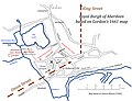
 Wyness Gordon Plan.jpg 15,175 × 11,617; 6.87 MB
.png)
.png)

.svg)


.svg)


_(2011_numbered).svg)


.svg)
.svg)
.svg)
.png)