Category:Maps of Adams County, Pennsylvania (style A)
Media in category "Maps of Adams County, Pennsylvania (style A)"
The following 43 files are in this category, out of 43 total.
-
 Map of Abbottstown, Adams County, Pennsylvania Highlighted.png 1,688 × 1,162; 50 KB
-

-
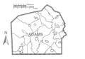 Map of Adams County, Pennsylvania No Text.png 1,688 × 1,162; 54 KB
-
 Map of Adams County, Pennsylvania.png 1,688 × 1,162; 148 KB
-
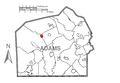 Map of Arendtsville, Adams County, Pennsylvania Highlighted.png 1,688 × 1,162; 50 KB
-
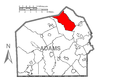
 Map of Bendersville Station-Aspers, Adams County, Pennsylvania Highlighted.png 1,688 × 1,162; 50 KB
-
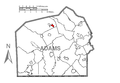
 Map of Bendersville, Adams County, Pennsylvania Highlighted.png 1,688 × 1,162; 50 KB
-
 Map of Berwick Township, Adams County, Pennsylvania Highlighted.png 1,688 × 1,162; 50 KB
-
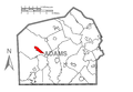
 Map of Biglerville, Adams County, Pennsylvania Highlighted.png 1,688 × 1,162; 50 KB
-
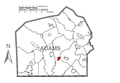
 Map of Bonneauville, Adams County, Pennsylvania Highlighted.png 1,688 × 1,162; 50 KB
-
 Map of Butler Township, Adams County, Pennsylvania Highlighted.png 1,688 × 1,162; 51 KB
-
 Map of Carroll Valley, Adams County, Pennsylvania Highlighted.png 1,688 × 1,162; 50 KB
-
 Map of Cashtown-McKnightstown, Adams County, Pennsylvania Highlighted.png 1,688 × 1,162; 51 KB
-
 Map of Conewago Township, Adams County, Pennsylvania Highlighted.png 1,688 × 1,162; 50 KB
-
 Map of Cumberland Township, Adams County, Pennsylvania Highlighted.png 1,688 × 1,162; 51 KB
-
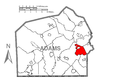
 Map of East Berlin, Adams County, Pennsylvania Highlighted.png 1,688 × 1,162; 50 KB
-
 Map of Fairfield, Adams County, Pennsylvania Highlighted.png 1,688 × 1,162; 50 KB
-
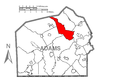
 Map of Franklin Township, Adams County, Pennsylvania Highlighted.png 1,688 × 1,162; 52 KB
-
 Map of Freedom Township, Adams County, Pennsylvania Highlighted.png 1,688 × 1,162; 51 KB
-
 Map of Germany Township, Adams County, Pennsylvania Highlighted.png 1,688 × 1,162; 51 KB
-
 Map of Gettysburg, Adams County, Pennsylvania Highlighted.png 1,688 × 1,162; 50 KB
-
 Map of Hamilton Township, Adams County, Pennsylvania Highlighted.png 1,688 × 1,162; 51 KB
-
 Map of Hamiltonban Township, Adams County, Pennsylvania Highlighted.png 1,688 × 1,162; 51 KB
-
 Map of Hampton, Adams County, Pennsylvania Highlighted.png 1,688 × 1,162; 50 KB
-
 Map of Highland Township, Adams County, Pennsylvania Highlighted.png 1,688 × 1,162; 51 KB
-
 Map of Huntington Township, Adams County, Pennsylvania Highlighted.png 1,688 × 1,162; 51 KB
-
 Map of Lake Heritage, Adams County, Pennsylvania Highlighted.png 1,688 × 1,162; 50 KB
-
 Map of Lake Meade, Adams County, Pennsylvania Highlighted.png 1,688 × 1,162; 50 KB
-
 Map of Latimore, Adams County, Pennsylvania Highlighted.png 1,688 × 1,162; 51 KB
-
 Map of Liberty Township, Adams County, Pennsylvania Highlighted.png 1,688 × 1,162; 50 KB
-
 Map of Littlestown, Adams County, Pennsylvania Highlighted.png 1,688 × 1,162; 50 KB
-
 Map of McSherrystown, Adams County, Pennsylvania Highlighted.png 1,688 × 1,162; 50 KB
-
 Map of Menallen Township, Adams County, Pennsylvania Highlighted.png 1,688 × 1,162; 51 KB
-
 Map of Midway, Adams County, Pennsylvania Highlighted.png 1,688 × 1,162; 50 KB
-

-
 Map of Mount Pleasant Township, Adams County, Pennsylvania Highlighted.png 1,688 × 1,162; 51 KB
-
 Map of New Oxford, Adams County, Pennsylvania Highlighted.png 1,688 × 1,162; 50 KB
-
 Map of Oxford Township, Adams County, Pennsylvania Highlighted.png 1,688 × 1,162; 51 KB
-
 Map of Reading Township, Adams County, Pennsylvania Highlighted.png 1,688 × 1,162; 51 KB
-
 Map of Straban Township, Adams County, Pennsylvania Highlighted.png 1,688 × 1,162; 51 KB
-
 Map of Tyrone, Adams County, Pennsylvania Highlighted.png 1,688 × 1,162; 51 KB
-
 Map of Union Township, Adams County, Pennsylvania Highlighted.png 1,688 × 1,162; 51 KB
-
 Map of York Springs, Adams County, Pennsylvania Highlighted.png 1,688 × 1,162; 50 KB


